


Why visit Kundgol
Townapedia lists 1 place to eat in and around town.
Weather in Kundgol
Forecast from MET Norway (CC BY 4.0). Full forecast
About Kundgol
Kundgol, also known as Kundagola, is a panchayat town in the Dharwad district, located in the Indian state of Karnataka. It is located about 14 km southwest of Hubli, and 32 km southwest of Dharwad.
From the Wikipedia article Kundgol (this version), under CC BY-SA 4.0.
Restaurants and cafes1

Schools, colleges and libraries1

Healthcare1

History
Kundgol translates to "a place with many kunds" (tanks or ponds) in Kannada, the dominant language of Karnataka. This name likely reflects the historical presence of numerous bodies of water in-and-around the town, which would have been vital for agriculture and daily life in the region. The suffix "-gol" could also refer to a village, or settlement in some contexts, further reinforcing the idea of Kundgol as a community centered around its water resources.
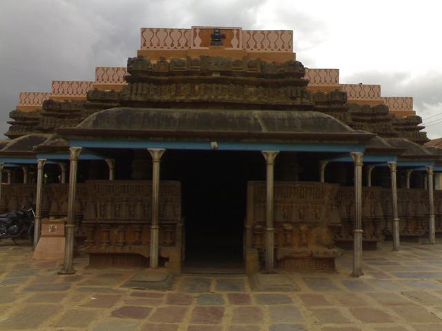
Kundgol existed under the core area of the Western Chalukya Empire, as evident by the existence of the 11th century Shri Shambulingeshwara temple. Before 1948, Kundgol was a non-contiguous part of the princely state of Jamkhandi.
Later, Kundgol came under the rule of the Vijayanagara Empire. It is known for its ancient temples, with the Murugharajendra Math being a significant religious and cultural institution. Agriculture is an important part of the local economy, with crops such as sugarcane and cotton cultivated in the region.
From the History section of Kundgol on Wikipedia, under CC BY-SA 4.0.
Map of Kundgol
3 places. The map loads OpenStreetMap tiles when you open it.
Getting there and nearby towns
Hubballi Airport (HBX) is the nearest airport with scheduled flights listed in OpenStreetMap, 22 km away.
- Hubballi 16 km northwest, about 16 min by car
- Lakshmeshwar 28 km southeast, about 28 min by car
- Annigeri 27 km northeast, about 27 min by car
- Shiggaon 30 km south, about 30 min by car
- Mulgund 30 km east, about 30 min by car
- Kalghatgi 31 km west, about 31 min by car
- Savanūr 33 km south, about 33 min by car
- Navalgund 36 km north, about 36 min by car
- Shirhatti 36 km east, about 36 min by car
- Bankāpur 37 km south, about 37 min by car
Drive times are estimates from straight-line distance, not routes.
Local news
Headlines from INDB.
Reviews, tips and questions
Loading what members have shared...
Sources and licences
- GeoNames (CC BY 4.0): population, coordinates, regions and time zone
- OpenStreetMap contributors (ODbL 1.0): places, airports, map data
- Wikidata (CC0 1.0): elevation, founding date, time zone, website
- Wikimedia Commons (see each image): photos
- Wikipedia (CC BY-SA 4.0): overview and history text
Photo credits
- Kundagol Shambhulinga temple 10, Manjunath Doddamani Gajendragad at en.wikipedia, Public domain
- Chalukya Exp. (38178274914), Belur Ashok from Secunderabad, India, CC BY 2.0
Page built November 3, 2026. Spotted a mistake? Tell us or suggest a place.