


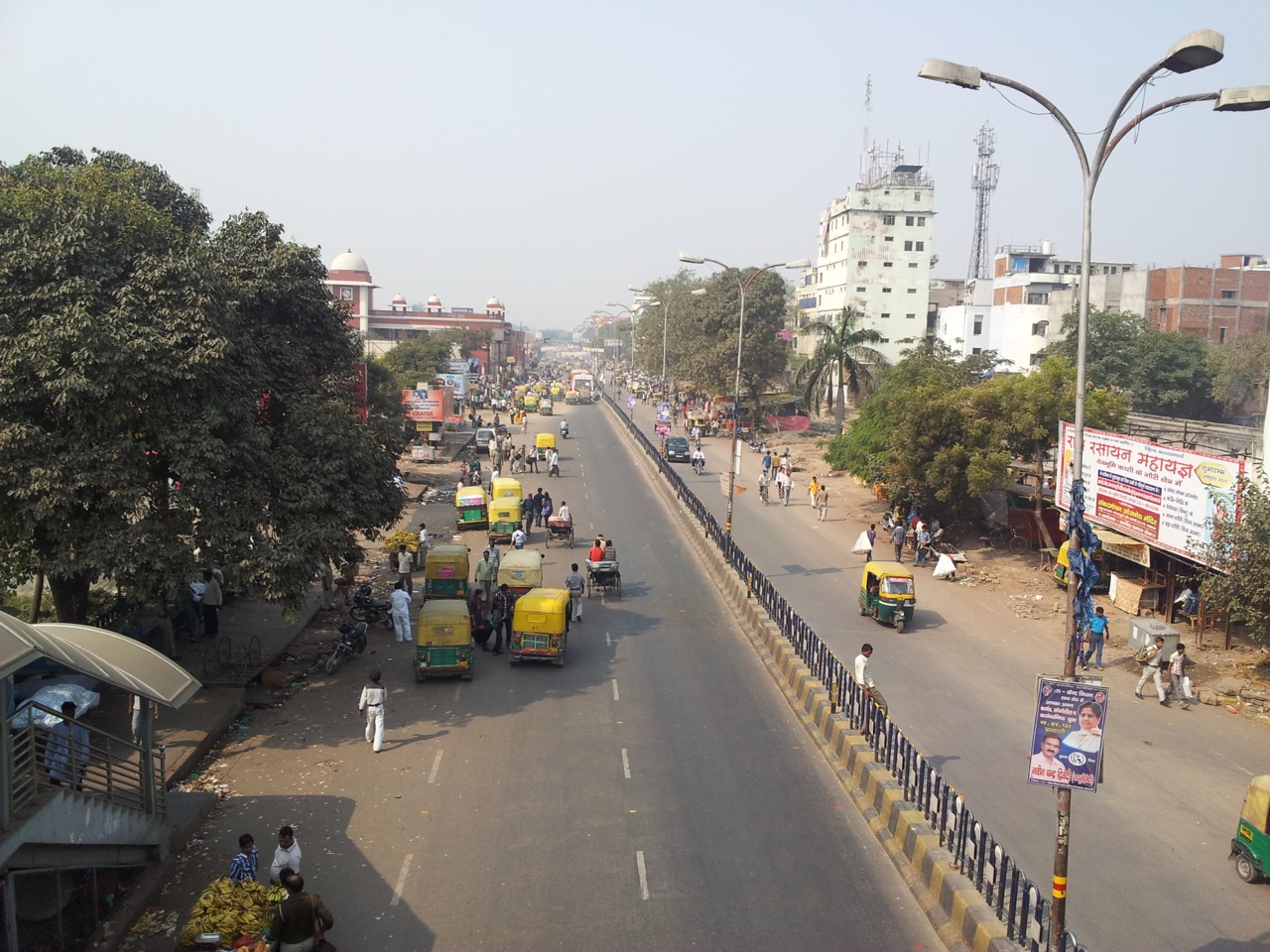


Lucknow, India
Lucknow is a regional capital of 2,472,011 people in Uttar Pradesh, India.
Why visit Lucknow
Townapedia lists 40 museums and landmarks, 103 parks and trails, 80 places to eat, 37 places to stay and 23 attractions in and around town.
Highlights include St. Francis' College, Dr. A. P. J. Abdul Kalam Technical University, Bara Imambara and State museum Lucknow.
Weather in Lucknow
Forecast from MET Norway (CC BY 4.0). Full forecast
About Lucknow
Lucknow (/ˈlʌknaʊ/ LUK-now; Hindi: Lakhanaū, pronounced [ˈləkʰnə.uː] ) is a metropolis and the second largest city of the Indian state of Uttar Pradesh where it serves as the capital and the administrative headquarters of the eponymous district and division. The city had a population of 2.8 million according to the 2011 census, making it the eleventh most populous city and the twelfth-most populous urban agglomeration of India. It is an important centre of education, commerce, aerospace, finance, pharmaceuticals, information technology, design, gastronomy, literature, arts, tourism, music, and poetry. Lucknow, along with Agra and Varanasi, forms the backbone of the Uttar Pradesh Heritage Arc.
From the Wikipedia article Lucknow (this version), under CC BY-SA 4.0.
Travel tips from other travellers: Lucknow on Wikivoyage (CC BY-SA 4.0).
Things to do23

St. Francis' College
School · 2.4 km
Unaided Anglo-Indian school in Lucknow, Uttar Pradesh, India
Shahnajaf Road, Lucknow

Dr. A. P. J. Abdul Kalam Technical University
School · 11.8 km
State public university in Lucknow, Uttar Pradesh, India
Dr. Ram Manohar Lohia National Law University
School · 6.4 km
State public university in Lucknow, Uttar Pradesh, India
Dr. Shakuntala Misra Rehabilitation University
School · 8.6 km
State public university in Lucknow, Uttar Pradesh, India

Indian Institute of Information Technology, Lucknow
School · 10.9 km
Institute in Lucknow, Uttar Pradesh

Iron Bridge
Bridge · 3.2 km
Bridge over Gomti River, Lucknow (1845–1960)
Khwaja Moinuddin Chishti Urdu, Arabi-Farsi University, Lucknow
School · 10.3 km
State public university in Lucknow, Uttar Pradesh, India

Lucknow College of Arts and Crafts
School · 2.8 km
Art school affiliated with the University of Lucknow
National Institute of Pharmaceutical Education and Research, Raebareli
School · 12.9 km
University in Lucknow, India
Sanjay Gandhi Post Graduate Institute of Medical Sciences
School · 10.9 km
Medical Institute in India

11 more on the map.
Museums and landmarks40

Bara Imambara
Monument and historic site · 3.5 km
Islamic congregation hall in Lucknow, India

State museum Lucknow
Museum · 3.2 km
Museum in Uttar Pradesh, India
Tu-Su 09:00-16:00

Nadan Mahal
Monument and historic site · 2.1 km
Mausoleum in Lucknow, India

Hussainnabad Imambara (Hussainabad Picture Gallery)
Museum · 4.3 km
Sa-Th 10:00-18:00


WP 7287
Monument and historic site · 1.2 km
Indian Railway steam locomotive for express trains

28 more on the map.
Parks, trails and playgrounds103

Manyawar Shri Kanshiram Ji Green Eco Garden
Park · 3.2 km
Park in Uttar Pradesh, India

Ambedkar Memorial
Park · 5.3 km
Public park and memorial in Uttar Pradesh, India



91 more on the map.
Restaurants and cafes80



The Hazelnut Factory - Alambagh
Cafe · Sandwich, Noodle, Coffee Shop, Pasta · 5.2 km
Mo-Su 08:30-23:30
68 more on the map.
History
From the sixth to the fourth century BCE, Lucknow was part of the realm of Kosala, one of the 16 Mahajanapadas in the Late Vedic period.
From 1350 onwards, Lucknow and parts of the Awadh region were ruled by the Delhi Sultanate, Sharqi Sultanate, Mughal Empire, Nawabs of Awadh, the British East India Company and the British Raj.
For about eighty-four years (from 1394 to 1478), Awadh was part of the Sharqi Sultanate of Jaunpur. Emperor Humayun made it a part of the Mughal Empire around 1555. Emperor Jahangir (1569–1627) granted an estate in Awadh to a favoured nobleman, Sheikh Abdul Rahim, who later built Machchi Bhawan on this estate. It later became the seat of power from where his descendants, the Sheikhzadas, controlled the region.
The Nawabs of Lucknow acquired the name after the reign of the third Nawab when Lucknow became their capital. The city became North India's cultural capital, and its nawabs, best remembered for their refined and extravagant lifestyles, were patrons of the arts.
Under their dominion, music and dance flourished, and construction of numerous monuments took place. Of the monuments standing today, the Bara Imambara, the Chota Imambara, and the Rumi Darwaza are notable examples. One of the Nawab's enduring legacies is the region's syncretic Hindu–Muslim culture that has come to be known as the Ganga-Jamuni Tehzeeb.
From the History section of Lucknow on Wikipedia, under CC BY-SA 4.0.
Where to stay37
Ayan Hostel (In front of Dr. A.K. Gupta)
Motel and hotel · 2.7 km
41/399 Dr. Tufail Ahmad Marg
Churches and places of worship46
Hanuman Setu Temple
Place of worship · 2.8 km
Babuganj, Hasanganj University Road, Lucknow
Shopping26
Gas and EV charging8
Schools, colleges and libraries61
Healthcare176
Apollo Medics Super Speciality hospital
Hospital · 5.0 km
Kanpur - Lucknow Rd, Sector B, Bargawan, LDA Colony, Lucknow, Uttar Pradesh 226012, Lucknow
Map of Lucknow
250 places. The map loads OpenStreetMap tiles when you open it.
Getting there and nearby towns
Chaudhary Charan Singh International Airport (LKO) is the nearest airport with scheduled flights listed in OpenStreetMap, 9 km away.
- Kākori 14 km west, about 14 min by car
- Goshāīnganj 20 km southeast, about 20 min by car
- Malīhābād 23 km northwest, about 23 min by car
- Mohān 25 km west, about 25 min by car
- Satrikh 27 km east, about 27 min by car
- Itaunja 27 km north, about 27 min by car
- Nawābganj 29 km east, about 29 min by car
- Dewā 33 km northeast, about 33 min by car
- Nagrām 33 km southeast, about 33 min by car
- Kanpur 71 km southwest, about 1 h 15 min by car
Drive times are estimates from straight-line distance, not routes.
Local news
Headlines from INDB.
Reviews, tips and questions
Loading what members have shared...
Sources and licences
- GeoNames (CC BY 4.0): population, coordinates, regions and time zone
- OpenStreetMap contributors (ODbL 1.0): places, airports, map data
- Wikidata (CC0 1.0): elevation, founding date, time zone, website, landmarks and historic places
- Wikimedia Commons (see each image): photos
- Wikipedia (CC BY-SA 4.0): overview and history text
Photo credits
- Gomti river in Downtown New Lucknow, Timestance, CC BY-SA 4.0
- Lucknow (8746970219), Aleksandr Zykov from Russia, CC BY-SA 2.0
- Lucknow (8746970203), Aleksandr Zykov from Russia, CC BY-SA 2.0
- Lucknow Charbagh Railway Station night view from bridge, Ravi Dwivedi, CC BY-SA 4.0
- Lucknow Charbagh railway station Platform 4-5, Ravi Dwivedi, CC BY-SA 4.0
- Nauchandi Express in Lucknow, Ravi Dwivedi, CC BY-SA 4.0
- Lucknow charbagh railway station 13, Ravi Dwivedi, CC BY-SA 4.0
- Lucknow charbagh railway station platform 7, Ravi Dwivedi, CC BY-SA 4.0
- Lucknow Charbagh Railway Station board, Ravi Dwivedi, CC BY-SA 4.0
- Bara Imambara Lucknow, Muhammad Mahdi Karim, GFDL 1.2
- Nadan Mahal 16 Khamba, Ramesh Lalwani, CC BY 2.0
- Dr. Babasaheb Ambedkar Memorial, SamuelDutta, CC BY 4.0
- All Saints Garrison Church, Lucknow, Uttar Pradesh, Arpan Mahajan, CC BY-SA 4.0
- Christ's Church, Unknown author, Public domain
- Janeshwar Mishra Park, Mohit, CC BY-SA 4.0
- Darul Uloom Nadwatul Ulama Lucknow, Md Anees Kashmiri, CC BY 4.0
- Shree Hanuman Ji., Anaviljaiswal, CC BY-SA 4.0
- La Martiniere College, Lucknow - by Ahmad Faiz Mustafa, Ahmad Faiz Mustafa, CC BY-SA 3.0
- St. Francis Lucknow, SFC, CC BY-SA 4.0
- 682 IndiaDelhiMuseum 19931226, MaltaGC (Nigel Tout), CC BY-SA 4.0
- Rumi Darwaza - DSC2797-01, Rishabhgpt, CC BY-SA 4.0
- Faculty of Fine Arts, University of Lucknow 01, Pearl1920, CC BY-SA 4.0
- Iiitli, Optimistic Bee, CC BY-SA 4.0
- MANYAWAR SHRI KANSHIRAM JI SMARAK STHAL, Ghanshyam lal pandey, CC BY-SA 4.0
- Iron Bridge, Darogha Ubbas Alli, Public domain
- The great beaks, ThenorthIndian, CC BY-SA 4.0
- Aloo tikki By fatima, Fatimahope, CC BY-SA 4.0
- Plain Katchori By Fatima, Fatimahope, CC BY-SA 4.0
- Dahi chutny Chat by fatima, Fatimahope, CC BY-SA 4.0
- Maa Durga at Shashi Bhushan, Arpita Singh, CC BY-SA 4.0
- Veg Mix By Fatima, Fatimahope, CC BY-SA 4.0
- Dhaaki at Durga puja, Arpita Singh, CC BY-SA 4.0
- Chana Daal with Pudina Flavor, Fatimahope, CC BY-SA 4.0
- Spicy Aloo Sabzi, Fatimahope, CC BY-SA 4.0
- Puffed Puri, Fatimahope, CC BY-SA 4.0
- Lindenbergia indica - Indian Pout-Flower (8), In Transit, CC BY 4.0
- Lindenbergia indica - Indian Pout-Flower (7), In Transit, CC BY 4.0
- Lindenbergia indica - Indian Pout-Flower (10), In Transit, CC BY 4.0
- Lindenbergia indica - Indian Pout-Flower (6), In Transit, CC BY 4.0
- Lindenbergia indica - Indian Pout-Flower (9), In Transit, CC BY 4.0
- Residency Lucknow 1858, Various artists., Public domain
- Satkhanda (5163864509), Varun Shiv Kapur from New Delhi, India, CC BY 2.0


Page built November 2, 2026. Spotted a mistake? Tell us or suggest a place.