


Why visit Mahād
Townapedia lists 1 museum or landmark and 1 place to eat in and around town.
Weather in Mahād
Forecast from MET Norway (CC BY 4.0). Full forecast
About Mahād
Mahad ( [məɦaːɖ]) is a city in Raigad district (formerly Kulaba district) situated in the North Konkan region of Maharashtra state, India. It is located 108.5 km (67.4 mi) from District Headquarters Alibag, and 167 km (104 mi) from Mumbai. Mahad is known for Raigad Fort, the capital of the Maratha Empire in Shivaji Maharaj's era and the revolutionary Mahad Satyagraha launched by (Dr Babasaheb Ambedkar) at Chavdar Tale (Tasty Lake) in the wake of modern India.
From the Wikipedia article Mahad (this version), under CC BY-SA 4.0.
Travel tips from other travellers: Mahād on Wikivoyage (CC BY-SA 4.0).
Museums and landmarks1

Restaurants and cafes1

Churches and places of worship2

Gas and EV charging1

History
Mahad, a town nestled in the Konkan region (History of Mahad) of Maharashtra, India, holds a significant historical and cultural legacy. With a rich past that dates back to ancient times, Ma-had has witnessed the rise and fall of empires, played a vital role in the Indian independence movement, and now stands as a thriving modern town.
From the History section of Mahad on Wikipedia, under CC BY-SA 4.0.
Schools, colleges and libraries1
Healthcare16
Map of Mahād
22 places. The map loads OpenStreetMap tiles when you open it.
Getting there and nearby towns
Pune International Airport (PNQ) is the nearest airport with scheduled flights listed in OpenStreetMap, 77 km away.
- Nadgaon Tarf Birwadi 5 km northeast, about 5 min by car
- Birvādi 10 km east, about 10 min by car
- Poladpur 12 km southeast, about 12 min by car
- Goregaon 15 km northwest, about 15 min by car
- Utekhol 23 km northwest, about 23 min by car
- Pune 67 km northeast, about 1 h by car
- Pimpri-Chinchwad 72 km northeast, about 1 h 15 min by car
- Pimpri 73 km northeast, about 1 h 15 min by car
- Satara 75 km southeast, about 1 h 15 min by car
- Lohogaon 79 km northeast, about 1 h 15 min by car
Drive times are estimates from straight-line distance, not routes.
Local news
Headlines from INDB.
Reviews, tips and questions
Loading what members have shared...
Sources and licences
- GeoNames (CC BY 4.0): population, coordinates, regions and time zone
- OpenStreetMap contributors (ODbL 1.0): places, airports, map data
- Wikidata (CC0 1.0): elevation, founding date, time zone, website
- Wikimedia Commons (see each image): photos
- Wikipedia (CC BY-SA 4.0): overview and history text
Photo credits
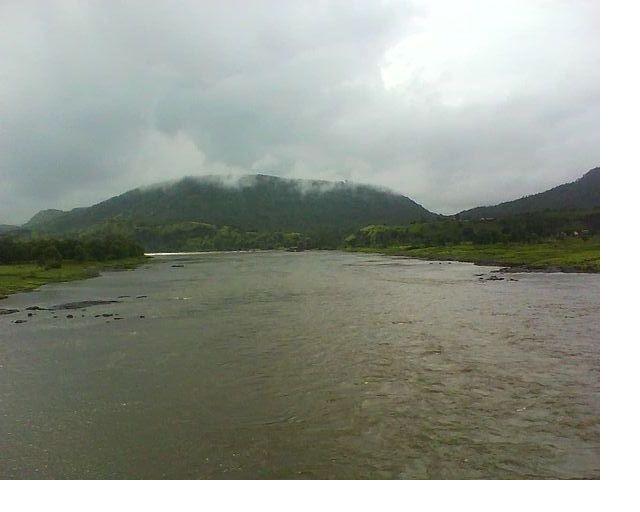
- Savitri river at Mahad, Kalpesh Sawant, CC BY-SA 3.0
- महाडचे चवदार तळे, बसवंत विठाबाई बाबाराव, CC BY-SA 4.0
- PROPOSAL WRITING WORKSHOP AT MAHAD, Savvywriter, CC BY-SA 4.0
- ISS061-E-112244 - View of Earth, Earth Science and Remote Sensing Unit, NASA Johnson Space Center, Public domain
Page built November 3, 2026. Spotted a mistake? Tell us or suggest a place.