
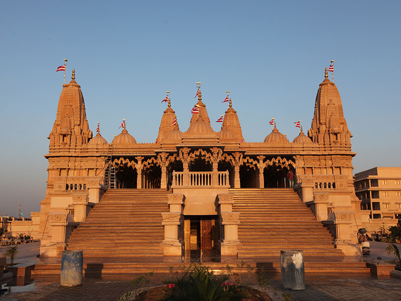


Why visit Mahuva
Townapedia lists 2 parks and trails, 1 place to eat and 8 places to stay in and around town.
Weather in Mahuva
Forecast from MET Norway (CC BY 4.0). Full forecast
About Mahuva
Mahuva is a town and taluka of Bhavnagar District, Gujarat, India. Located on the coast of the Arabian Sea, Mahuva has mild weather and surroundings that include many coconut plantations. The town is a part of the Saurashtra region and is known as the Kashmir of Saurashtra.
From the Wikipedia article Mahuva, Bhavnagar (this version), under CC BY-SA 4.0.
Parks, trails and playgrounds2

Restaurants and cafes1

Where to stay8

Hotel Heaven
Motel and hotel · 0.8 km
Dr. BabaSaheb Ambedkar Road, MAHUVA
Churches and places of worship6

Shri Swaminarayan Mukhya Mandir
Place of worship · Swaminarayan · 1.9 km
Swaminarayan Road, MAHUVA
Shopping1
Schools, colleges and libraries3
Healthcare21
Map of Mahuva
42 places. The map loads OpenStreetMap tiles when you open it.
Getting there and nearby towns
Bhavnagar Airport (BHU) is the nearest airport with scheduled flights listed in OpenStreetMap, 85 km away.
- Katpur 4 km southeast, about 4 min by car
- Dungarpur 22 km north, about 22 min by car
- Pipāvāv Bandar 25 km southwest, about 25 min by car
- Rājula 34 km west, about 34 min by car
- Talāja 40 km northeast, about 40 min by car
- Pālitāna 49 km north, about 49 min by car
- Jāfarābād 49 km southwest, about 49 min by car
- Savarkundla 56 km northwest, about 56 min by car
- Kundla 56 km northwest, about 56 min by car
- Bhavnagar 85 km northeast, about 1 h 30 min by car
Drive times are estimates from straight-line distance, not routes.
Local news
Headlines from INDB.
Reviews, tips and questions
Loading what members have shared...
Sources and licences
- GeoNames (CC BY 4.0): population, coordinates, regions and time zone
- OpenStreetMap contributors (ODbL 1.0): places, airports, map data
- Wikidata (CC0 1.0): elevation, founding date, time zone, website
- Wikimedia Commons (see each image): photos
- Wikipedia (CC BY-SA 4.0): overview and history text
Photo credits
- BAPS Mandir Mahuva, Work for hire; Copyright held by BAPS Swaminarayan Sanstha (web: www.baps.org, email: [email protected]); Unknown photographer, CC BY-SA 3.0
- Cats of KD's Home 21, Kaushalkumar Hareshbhai Desai, CC BY-SA 4.0
Page built November 3, 2026. Spotted a mistake? Tell us or suggest a place.