


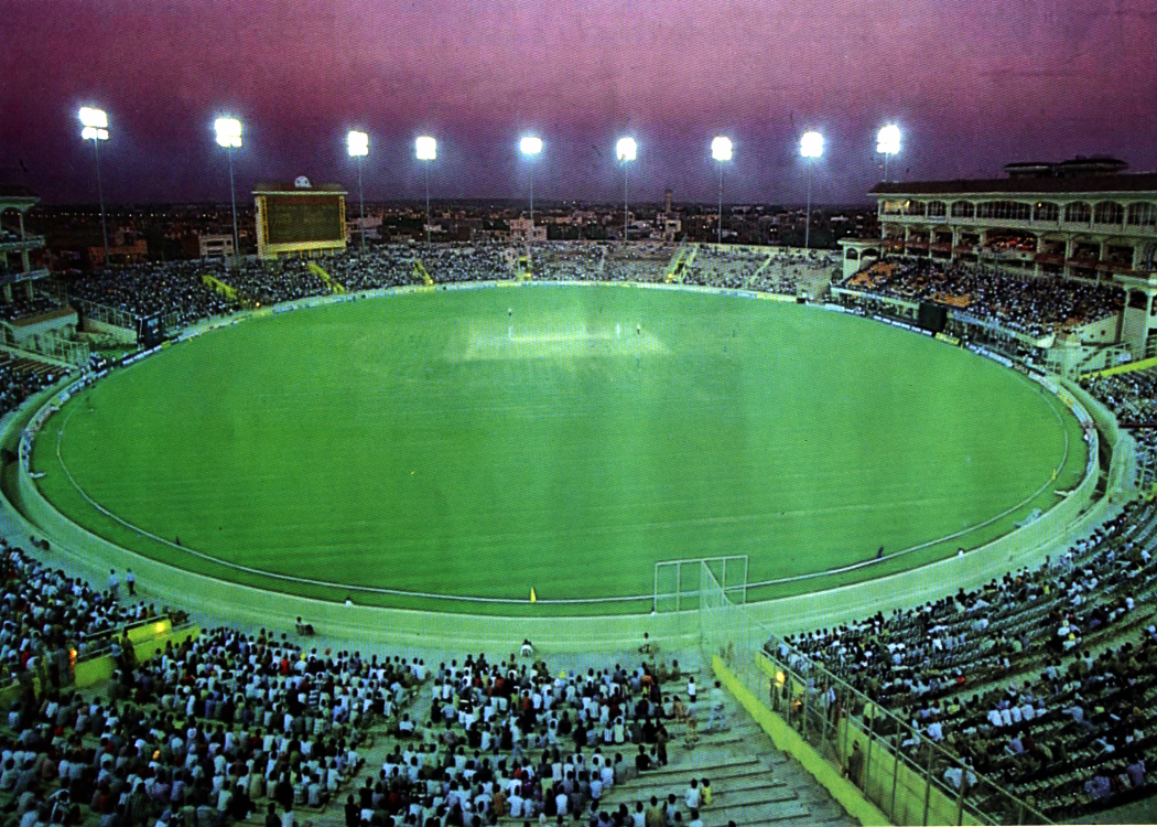


Mohali, India
Mohali is a town of 166,864 people in Punjab, India, founded in November 1, 1966.
Why visit Mohali
Townapedia lists 27 parks and trails, 11 places to eat, 4 places to stay and 3 attractions in and around town.
Highlights include Institute of Nano Science and Technology, National Institute of Pharmaceutical Education and Research, S.A.S. Nagar, Garden of Springs, Chandigarh and Inderjit Singh Bindra Stadium.
Weather in Mohali
Forecast from MET Norway (CC BY 4.0). Full forecast
About Mohali
Mohali, officially Sahibzada Ajit Singh Nagar or Ajitgarh, is a planned city in the Mohali district in Punjab, India, which is an administrative and a commercial hub lying south-west of Chandigarh. It is the headquarters of the Mohali district and one of the six Municipal Corporations of the State. It is officially named after Sahibzada Ajit Singh, the eldest son of Guru Gobind Singh. It is one of the major satellite cities of Chandigarh and is part of the Chandigarh Capital Region.
From the Wikipedia article Mohali (this version), under CC BY-SA 4.0.
Travel tips from other travellers: Mohali on Wikivoyage (CC BY-SA 4.0).
Things to do3

Institute of Nano Science and Technology
School · 1.4 km
Research institute of the government of India
National Institute of Pharmaceutical Education and Research, S.A.S. Nagar
School · 1.4 km
University in Sahibzada Ajit Singh Nagar, India

Parks, trails and playgrounds27




15 more on the map.
Restaurants and cafes11

Pinda Aale Restaurant in Mohali
Restaurant · Indian · 1.8 km
"Come enjoy yummy Punjabi food at 'Pinda Aaale' in Mohali! We serve everything fresh in clean steel plates, just like the good old days....
Booth No 191 Mohali Bypass, Phase 10, Sector 64,, Mohali
Mo-Su 09:00-21:00

Retro Mocha
Cafe · Coffee Shop
Sco 15, Sector 68 Sector 68, SAS Nagar, Sahibzada Ajit Singh Nagar, Mohali


Subway
Fast food · Sandwich · 0.6 km
Sector 68, Sahibzada Ajit Singh Nagar, Mohali
Subway
Fast food · Sandwich · 2.0 km
Sector 70, Sahibzada Ajit Singh Nagar, Mohali
Where to stay4

Churches and places of worship2
Shopping2
Gas and EV charging3
Schools, colleges and libraries3
Healthcare26
Dr Manit Arora Fortis Hospital, Mohali,
Clinic and pharmacy · 1.9 km
Fortis Hospital, Mohali, Chandigarh Panjab, India
Dr. Deepak Joshi/ Spine Surgeon
Clinic and pharmacy · 1.8 km
Fortis Hospital, Sector 62, Phase VIII, Mohali
Map of Mohali
81 places. The map loads OpenStreetMap tiles when you open it.
Getting there and nearby towns
Chandigarh International Airport (IXC) is the nearest airport with scheduled flights listed in OpenStreetMap, 6 km away.
- Sohāna 2 km northwest, about 2 min by car
- Balaungi 6 km northwest, about 6 min by car
- Behlana 8 km east, about 8 min by car
- Chandigarh 9 km northeast, about 9 min by car
- Panchkula 12 km east, about 12 min by car
- Patiāla 50 km southwest, about 50 min by car
- Shimla 63 km northeast, about 1 h by car
- Thānesar 79 km south, about 1 h 15 min by car
- Māler Kotla 82 km west, about 1 h 15 min by car
- Ludhiana 87 km west, about 1 h 30 min by car
Drive times are estimates from straight-line distance, not routes.
Local news
Headlines from INDB.
Reviews, tips and questions
Loading what members have shared...
Sources and licences
- GeoNames (CC BY 4.0): population, coordinates, regions and time zone
- OpenStreetMap contributors (ODbL 1.0): places, airports, map data
- Wikidata (CC0 1.0): elevation, founding date, time zone, website, landmarks and historic places
- Wikimedia Commons (see each image): photos
- Wikipedia (CC BY-SA 4.0): overview and history text
Photo credits
- View of Chandigarh International Airport road ,Mohali in spring season 08, Harvinder Chandigarh, CC BY-SA 4.0
- LightsMohali, The original uploader was The strokes at English Wikipedia ., Public domain
- IISER Mohali in Spring 2014, Frederickarcher, CC BY-SA 4.0
- CP67 Mall Building, Iamnegi01, CC BY-SA 4.0
- Sheep 5, RakkaRajput123, CC BY-SA 4.0
- Курсы ITEC по фармации в 2015 году, AlexUfaPh, CC BY-SA 4.0
- Dheeraj 2, Dheerajkkumar9099, CC0
- Avtarjeet Singh Atwal, Harvinder Chandigarh, CC BY 4.0
- Dhiyan Singh Kahlon, Harvinder Chandigarh, CC BY 4.0
- Woofs of Street, Sargun ji, CC0
- Waterfall, Nek Chand, India (8240208365), Rod Waddington from Kergunyah, Australia, CC BY-SA 2.0
- Nek Chand, India (8241218518), Rod Waddington from Kergunyah, Australia, CC BY-SA 2.0
- Grotto, Nek Chand, India (8241235336), Rod Waddington from Kergunyah, Australia, CC BY-SA 2.0
- Silvie Park - panoramio, ソキ, CC BY-SA 3.0
- A shelled Garden snail, H.u.nar, CC BY 4.0
- Deep jele jai, Iamishan32701, CC BY-SA 4.0
- Canebrakes - panoramio, ソキ, CC BY-SA 3.0
- Tyndall effect, H.u.nar, CC BY 4.0
- Piano 1212, Iamishan32701, CC BY-SA 4.0
- Stomata observed on the rear side of a leaf, H.u.nar, CC BY 4.0
- Mosaic Figures, Nek Chand, India (8241299192), Rod Waddington from Kergunyah, Australia, CC BY-SA 2.0
- Gurdwara visit, Kripa arts 555, CC BY-SA 4.0
- Tuition123Host, Hosting Tuition, CC BY-SA 4.0
- Gurupurab clebration, Kripa arts 555, CC BY-SA 4.0
- Shadow of monsoon clouds, Sukhwinder Khepar, CC BY-SA 4.0


Page built November 2, 2026. Spotted a mistake? Tell us or suggest a place.