



Morādābād, India
Morādābād is a town of 721,139 people in Uttar Pradesh, India, founded in 1625.
Why visit Morādābād
Townapedia lists 1 museum or landmark, 1 park or trail, 4 places to eat and 3 places to stay in and around town.
Weather in Morādābād
Forecast from MET Norway (CC BY 4.0). Full forecast
About Morādābād
Moradabad (Hindi pronunciation: [mʊɾaːd̪aːbaːd̪] ) is an industrial city, police commissionerate and municipal corporation in Moradabad district of the Indian state of Uttar Pradesh. It is on the banks of the Ramganga river, 165 km (103 mi) from the national capital, New Delhi and 356 km north-west of the state capital, Lucknow. Based on the 2011 census, it is the tenth most populous city in the state and 54th most populous city in the country. It is one of the largest cities in the Western UP region, and a hub for employment, education, industry, culture and administration.
From the Wikipedia article Moradabad (this version), under CC BY-SA 4.0.
Travel tips from other travellers: Morādābād on Wikivoyage (CC BY-SA 4.0).
Museums and landmarks1

swargiya shreemati veena aggarwal smriti udyan
Monument and historic site · 1.2 km
Parks, trails and playgrounds1

Restaurants and cafes4

Pind Balluchi Express Moradabad
Restaurant · North India · 4.6 km
C-04, First Floor High Street Near Gold's Gym, Ram Ganga Vihar Phase 2, Moradabad
Mo-Su 12:00-23:59
Yaara Dimsum
Restaurant · Chinese, Sandwich, Mexican, Cuban, Fries, Shakes, Dimsums, Momos · 4.4 km
Shop No. A2-01 near Sales tax chauraha, ramganga Vihar Phase 1,, Moradabad
Mo-Su 03:30-21:00

Byte cafe
Cafe · Ice Cream, Coffee Shop, Indian, Tea · 11.5 km
10am o 12am
Where to stay3

Churches and places of worship13
Bhagwan shree sumati nath jain mandir
Place of worship · 0.9 km
Bhagwan Mahaveer Marg, Civil Lines
Shopping1
Gas and EV charging1
Schools, colleges and libraries3
Healthcare126
Map of Morādābād
153 places. The map loads OpenStreetMap tiles when you open it.
Getting there and nearby towns
Pantnagar Airport (PGH) is the nearest airport with scheduled flights listed in OpenStreetMap, 71 km away.
- Got 6 km east, about 6 min by car
- Kundarkhi 17 km south, about 17 min by car
- Tānda 22 km northeast, about 22 min by car
- Rāmpur 25 km east, about 25 min by car
- Bilāri 24 km south, about 24 min by car
- Sirsi 26 km southwest, about 26 min by car
- Kānth 28 km northwest, about 28 min by car
- Amroha 31 km west, about 31 min by car
- Suār 34 km northeast, about 34 min by car
- Sambhal 35 km southwest, about 35 min by car
Drive times are estimates from straight-line distance, not routes.
Local news
Headlines from INDB.
Reviews, tips and questions
Loading what members have shared...
Sources and licences
- GeoNames (CC BY 4.0): population, coordinates, regions and time zone
- OpenStreetMap contributors (ODbL 1.0): places, airports, map data
- Wikidata (CC0 1.0): elevation, founding date, time zone, website
- Wikimedia Commons (see each image): photos
- Wikipedia (CC BY-SA 4.0): overview and history text
Photo credits
- Moradabad 009, Rishabh Mathur, CC BY-SA 2.0
- Town Hall Market Moradabad, Ashishb04, CC BY-SA 4.0
- Prachin Hanuman Mandir Moradabad, Ashishb04, CC BY-SA 4.0
- Old Central Church Moradabad, Ashishb04, CC BY-SA 4.0
- Nature at best!, Vivek ghai, CC BY-SA 4.0
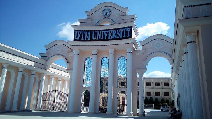
- IFTM University Moradabad, Uttar Pradesh, College Dunia, CC BY-SA 4.0
- Natureatbest, Vivek ghai, CC BY-SA 4.0
- The Bridal Procession, Korak Datta, CC BY 3.0
- Karela, SUHEL, CC BY-SA 4.0
- Dr Archana Tandon, Artistic Creator, CC BY-SA 4.0
- Randomclick, Nitin044, CC BY-SA 4.0
- Ultra runner Zainul 08, Alexanderindi, CC0
- Nomadic women, Chanakya tyagi, CC BY-SA 4.0
- Indian nomadic woman, Chanakya tyagi, CC BY-SA 4.0
- Nomadic lifestyle, Chanakya tyagi, CC BY-SA 4.0
- Moradabad Railway Station Night View, Ashishb04, CC BY-SA 4.0
- Moradabad Junction platform 5, Ravi Dwivedi, CC BY-SA 4.0
- Moradabad Junction railway station Platform 4-5, Ravi Dwivedi, CC BY-SA 4.0
- Moradabad Junction board on Platform 4-5, Ravi Dwivedi, CC BY-SA 4.0
- Moradabad Junction station view from Platform 5, Ravi Dwivedi, CC BY-SA 4.0
- Moradabad Junction view from Platform 5, Ravi Dwivedi, CC BY-SA 4.0
- Pili Kothi Circle, Moradabad, Ashishb04, CC BY-SA 4.0
- Moradabad junction platform 4, Ravi Dwivedi, CC BY-SA 4.0
- Nauchandi Express standing on platform 5 in Moradabad Jn, Ravi Dwivedi, CC BY-SA 4.0
- 14512 Nauchandi Express standing on Platform 1 in Moradabad Junction, Ravi Dwivedi, CC BY-SA 4.0
- Jama Masjid Moradabad With Lights, Ashishb04, CC BY-SA 4.0
- Pawan Dhakoliya, Pawankmr600, CC BY-SA 4.0
- Onthophagus dynastoides Arrow, 1931 male (4798587577), Udo Schmidt from Deutschland, CC BY-SA 2.0
- Police Academy Moradabad, Ashishb04, CC BY-SA 4.0
- Designer Brass Showpieces of Moradabad, Ashishb04, CC BY-SA 4.0
- Brass deities of Moradabad, Ashishb04, CC BY-SA 4.0
- Brass Handicrafts of Moradabad, Ashishb04, CC BY-SA 4.0
- Designer brassware Moradabad, Ashishb04, CC BY-SA 4.0
- Wave Mall Moradabad, Ashishb04, CC BY-SA 4.0
- Sai Temple Moradabad, Ashishb04, CC BY-SA 4.0
- Sonakpur Overbridge, Ashishb04, CC BY-SA 4.0
- Ultra runner Zainul 24, Alexanderindi, CC0
- Ultra runner Zainul 25, Alexanderindi, CC0
- ISS046-E-34491 - View of Earth, Earth Science and Remote Sensing Unit , Lyndon B. Johnson Space Center, Public domain
- ISS046-E-34493 - View of Earth, Earth Science and Remote Sensing Unit , Lyndon B. Johnson Space Center, Public domain


Page built November 2, 2026. Spotted a mistake? Tell us or suggest a place.