


Nagpur, India
Nagpur is a town of 2,405,665 people in Maharashtra, India, founded in 1702.
Why visit Nagpur
Townapedia lists 21 museums and landmarks, 50 parks and trails, 47 places to eat, 16 places to stay and 22 attractions in and around town.
Highlights include Laxminarayan Institute of Technology, Maharashtra Animal and Fishery Sciences University, Nagpur Central Museum and Raman Science Centre.
Weather in Nagpur
Forecast from MET Norway (CC BY 4.0). Full forecast
About Nagpur
Nagpur is the largest and most populous city in central India. It is the second capital and the third-largest city of the Indian state Maharashtra. Also known as the "Orange City", Nagpur is the 13th largest city in India by population. Nagpur is the seat of the annual winter session of the Maharashtra state assembly, and is a major commercial and political centre of the Vidarbha region of Maharashtra.
From the Wikipedia article Nagpur (this version), under CC BY-SA 4.0.
Travel tips from other travellers: Nagpur on Wikivoyage (CC BY-SA 4.0).
Things to do22

Laxminarayan Institute of Technology
School · 4.0 km
State public university in Nagpur, Maharashtra, India

Maharashtra Animal and Fishery Sciences University
School · 4.2 km
State public university in Nagpur, Maharashtra, India

Nagpur Naturals
Farm and orchard · 3.4 km
Organic Farmers' Store
Off LAD College Sq Hill Road
Mo-Sa 11:00-20:00
National Academy of Defence Production
School · 11.7 km
Indian military academy


Visvesvaraya National Institute of Technology, Nagpur
School · 4.1 km
Institute in Nagpur, Maharashtra

G H Raisoni Department of Microbiology and Biotechnology, GHRIIT, Nagpur
School · 0.9 km


10 more on the map.
Museums and landmarks21

Nagpur Central Museum
Museum · 0.9 km
Museum in Nagpur, Maharashtra, India


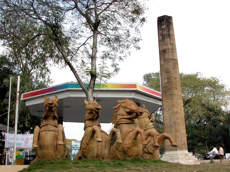
Namantar Shahid Smarak
Monument and historic site · 3.0 km
Martyrdom memorial in Maharashtra, India

Stone circles of Junapani
Monument and historic site · 10.6 km
Historic site in Dist. Nagpur, Maharashtra




9 more on the map.
Parks, trails and playgrounds50




Vidharhba Cricket Association Stadium
Sports field and stadium · 1.5 km

Dr. Babashaheb Ambedkar Udhyan
Park · 3.7 km
Vaishali Nagar Rd, Vaishali Nagar, Nagpur
Elephant statue
Park · 1.0 km
Black Elephant statue depicting the Maharaja's mode of transportation
Tuta Bagicha
Park · 2.0 km
An open public playground on one end & a public garden park with benches on the other end.
38 more on the map.
Restaurants and cafes47

22nd Bridge Coffee Roasters
Cafe · Coffee Shop · 1.2 km
5, Galaxy Museum Road, Civil Lines
Mo-Su 09:00-23:55

HUNGRY PUTTAR RESTAURANT
Restaurant · Indian, Chicken, Dessert · 3.5 km
PLOT 8 VNIT Gate, Nagpur
Mo-Su 10:00-22:00
Bouffage Cafe And Bistro
Cafe · Cafe · 3.1 km
B Wing Lower Ground Floor, Rashtra Bhasha Sankul, Shankar Nagar,, nagpur
Mo-Su 11:00-23:00
CAFE-HOLICS
Restaurant · Pizza, Burger, Coffee Shop, Italian, Chinese, Sandwich, Indian, Chicken · 2.2 km
G-3 chaitanya appt,beside svc bank,dharampeth mata mandir road, nagpur


Jagdish Restaurant & Mess
Restaurant · Tea, Samosa, Indian · 3.7 km
09:00 - 21:00

PP's Garage Pub
Bar and pub · 3.7 km
376 North Ambazari Road, Nagpur
14:00 - 23:50
Ghate Restaurant
Restaurant · Regional · 2.2 km
Near Abhyankar Statue ,Mahal, Nagpur
Ghate Restaurant (Ext)
Restaurant · Regional · 2.0 km
Chitnis Park square, Nagpur
35 more on the map.
History
One of the earlier names of Nagpur was "Fanindrapura". It derives its origin from the Marathi word phaṇa (transl. hood of a cobra). Nagpur's first newspaper was named Fanindramani, which means a jewel that is believed to be suspended over a cobra's hood. It is this jewel that lights up the darkness, hence the name of the newspaper. B. R. Ambedkar claimed that both the city and the river are named after the 'Nags' who were opponents of the Indo-Aryans. During British rule, the name of the city was spelt and pronounced as "Nagpore".
From the History section of Nagpur on Wikipedia, under CC BY-SA 4.0.
Where to stay16
Tree House Cafe THC
Motel and hotel · 2.9 km
507 Professor Colony beside Basket Ball ground, Nagpur
Churches and places of worship39
Shopping21
Devika Traders Hardware and Paints Store
Hardware store · 3.6 km
266 near water tank, Laxminagar, Nagpur
Gas and EV charging16
Schools, colleges and libraries51
Atlanta Computer Institute
School · 2.5 km
2nd Floor, Shivaji Complex, Near Coffee House and Bank of Baroda, Opposite Titan Eye, Dharampeth West High Court Road, Nagpur
Tripude Institute Of Management Education
School · 2.4 km
1 Putala Road, Balasaheb Tirpude Marg, Civil Lines, Nagpur
Vasantrao Naik Government Institute of Arts and Social Sciences
School · 0.6 km
Dr. Ambedkar Law College
School · 2.5 km
Amravati Road, Law College Square Law College Square, Nagpur
GS Collage of Commerce and Economics
School · 2.3 km
Amravati Rd, RTO Rd, Near HP Petrol Pump, Law College Square, Civil Lines, Nagpur
Mt. Carmel School
School · 3.2 km
Wardha Rd, Ajni Square, Vivekanand Nagar, Nagpur
Shri Balasaheb Tirpude College Of Hotel Management and Catering Technology
School · 2.3 km
Shri Nasikraoji Tirpude Marg, Civil Lines, Sadar,, Nagpur
Anjuman High School & Jr College
School · 2.1 km
Chindwada Rd, Mangalwari, Koradi Colony, Nagpur
Healthcare314
Dr Akash Khune Arthritis and Rheumatology Clinic
Clinic and pharmacy · 1.6 km
22, 3rd floor, office wing, pushpkunj building, opposite midas heights, beside hotel centre point, Ramdaspeth, ,Maharashtra, India, Nagpur
Wockhardt Super Speciality Hospital
Hospital · 2.1 km
1648, North Ambazari Road, Shankar Nagar, Nagpur
Cancer Care Clinic & Hospital
Hospital · 1.4 km
Cancer Care Clinic & Hospital 5th Floor Vasanst Sheela Tower, Lokmat Square, Dhantoli, Nagpur
Galaxy Vidarbha Diagnostics Pvt. Ltd.
Hospital · 1.4 km
12, Milestone Building, Near Lokmat Square Ramdaspeth,, Nagpur
Indus Health Care & Checkup Centre
Hospital · 3.1 km
Plot No. 84, Rama Niwas, Hill Road Ramnagar, Nagpur
Paldiwal Hospital And Polyclinic
Hospital · 2.2 km
Opposite R T O Office, Amravati Road, Amravati Road Gorepeth, Nagpur
Rane Bandhu Aushadhalaya
Clinic and pharmacy · 3.1 km
South Ambazari Road, Nagpur
Map of Nagpur
250 places. The map loads OpenStreetMap tiles when you open it.
Getting there and nearby towns
Dr. Babasaheb Ambedkar International Airport (NAG) is the nearest airport with scheduled flights listed in OpenStreetMap, 8 km away.
- Wāri 8 km west, about 8 min by car
- Hudkeshwar Buzurg 8 km southeast, about 8 min by car
- Nārsala 8 km southeast, about 8 min by car
- Sonegaon 9 km west, about 9 min by car
- Bhokra 9 km north, about 9 min by car
- Isasani 10 km southwest, about 10 min by car
- Nildoh 11 km west, about 11 min by car
- Mahādula 12 km north, about 12 min by car
- Korādi 11 km north, about 11 min by car
- Deolimet 12 km west, about 12 min by car
Drive times are estimates from straight-line distance, not routes.
Local news
Headlines from INDB.
Reviews, tips and questions
Loading what members have shared...
Sources and licences
- GeoNames (CC BY 4.0): population, coordinates, regions and time zone
- OpenStreetMap contributors (ODbL 1.0): places, airports, map data
- Wikidata (CC0 1.0): elevation, founding date, time zone, website, landmarks and historic places
- Wikimedia Commons (see each image): photos
- Wikipedia (CC BY-SA 4.0): overview and history text
Photo credits
- Sitabuldi Market, Gppande, CC BY-SA 3.0
- LIT Nagpur Main Building, Cgarway, CC BY-SA 3.0
- VNIT - panoramio (10), Amey Khot, CC BY 3.0
- GHRaisoni, Sanketholey, CC0
- Nagpur Central Museum, Painting Gallery, Oct 2019, SafarNama, CC BY-SA 4.0
- Raman Science Centre Nagpur, Nriyer64, CC BY-SA 4.0
- Namantar Shahid Smarak Nagpur, Shivashree, CC BY 3.0
- Stone circles of Junapani - panoramio, Kailash Mohankar, CC BY 3.0
- A view of Maharajbag, Nagpur, Ganesh Dhamodkar ( User:Shivashree ), CC BY-SA 3.0
- Deekshabhoomi - panoramio, Ganesh Dhamodkar, CC BY 3.0
- Sitabuldi fort gate, Gppande, CC BY-SA 3.0
- VCA Jamtha 1, sanketholey, Public domain
- Zero mile nagpur, Dr. Tarique Sani, CC BY-SA 3.0
- Yashwant Stadium, Gppande, CC BY-SA 3.0
- Meetha Neem Dargah - panoramio, Ganesh Dhamodkar, CC BY 3.0
- Dheekshabhoomi in Nagpur, Nikkul ( talk ), CC BY 3.0
- VCA Nagpur,India, Jms1241, CC BY-SA 4.0
- Gorewada Zoo, Vishwanathiyer, CC BY-SA 4.0
- Ram Jhoola Bridge in Nagpur, Azhar Khan, CC BY-SA 4.0
- Barbeque Nation Park Street, QuadriSyedSahab, CC0
- Dr. Babasaheb Ambedkar Memorial Column, Lashkaribag, Nagpur - panoramio, Ganesh Dhamodkar, CC BY 3.0
- Mahal Zonal Office - panoramio, Ganesh Dhamodkar, CC BY 3.0


Page built November 2, 2026. Spotted a mistake? Tell us or suggest a place.