
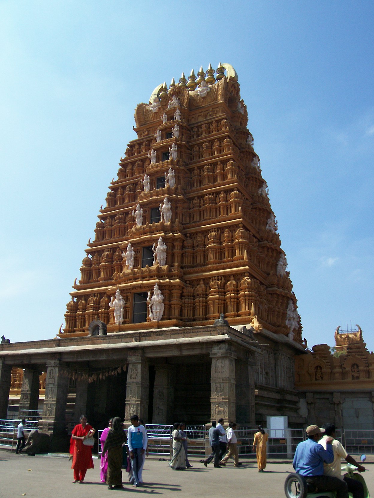


Why visit Nanjangūd
Townapedia lists 1 place to eat and 1 attraction in and around town.
Highlights include Kabini bridge.
Weather in Nanjangūd
Forecast from MET Norway (CC BY 4.0). Full forecast
About Nanjangūd
Nanjangud, officially known as Nanjanagudu, is a town and taluka in the Indian state of Karnataka. It lies on the banks of the river Kabini, 23 km (14 mi) from the city of Mysore. Nanjangud is famous for its Srikanteshwara Temple (also known as the Nanjundeshwara Temple). Nanjangud is also called the Varanasi of the South or Dakshina Kashi (southern Kashi).
From the Wikipedia article Nanjangud (this version), under CC BY-SA 4.0.
Travel tips from other travellers: Nanjangūd on Wikivoyage (CC BY-SA 4.0).
Things to do1
Restaurants and cafes1

Churches and places of worship3



Schools, colleges and libraries5

History
Nanjangud has been a major Shaiva centre for nearly a thousand years. Western Ganga dynasty kings in the 9th–10th centuries are considered to have built this temple, with significant additions by the Hoysalas, Cholas, and the Vijayanagara kings.
From the History section of Nanjangud on Wikipedia, under CC BY-SA 4.0.
Healthcare5
Map of Nanjangūd
15 places. The map loads OpenStreetMap tiles when you open it.
Getting there and nearby towns
Mysore Mandakalli Airport (MYQ) is the nearest airport with scheduled flights listed in OpenStreetMap, 13 km away.
- Kadakola 8 km north, about 8 min by car
- Srirampura 17 km northwest, about 17 min by car
- Mysuru 21 km north, about 21 min by car
- Bogādi 23 km northwest, about 23 min by car
- Hinakallu 25 km north, about 25 min by car
- Bhairāpura 26 km northeast, about 26 min by car
- Shrīrangapattana 34 km north, about 34 min by car
- Mandya 51 km northeast, about 51 min by car
- Ooty 78 km south, about 1 h 15 min by car
- Kalpatta 86 km southwest, about 1 h 30 min by car
Drive times are estimates from straight-line distance, not routes.
Local news
Headlines from INDB.
Reviews, tips and questions
Loading what members have shared...
Sources and licences
- GeoNames (CC BY 4.0): population, coordinates, regions and time zone
- OpenStreetMap contributors (ODbL 1.0): places, airports, map data
- Wikidata (CC0 1.0): elevation, founding date, time zone, website, landmarks and historic places
- Wikimedia Commons (see each image): photos
- Wikipedia (CC BY-SA 4.0): overview and history text
Photo credits
- Nanjanagudu 1, Naveen, CC BY-SA 3.0
- Srikanteshvara Temple, Nanjangud, Dineshkannambadi, CC BY-SA 3.0
- Nanjangud Oldest Bridge, Suraj T S, CC BY-SA 3.0
- Nanjangyd.Bhargavi cinema, Prof tpms, CC BY-SA 4.0
- Ali Mosque Nanjangud, Prof tpms, CC BY-SA 4.0
- Nanjangud.Durbar Restaurant, Prof tpms, CC BY-SA 4.0
- Sri Srikanteshvara Temple, Sekhar gunturu, CC BY-SA 3.0
- Nanjangyd.Golur school, Prof tpms, CC BY-SA 4.0
- Nanjangyd.Golur temple, Prof tpms, CC BY-SA 4.0
- Srikanteshwara Temple, Nanjangud - panoramio, Likhith N.P, CC BY-SA 3.0
- Nanjungudu, Yurzkumar, CC BY-SA 4.0
- The Kapila river in Nanjangud, Msclrfl22, CC BY-SA 3.0
- Nanjangud Temple at Night, Vedamurthy J, CC BY 3.0
- Nanjundeshwara temple ,Nanjanagudu - panoramio, Likhith N.P, CC BY-SA 3.0
- Nanjungudu mysore, Yurzkumar, CC BY-SA 4.0
- Kapila river bank, Nanjangud - panoramio, Likhith N.P, CC BY-SA 3.0
- Kabini Canal Road, Nanjangud, Prof tpms, CC BY-SA 4.0
- Botanical Garden (Ooty), Yogiroxxx, CC BY-SA 4.0
- Setting Out On A Serene Morning, Raja Selvaraj, CC BY 3.0
- Drying Up In The Golden Light, Raja Selvaraj, CC BY 3.0
- Taken over by nature, Preethi K., CC BY-SA 4.0
- Grandiose, Preethi K., CC BY-SA 4.0
- Grab on the go, Preethi K., CC BY-SA 4.0
- When you are late and need to shower quickly!!, Preethi K., CC BY-SA 4.0
- Mom's instincts, Preethi K., CC BY-SA 4.0
- Aloof, Preethi K., CC BY-SA 4.0
- Old and Wise, Preethi K., CC BY-SA 4.0
- A stark egret, Preethi K., CC BY-SA 4.0
- Maramma Temple, Bypass, Prof tpms, CC BY-SA 4.0
- Mahadeshwara Temple, Nanjangud, Prof tpms, CC BY-SA 4.0
- School at Korehundi, Nanjangud, Prof tpms, CC BY-SA 4.0
- Sujathapuram-Railway-Station, Rsrikanth05, CC BY-SA 3.0


Page built November 3, 2026. Spotted a mistake? Tell us or suggest a place.