


Why visit Narmadapuram
Townapedia lists 1 museum or landmark, 1 park or trail and 1 place to stay in and around town.
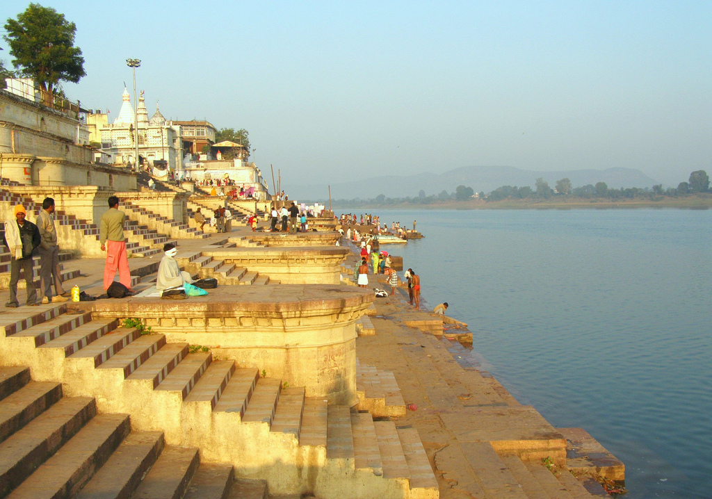
Highlights include Sethani Ghat.
Weather in Narmadapuram
Forecast from MET Norway (CC BY 4.0). Full forecast
About Narmadapuram
Hoshangabad (Hindi: IPA: [ɦoːʃə̃ŋɡɑːbɑːd]), officially Narmadapuram ([nəɾmədɑːəpʊɾəm]), is a city in the Indian state of Madhya Pradesh. It serves as the headquarters of both Hoshangabad district and Narmadapuram division. It is located in central India, on the south bank of the Narmada River. Hoshangabad is 76.7 km (47.7 mi) from the capital of Madhya Pradesh and the nearest airport Bhopal.
From the Wikipedia article Hoshangabad (this version), under CC BY-SA 4.0.
Travel tips from other travellers: Narmadapuram on Wikivoyage (CC BY-SA 4.0).
Museums and landmarks1
Parks, trails and playgrounds1

Where to stay1

Churches and places of worship1

History
The city was earlier called Narmadapur after the Narmada river. Later, the name was changed to Hoshangabad after Hoshang Shah Gori, the first ruler of Malwa Sultanate. Hoshangabad district was part of the Nerbudda (Narmada) Division of the Central Provinces and Berar, which became the state of Madhya Bharat (later Madhya Pradesh) after India's independence in 1947.
From the History section of Hoshangabad on Wikipedia, under CC BY-SA 4.0.
Schools, colleges and libraries1
Healthcare8
Map of Narmadapuram
13 places. The map loads OpenStreetMap tiles when you open it.
Getting there and nearby towns
Raja Bhoj Airport (BHO) is the nearest airport with scheduled flights listed in OpenStreetMap, 73 km away.
- Budhni 6 km northwest, about 6 min by car
- Itārsi 15 km south, about 15 min by car
- Mahrāgaon 16 km south, about 16 min by car
- Bhilakhedi 17 km south, about 17 min by car
- Bābai 22 km east, about 22 min by car
- Ordnance Factory Itarsi 24 km southeast, about 24 min by car
- Rehti 30 km west, about 30 min by car
- Ubaidullāhganj 31 km northwest, about 31 min by car
- Rānīpur 32 km southeast, about 32 min by car
- Bhopal 65 km northwest, about 1 h by car
Drive times are estimates from straight-line distance, not routes.
Local news
Headlines from INDB.
Reviews, tips and questions
Loading what members have shared...
Sources and licences
- GeoNames (CC BY 4.0): population, coordinates, regions and time zone
- OpenStreetMap contributors (ODbL 1.0): places, airports, map data
- Wikidata (CC0 1.0): elevation, founding date, time zone, website
- Wikimedia Commons (see each image): photos
- Wikipedia (CC BY-SA 4.0): overview and history text
Photo credits
- Setani ghat hoshangabad, Maheshbasedia, CC BY-SA 3.0
- Neebu, Rishabhvyadav, CC BY-SA 4.0
- D&T Chess.img, Sam patwa, CC BY-SA 4.0
- D&TChess.img, Sam patwa, CC BY-SA 4.0
- This photo is of the native Gond and Bhil community living in the country of India.jay adivasi johar, Deviram urf devraven bhalavi, CC BY-SA 4.0
- Sethani ghat hoshangabad, 03Ani03, CC BY-SA 4.0
- HoshangabadFort, IJOKETOOMUCH, CC BY-SA 4.0

Page built November 2, 2026. Spotted a mistake? Tell us or suggest a place.