


Why visit Pandharpur
Townapedia lists 3 parks and trails and 1 place to stay in and around town.
Weather in Pandharpur
Forecast from MET Norway (CC BY 4.0). Full forecast
About Pandharpur
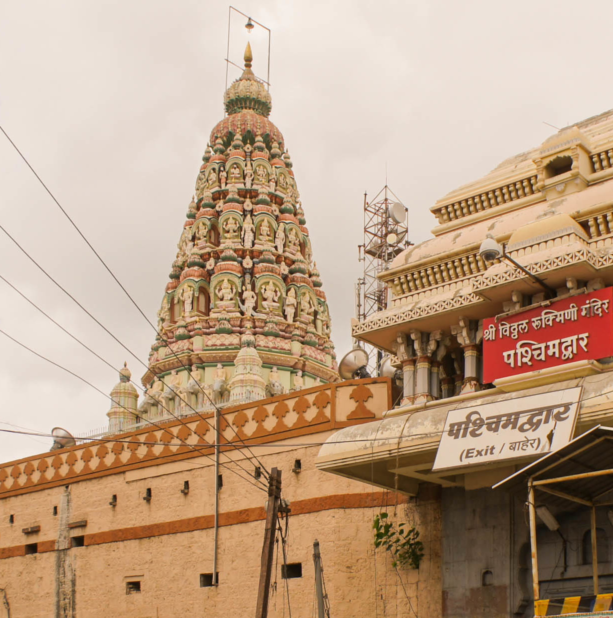
Pandharpur (Pronunciation: [pəɳɖʱəɾpuːɾ]), also Pandaripuram is a popular pilgrimage city, on the banks of Chandrabhagā River, near Solapur city in Solapur District, Maharashtra, India. Its administrative area is one of eleven tehsils in the District, and it is an electoral constituency of the state legislative assembly (vidhan sabha). The Vithoba temple attracts about a million Hindu pilgrims during the major yātrā (pilgrimage) in Ashadha (June–July).
From the Wikipedia article Pandharpur (this version), under CC BY-SA 4.0.
Parks, trails and playgrounds3

Where to stay1

Churches and places of worship8



Healthcare34


22 more on the map.
History
Small-scale archaeological excavation by Mate and Dhavalikar in 1968 found no evidence of occupation at the site before the 1200s, during the Yadava period. Evidence from this earliest phase of settlement consisted of one or two structures with a double hearth, along with various pottery fragments. Slightly older than this, though, is an inscription in the Vithoba temple dated to the year 1189, which states that a small shrine to Vithoba was set up that year for the first time. Thus, according to Shima Iwao, the origins of Vithoba worship at Pandharpur cannot be much older than this period.
The earliest undisputed epigraphic mentions of Pandharpur itself date from the 1200s as well: the 1237 inscription referring to the village of Paṇḍarage, which describes the construction of a temple gateway by the reigning monarch, and the 1270 inscription referring to the city of Pāṇḍuraṅgapura, which refers to a sacrifice taking place here. Further inscriptions dated to 1273-77 record the construction of a temple to Vithoba on the site of the earlier shrine — that is, on the site of the present temple.
From this point on, references to Pandharpur in literary and administrative documents become commonplace.
From the History section of Pandharpur on Wikipedia, under CC BY-SA 4.0.
Map of Pandharpur
46 places. The map loads OpenStreetMap tiles when you open it.
Getting there and nearby towns
Solapur Airport (SSE) is the nearest airport with scheduled flights listed in OpenStreetMap, 64 km away.
- Mangalvedha 22 km southeast, about 22 min by car
- Sāngola 30 km southwest, about 30 min by car
- Aklūj 40 km northwest, about 40 min by car
- Sangramnagar 42 km northwest, about 42 min by car
- Kurduvādi 47 km north, about 47 min by car
- Mhaswad 58 km west, about 58 min by car
- Indāpur 58 km northwest, about 58 min by car
- Sholapur 61 km east, about 1 h by car
- Nāteputa 66 km west, about 1 h by car
- Barshi 73 km northeast, about 1 h 15 min by car
Drive times are estimates from straight-line distance, not routes.
Local news
Headlines from INDB.
Reviews, tips and questions
Loading what members have shared...
Sources and licences
- GeoNames (CC BY 4.0): population, coordinates, regions and time zone
- OpenStreetMap contributors (ODbL 1.0): places, airports, map data
- Wikidata (CC0 1.0): elevation, founding date, time zone, website
- Wikimedia Commons (see each image): photos
- Wikipedia (CC BY-SA 4.0): overview and history text
Photo credits
- Pandharpur Vithoba temple, Parag Mahalley, CC BY-SA 2.0
- Pundlik Nagar, Pandharpur, Maharashtra 413304, India - panoramio (55), Udaykumar PR, CC BY 3.0
- Pandharpur 2013 Aashad - panoramio (10) (cropped), Udaykumar PR, CC BY 3.0
Page built November 3, 2026. Spotted a mistake? Tell us or suggest a place.