
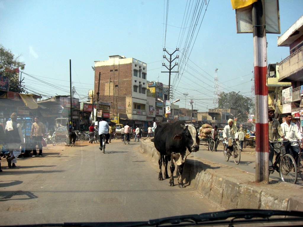


Pandit Deen Dayal Upadhyaya Nagar, India
Pandit Deen Dayal Upadhyaya Nagar is a town of 109,650 people in Uttar Pradesh, India.
Why visit Pandit Deen Dayal Upadhyaya Nagar
Townapedia lists 1 park or trail and 2 places to eat in and around town.
Weather in Pandit Deen Dayal Upadhyaya Nagar
Forecast from MET Norway (CC BY 4.0). Full forecast
About Pandit Deen Dayal Upadhyaya Nagar
Mughalsarai (; English: Mughal Tavern), officially known as Pandit Deen Dayal Upadhyaya Nagar since 2018, is a city and a municipal board in the Chandauli district of Uttar Pradesh. Located around 16 kilometres (10 miles) from Chandauli town, the district headquarters, it is an important railway junction.
From the Wikipedia article Mughalsarai (this version), under CC BY-SA 4.0.
Parks, trails and playgrounds1

Restaurants and cafes2

Moonville Rooftop
Restaurant · Indian · 3.6 km
pt road Opposite IP Mughal, Mughalsarai
Churches and places of worship2


Gas and EV charging1

History
Mughalsarai is located along the Grand Trunk Road (NH 19), also called Sadak-e-Azam by Sher Shah Suri, was one of the corridors connecting North India with the east during the Mughal period. In past centuries, it has been variously known as Mughalchak, Mangalpur and Oven Nagar. The township was named Mughalsarai when Indian railways established a junction here in 1883.
In August 2018, the city was renamed as Pandit Deen Dayal Upadhyaya Nagar, after Deendayal Upadhyaya, a politician and leader of the Bharatiya Jana Sangh.
From the History section of Mughalsarai on Wikipedia, under CC BY-SA 4.0.
Schools, colleges and libraries2
Healthcare7
Map of Pandit Deen Dayal Upadhyaya Nagar
15 places. The map loads OpenStreetMap tiles when you open it.
Getting there and nearby towns
Lal Bahadur Shastri International Airport (VNS) is the nearest airport with scheduled flights listed in OpenStreetMap, 32 km away.
- Rāmnagar 9 km west, about 9 min by car
- Varanasi 12 km west, about 12 min by car
- Chandauli 15 km east, about 15 min by car
- Dīkshitpur 21 km southwest, about 21 min by car
- Chakia 28 km south, about 28 min by car
- Chunār 29 km southwest, about 29 min by car
- Saidpur 30 km north, about 30 min by car
- Ahraura 31 km south, about 31 min by car
- Barāgaon 34 km northwest, about 34 min by car
- Kachhwa 42 km west, about 42 min by car
Drive times are estimates from straight-line distance, not routes.
Local news
Headlines from INDB.
Reviews, tips and questions
Loading what members have shared...
Sources and licences
- GeoNames (CC BY 4.0): population, coordinates, regions and time zone
- OpenStreetMap contributors (ODbL 1.0): places, airports, map data
- Wikidata (CC0 1.0): elevation, founding date, time zone, website
- Wikimedia Commons (see each image): photos
- Wikipedia (CC BY-SA 4.0): overview and history text
Photo credits
- GT Road Mughalsarai, Shahid1024 at English Wikipedia, Public domain
- Mughalsarai junction, 25 Cents FC, CC BY-SA 3.0
- Mughalsarai Junction entrance, 25 Cents FC, CC BY-SA 3.0
- Platform 1 and 2 of Mughalsarai Junction, India, Ravi Dwivedi, CC BY-SA 4.0
- Mughalsarai Junction from flyover 01, Ravi Dwivedi, CC BY-SA 4.0
- A view of Mughalsarai Junction from Platform 5, Ravi Dwivedi, CC BY-SA 4.0
- Local-train-platform-5-mughalsarai, Ravi Dwivedi, CC BY-SA 4.0
- Mughalsarai Junction from flyover, Ravi Dwivedi, CC BY-SA 4.0
- Pt. Deen Dayal Upadhyaya Junction board, Ravi Dwivedi, CC BY-SA 4.0
- A view of Mughalsarai Junction from the flyover bridge, Ravi Dwivedi, CC BY-SA 4.0
- Platform 6 of Mughalsarai Junction from flyover bridge, Ravi Dwivedi, CC BY-SA 4.0
- Mughalsarai Junction view from platform 5, Ravi Dwivedi, CC BY-SA 4.0
- Local Train on Platform 5 of Mughalsarai Junction, Ravi Dwivedi, CC BY-SA 4.0
- Platform 7 of Mughalsarai Junction, India, Ravi Dwivedi, CC BY-SA 4.0
- Bread-Omlette-at-Mughalsarai-Junction, Ravi Dwivedi, CC BY-SA 4.0
- Howrah-New Delhi Duronto Express on Platform 6 of Mughalsarai Junction, Ravi Dwivedi, CC BY-SA 4.0
- PT.DEEN DAYAL UPADHYAYA Jn, Goutam1962, CC BY-SA 4.0
- Upper Class waiting room at Platform 6 of Mughalsarai Junction, India, Ravi Dwivedi, CC BY-SA 4.0
- Green colored coach of 12273 Howrah-New Delhi Duronto Express, Ravi Dwivedi, CC BY-SA 4.0
- Food Track at Mughalsarai Junction platform 6, Ravi Dwivedi, CC BY-SA 4.0
- Mughalsarai Railway Station, Uttar Pardesh, India, Ravi Dwivedi, CC BY-SA 4.0
- Pantry car of 12273 Howrah-New Delhi Duronto Express, Ravi Dwivedi, CC BY-SA 4.0
- Aloo sabzi at Mughalsarai Junction, Ravi Dwivedi, CC BY-SA 4.0
- Rice and Boiled Eggs at a shop at platform 6 in Mughalsarai Junction, Ravi Dwivedi, CC BY-SA 4.0
- Platform 4 and 5 of Mughalsarai Junction from flyover, Ravi Dwivedi, CC BY-SA 4.0
- Pt. Deen Dayal Upadhyaya Junction railway station, India, Ravi Dwivedi, CC BY-SA 4.0
- Pt. Deen Dayal Upadhyaya Junction platform, Ravi Dwivedi, CC BY-SA 4.0
- Pt. Deen Dayal Upadhyaya Junction platform 6, Ravi Dwivedi, CC BY-SA 4.0
- Train-outside-mughalsarai-junction-railway-station, Ravi Dwivedi, CC BY-SA 4.0
- Mughalsarai Junction view from flyover bridge, Ravi Dwivedi, CC BY-SA 4.0
- Pt. Deen Dayal Upadhyaya Junction platform 6, India, Ravi Dwivedi, CC BY-SA 4.0
- A-view-of-mughalsarai-junction, Ravi Dwivedi, CC BY-SA 4.0
- Platform 6 of Mughalsarai Junction, Ravi Dwivedi, CC BY-SA 4.0
- Shot of Mughalsarai Junction from a train departing from Mughalsarai Junction, Ravi Dwivedi, CC BY-SA 4.0
- One of the diamnod crossings in MGS - Flickr - Dr. Santulan Mahanta, Santulan Mahanta from Golaghat (GLGT), Guwahati (GHY), Lucknow (LKO), New Delhi (NDLS), INDIA, CC BY 2.0
- ISS036-E-785 - View of India, Earth Science and Remote Sensing Unit , Lyndon B. Johnson Space Center, Public domain


Page built November 2, 2026. Spotted a mistake? Tell us or suggest a place.