

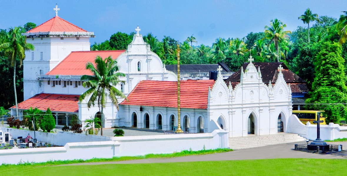


Why visit Perumpāvūr
Townapedia lists 2 museums and landmarks, 4 parks and trails, 86 places to eat, 7 places to stay and 5 attractions in and around town.
Highlights include Vallam–Parakkadavu Bridge.
Weather in Perumpāvūr
Forecast from MET Norway (CC BY 4.0). Full forecast
Things to do5


ashirvad film complex
Cinema and theater
Perumbavoor-Nellimolam Road, Perumbavoor

Museums and landmarks2



Parks, trails and playgrounds4


Restaurants and cafes86




74 more on the map.
Where to stay7
Churches and places of worship40
Shopping29
Gas and EV charging9
Schools, colleges and libraries23
Asram Higher Secondary School Perumbavoor
School · 1.4 km
Perumbavoor, Perumbavoor
Government Higher Secondary School Perumbavoor
School · 0.6 km
Perumbavoor, Perumbavoor
Goverment Lower Primary School, Kanjirakkadu
School · 1.3 km
Kanjirakkadu, perumbavoor
Government Girls Higher Secondary School Perumbavoor
School
Perumbavoor, Perumbavoor
Government Girls Lower Primary School Perumbavoor
School
Perumbavoor, Perumbavoor
government lower primary school kanjirakkadu
School · 1.3 km
kanjirakkadu, perumbavoor
Healthcare20
oasis medical clinic
Clinic and pharmacy · 2.1 km
souhrdha junction,mudickal Aluva-Perumbavoor Road
Map of Perumpāvūr
225 places. The map loads OpenStreetMap tiles when you open it.
Getting there and nearby towns
Cochin International Airport (COK) is the nearest airport with scheduled flights listed in OpenStreetMap, 9 km away.
- Piravam 28 km south, about 28 min by car
- Kochi 31 km southwest, about 31 min by car
- Vypīn 30 km southwest, about 30 min by car
- Arukutti 31 km southwest, about 31 min by car
- Vaikam 42 km south, about 42 min by car
- Vayalār 47 km south, about 47 min by car
- Thrissur 53 km northwest, about 53 min by car
- Alappuzha 71 km south, about 1 h 15 min by car
- Palakkad 76 km north, about 1 h 15 min by car
- Shōranūr 75 km north, about 1 h 15 min by car
Drive times are estimates from straight-line distance, not routes.
Local news
Headlines from INDB.
Reviews, tips and questions
Loading what members have shared...
Sources and licences
- GeoNames (CC BY 4.0): population, coordinates, regions and time zone
- OpenStreetMap contributors (ODbL 1.0): places, airports, map data
- Wikidata (CC0 1.0): elevation, founding date, time zone, website, landmarks and historic places
- Wikimedia Commons (see each image): photos
Photo credits
- Parappuram Vallamkadavu Bridge IMG 20231110 090447, Ranjithsiji, CC BY-SA 4.0
- Marth Mariam Pally Kuruppampady, Mathen Payyappilly Palakkappilly, CC BY-SA 4.0
- Statue of Mahatma Gandhi Perumbavoor, Ranjithsiji, CC BY-SA 3.0
- Statue of Mahatma Gandhi, Perumbavoor 02, Vis M, CC0
- Perumbavoor Taluk Headquarters Hospital, Ronyrajan95, CC BY-SA 4.0
- Subhas Chandra Bose statue, Perumbavoor, Vis M, CC0
- Subhas Chandra Bose statue, Perumbavoor 02, Vis M, CC0
- Perumbavoor Kalady Junction, Wikiwikirajesh, CC BY-SA 3.0
- Orthodox Church, Perumbavoor - panoramio, Suresh Babunair, CC BY 3.0
- All Saints CSI Church, Perumbavoor, Vis M, CC0
- Dharmasastha perumpavoor 03, Dvellakat, CC BY-SA 4.0
- Flood kerala 2018 2, Vishnus00, CC BY-SA 3.0
- St. George Church, Perumbavoor, Vis M, CC BY-SA 4.0
- Kuzhuppillykavu sree bhagavathi temple, SijiR, CC BY-SA 4.0
- A bunch fo flowers, Arisepeter, CC BY-SA 4.0
- A bunch of yellow flower, Arisepeter, CC BY-SA 4.0
- Beautiful Artificial Christmas Tree, Arisepeter, CC BY-SA 4.0
- Cat in a chair (2018 photo; cropped 2023), Arisepeter, CC BY-SA 4.0
- Cat in a chair, Arisepeter, CC BY-SA 4.0
- The Union of Faith, Biju Grace, CC BY-SA 4.0
- Flood kerala 2018 3, Vishnus00, CC BY-SA 3.0
- Perumbavoor KSRTC Bus Terminal, Ronyrajan95, CC BY-SA 4.0
- Dharmasastha perumpavoor 02, Dvellakat, CC BY-SA 4.0
- Muhammed Koya Thangal addressing people in Kandanthara, Thangal.muthu, CC0
- Kaithi biriyani chicken, Baluej, CC BY-SA 4.0
- Kaithi biriyani beef, Baluej, CC BY-SA 4.0
- Beautiful cock, Arisepeter, CC BY-SA 4.0


Page built November 3, 2026. Spotted a mistake? Tell us or suggest a place.