
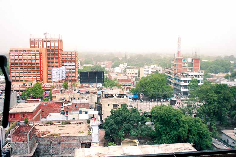


Why visit Prayagraj
Townapedia lists 13 museums and landmarks, 55 parks and trails, 146 places to eat, 40 places to stay and 12 attractions in and around town.
Highlights include Lord Curzon Bridge, Motilal Nehru National Institute of Technology, Allahabad, Anand Bhavan and Allahabad Museum.
Weather in Prayagraj
Forecast from MET Norway (CC BY 4.0). Full forecast
About Prayagraj
Prayagraj (, Hindi: [pɾəjaːɡ.ɾaːd͡ʑ]; ISO: Prayāgarāja), formerly and colloquially known as Allahabad (), is a metropolis in the Indian state of Uttar Pradesh. It is the administrative headquarters of the Prayagraj district, the most populous district in the state and 13th most populous district in India and the Prayagraj division. The city is the judicial capital of Uttar Pradesh with the Allahabad High Court being the highest judicial body in the state. As of 2011, Prayagraj is the seventh most populous city in the state, thirteenth in Northern India and thirty-sixth in India, with an estimated population of 1.53 million in the city.
From the Wikipedia article Prayagraj (this version), under CC BY-SA 4.0.
Travel tips from other travellers: Prayagraj on Wikivoyage (CC BY-SA 4.0).
Things to do12

Lord Curzon Bridge
Bridge · 7.4 km
Lord Curzon Bridge is situated over the Ganges that connects Allahabad with Phaphamau from the Teliarganj area

Motilal Nehru National Institute of Technology, Allahabad
School · 5.7 km
Institute of technology in Prayagraj, Uttar Pradesh

New Yamuna Bridge
Bridge · 2.9 km
Bridge at Prayagraj over River Yamuna, Uttar Pradesh, India

Sam Higginbottom Institute of Agriculture, Technology and Sciences
School · 3.5 km
Government-aided deemed university in Prayagraj, Uttar Pradesh


Museums and landmarks13
Anand Bhavan
Museum · 2.3 km
Historic house museum in Prayagraj, India





1 more on the map.
Parks, trails and playgrounds55




43 more on the map.
Restaurants and cafes146

CAFÉ 60 FEET
Restaurant · Coffee Shop, Pizza, Burger, Chinese, Sandwich, Pasta · 4.3 km
133k/18b Rajroopur Road (60 feet Rd), Allahabad

Dosa Plaza
Restaurant · Indian, South Indian · 1.4 km
F-1 Strachey Road, Civil Lines, Prayagraj
134 more on the map.
Where to stay40
Zone Connect by The Park
Motel and hotel · 1.3 km
2/1A, Near Bhagwan Ram Mandir, Civil Lines Stretchy Road, Prayagraj
Hotel Yatrik
Motel and hotel · 1.5 km
33 Sardar Patel Marg, Gayatripuram Colony, Civil Lines, Prayagraj
Churches and places of worship49
Attraction Point 6 (KULVRIKSH GANGA AARTI STHAL)
Place of worship · 4.1 km
Sangam Marg, Kumbh Mela Area I, Prayagraj
Attraction Point 7 (Bhagwan Adi Shankaracharya Ghat)
Place of worship · 4.2 km
12 Sangam Marg, Prayagraj
Shopping40
Vinayak City Centre
Shopping center · 1.4 km
24 Sardar Patel Marg, Civil Lines, Prayagraj
Gas and EV charging15
Schools, colleges and libraries68
Institute of Psychology Education and Measurement (IPEM)
School · 1.6 km
25-A MG Marg, Civil Lines, Prayagraj
Sam Higginbottom University of Agriculture, Technology and Sciences
School · 3.5 km
Healthcare148
Arthritis Homoeopathic Clinic
Clinic and pharmacy · 3.2 km
Labour Chauraha, Sabzi Mandi Road, Allahabad
Map of Prayagraj
250 places. The map loads OpenStreetMap tiles when you open it.
Getting there and nearby towns
Allahabad Bamrauli Airport (IXD) is the nearest airport with scheduled flights listed in OpenStreetMap, 10 km away.
- Jhūsi 6 km east, about 6 min by car
- Chail 21 km west, about 21 min by car
- Phulpur 27 km northeast, about 27 min by car
- Mau Aimma 29 km north, about 29 min by car
- Sirsā 32 km southeast, about 32 min by car
- Sarāi Ākil 34 km west, about 34 min by car
- Handiā 36 km east, about 36 min by car
- Shankargarh 37 km southwest, about 37 min by car
- Bharwāri 38 km west, about 38 min by car
- Karārī 42 km west, about 42 min by car
Drive times are estimates from straight-line distance, not routes.
Local news
Headlines from INDB.
Reviews, tips and questions
Loading what members have shared...
Sources and licences
- GeoNames (CC BY 4.0): population, coordinates, regions and time zone
- OpenStreetMap contributors (ODbL 1.0): places, airports, map data
- Wikidata (CC0 1.0): elevation, founding date, time zone, website, landmarks and historic places
- Wikimedia Commons (see each image): photos
- Wikipedia (CC BY-SA 4.0): overview and history text
Photo credits
- Allahabad city, Vroomtrapit at English Wikipedia, CC0
- NewYamunaBridge Ald, Dhirendram, Public domain
- Anand Bhawan, Allahabad, Balasub, CC BY-SA 2.0
- Allahabad Museum Jan 2014 AJ, Dananuj, CC BY-SA 3.0
- Jawahar Planetarium, Allahabad Jan 2014 AJ, Dananuj, CC BY-SA 3.0
- Around and near Anand Bhavan, Swaraj Bhavan, Allahabad, IRCTC 2017 (32), Vinayaraj, CC BY-SA 4.0
- Front Facade St Joseph Cathedral Allahabad Dec23 A7C 08436, This Photo was taken by Timothy A. Gonsalves . Feel free to use my photos, but please mention me as the author. I would much appreciate if you send me an email [email protected] or write on my talk..., CC BY-SA 4.0
- Front St Thomas Orthodox Syrian Church Allahabad Dec23 A7C 08492, This Photo was taken by Timothy A. Gonsalves . Feel free to use my photos, but please mention me as the author. I would much appreciate if you send me an email [email protected] or write on my talk..., CC BY-SA 4.0
- Akbar Fort Allahabad, Vyomtripathi, CC BY-SA 4.0
- Khusru Bagh (Interior View)-Allahabad-Uttar Pradesh-IMG 20190915 082854, Harshgupta28, CC BY-SA 4.0
- Victoria Memorial Allahabad, Vyomtripathi, CC BY-SA 4.0
- Mlnmc1, Mikudavidson, CC BY-SA 4.0
- Thornhill Mayne Memorial, Alfred Park, Allahabad, Dananuj, CC BY-SA 3.0
- Queen Victoria's Memorial in Alfred park,Allahabad, U.P., India.., Maini vaibhav, CC BY-SA 3.0
- Tomb of Nisar Begum at Khusro Bagh Allahabad, सत्यम् मिश्र, CC BY-SA 4.0
- Ashoka Pillar in Allahabad, Aj.abhishek1998, CC BY-SA 4.0
- Phaphamau, Arshsangh, CC BY 4.0
- Hanuman Niketan Door, 21GauriGuptaa, CC BY-SA 4.0
- Bade Hanumanji Civil lines - panoramio, Rajesh Tripathi, CC BY 3.0
- Allahabad, Johnston Ganj 2 (40136815282), juggadery, CC BY-SA 2.0
- Allahabad, Johnston Ganj 3 (28389464959), juggadery, CC BY-SA 2.0
- Allahabad, Johnston Ganj 1 (40136805512), juggadery, CC BY-SA 2.0
- Tradescantia pallida - Wandering Jew, Apurv013, CC0
- Allahabad, Johnston Ganj 5 (40157653421), juggadery, CC BY-SA 2.0
- Allahabad, Johnston Ganj Mahadeo Palace 5b - ornament (39914727471), juggadery, CC BY-SA 2.0
- Allahabad, Johnston Ganj Mahadeo Palace 3f - (40012579612), juggadery, CC BY-SA 2.0
- Allahabad, Johnston Ganj Mahadeo Palace 5a - (25053013017), juggadery, CC BY-SA 2.0
- Allahabad, Johnston Ganj Mahadeo Palace 3c - (40025055202), juggadery, CC BY-SA 2.0
- Allahabad, Johnston Ganj Mahadeo Palace 4d - (39950117901), juggadery, CC BY-SA 2.0
- Allahabad, Johnston Ganj Mahadeo Palace 4c - complication (39918212472), juggadery, CC BY-SA 2.0
- Allahabad, Johnston Ganj Mahadeo Palace 3a - 1933 (39346885174), juggadery, CC BY-SA 2.0
- Allahabad, Johnston Ganj Mahadeo Palace 3b - (40025060012), juggadery, CC BY-SA 2.0
- Allahabad, Johnston Ganj Mahadeo Palace 1 - (40043594022), juggadery, CC BY-SA 2.0
- Allahabad, Johnston Ganj 4 (26296856458), juggadery, CC BY-SA 2.0
- Allahabad, Johnston Ganj Mahadeo Palace 3 - (40076657171), juggadery, CC BY-SA 2.0
- Allahabad, Johnston Ganj Mahadeo Palace 5 - (39943990981), juggadery, CC BY-SA 2.0
- Allahabad, Johnston Ganj Mahadeo Palace 4b - (39240114774), juggadery, CC BY-SA 2.0
- Allahabad, Johnston Ganj Mahadeo Palace 3d - capital (39334731184), juggadery, CC BY-SA 2.0
- Allahabad, Johnston Ganj Mahadeo Palace 4a - (40045498271), juggadery, CC BY-SA 2.0
- Allahabad, Johnston Ganj Mahadeo Palace 8 - ladies (39204196394), juggadery, CC BY-SA 2.0


Page built November 2, 2026. Spotted a mistake? Tell us or suggest a place.