


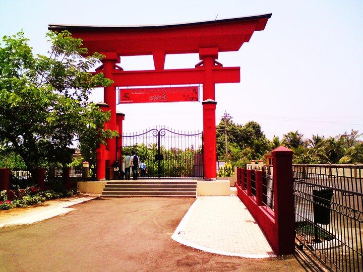

Why visit Raia
Townapedia lists 4 museums and landmarks, 7 parks and trails, 44 places to eat, 1 place to stay and 3 attractions in and around town.
Highlights include Govind Ramnath Kare College of Law, Parvatibai Chowgule College of Arts and Science, Ashvek Vintage World and Big Foot Museum.
Weather in Raia
Forecast from MET Norway (CC BY 4.0). Full forecast
About Raia
Raia (Goan Konkani: Rai) is a quaint village in the Salcete taluka of South Goa district, Goa state, India. It is located 4 km (2.5 mi) east from the district headquarters of Margao and 35 km (22 mi) from the state capital Panjim.
From the Wikipedia article Raia, Goa (this version), under CC BY-SA 4.0.
Things to do3

Govind Ramnath Kare College of Law
School · 4.0 km
Law college in Goa
Parvatibai Chowgule College of Arts and Science
School · 2.0 km
College in Goa, India

Museums and landmarks4

Ashvek Vintage World
Museum · 3.6 km
Vintage car museum in South Goa, India


Memorial For Goan Victims of 1918 Spanish Flu
Monument and historic site · 1.7 km
Parks, trails and playgrounds7





Restaurants and cafes44




32 more on the map.
History
Pe. Jorge Paulino da Piedade Sequeira, a priest from the area, wrote a book titled Raia e Camorlim. Para a História das Aldeias, (Raia and Camorlim: About the History of the Villages), published by the Xaverian Press at Pilar in 1972. Camorlim is a village between Raia and Loutolim.
According to former Indian Union minister Eduardo Faleiro, Raia "derives its name from Agni Mukha Roy, one of the earlier Kadamba kings who established his headquarters in this village." Faleiro cites Fr. Jorge Sequeira to suggest that, in the past, the village was known variously as Rayanagara, Rajapur and Rayapur, and with the decline of the Kadamba dynasty it became known simply as Raya and then Raia.
The earlier ruling empire of the Kadambas are believed to have brought the deity of Kamakshi to the village, the temple of which was destroyed during Portuguese rule, with the deity being shifted across the river to Rai Shiroda, a locality on the other bank of the river beyond the then Portuguese territory.
Raia was the first village in Salcette to have been Christianised, when its populace was converted en masse to Christianity in 1560.
From the History section of Raia, Goa on Wikipedia, under CC BY-SA 4.0.
Where to stay1
Churches and places of worship11
Shopping16
Gas and EV charging2
Schools, colleges and libraries7
Healthcare20
Map of Raia
115 places. The map loads OpenStreetMap tiles when you open it.
Getting there and nearby towns
Goa International Airport (GOI) is the nearest airport with scheduled flights listed in OpenStreetMap, 17 km away.
- Madgaon 4 km southwest, about 4 min by car
- Nuvem 4 km west, about 4 min by car
- Davorlim 4 km southeast, about 4 min by car
- Navelim 5 km south, about 5 min by car
- Taleigao 24 km northwest, about 24 min by car
- Serula 30 km northwest, about 30 min by car
- Canacona 35 km south, about 35 min by car
- Solim 41 km northwest, about 41 min by car
- Sāvantvādi 69 km north, about 1 h 15 min by car
- Belagavi 83 km northeast, about 1 h 30 min by car
Drive times are estimates from straight-line distance, not routes.
Local news
Headlines from INDB.
Reviews, tips and questions
Loading what members have shared...
Sources and licences
- GeoNames (CC BY 4.0): population, coordinates, regions and time zone
- OpenStreetMap contributors (ODbL 1.0): places, airports, map data
- Wikidata (CC0 1.0): elevation, founding date, time zone, website, landmarks and historic places
- Wikimedia Commons (see each image): photos
- Wikipedia (CC BY-SA 4.0): overview and history text
Photo credits
- Rachol Church, Historic Discoveries, CC BY-SA 3.0
- Holy Spirit Church. Margao. Goa. India. Церковь Святого Духа. Маргао. Гоа. Индия - panoramio (2), kikiwis, CC BY 3.0
- Fatorda stadium exterior 1, The original uploader was Vrlobo888 at English Wikipedia ., Public domain
- Fatorda Stadium, Goa, Donkey335, CC BY-SA 4.0
- Chowgule, pravinsilva, Public domain
- Govind Ramnath Kare College, Rejoy2003, CC BY-SA 4.0
- Big Foot 2, JosephAssisFernandes, CC BY-SA 4.0
Page built November 3, 2026. Spotted a mistake? Tell us or suggest a place.