
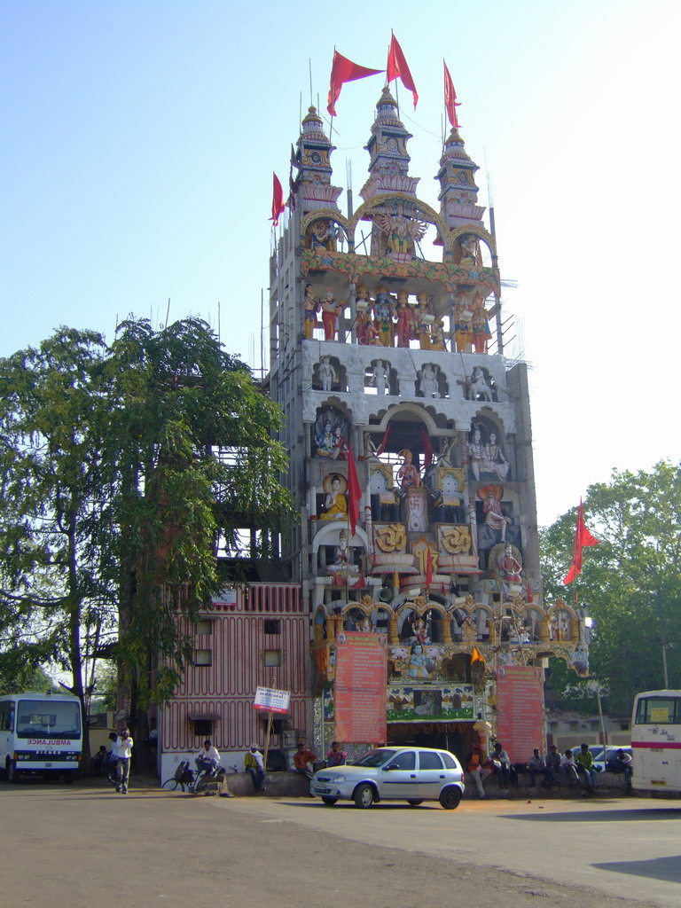


Why visit Raipur
Townapedia lists 9 museums and landmarks, 50 parks and trails, 98 places to eat, 20 places to stay and 12 attractions in and around town.
Highlights include National Institute of Technology Raipur, Bigcinema, Mahant Ghasidas Museum Raipur and Gulmohar Vatika Park.
Weather in Raipur
Forecast from MET Norway (CC BY 4.0). Full forecast
About Raipur
Raipur (Hindi: rāypura, pronounced [ɾaːɪpʊɾᵊ] ) is the capital city of the Indian state of Chhattisgarh. Raipur is also the administrative headquarters of Raipur district and Raipur division, and the most populous city of the state. It was a part of Madhya Pradesh before the state of Chhattisgarh was formed on 1 November 2000. It is a major commercial hub for trade and commerce in the region.
From the Wikipedia article Raipur (this version), under CC BY-SA 4.0.
Travel tips from other travellers: Raipur on Wikivoyage (CC BY-SA 4.0).
Things to do12

National Institute of Technology Raipur
School · 3.4 km
Premier engineering institute

Glitz Cinemas
Cinema and theater · 3.0 km
NH43 PachpediNaka,bajaj colony,gurumukh singh nagar, Raipur
raj talkies
Cinema and theater · 1.3 km
GE Rd, New Bombay Market, raipur
shyam talkies
Cinema and theater
Opposite Budhapara Lake, Budhapara, Raipur, Chhattisgarh, Raipur
Cantavil
Cinema and theater · 5.4 km
City Mall 36, Shop no-21 , Ground Floor, City Mall 36, Raipur, Chhattisgarh, raipur
MirrorMaze
Cinema and theater · 3.0 km
NH43 PachpediNaka,bajaj colony,gurumukh singh nagar, Raipur
TimeZone
Cinema and theater · 3.0 km
NH43 PachpediNaka,bajaj colony,gurumukh singh nagar, Raipur
Museums and landmarks9


Mahant Ghasidas Museum Raipur
Museum · 1.7 km
Archaeological Museum in Chhattisgarh, India

Maha koshal Art Gallery
Monument and historic site · 1.3 km
jaistambh chowk,civillines, raipur

Parks, trails and playgrounds50

Shankracharya Garden
Park · 1.8 km
Local Park and Garden for people to sit, exercise, relax. It has cool sitting areas, equipment for exercise, jogging track.
Samta Colony, Raipur

Wonder Land Park
Sports field and stadium · 5.9 km
Indraprastha Colony, Raipura, Raipur, Chhattisgarh 492013, raipur
Sardar Vallabh Bhai Patel International Hockey Stadium
Sports field and stadium · 3.8 km
GE Road, raipur
38 more on the map.
Restaurants and cafes98

Madrasi Restaurant
Restaurant · Biryani, Indian, Halaal · 1.0 km
Malviya Main Road, raipur
Mo-Su 11:00-23:30

Madrasi Grill
Restaurant · Biryani, Indian, Halaal · 2.9 km
Bhawani Patna-Raipur High Way,TeliBaldha, Raipur
11:00-23:30
Pizza Hut
Restaurant · Italian Pizza · 2.5 km
Shop No 1&2 Raheja Towers,Fafadi Chowk, Jail Road, Raipur
Mo-Su 11:00-23:00

CCD chotpara
Cafe · 0.9 km
inside DMZ plaza near subhash stadium,stadium road, Raipur
Mo-Su 11:00-23:00
Cafe Coffee Day
Cafe · Coffee Shop · 2.5 km
amazing hotel,multi function complex,rail way station, raipur
Mo-Su 07:00-24:00
Dominos Tihmapara
Restaurant · 2.9 km
grnd floor,kh no 464/83/p, Mousa,Tihmapara,ward no. 51,Rabindranath Tagore ward raipur, Raipur
11:00-23:00
86 more on the map.
History
Raipur district, like the rest of the Chhattisgarh plain, was once known as Dakshina Kosala and considered to be under Maurya Empire. In Arang near Raipur, a Gupta inscription dated to the 6th century CE shows Gupta hegemony over the region. In the 7th century CE, the region was ruled by a Buddhist kingdom in Bhandak in modern-day Maharashtra and was described by Xuanzang. A branch of this family later migrated to Sirpur in present-day Mahasamund district, and later took control of the entirety of Dakshina Kosala. This kingdom's prosperity reached its height with Tivaradeva. His son inscribed almost all temples in Sirpur. They were later ousted by the Sharabpuriyas, who took control of the rest of Chhattisgarh and ruled for several centuries.
By the early 9th century the Kalachuris gained control of the region. The Kalachuris of Ratnapura ruled Ratnapur until the 13th century. By the 14th century, the Kalachuris of Raipur branch gained power. One king of the Raipur branch conquered 18 garh, or forts, of the enemy - lending an etymology to Chhattisgarh, the 36 forts. By the 18th century Kalachuris became the overlords of entire Chhattisgarh region.
From the History section of Raipur on Wikipedia, under CC BY-SA 4.0.
Where to stay20
Hotel Prakash Palace
Motel and hotel · 2.1 km
Prakash Swimming Pool, Near Pachpedi Naka Flyover, NH-6, Raipur,
Aghariya samaj seva samiti boys hostel
Motel and hotel · 2.8 km
Aghariya samaj seva samiti boys hostel danganiya market
Major Gore Hostel no.02
Motel and hotel · 3.7 km
Science College Campus Road, raipur
R.K. Hills Girls Hostel
Motel and hotel · 1.9 km
Ring Road No. 1, Pachpedi Naka Rd, Priyadarshini Nagar Colony, Pachpedi Naka, Raipur, Mathpurena
Sahu PG
Motel and hotel · 1.9 km
Pachpedi Naka Rd, Dharam Nagar, Postal Colony, Tikrapara, Raipur, Mathpurena, Chhattisgarh 492001
Churches and places of worship82
BANJARI MANDIR
Place of worship · Orthodox · 4.6 km
banjari mata road PT. RSU, raipur
Chottapara Baijnatpara Mazjid
Place of worship · Sunni · 0.8 km
Janta Colony,Stadium Road, Raipur
Shopping42
Oxford book store and stationary
Shop · 5.4 km
2nd floor citymall36, NH6,near chokra nala,vishal nagar,GE road, raipur
Gas and EV charging13
all india radio petrolbunk
Gas station · 1.4 km
kamla nehru marg,civil lines,opp gass memorial ground, raipur
Bharat Petroleum Corporation Limited
Gas station · 2.3 km
Dhamtari Abhanpur Road, Raipur
Hindustan Petroleum
Gas station · 1.6 km
industrial area,godnwara rd,no2 ring rd,near ganesh dharam kanta, raipur
Hindustan Petroleum Corporation Limited
Gas station · 2.1 km
Flyover Bhatagaon, Raipur
Star indian oil
Gas station · 0.7 km
nr nehru nagar,near police petrol pump,dhamtari rd,nehrunagar, raipur
Schools, colleges and libraries67
Government .J. yaganandam chittisgarh college
School · 1.4 km
Baron bazar ,in front of kamala tiwari nursing room,, raipur
Government nagarjuna post graduate college of science
School · 3.6 km
GE road ,international swimming pool ,near rk college, raipur
govrnment dudhari bajarang girls post graduate autonomous college
School
kalibadichowk, budhapura raipur, Raipur
Maharaj Agrasen International College
School · 1.5 km
6JVF+QQW Shri Ramanth Bhimsen Marg Samta Colony, Raipur
Allen Carrier Institute Raipur
School · 1.7 km
Pujari Complex, Block A-2, opp. GST Bhawan, beside Pujari Park Road, Pachpedi Naka, Raipur
Excel Educational Institute
School · 1.9 km
6JCW+MP9 Excel Tower, Pachpedi Naka Rd, Postal Colony, Pachpedi Naka, Raipur, Mathpurena, Chhattisga
Healthcare183
Bal Gopal Children Hospital and Research Institute
Hospital · 0.8 km
Near mahila police thane, byron bazar road, Raipur
chhattisgarh info tech promotion society
Clinic and pharmacy · 2.2 km
3rd floor,state data central building,oppt.new circuit house,civil lines, raipur
Ramkrishna Care Hospital
Hospital · 3.1 km
Aurobindo Enclave, Pachpedi Naka, Dhamtari Road, NH43,, Raipur
Sai Baba Nursing Home, Raipur
Clinic and pharmacy · 2.8 km
Dr.swathi mahobia, newrajandranagar opp.vijeta complex, Raipur
Suyash Superspeciality Hospital
Hospital · 4.0 km
Gudhiyari Road, Behind hotel piccadily, kota, Raipur
Vardaan Hospital (Unit Of Jindal Medicare)
Hospital · 3.7 km
Infront of shankar nagargarden, main road, sector-1, shankar nagar,, Raipur
Shri Karni Medical Store
Clinic and pharmacy · 4.1 km
ekta nagar chowk Ekta Nagar Road, Raipur
Map of Raipur
250 places. The map loads OpenStreetMap tiles when you open it.
Getting there and nearby towns
Swami Vivekananda Airport (RPR) is the nearest airport with scheduled flights listed in OpenStreetMap, 13 km away.
- Mana-Camp 10 km southeast, about 10 min by car
- Bhatgaon 12 km southeast, about 12 min by car
- Kumhāri 13 km west, about 13 min by car
- Mandir Hasaud 14 km east, about 14 min by car
- Siltara 17 km north, about 17 min by car
- Bhilai Charoda 18 km west, about 18 min by car
- Bhilai 21 km west, about 21 min by car
- Abhanpur 23 km southeast, about 23 min by car
- Koora 22 km north, about 22 min by car
- Jāmul 24 km west, about 24 min by car
Drive times are estimates from straight-line distance, not routes.
Local news
Headlines from INDB.
Reviews, tips and questions
Loading what members have shared...
Sources and licences
- GeoNames (CC BY 4.0): population, coordinates, regions and time zone
- OpenStreetMap contributors (ODbL 1.0): places, airports, map data
- Wikidata (CC0 1.0): elevation, founding date, time zone, website, landmarks and historic places
- Wikimedia Commons (see each image): photos
- Wikipedia (CC BY-SA 4.0): overview and history text
Photo credits
- TempioRaipur, User:YukioSanjo, CC BY-SA 3.0
- Mahant Ghasidas Sangrahalaya Raipur (1), Suyash Dwivedi, CC BY-SA 4.0
- Painting 3 Mahamaya Mandir,Raipur, Dvellakat, CC BY-SA 4.0
- Painting 4 Mahamaya Mandir,Raipur, Dvellakat, CC BY-SA 4.0
- 10th century Nrusingh at Raipur (1), Suyash Dwivedi, CC BY-SA 4.0
- 10th century Nrusingh at Raipur (2), Suyash Dwivedi, CC BY-SA 4.0
- Gate to Mahamaya Mandir, Dvellakat, CC BY-SA 4.0
- Wedding dress chattisgarh, Dvellakat, CC BY-SA 4.0
- Lion statue in front Mahamaya, Dvellakat, CC BY-SA 4.0
- OM GURUVE, Ashu ryp, CC BY-SA 3.0
- MAA BAGALAMUKHI, Ashu ryp, CC BY-SA 3.0
- SHIV-SHAKTI, Ashu ryp, CC BY-SA 3.0
- Kalabhairava, Ashu ryp, CC BY-SA 3.0
- Dudhadhari mandir, Dvellakat, CC BY-SA 4.0
- Dudhaadhaari mutt 09, Dvellakat, CC BY-SA 4.0
- Dudhaadhaari mutt 16, Dvellakat, CC BY-SA 4.0
- Dudhaadhaari mutt 17, Dvellakat, CC BY-SA 4.0
- Dudhaadhaari mutt 04, Dvellakat, CC BY-SA 4.0
- Dudhaadhaari mutt 01, Dvellakat, CC BY-SA 4.0
- Dudhaadhaari mutt 02, Dvellakat, CC BY-SA 4.0
- Dudhaadhaari mutt 18, Dvellakat, CC BY-SA 4.0
- Dudhaadhaari mutt 07, Dvellakat, CC BY-SA 4.0
- Dudhaadhaari mutt 10, Dvellakat, CC BY-SA 4.0
- Dudhaadhaari mutt 03, Dvellakat, CC BY-SA 4.0
- Dudhaadhaari mutt 13, Dvellakat, CC BY-SA 4.0
- Dudhaadhaari mutt 08, Dvellakat, CC BY-SA 4.0
- Dudhaadhaari mutt 12, Dvellakat, CC BY-SA 4.0
- Dudhaadhaari mutt 15, Dvellakat, CC BY-SA 4.0
- Dudhaadhaari mutt 14, Dvellakat, CC BY-SA 4.0
- Dudhaadhaari mutt 11, Dvellakat, CC BY-SA 4.0
- Dudhaadhaari mutt 05, Dvellakat, CC BY-SA 4.0
- Dudhaadhaari mutt 06, Dvellakat, CC BY-SA 4.0
- Sagar Soni with Lopamudra Raut in 2017, Sagar Soni, CC BY-SA 4.0
- Anuj Sharma, Suyash Dwivedi, CC BY-SA 4.0
- Natraj - 10-11th century, Suyash Dwivedi, CC BY-SA 4.0
- Buddha - Sirpur 8th century, Suyash Dwivedi, CC BY-SA 4.0
- Pottery pieces 5-12 century, Suyash Dwivedi, CC BY-SA 4.0
- Wooden Face mask Bastar, India, Suyash Dwivedi, CC BY-SA 4.0
- Iron tongs from Sirpur Excavation (10), Suyash Dwivedi, CC BY-SA 4.0


Page built November 2, 2026. Spotted a mistake? Tell us or suggest a place.