
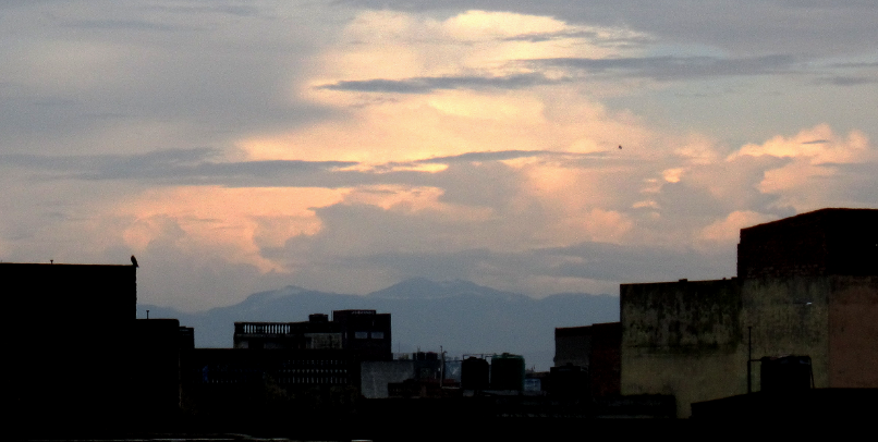


Why visit Sahāranpur
Townapedia lists 3 museums and landmarks, 10 parks and trails, 28 places to eat, 3 places to stay and 1 attraction in and around town.
Highlights include Mazahir Uloom.
Weather in Sahāranpur
Forecast from MET Norway (CC BY 4.0). Full forecast
About Sahāranpur
Saharanpur is a city and a municipal corporation in Uttar Pradesh, India. It is also the administrative headquarters of Saharanpur district.
From the Wikipedia article Saharanpur (this version), under CC BY-SA 4.0.
Travel tips from other travellers: Sahāranpur on Wikivoyage (CC BY-SA 4.0).
Things to do1


Museums and landmarks3

jain bagh temple
Monument and historic site · 1.9 km
na jain bagh road, saharanpur

Parks, trails and playgrounds10


Restaurants and cafes28

Firangi Bites
Restaurant · American, Chinese · 1.3 km
Shop No.16 Court Road, Saharanpur
Mo-Su 12:00-23:00
Zorko
Restaurant · Pizza, Coffee Shop, Burger, Chinese, Italian, Sandwich, Indian · 3.0 km
shop no 3 opposite tata croma NH709B, Saharanpur
Mo-Su 12:00-22:00



16 more on the map.
Where to stay3
Churches and places of worship13
Shopping5
Raja Gift House and General Store
Grocery · 1.8 km
Saharanpur - Delhi Rd, near Collectorate, Vasant Vihar, Saharanpur, Uttar Pradesh 247001, saharanpur
Gas and EV charging2
Schools, colleges and libraries28
J.V. Jain College
School · 3.1 km
247001, Avas Vikas Colony Lane, Avas Vikas Colony, PoliceLine, Saharanpur
Sanjeevni coaching centre
Library · 2.1 km
Near policeline saharanpur , court road
Healthcare81
Dr. Jai Malik's Piles Clinic
Clinic and pharmacy · 3.0 km
Dhanwantari health care opposite sahiram hospital, first floor aadhar seva kendra, hassanpur chowk delhi road, Saharanpur
Map of Sahāranpur
174 places. The map loads OpenStreetMap tiles when you open it.
Getting there and nearby towns
Sarsawa Air Force Station (SWN) is the nearest airport with scheduled flights listed in OpenStreetMap, 12 km away.
- Rāmpur 20 km southwest, about 20 min by car
- Chhutmalpur 21 km east, about 21 min by car
- Nakūr 24 km west, about 24 min by car
- Behat 24 km north, about 24 min by car
- Ambahta 24 km southwest, about 24 min by car
- Būriya 28 km northwest, about 28 min by car
- Yamuna Nagar 31 km northwest, about 31 min by car
- Karnāl 62 km southwest, about 1 h by car
- Thānesar 69 km west, about 1 h 15 min by car
- Panipat 85 km southwest, about 1 h 30 min by car
Drive times are estimates from straight-line distance, not routes.
Local news
Headlines from INDB.
Reviews, tips and questions
Loading what members have shared...
Sources and licences
- GeoNames (CC BY 4.0): population, coordinates, regions and time zone
- OpenStreetMap contributors (ODbL 1.0): places, airports, map data
- Wikidata (CC0 1.0): elevation, founding date, time zone, website, landmarks and historic places
- Wikimedia Commons (see each image): photos
- Wikipedia (CC BY-SA 4.0): overview and history text
Photo credits
- Saharanpur, Javed1972, CC BY-SA 3.0
- Mazahir Uloom Waqf, TheAafi, CC BY-SA 4.0
- Saurabh'S Nature, Saurabh Saini, CC BY-SA 4.0
- Saurabh'S nature, Saurabh Saini, CC BY-SA 4.0
- Outer area of Saharanpur Junction, Ravi Dwivedi, CC BY-SA 4.0
- Platform number 4, Saharanpur Junction, Ravi Dwivedi, CC BY-SA 4.0
- Saharanpur Junction, UP, India, Ravi Dwivedi, CC BY-SA 4.0
- Saharanpur Jn railway station, India, Ravi Dwivedi, CC BY-SA 4.0
- Saharanpur Junction Railway Station, Uttar Pradesh, India 12, Ravi Dwivedi, CC BY-SA 4.0
- Saharanpur Junction Railway Station, Uttar Pradesh, India 13, Ravi Dwivedi, CC BY-SA 4.0
- Saharanpur Junction Railway Station, Uttar Pradesh, India 04, Ravi Dwivedi, CC BY-SA 4.0
- Platform 3, Saharanpur Junction, UP, India, Ravi Dwivedi, CC BY-SA 4.0
- Saharanpur Junction Railway Station platform number 4, Ravi Dwivedi, CC BY-SA 4.0
- WDS-6AD locomotive used in Indian Railways, Ravi Dwivedi, CC BY-SA 4.0
- Saharanpur Jn railway station 01, Ravi Dwivedi, CC BY-SA 4.0
- Platform 4 of Saharanpur Junction Railway Station, Ravi Dwivedi, CC BY-SA 4.0
- Saharanpur Junction Railway Station, UP, India, Ravi Dwivedi, CC BY-SA 4.0
- Outer area of Saharanpur Junction Railway Station, Ravi Dwivedi, CC BY-SA 4.0
- Saharanpur Junction Railway Station, Uttar Pradesh, India 01, Ravi Dwivedi, CC BY-SA 4.0
- Saharanpur Junction railway station board, Ravi Dwivedi, CC BY-SA 4.0
- Platform 3 of Saharanpur Junction, Ravi Dwivedi, CC BY-SA 4.0
- Platform3, Saharanpur Junction Railway Station, Uttar Pradesh, India, Ravi Dwivedi, CC BY-SA 4.0
- Saharanpur Junction Railway Station, Uttar Pradesh, India 14, Ravi Dwivedi, CC BY-SA 4.0
- Howrah Amritsar Express at Saharanpur, ArmouredCyborg, CC BY-SA 4.0
- Sunrise india, Saurabh Saini, CC BY-SA 4.0
- White labra, Chirag Tyagi04, CC BY-SA 4.0
- Out Side View Of Saharanpur Junction, Sonuirfan42, CC BY-SA 4.0
- The class for Tajweed and Qirat, Mazahir Uloom Waqf, TheAafi, CC BY-SA 4.0
- One of the earliest buildings of Mazahir Uloom, TheAafi, CC BY-SA 4.0
- Guest House, Mazahir Uloom Waqf, TheAafi, CC BY-SA 4.0
- Inscriptions depicting establishment of the Library at Mazahir Uloom Waqf, Inscriptions at the entrance of Guest House, TheAafi, CC BY-SA 4.0
- A view of the Darul Hadees, Mazahir Uloom Waqf, TheAafi, CC BY-SA 4.0
- Darul Hadees, Mazahir Uloom Waqf, TheAafi, CC BY-SA 4.0
- A view of Mazahir Uloom Waqf's Darul Hadees, TheAafi, CC BY-SA 4.0
- Mazahir Uloom Jadeed's Zakariyyah Manzil, Aafi, CC BY-SA 4.0
- Zakariyyah Manzil, Mazahir Uloom Jadeed, TheAafi, CC BY-SA 4.0
- Zakariyyah Manzil front view, Mazahir Uloom Jadeed, TheAafi, CC BY-SA 4.0
- Zakariyyah Manzil Entrance, Mazahir Uloom Jadeed, TheAafi, CC BY-SA 4.0
- Besani Roti With Urad Dal, Anubhav Jain, CC BY-SA 4.0


Page built November 2, 2026. Spotted a mistake? Tell us or suggest a place.