
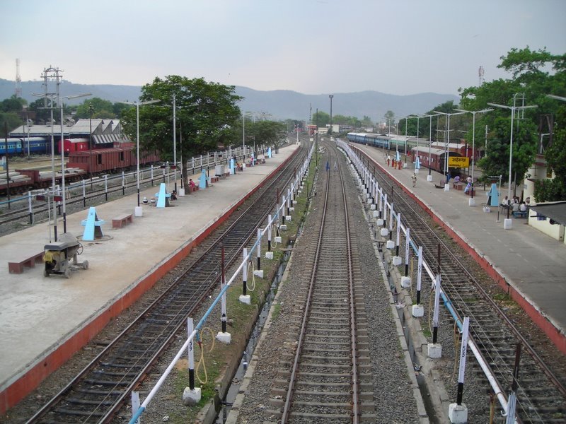

Why visit Sāhibganj
Townapedia lists 3 museums and landmarks, 1 park or trail, 1 place to eat, 2 places to stay and 4 attractions in and around town.
Weather in Sāhibganj
Forecast from MET Norway (CC BY 4.0). Full forecast
About Sāhibganj
Sahebganj, originally named Kajrotia (also known as Sahibganj) is a scenic town and a port city in the Sahibganj subdivision of the Sahebganj district of Jharkhand state, India. It serves as headquarters for Sahibganj District, Sahibganj subdivision and Sahibganj (community development block). It is located on the north-east of Jharkhand and situated on the banks of Ganges. 17th May is the Foundation Day of the District, when Rajmahal and Pakur subdivisions of old Santal Pargana district were carved out to form Sahibganj district.
From the Wikipedia article Sahebganj (this version), under CC BY-SA 4.0.
Things to do4


Museums and landmarks3

Parks, trails and playgrounds1

Restaurants and cafes1

Kaveri Restaurant S. b. Roy Road
Restaurant · Chinese, Indian, Italian
786 S. B. Roy Road
Mo-Su 08:00-22:00
Where to stay2
Hotel Vaikunth
Motel and hotel
Mahajan Patti Road, Opposite Satyanarayn Mandir, Sahibganj
Schools, colleges and libraries1
Healthcare11
Map of Sāhibganj
23 places. The map loads OpenStreetMap tiles when you open it.
Getting there and nearby towns
Malda Airport (LDA) is the nearest airport with scheduled flights listed in OpenStreetMap, 56 km away.
- Manihāri 11 km north, about 11 min by car
- Borio 24 km south, about 24 min by car
- Rājmahal 29 km southeast, about 29 min by car
- Tinpahār 31 km south, about 31 min by car
- Katihar 33 km north, about 33 min by car
- Patra 37 km southeast, about 37 min by car
- Colgong 41 km west, about 41 min by car
- Mahāgama 39 km southwest, about 39 min by car
- Malda 58 km southeast, about 58 min by car
- Bhāgalpur 67 km west, about 1 h by car
Drive times are estimates from straight-line distance, not routes.
Local news
Headlines from INDB.
Reviews, tips and questions
Loading what members have shared...
Sources and licences
- GeoNames (CC BY 4.0): population, coordinates, regions and time zone
- OpenStreetMap contributors (ODbL 1.0): places, airports, map data
- Wikidata (CC0 1.0): elevation, founding date, time zone, website
- Wikimedia Commons (see each image): photos
- Wikipedia (CC BY-SA 4.0): overview and history text
Photo credits
- Sahibganj railway station, Nishantsbg, CC BY-SA 3.0
Page built November 3, 2026. Spotted a mistake? Tell us or suggest a place.