


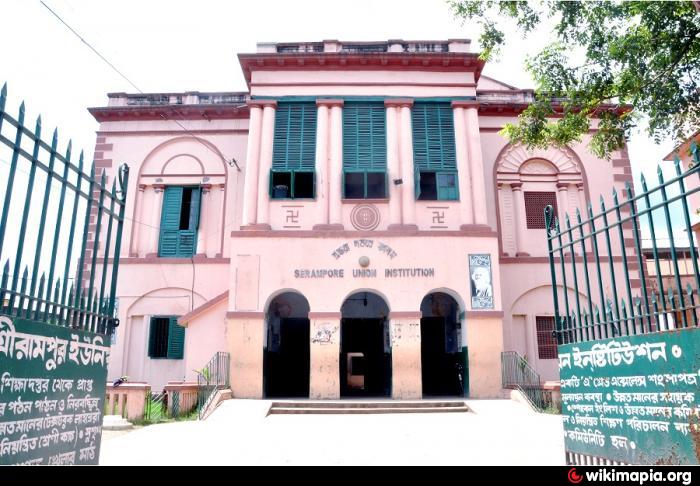


Why visit Shrīrāmpur
Townapedia lists 6 museums and landmarks, 29 parks and trails, 30 places to eat and 5 attractions in and around town.
Highlights include Carey Museum, Denmark Tavern and Hotel and Subhasnagar football ground.
Weather in Shrīrāmpur
Forecast from MET Norway (CC BY 4.0). Full forecast
About Shrīrāmpur
Serampore (Bengali: [ʃriɾampuɾ]) is a city in Hooghly district of the Indian state of West Bengal. It serves as the headquarters of the Srirampore subdivision and is part of the area covered by Kolkata Metropolitan Development Authority (KMDA). Located on the west bank of the Hooghly River, it was a pre-colonial city that was part of Danish India under the name Frederiknagore from 1755 to 1845.
From the Wikipedia article Serampore (this version), under CC BY-SA 4.0.
Travel tips from other travellers: Shrīrāmpur on Wikivoyage (CC BY-SA 4.0).
Things to do5

Museums and landmarks6



Parks, trails and playgrounds29

Jolkol Park
Park · 1.5 km
Jolkol Park is one the biggest parks of this area. Very popular and a lovely picnic spot.
Mini Jolkol Park
Park · 1.4 km
A smaller park and playground situated beside the jolkol park.
Riverside Park
Park · 0.6 km
A park located just beside the river. provides open access to all.

17 more on the map.
Restaurants and cafes30



18 more on the map.
History
The city is several centuries old and has undergone significant transformations. It witnessed the arrival and establishment of a Danish settlement, which was later followed by a period of British rule. After the British acquisition in 1845, the city experienced substantial industrial development, including the construction of railways and factories, leading to its emergence as an industrial hub.
The process of urbanization in Serampore can be understood through three distinct phases: a pre-urbanization period occurring before 1755, an urbanization phase spanning from 1755 to 1854, and an industrialization phase from 1854 to 1947.
From the History section of Serampore on Wikipedia, under CC BY-SA 4.0.
Churches and places of worship27
Shopping5
Reliance fresh
Grocery · 3.2 km
67/2 Barrackpore, East, Ghoshpara Rd, Titagarh, West Bengal 700120
Gas and EV charging1
Schools, colleges and libraries25
Government College of Engineering And Textile Technology
School · 1.2 km
12 William Carey Sarani, Serampore
Baidyabati Banamali Mukherjee Institution
School · 3.5 km
Sarat Chandra Mukherjee Road, Baidyabati
Healthcare34
Map of Shrīrāmpur
162 places. The map loads OpenStreetMap tiles when you open it.
Getting there and nearby towns
Netaji Subhash Chandra Bose International Airport (CCU) is the nearest airport with scheduled flights listed in OpenStreetMap, 15 km away.
- Bārākpur 3 km northeast, about 3 min by car
- Rishra 3 km south, about 3 min by car
- Titāgarh 3 km east, about 3 min by car
- Baidyabāti 4 km northwest, about 4 min by car
- Khardah 5 km southeast, about 5 min by car
- Konnagar 5 km south, about 5 min by car
- Pānihāti 8 km southeast, about 8 min by car
- Howrah 20 km south, about 20 min by car
- Kolkata 21 km south, about 21 min by car
- Rajpur Sonarpur 36 km south, about 36 min by car
Drive times are estimates from straight-line distance, not routes.
Local news
Headlines from INDB.
Reviews, tips and questions
Loading what members have shared...
Sources and licences
- GeoNames (CC BY 4.0): population, coordinates, regions and time zone
- OpenStreetMap contributors (ODbL 1.0): places, airports, map data
- Wikidata (CC0 1.0): elevation, founding date, time zone, website, landmarks and historic places
- Wikimedia Commons (see each image): photos
- Wikipedia (CC BY-SA 4.0): overview and history text
Photo credits
- বটতলা পাঁচ মাথার মোড়, শ্রীরামপুর, রাজশ্রী রায়, CC BY-SA 4.0
- St Olaf's Church-Serampore-West Bengal-13, Kinjal bose 78, CC BY-SA 4.0
- School union gate, Sarkarsayantan.2241, CC BY-SA 4.0
- William Carey Museum, Serampore College, Serampore - 1, PIN 712201, CC BY-SA 4.0
- Henry Martin's Pagoda at Serampore in Hooghly district, Mukut Tapadar, CC BY-SA 4.0
- Radhaballav Temple-Serampore-West Bengal-15, Kinjal bose 78, CC BY-SA 4.0
- The Denmark Tavern of Serampore in West Bengal, Dassurojitsd, CC BY-SA 4.0
- Annapurna Temple of Titagarh-Barrackpore in North 24 Parganas 19, Pinakpani, CC BY-SA 4.0
- Sramajibi Hospital, Belumilki, Serampore 06, Pinakpani, CC BY 4.0
- Annapurna Mandir-Barrackpore-West Bengal-3, Kinjal bose 78, CC BY-SA 4.0
- St Olav's Church, Serampore, SoumilyaDe, CC BY-SA 4.0
- Serampore College, Serampore, Hooghly, West Bengal, Kanad Sanyal, CC BY-SA 4.0
- Terracotta Figurines at Mela Bari temple in Serampore, Mukut Tapadar, CC BY-SA 4.0
- Two faces of aggression, Saptarshi Sanyal, CC BY 2.0
- Front pictures', Ayon samanta, CC BY-SA 4.0
- Commuter train- Serampore, Saptarshi Sanyal, CC BY 2.0
- St. Olav's Church, Serampore, Hooghly, West Bengal, Kanad Sanyal, CC BY-SA 4.0
- Serampur Rajbari, Kanad Sanyal, CC BY-SA 4.0
- House of Kishorilal Goswami, Serampur, Kanad Sanyal, CC BY-SA 4.0
- Maniktala, Serampore, West Bengal 712201, India - panoramio, Arnab Majumdar, CC BY-SA 3.0
- Maniktala, Serampore, West Bengal 712201, India - panoramio (1), Arnab Majumdar, CC BY-SA 3.0
- Maniktala, Serampore, West Bengal 712201, India - panoramio (2), Arnab Majumdar, CC BY-SA 3.0
- Maniktala, Serampore, West Bengal 712201, India - panoramio (3), Arnab Majumdar, CC BY-SA 3.0
- Cast Iron Gate - Serampur College, Kanad Sanyal, CC BY-SA 4.0
- Roll of Honour - List of Principals in the Principal's Office in Serampore College, Kanad Sanyal, CC BY-SA 4.0
- Howrah Water Works - Serampur Jal Kal, Serampur, West Bengal, Kanad Sanyal, CC BY-SA 4.0
- Commemorative Tablet, Howrah Water Works, Serampur, West Bengal, Kanad Sanyal, CC BY-SA 4.0
- Dhobi Ghat Jetty - Barrackpore Cantonment - North 24 Parganas 2012-05-27 01236, Biswarup Ganguly, CC BY 3.0
- Dhobi Ghat Jetty - Barrackpore Cantonment - North 24 Parganas 2012-05-27 01233, Biswarup Ganguly, CC BY 3.0
- Dhobi Ghat Jetty - Barrackpore Cantonment - North 24 Parganas 2012-05-27 01231, Biswarup Ganguly, CC BY 3.0
- Dhobi Ghat Jetty - Barrackpore Cantonment - North 24 Parganas 2012-05-27 01223, Biswarup Ganguly, CC BY 3.0
- Dhobi Ghat Jetty Plaque - Barrackpore Cantonment - North 24 Parganas 2012-05-27 01229, Biswarup Ganguly, CC BY 3.0
- Kali & Shani Temple - Dhobi Ghat - Barrackpore Cantonment - North 24 Parganas 2012-05-27 01239, Biswarup Ganguly, CC BY 3.0
- Kali & Shani Deities - Kali & Shani Temple - Dhobi Ghat - Barrackpore Cantonment - North 24 Parganas 2012-05-27 01238, Biswarup Ganguly, CC BY 3.0
- Dhobi Ghat Jetty Plaque - Barrackpore Cantonment - North 24 Parganas 2012-05-27 01230, Biswarup Ganguly, CC BY 3.0
- Senior Citizens' Park - Dhobi Ghat - Barrackpore Cantonment - North 24 Parganas 2012-05-27 01225, Biswarup Ganguly, CC BY 3.0
- Dhobi Ghat Area - Barrackpore Cantonment - North 24 Parganas 2012-05-27 01240, Biswarup Ganguly, CC BY 3.0
- Ticket Counter - Dhobi Ghat - Barrackpore Cantonment - North 24 Parganas 2012-05-27 01241, Biswarup Ganguly, CC BY 3.0
- Dhobi Ghat Area - Barrackpore Cantonment - North 24 Parganas 2012-05-27 01226, Biswarup Ganguly, CC BY 3.0
- Ukil Bari , Chatra, Drshaunakdas, CC BY-SA 4.0


Page built November 2, 2026. Spotted a mistake? Tell us or suggest a place.