


Why visit Sīkar
Townapedia lists 6 museums and landmarks, 14 parks and trails, 101 places to eat, 100 places to stay and 5 attractions in and around town.
Weather in Sīkar
Forecast from MET Norway (CC BY 4.0). Full forecast
About Sīkar
Sikar is a city and municipal council in the Sikar district of the state of Rajasthan in India. It is the administrative headquarters of the Sikar district. It is largest city of the Shekhawati region, which consists of Sikar, Churu and Jhunjhunu. After Kota, Sikar is number one coaching hub in the country for competitive examination preparations and has a number of engineering and medical coaching institutes.It is also known as Rajasthan's 'Mini Kota'.
From the Wikipedia article Sikar (this version), under CC BY-SA 4.0.
Travel tips from other travellers: Sīkar on Wikivoyage (CC BY-SA 4.0).
Things to do5



Museums and landmarks6


Parks, trails and playgrounds14


2 more on the map.
Restaurants and cafes101

Kaarodiya Restaurant
Restaurant · Indian, Local · 1.4 km
Near Nawalgarh Puliya
Mo-Fr 11:00-21:00; Sa-Su 11:00-20:00

Lakshay Food Corner
Restaurant · Burger, Regional, Sandwich, Chinese, Ice Cream, Indian · 3.8 km
Indira Gandhi Bhawan Street, Maharaja Surajmal Nagar-I
07:00-22:00

Jawaharji Pandya Piprali Road Branch
Restaurant · Indian · 2.3 km
Mo-Su 09:00-21:00
Cook Restaurant Sikar
Restaurant · Burger, Pizza, Coffee Shop, Sandwich, Indian Veg Food · 4.1 km
piprali road NEAR PIPRALI CIRCLE, SIKAR
89 more on the map.
History
Sikar had been the biggest Thikana (Estate) of the Jaipur state. Previously Sikar was known as Shekhawati pradesh. It was the capital of Thikana Sikar. Sikar is surrounded by fortified walls consisting of seven "Pols" (gates). These historic gates are named: Bawari Gate, Fatehpuri Gate, Nani Gate, Surajpole Gate, Dujod Gate Old, Dujod Gate New, and Chandpole Gate.
From the History section of Sikar on Wikipedia, under CC BY-SA 4.0.
Where to stay100
Akshita Girls Hostel
Motel and hotel · 4.1 km
VEER HANUMAN MANDIR WALI GALI, sikar
Hotel Shree Shayam Resort
Motel and hotel · 4.4 km
loharu sikar main road near piprali circle, sikar
Churches and places of worship31
Shopping43
Ghasoliya Furniture House
Grocery · 0.6 km
NearMaru Mandir Laxmi Market , Station Road, Sikar
Gas and EV charging7
Schools, colleges and libraries46
International Academy Of Design
School · 0.7 km
W. NO .35 Railway Sta Rd, opp. garg hospital, near city centre mall, Ward No 35, Sakpura Mohlla, Radha Kishanpura,, Sikar
Healthcare83
Pradhan Mantri Bhartiya Jan Aushadhi Kendra
Clinic and pharmacy · 1.3 km
G-15 Shiv Plaza
Trivedi Complex- SAZID Hospital
Clinic and pharmacy · 1.4 km
Indira Colony,Devipura
Map of Sīkar
250 places. The map loads OpenStreetMap tiles when you open it.
Getting there and nearby towns
Jaipur International Airport (JAI) is the nearest airport with scheduled flights listed in OpenStreetMap, 110 km away.
- Laxmangarh 26 km northwest, about 26 min by car
- Bhuma 28 km northwest, about 28 min by car
- Nawalgarh 30 km northeast, about 30 min by car
- Losal 32 km southwest, about 32 min by car
- Udaipur 35 km east, about 35 min by car
- Udaipurwati 35 km east, about 35 min by car
- Khandela 36 km east, about 36 min by car
- Danta 35 km south, about 35 min by car
- Bay 37 km southeast, about 37 min by car
- Mukandgarh 39 km north, about 39 min by car
Drive times are estimates from straight-line distance, not routes.
Local news
Headlines from INDB.
Reviews, tips and questions
Loading what members have shared...
Sources and licences
- GeoNames (CC BY 4.0): population, coordinates, regions and time zone
- OpenStreetMap contributors (ODbL 1.0): places, airports, map data
- Wikidata (CC0 1.0): elevation, founding date, time zone, website
- Wikimedia Commons (see each image): photos
- Wikipedia (CC BY-SA 4.0): overview and history text
Photo credits
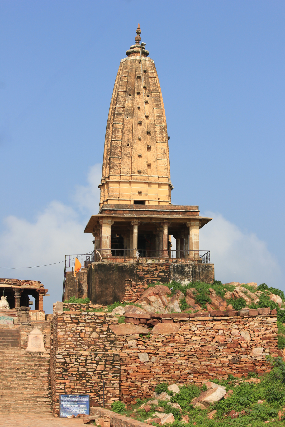
- Harshnath Temple Sikar outer view, Ashish Choudhary, CC BY-SA 3.0
- Priyanshu Soni opening the manually operated metal roller shutter of the VSP Gems storefront in Sikar, Rajasthan, VSPGEMS, CC BY 4.0
- Priyanshu Soni standing at entry VSP GEMS, VSPGEMS, CC BY 4.0
- ISS034-E-29212 - View of Earth, Earth Science and Remote Sensing Unit , Lyndon B. Johnson Space Center, Public domain
Page built November 2, 2026. Spotted a mistake? Tell us or suggest a place.