


Why visit Tezpur
Townapedia lists 2 museums and landmarks, 7 parks and trails, 8 places to eat, 13 places to stay and 7 attractions in and around town.
Highlights include Darrang College, Kolia Bhomora Setu and Da Parbatia.
Weather in Tezpur
Forecast from MET Norway (CC BY 4.0). Full forecast
About Tezpur
Tezpur (Assamese: [tɛz.pʊɹ]) is a city in Sonitpur district, Assam state, India. Tezpur is located on the banks of the river Brahmaputra, 175 kilometres (109 mi) northeast of Guwahati, and is the largest of the north bank cities.
From the Wikipedia article Tezpur (this version), under CC BY-SA 4.0.
Travel tips from other travellers: Tezpur on Wikivoyage (CC BY-SA 4.0).
Things to do7





Museums and landmarks2



Parks, trails and playgrounds7



Restaurants and cafes8

Spring Valley
Restaurant · Coffee Shop, Chinese, Burger, Regional, Indian · 2.3 km

Foodzone
Fast food · International, Burger, Indian, Pasta, Tea, Pizza · 0.9 km
main road
History
Tezpur was under the rule of the Koch dynasty and later became a part of the Ahom kingdom in the 16th century. The Ahoms, known for their administrative prowess and patronage of art and culture, played a vital role in shaping Tezpur's heritage. The city witnessed several battles and conflicts during the medieval period.
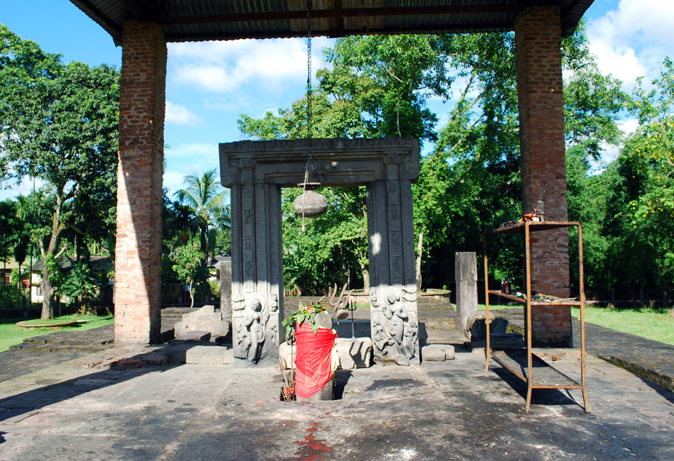
Modern Tezpur is a medieval trading town and cultural and educational hub, home to several archaeological sites, temples, and monuments.
From the History section of Tezpur on Wikipedia, under CC BY-SA 4.0.
Where to stay13
Churches and places of worship7
Shopping3
Gas and EV charging3
Schools, colleges and libraries9
Healthcare28
Map of Tezpur
87 places. The map loads OpenStreetMap tiles when you open it.
Getting there and nearby towns
Tezpur Air Force Station (TEZ) is the nearest airport with scheduled flights listed in OpenStreetMap, 9 km away.
- Barika Chuburi 1 km east, about 1 min by car
- Majgaon 2 km northwest, about 2 min by car
- Gutlong Gaon 3 km northeast, about 3 min by car
- Rupahi Town 24 km south, about 24 min by car
- Rangāpāra 26 km northwest, about 26 min by car
- Dhekiajuli 33 km west, about 33 min by car
- Nagaon 34 km southwest, about 34 min by car
- Dimaruguri 33 km south, about 33 min by car
- Biswanath Chariali 36 km east, about 36 min by car
- Morongial 35 km south, about 35 min by car
Drive times are estimates from straight-line distance, not routes.
Local news
Headlines from INDB.
Reviews, tips and questions
Loading what members have shared...
Sources and licences
- GeoNames (CC BY 4.0): population, coordinates, regions and time zone
- OpenStreetMap contributors (ODbL 1.0): places, airports, map data
- Wikidata (CC0 1.0): elevation, founding date, time zone, website, landmarks and historic places
- Wikimedia Commons (see each image): photos
- Wikipedia (CC BY-SA 4.0): overview and history text
Photo credits
- Sunset at Ganesh Ghat (Tezpur), Koolzadityax, CC BY-SA 3.0
- Mahabhairab mandir , tezpur, Akashdoley13, CC BY-SA 4.0
- Mound and Ruins of Da-Parbatia-Tezpur-Assam-DSC 0011, Jyotirmoi Borah, CC BY-SA 4.0
- Mound and Ruins of Da-Parbatia-Tezpur-Assam-DSC 0010, Jyotirmoi Borah, CC BY-SA 4.0
- Mound and Ruins of Da-Parbatia-Tezpur-Assam-DSC 0004, Jyotirmoi Borah, CC BY-SA 4.0
- Mound and Ruins Da-Parbatia-Tezpur-Assam-DSC 0008, Jyotirmoi Borah, CC BY-SA 4.0
- Mound and Ruins of Da-Parbatia-Tezpur-Assam-DSC 0003, Jyotirmoi Borah, CC BY-SA 4.0
- Mound and Ruins of Da-Parbatia-Tezpur-Assam-DSC 0001, Jyotirmoi Borah, CC BY-SA 4.0
- Mound and Ruins of Da-Parbatia-Tezpur-Assam-DSC 0009, Jyotirmoi Borah, CC BY-SA 4.0
- Mound and Ruins of Da-Parbatia-Tezpur-Assam-DSC 0006, Jyotirmoi Borah, CC BY-SA 4.0
- Mound and Ruins of Da-Parbatia-Tezpur-Assam-DSC 0007, Jyotirmoi Borah, CC BY-SA 4.0
- Mound and Ruins of Da-Parbatia-Tezpur-Assam-DSC 0002, Jyotirmoi Borah, CC BY-SA 4.0
- Mound and Ruins of Da-Parbatia-Tezpur-Assam-DSC 0005, Jyotirmoi Borah, CC BY-SA 4.0
- Tezpur, Assam, Konistha1269, CC BY-SA 4.0
- Tezpur, Assam 2, Konistha1269, CC BY-SA 4.0
- Busy streets of Tezpur Town, Konistha1269, CC BY-SA 4.0
- Kolia Bhomora Bridge, Tezpur4u, CC BY-SA 3.0
- Da-Parbatia, Jugal Bharali, CC BY-SA 3.0
- Cassia fistula L., Nayan j Nath, CC BY-SA 4.0
- Jakoi and Khaloi, Nayan j Nath, CC BY-SA 4.0
- Architecture- The Entrance of Mahabhairav Temple, Gitika Gayan, CC BY 3.0
- Mahabhairab Temple Sonitpur, ঈশান জ্যোতি বৰা, CC BY-SA 4.0
- Mahabhairab Temple2 Sonitpur, ঈশান জ্যোতি বৰা, CC BY-SA 4.0
- Da four Mama Food truck, Konistha1269, CC BY-SA 4.0
- Ghanta 2, Nayan j Nath, CC BY-SA 4.0
- Alocasia Jacklyn Plant, Accordingtoprince, CC BY 4.0
- Light work showing Raam mandir and Rama, Nayan j Nath, CC BY-SA 4.0
- Durga idol Assam, Nayan j Nath, CC BY-SA 4.0
- Dahlia imperialis 3, পাপৰি বৰা, CC BY-SA 4.0
- Common Daisy 2, পাপৰি বৰা, CC BY-SA 4.0
- Baan theatre office, Bishnu Saikia, CC BY-SA 4.0
- Streets of Darrang College, Konistha1269, CC BY-SA 4.0
- Busy Streets, Konistha1269, CC BY-SA 4.0
- গামোচা তাঁত, Nayan j Nath, CC BY-SA 4.0
- Agnigarh 5, Jyotishman08, CC BY-SA 4.0
- Tree 72, Jyotishman08, CC BY-SA 4.0
- Scenery 12, Jyotishman08, CC BY-SA 4.0
- View point 2, Jyotishman08, CC BY-SA 4.0
- Sculpture 7, Jyotishman08, CC BY-SA 4.0
- Kamrupiya Namghar, Konistha1269, CC BY-SA 4.0
- Baan theatre stage, Bishnu Saikia, CC BY-SA 4.0


Page built November 3, 2026. Spotted a mistake? Tell us or suggest a place.