


Why visit Vijayapura
Townapedia lists 22 museums and landmarks, 2 parks and trails, 8 places to eat, 13 places to stay and 2 attractions in and around town.
Highlights include Karnataka State Akkamahadevi Women's University, Vijayapura, Bara Kaman and Gol Gumbaz.
Weather in Vijayapura
Forecast from MET Norway (CC BY 4.0). Full forecast
About Vijayapura
Bijapur (officially Vijayapura) is the district headquarters of the Bijapur district of the Karnataka state of India. It is also the headquarters for Bijapur Taluk. Bijapur city is well known for its historical monuments of architectural importance built during the rule of the Adil Shahi dynasty. It is also well known for the popular Karnataka premier league team, the Bijapur Bulls.
From the Wikipedia article Bijapur (this version), under CC BY-SA 4.0.
Travel tips from other travellers: Vijayapura on Wikivoyage (CC BY-SA 4.0).
Things to do2

Karnataka State Akkamahadevi Women's University, Vijayapura
School · 8.0 km
State public university in Vijayapura, Karnataka, India

Museums and landmarks22


Gol Gumbaz
Monument and historic site · 2.3 km
Mausoleum of Mohammed Adil Shah, Sultan of Bijapur
Station Road

Ibrahim Rouza
Monument and historic site · 1.5 km
Tomb in Bijapur, Karnataka, India
Mo-Su 06:00-18:00


Archaeological Museum, Vijayapura
Museum · 2.0 km
Museum in the Indian state of Karnataka


10 more on the map.
Parks, trails and playgrounds2


Restaurants and cafes8

The comunitii
Cafe · 2.0 km
4TH FLOOR, KULKARNI ARCADE, BUS STOP, opp. AINAPUR HOUSE, Vijayapur, Jala Nagar, Vijayapura, Karnata



KA 28 Chaats
Fast food · Indian, Vada Pav, Samosa, French Fries, Mirchi Bhajji, Brinjal Bhajji, Aloo Bhajji, South Indian, Uttar Karnataka · 3.0 km
Gachhinakatti Complex Gururaj Colony, Ashram Road, Vijayapur
Mo-Sa 17:00-22:00
Where to stay13
Churches and places of worship37
Shopping2
Gas and EV charging5
Schools, colleges and libraries18
Healthcare145
Map of Vijayapura
250 places. The map loads OpenStreetMap tiles when you open it.
Getting there and nearby towns
Solapur Airport (SSE) is the nearest airport with scheduled flights listed in OpenStreetMap, 92 km away.
- Basavana Bāgevādi 39 km southeast, about 39 min by car
- Indi 47 km northeast, about 47 min by car
- Bilgi 54 km south, about 54 min by car
- Sindgi 56 km east, about 56 min by car
- Jamkhandi 57 km southwest, about 57 min by car
- Muddebihāl 70 km southeast, about 1 h 15 min by car
- Bagalkot 71 km south, about 1 h 15 min by car
- Athani 70 km west, about 1 h 15 min by car
- Mudhol 71 km southwest, about 1 h 15 min by car
- Rabkavi-Banhatti 75 km southwest, about 1 h 15 min by car
Drive times are estimates from straight-line distance, not routes.
Local news
Headlines from INDB.
Reviews, tips and questions
Loading what members have shared...
Sources and licences
- GeoNames (CC BY 4.0): population, coordinates, regions and time zone
- OpenStreetMap contributors (ODbL 1.0): places, airports, map data
- Wikidata (CC0 1.0): elevation, founding date, time zone, website, landmarks and historic places
- Wikimedia Commons (see each image): photos
- Wikipedia (CC BY-SA 4.0): overview and history text
Photo credits
- Ibrahim Rauza, An Architectural Marvel, Kdas1977, CC BY-SA 4.0
- BarakamanDSC03712, Ksprabhukumar37, CC BY-SA 3.0
- Gol Gumbaj2, Meesanjay, CC BY-SA 3.0
- Ibrahim roja 04, Akshatha, CC BY-SA 3.0
- Archaeological Museum, inside the Gol Gumbaz, Vijayapura 02, Pinakpani, CC BY 4.0
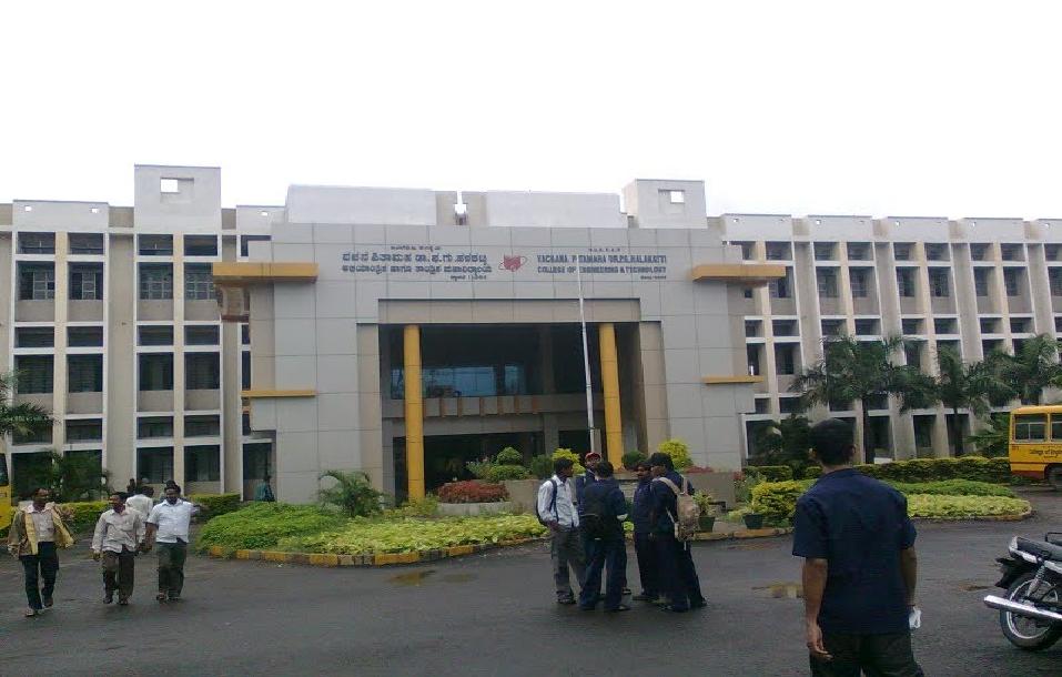
- BLDEA's Dr.P.G.Halakatti College of Engineering and Technology. Bijapur - 586101, Karnataka , India., Sachin Hubballi, CC BY-SA 3.0
- Street vendors in Karnataka (27626), Shagil Kannur, CC BY-SA 4.0
- Street vendors in Karnataka, Shagil Kannur, CC BY-SA 4.0
- Street vendors in Karnataka (50540), Shagil Kannur, CC BY-SA 4.0
- Street vendors in Karnataka (12253), Shagil Kannur, CC BY-SA 4.0
- Street vendors in Karnataka (60321), Shagil Kannur, CC BY-SA 4.0
- Street vendors in Karnataka (44106), Shagil Kannur, CC BY-SA 4.0
- Street vendors in Karnataka (84446), Shagil Kannur, CC BY-SA 4.0
- Remains of Barah Khaman - 3, Vivek B Govindaraju, CC BY-SA 4.0
- Bara Kaman, Itsmalay~commonswiki, CC BY-SA 4.0
- Remains of Barah Khaman - 2, Vivek B Govindaraju, CC BY-SA 4.0
- Remains of Barah Khaman - 1, Vivek B Govindaraju, CC BY-SA 4.0
- Bara Kaman View, Omkar N Kashyap, CC BY-SA 4.0
- Gumbuz, Madhu Kumar D S, CC BY-SA 4.0
- Upali Buruz in bijapur, Dr Sudak, CC BY-SA 4.0
- Upali Buruz, Dr Sudak, CC BY-SA 4.0
- Malik-e-Maidan Bijapur, Santoshsmalagi, CC BY-SA 3.0
- Ibrahim Rouza Taj Mahal of South, Gurnam Jagota, CC BY-SA 4.0
- Bijapur Ibrahim Rouza 100C, Sanyam Bahga, CC BY-SA 3.0
- Bijapur 100 (10072002845), Sanyam Bahga from Roorkee, India, CC BY-SA 2.0
- Burial in Ibrahim Rouza, IM3847, CC BY-SA 4.0
- Ibrahim jami masjid Bijapur, JunaidkhalilPNQ, CC BY-SA 4.0
- Ibhrahim Roza Bijapur, Santoshsmalagi, CC BY-SA 3.0
- IMAG0951, Shefalikarve, CC BY-SA 3.0
- Ibrahim Rauza, Bijapur, Karnataka, Mukul Banerjee, CC BY-SA 3.0
- Ibrahim Rouza - Bijapur, PogonophileRohan, CC BY-SA 4.0
- Ibrahim Rouza a garden, IM3847, CC BY-SA 4.0
- Ibrahim Rouza from Entrance, IM3847, CC BY-SA 4.0
- Ibrahim Rouza 03, Klsateeshvarma, CC BY-SA 4.0
- Ibrahim Roza vijayapur, Mallikarjun h sarawad, CC BY-SA 4.0
- Inside Jama Masjid, Bijapur, Karnataka, Mukul Banerjee, CC BY-SA 3.0
- Arches -2, Jama Masjid, Bijapur, Karnataka, Mukul Banerjee, CC BY-SA 3.0
- Ibrahim Rouza 01, Klsateeshvarma, CC BY-SA 4.0
- IbrahimRozaBijapur, Sanyam Bahga, CC BY-SA 3.0
- IBRAHIM ROZA VIJAYPURA, Sunilkumar Ganiger, CC BY-SA 4.0


Page built November 2, 2026. Spotted a mistake? Tell us or suggest a place.