




Why visit Ithaca
Townapedia lists 3 museums and landmarks, 5 parks and trails and 10 places to eat in and around town.
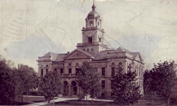
Highlights include Gratiot County Courthouse, Ithaca Downtown Historic District, Woodland Park and McNabb Park.
July is the warmest month, with average highs of 82°F; January lows average 15°F, and about 39 inches of snow fall in a normal year.
Weather in Ithaca
Forecast from the National Weather Service. Full forecast
About Ithaca
Ithaca is a city and the county seat of Gratiot County, Michigan. It is located very near the geographical center of the state's lower peninsula. The population was 2,853 as of the 2020 census. Ithaca is run as a council-manager government.
From the Wikipedia article Ithaca, Michigan (this version), under CC BY-SA 4.0.
Museums and landmarks3
Gratiot County Courthouse
Monument and historic site · National Register of Historic Places · 0.5 mi
County courthouse in Ithaca, United States of America

Ithaca Downtown Historic District
Monument and historic site · National Register of Historic Places · 0.6 mi
Historic district in Michigan, United States

Gratiot County Area Historical Museum
Museum · 0.7 mi
129 West Center Street, Ithaca
Parks, trails and playgrounds5


Restaurants and cafes10

Great Lakes Family Restaurant
Restaurant · American, Burger, Sandwich, Salad, Fish And Chips, Breakfast, Pancake · 0.6 mi
1335 East Center Street, Ithaca
Chee Peng
Restaurant · Chinese · 0.5 mi
161 East Center Street, Ithaca
Mo-Fr 11:00-21:00; Sa 16:00-21:00
Main Street Pizza
Restaurant · Pizza · 0.5 mi
Mo-Th 11:00-23:00; Sa 11:00-24:00; Su 11:00-23:00

Sip-n-Knit
Cafe · Coffee Shop · 0.5 mi
140 East Center Street, Ithaca
Mo 10:00-20:00; Tu-Fr 10:00-16:00; Sa 10:00-14:00
Country Chef Cafe
Restaurant · 0.5 mi
East Center Street, Ithaca
Mo-Fr 06:00-20:00; Sa 06:00-14:00; Su 09:00-14:00

Downtown Bakery
Bakery · 0.5 mi
East Center Street, Ithaca
Mo-Fr 06:30-13:20; Sa 06:30-12:00

Taco Bell
Fast food · Tex-Mex · 0.5 mi
1321 East Center Street, Ithaca
Mo-Th 09:00-24:00; Fr-Sa 09:00-01:00; Su 09:00-24:00
Churches and places of worship2

History
Along with the Native Americans, the first recorded settler in Ithaca was James J. Bush from Howell, Michigan in 1850. John Jeffery, from New York State, bought land in 1853, and permanently relocated on the land in 1855. He platted the area in 1856, assisted by Sidney S. Hastings, calling it Gratiot Center and laying out streets, lots, blocks, and even alleys. Gratiot Center was the name of its first post office, granted on November 16, 1855 with John Knight as the first postmaster. In 1856 the site was named as the county seat of Gratiot County. The settlement's name was changed on April 13, 1857 to Ithaca, after Ithaca, New York. Ithaca was incorporated as a village in 1869 and became a city in 1961.
From the History section of Ithaca, Michigan on Wikipedia, under CC BY-SA 4.0.
Shopping3
Gas and EV charging4
Schools, colleges and libraries7
Map of Ithaca
34 places. The map loads OpenStreetMap tiles when you open it.
Climate by month
Monthly table
| Month | High | Low | Rain | Snow |
|---|---|---|---|---|
| Jan | 29°F | 15°F | 2.2 in | 10.7 in |
| Feb | 32°F | 15°F | 1.8 in | 9.9 in |
| Mar | 43°F | 23°F | 2.1 in | 5.4 in |
| Apr | 56°F | 34°F | 3.5 in | 2.1 in |
| May | 68°F | 46°F | 3.7 in | 0.0 in |
| Jun | 78°F | 56°F | 3.6 in | 0.0 in |
| Jul | 82°F | 59°F | 3.3 in | 0.0 in |
| Aug | 80°F | 58°F | 3.7 in | 0.0 in |
| Sep | 73°F | 50°F | 2.7 in | 0.0 in |
| Oct | 60°F | 39°F | 3.2 in | 0.3 in |
| Nov | 46°F | 30°F | 2.7 in | 2.7 in |
| Dec | 34°F | 22°F | 2.0 in | 8.2 in |
U.S. Climate Normals 1991-2020 for Alma Hcn (7 mi away), NOAA NCEI.
People and cost of living
American Community Survey 5-year estimates, 2020-2024, U.S. Census Bureau. Estimates have margins of error, larger for small towns.
Disaster history
Gratiot County has had 5 federal disaster declarations since 2000, most often for biologicals.
- 2026-06-30: Severe Storms, Tornadoes, And Flooding (Flood)
- 2020-03-27: Covid-19 Pandemic (Biological)
- 2020-03-13: Covid-19 (Biological)
- 2005-09-07: Hurricane Katrina Evacuation (Hurricane)
- 2001-01-10: Snow (Snowstorm)
OpenFEMA disaster declarations summaries.
Getting there and nearby towns
Gratiot Community Airport (AMN) is the nearest airport with scheduled flights listed in OpenStreetMap, 5 miles away.
- Breckenridge 10 mi northeast, about 16 min by car
- Carson City 15 mi southwest, about 24 min by car
- Elsie 17 mi southeast, about 28 min by car
- Hemlock 20 mi northeast, about 32 min by car
- Fowler 21 mi south, about 34 min by car
- Mount Pleasant 23 mi northwest, about 37 min by car
- Edmore 24 mi west, about 38 min by car
- Chesaning 25 mi east, about 40 min by car
- Midland 29 mi northeast, about 47 min by car
- Owosso 29 mi southeast, about 47 min by car
Drive times are estimates from straight-line distance, not routes.
Local news
Headlines from INDB, the NEMICO news database.
Reviews, tips and questions
Loading what members have shared...
Sources and licences
- NCES EDGE (Public domain): public schools
- NOAA NCEI U.S. Climate Normals 1991-2020 (Public domain): climate by month
- OpenFEMA (Public domain): disaster declarations
- OpenStreetMap contributors (ODbL 1.0): places, airports, map data
- U.S. Census Bureau (Public domain): population, income, housing, education, commute
- Wikidata (CC0 1.0): elevation, founding date, time zone, website, landmarks and historic places
- Wikimedia Commons (see each image): photos
- Wikipedia (CC BY-SA 4.0): overview and history text
Photo credits
- Gratiot County Courthouse, rossograph, CC BY-SA 4.0
- Downtown Ithaca Michigan, Radman 99 1999, CC BY-SA 4.0
- Gratiot County MI Courthouse c1908, Unknown author Unknown author, Public domain
- Fall Pastoral (6327486318), Christian Collins, CC BY 2.0
Page built October 30, 2026. Spotted a mistake? Tell us or suggest a place.