


Jefferson, Louisiana
Jefferson is a community of 9,703 people in Jefferson Parish, Louisiana.
Why visit Jefferson
Townapedia lists 24 museums and landmarks, 13 parks and trails, 100 places to eat, 3 places to stay and 9 attractions in and around town.
Highlights include Tulane University, Huey P. Long Bridge, American Chicle Company Building and Arabella Station.
August is the warmest month, with average highs of 94°F; January lows average 46°F.
Weather in Jefferson
Forecast from the National Weather Service. Full forecast
About Jefferson
Jefferson is a census-designated place (CDP) in Jefferson Parish, Louisiana, United States, on the north side (referred to as the "East Bank") of the Mississippi River. Jefferson is part of the New Orleans–Metairie–Kenner metropolitan statistical area. The population was 11,193 at the 2010 census, and 10,533 in 2020. It is often known by locals as "Old Jefferson" (to distinguish itself from the rest of Jefferson Parish), but should not be confused with Old Jefferson in East Baton Rouge Parish, Louisiana.
From the Wikipedia article Jefferson, Louisiana (this version), under CC BY-SA 4.0.
Things to do9

Tulane University
School · National Register of Historic Places · 2.5 mi
Private research university in New Orleans, Louisiana, United States

Huey P. Long Bridge
Bridge · 1.4 mi
Cantilevered steel through truss bridge that carries a two-track railroad line over the Mississippi River at mile 106.1 with three lanes...

Jefferson Performing Arts Center
Cinema and theater · 3.1 mi
Theater in LaSalle Park in Metairie, Louisiana, United States

Loyola University New Orleans
School · 2.7 mi
Private Jesuit university in New Orleans, Louisiana, United States
New Orleans University
School · 3.5 mi
Historically black college (1869–1935)
Tulane University School of Architecture and Built Environment
School · 2.7 mi
Architecture school of Tulane University

White City
Monument and historic site · 3.0 mi
Amusement park in New Orleans, Louisiana, United States
Xavier University of Louisiana
School · 2.9 mi
Catholic university in the U.S state of Louisiana
Museums and landmarks24

American Chicle Company Building
Monument and historic site · National Register of Historic Places · 2.3 mi
Building in Louisiana, United States

Arabella Station
Monument and historic site · National Register of Historic Places · 3.6 mi
Historic streetcar barn in New Orleans, Louisiana, USA

Blue Plate Building
Monument and historic site · National Register of Historic Places · 3.0 mi
Building in Louisiana, United States

Bohn Motor Company Automobile Dealership
Monument and historic site · National Register of Historic Places · 3.4 mi
Building in New Orleans, United States of America

Broadmoor
Monument and historic site · National Register of Historic Places · 3.1 mi
Human settlement in New Orleans, Louisiana, United States of America

Camp Parapet
Monument and historic site · National Register of Historic Places
Civil War fortification at Shrewsbury, Louisiana, United States
Carrollton
Monument and historic site · National Register of Historic Places · 1.8 mi
Section of New Orleans, formerly town
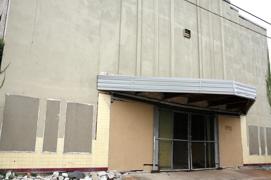
Gem Theater
Monument and historic site · National Register of Historic Places · 3.6 mi
Former movie theater in New Orleans, Louisiana, United States

Huey P. Long Mansion
Monument and historic site · National Register of Historic Places · 2.5 mi
Building in Louisiana, United States

James H. Dillard House
Monument and historic site · National Register of Historic Places · 2.5 mi
Historic house in Louisiana, United States

L.J. Bernard Hardware Store
Monument and historic site · National Register of Historic Places · 3.3 mi
Commercial building in Westwego, Louisiana

Longue Vue House and Gardens
Monument and historic site · National Register of Historic Places · 2.3 mi
Historic house in Louisiana, United States
12 more on the map.
Parks, trails and playgrounds13

Audubon Park
Park · 2.7 mi
City park in the Uptown neighborhood of New Orleans, Louisiana, United States
Audubon Zoo
Park · 2.9 mi
Zoo in Uptown New Orleans, Louisiana, United States
Lincoln Park
Park · 2.4 mi
Noted amusement park in New Orleans, Louisiana


1 more on the map.
Restaurants and cafes100



Breads on Oak
Bakery · 1.4 mi
Bakery that offers sourdough breads, tea biscuits, brioche, cakes, tarts and brownies.
8640 Oak Street, New Orleans
Mo-Su 07:00-15:00

Cowbell
Restaurant · Comfort Food, Small Plates · 1.3 mi
8801 Oak Street, New Orleans
Tu-Th 11:30-21:00; Fr-Sa 11:30-22:00
Jacques-Imo's
Restaurant · Regional, Creole, Cajun · 1.6 mi
8324 Oak Street, New Orleans
Mo-Th 17:00-22:00; Fr-Sa 17:00-22:30
Midori Sushi and Hibachi Express
Restaurant · Japanese · 1.8 mi
1120 South Carrollton Avenue
Mo-Fr 11:00-21:30; Sa-Su 12:00-21:30
Mizu Sushi Bar & Asian Fusion
Restaurant · Japanese · 1.7 mi
5250 Jefferson Highway, Harahan
Tu-Th 11:00-20:30; Fr 11:00-21:30; Sa 12:00-21:00; Su 12:00-20:30

The Galley Seafood Restaurant
Restaurant · American, Seafood, Fish · 1.5 mi
2535 Metairie Road
Mo-Su 11:00-21:00

88 more on the map.
History
Early French colonial documents show what would become Jefferson as part of the "Tchoupitoulas Coast" of Native American settlement. In the French and Spanish colonial era it was divided into a series of plantations with boundary lines perpendicular to the Mississippi River.
In the American Civil War, Camp Parapet was built originally by Confederate forces to defend New Orleans from an attack from the upriver side. After the Union liberated the city sailing up from downriver, U.S. troops expanded the fortifications to defend against Confederate counterattacks which never came.
What is now Jefferson includes formerly separate small communities dating back to the 19th century, including, Hoeyville, New Carrollon, Southport, and Shrewsbury, along with 20th century subdivisions/land developments including Azalea Gardens, Camellia Gardens, Jefferson Heights, and Rio Vista. Some of these names continue to sometimes be used locally to refer to neighborhoods.
The current four-lane Jefferson Highway was inaugurated in 1928, accelerating development as a suburban area within Greater New Orleans.
From the History section of Jefferson, Louisiana on Wikipedia, under CC BY-SA 4.0.
Where to stay3
Churches and places of worship34
Saint Joan of Arc Catholic Church
Church · Roman Catholic · 1.6 mi
8321 Burthe Street, New Orleans
Shopping14
Baldwin-Taylor Hardware
Hardware store · 0.9 mi
4301 Jefferson Highway, Jefferson
Gas and EV charging12
Schools, colleges and libraries62
Booker T. Washington High School
School · 4.1 mi
1201 South Roman St., New Orleans
Edward Hynes Charter School - Lakeview
School · 4.4 mi
990 Harrison Ave, New Orleans
Eleanor Mcmain Secondary School
School · 2.9 mi
5712 South Claiborne Avenue, New Orleans
Healthcare11
Map of Jefferson
250 places. The map loads OpenStreetMap tiles when you open it.
Climate by month
Monthly table
| Month | High | Low | Rain |
|---|---|---|---|
| Jan | 64°F | 46°F | 5.0 in |
| Feb | 68°F | 50°F | 4.1 in |
| Mar | 74°F | 56°F | 4.6 in |
| Apr | 81°F | 62°F | 5.0 in |
| May | 88°F | 69°F | 5.4 in |
| Jun | 92°F | 75°F | 7.4 in |
| Jul | 94°F | 77°F | 8.8 in |
| Aug | 94°F | 77°F | 6.8 in |
| Sep | 90°F | 74°F | 5.7 in |
| Oct | 83°F | 65°F | 3.6 in |
| Nov | 73°F | 55°F | 3.8 in |
| Dec | 66°F | 49°F | 4.5 in |
U.S. Climate Normals 1991-2020 for New Orleans Audubon Hcn (3 mi away), NOAA NCEI.
People and cost of living
American Community Survey 5-year estimates, 2020-2024, U.S. Census Bureau. Estimates have margins of error, larger for small towns.
Disaster history
Jefferson Parish has had 40 federal disaster declarations since 2000, most often for hurricanes.
- 2026-01-24: Severe Winter Storm (Winter Storm)
- 2024-09-16: Hurricane Francine (Hurricane)
- 2024-09-10: Tropical Storm Francine (Hurricane)
- 2023-09-27: Seawater Intrusion (Other)
- 2021-09-13: Tropical Storm Nicholas (Coastal Storm)
- 2021-08-29: Hurricane Ida (Hurricane)
OpenFEMA disaster declarations summaries.
Getting there and nearby towns
Louis Armstrong New Orleans International Airport (MSY) is the nearest airport with scheduled flights listed in OpenStreetMap, 7 miles away.
- Bridge City 1 mi south, about 2 min by car
- Elmwood 2 mi west, about 3 min by car
- Metairie 3 mi northwest, about 5 min by car
- Harahan 3 mi southwest, about 5 min by car
- River Ridge 4 mi west, about 6 min by car
- Westwego 4 mi south, about 6 min by car
- Waggaman 5 mi west, about 8 min by car
- Avondale 5 mi southwest, about 8 min by car
- Marrero 6 mi southeast, about 9 min by car
- Kenner 7 mi northwest, about 11 min by car
Drive times are estimates from straight-line distance, not routes.
Local news
Headlines from INDB, the NEMICO news database.
Reviews, tips and questions
Loading what members have shared...
Sources and licences
- NCES EDGE (Public domain): public schools
- NOAA NCEI U.S. Climate Normals 1991-2020 (Public domain): climate by month
- OpenFEMA (Public domain): disaster declarations
- OpenStreetMap contributors (ODbL 1.0): places, airports, map data
- U.S. Census Bureau (Public domain): population, income, housing, education, commute
- Wikidata (CC0 1.0): landmarks and historic places
- Wikimedia Commons (see each image): photos
- Wikipedia (CC BY-SA 4.0): overview and history text
Photo credits
- Fro stop Old Jefferson LA, coffee shop soulja, CC BY 2.0
- Balloons limited Jeff Hwy Old Jefferson LA, coffee shop soulja, CC BY 2.0
- Arcade Jeff Hwy Old Jefferson LA 2010, coffee shop soulja, CC BY 2.0
- Dead Gas Station Hut Jefferson LA, Bart Everson, CC BY 2.0
- Dead Gas Station Jefferson LA, Bart Everson, CC BY 2.0
- Voyage under the Huey P. Long Bridge, Jefferson Parish, Louisiana, ---=XEON=---, CC BY 3.0
- Huey P. Long Bridge, Jefferson Parish, Louisiana - Panorama view from Mississippi River, ---=XEON=---, CC BY 3.0
- US90 Huey P. Long Bridge, Jefferson Parish, Louisiana, formulanone from Huntsville, United States, CC BY-SA 2.0
- Huey P. Long Bridge, Jefferson Parish, LA, US90, Mississippi River, formulanone from Huntsville, United States, CC BY-SA 2.0
- Cross-Road - Huey P. Long Bridge, Jefferson Parish, LA, bridge pier, ---=XEON=---, CC BY 3.0
- Huey P. Long Bridge, Jefferson Parish, LA - City Of Bridges, ---=XEON=---, CC BY 3.0
- Huey P. Long Bridge, Jefferson Parish, Louisiana - Infinity, ---=XEON=---, CC BY 3.0
- Infinite - Huey P. Long Bridge pier, Jefferson Parish, LA with Metairie CBD Towers in background, ---=XEON=---, CC BY 3.0
- Huey P. Long Bridge, Jefferson Parish, Louisiana, View from Mississippi River, ---=XEON=---, CC BY 3.0
- Steamfest07Choochoo4, Infrogmation of New Orleans, CC BY-SA 3.0
- Audubon Blvd 14 NOLA Feb 2012 A, Infrogmation of New Orleans, CC BY-SA 3.0
- CampParapet21Jan2008DRView, Infrogmation of New Orleans, CC BY-SA 3.0
- BluePlateBroadmoorMay07B, see above, CC BY 3.0
- MetCem1932Schoolchildren1, Unknown author, CC BY 2.5
- BroadmoorLives, Infrogmation, CC BY 2.5
- BroadmoorBohnWingedWheel, Infrogmation, CC BY 2.5
- Magnolia Lane Plantation House Posted, Infrogmation of New Orleans, CC BY-SA 3.0
- ChicletsFactoryFigDanteJan2010, Infrogmation of New Orleans, CC BY-SA 3.0
- NewcombHallDownsideCenterJan08, Infrogmation of New Orleans, CC BY-SA 3.0
- OddFellowsRestGateNOLA1, Infrogmation of New Orleans, CC BY-SA 3.0
- LatterLibraryStoneSignHouse, Unknown author, CC BY 2.5
- FishermensExchangeMuseumWestwego, Infrogmation of New Orleans, CC BY-SA 3.0
- DillardHouseFrontA, Infrogmation of New Orleans, CC BY-SA 3.0
- LongueVue5Jan07BackC, Infrogmation of New Orleans, CC BY-SA 2.5
- Streetcar in New Orleans, USA1, Diego Delso, CC BY-SA 3.0
- Gem 3940 Thalia, Karen Apricot, CC BY-SA 2.0
- CanalRedcarFirstGraceNOLA, Infrogmation of New Orleans, CC BY-SA 3.0
- Arabella Station NOLA Exterior 2009, Infrogmation of New Orleans, CC BY-SA 3.0
- Breads on Oak, New Orleans, 1 October 2026 - 4, Infrogmation, CC BY-SA 4.0
- Rivershack Tavern Shrewsbury Louisiana Coffee, Infrogmation of New Orleans, CC BY 2.0
- Cross - panoramio (17), ---=XEON=---, CC BY 3.0
- Dead Gas Station Jeff Hwy Louisiana Counter, Bart Everson, CC BY 2.0
- Dead Gas Station Jeff Hwy Louisiana Panorama, Bart Everson, CC BY 2.0
- Dead Gas Station Jeff Hwy Louisiana Pump Counter, Bart Everson, CC BY 2.0
- Dead Gas Station Jeff Hwy Louisiana Pump Up Hose Down, Bart Everson, CC BY 2.0


Page built October 30, 2026. Spotted a mistake? Tell us or suggest a place.