


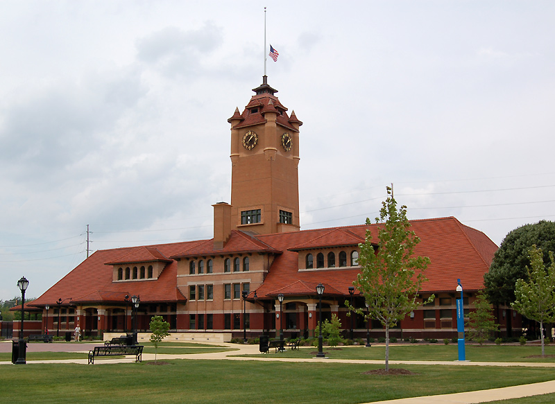
Why visit Jerome
Townapedia lists 40 museums and landmarks, 13 parks and trails, 76 places to eat, 2 places to stay and 1 attraction in and around town.
Highlights include Hoogland Center for the Arts, Alvin S. Keys House, Dr. Charles Compton House and Washington Park.
July is the warmest month, with average highs of 86°F; January lows average 19°F.
Weather in Jerome
Forecast from the National Weather Service. Full forecast
About Jerome
Jerome is a village in Sangamon County, Illinois, United States. As of the 2020 census, Jerome had a population of 1,692. It is part of the Springfield, Illinois Metropolitan Statistical Area.
From the Wikipedia article Jerome, Illinois (this version), under CC BY-SA 4.0.
Things to do1

Hoogland Center for the Arts
Cinema and theater · 2.6 mi
Performing arts center in Springfield, Illinois, United States
Museums and landmarks40

Alvin S. Keys House
Monument and historic site · National Register of Historic Places · 1.1 mi
Historic house in Illinois, United States
1600 Illini Road, Leland Grove

Dr. Charles Compton House
Monument and historic site · National Register of Historic Places · 1.3 mi
Historic house in Illinois, United States
1303 South Wiggins Avenue, Springfield

Bell Miller Apartments
Monument and historic site · National Register of Historic Places · 2.1 mi
Apartment building in Springfield, Illinois

Bressmer-Baker House
Monument and historic site · National Register of Historic Places · 2.3 mi
Historic house in Illinois, United States

Central Springfield Historic District
Monument and historic site · National Register of Historic Places · 2.7 mi
Historic district in Springfield, Illinois, USA

Clarkson W. Freeman House
Monument and historic site · National Register of Historic Places · 2.3 mi
Springfield, Illinois, listed on the NRHP

Cong. James M. Graham House
Monument and historic site · National Register of Historic Places · 2.7 mi
Historic house in Illinois, United States

Dana-Thomas House
Monument and historic site · National Register of Historic Places · 2.3 mi
Historic house in Illinois, United States

Edwards Place
Monument and historic site · National Register of Historic Places · 3.2 mi
Historic house in Illinois, United States

Elijah Iles House
Monument and historic site · National Register of Historic Places · 2.6 mi
Historic house in Illinois, United States


Gov. Richard Yates House
Monument and historic site · National Register of Historic Places · 1.6 mi
Historic house in Illinois, United States

H. P. Boult House
Monument and historic site · National Register of Historic Places · 1.9 mi
Historic house in Illinois, United States
28 more on the map.
Parks, trails and playgrounds13
Washington Park
Park · National Register of Historic Places · 1.5 mi
Park in Springfield, Illinois
1501 South Grand Avenue West, Springfield
Mo-Su 06:00-22:30


Malibu Jack's
Sports field and stadium · 1.4 mi
2501 Wabash Avenue, Springfield
Mo-Th 11:00-21:00; Fr-Sa 11:00-23:00; Su 12:00-21:00

1 more on the map.
Restaurants and cafes76

Charlie Parker's Diner
Restaurant · Western · 0.8 mi
700 West North Street, Springfield
Mo-Su 07:00-14:00


Gateway to India
Restaurant · Indian · 0.6 mi
3115 Chatham Road, Springfield
Tu-Su 11:00-14:15, 17:00-21:00

7 Brew
Cafe · Coffee Shop · 1.5 mi
2599 Wabash Avenue, Springfield
Su-Th 05:30-22:00; Fr-Sa 05:30-23:00
AZ-T-CA Mexican Grill
Restaurant · Mexican · 0.6 mi
2753 Chatham Road, Springfield
Mo-Th 11:00-21:00; Fr-Sa 11:00-22:00
Antonio's Pizza
Restaurant · Pizza · 0.5 mi
1013 Wabash Avenue, Springfield
Su-Th 11:00-21:00; Fr-Sa 11:00-22:00

Baskin-Robbins
Ice cream · Ice Cream · 1.2 mi
1700 South MacArthur Boulevard, Springfield
Mo-Su 11:00-22:00
Cafe Moxo
Restaurant · American, Bagel, Breakfast, Deli, Diner · 0.5 mi
2661 Chatham Road, Springfield
Mo-Su 06:30-15:00
Casa Real
Restaurant · Mexican · 1.4 mi
1121 Lincolnshire Boulevard, Springfield
Mo-Th 11:00-22:00; Fr-Sa 11:00-24:00; Su 12:00-22:00
64 more on the map.
Where to stay2
Fairfield by Marriott Inn & Suites Springfield
Motel and hotel · 1.5 mi
3951 South MacArthur Boulevard, Springfield
Churches and places of worship14
Christ Episcopal Church
Church · National Register of Historic Places · 2.6 mi
Saint Anthony Greek Orthodox Church
Church · Greek Orthodox · 1.3 mi
1600 South Glenwood Avenue, Springfield
Heritage Free Will Baptist Church
Church · Baptist · 0.7 mi
3436 South Douglas Avenue, Springfield
Jerome United Methodist Church
Church · United Methodist
1570 Reed Avenue, Springfield
Shopping19
Gas and EV charging7
Schools, colleges and libraries48
Healthcare5
Hy-Vee Pharmacy
Clinic and pharmacy · 0.7 mi
2115 South MacArthur Boulevard, Springfield
Map of Jerome
225 places. The map loads OpenStreetMap tiles when you open it.
Climate by month
Monthly table
| Month | High | Low | Rain |
|---|---|---|---|
| Jan | 36°F | 19°F | 2.2 in |
| Feb | 41°F | 22°F | 2.2 in |
| Mar | 52°F | 31°F | 3.0 in |
| Apr | 64°F | 41°F | 4.1 in |
| May | 74°F | 53°F | 5.1 in |
| Jun | 83°F | 63°F | 5.0 in |
| Jul | 86°F | 66°F | 4.4 in |
| Aug | 84°F | 64°F | 2.9 in |
| Sep | 78°F | 56°F | 3.1 in |
| Oct | 66°F | 44°F | 3.1 in |
| Nov | 53°F | 33°F | 3.1 in |
| Dec | 41°F | 24°F | 2.3 in |
U.S. Climate Normals 1991-2020 for Springfield #2 (2 mi away), NOAA NCEI.
People and cost of living
American Community Survey 5-year estimates, 2020-2024, U.S. Census Bureau. Estimates have margins of error, larger for small towns.
Disaster history
Sangamon County has had 8 federal disaster declarations since 2000, most often for severe storms.
- 2023-08-15: Severe Storms And Flooding (Severe Storm)
- 2020-03-26: Covid-19 Pandemic (Biological)
- 2020-03-13: Covid-19 (Biological)
- 2011-03-17: Severe Winter Storm And Snowstorm (Snowstorm)
- 2007-02-09: Severe Winter Storm (Severe Ice Storm)
- 2006-03-28: Tornadoes And Severe Storms (Severe Storm)
OpenFEMA disaster declarations summaries.
Getting there and nearby towns
Abraham Lincoln Capital Airport (SPI) is the nearest airport with scheduled flights listed in OpenStreetMap, 5 miles away.
- Springfield 2 mi northeast, about 4 min by car
- Grandview 5 mi northeast, about 8 min by car
- Chatham 6 mi south, about 10 min by car
- Auburn 14 mi south, about 22 min by car
- Athens 14 mi north, about 22 min by car
- Divernon 14 mi south, about 22 min by car
- Taylorville 24 mi southeast, about 38 min by car
- Jacksonville 30 mi west, about 48 min by car
- Lincoln 31 mi northeast, about 50 min by car
- Decatur 40 mi east, about 1 h by car
Drive times are estimates from straight-line distance, not routes.
Local news
Headlines from INDB, the NEMICO news database.
Reviews, tips and questions
Loading what members have shared...
Sources and licences
- NCES EDGE (Public domain): public schools
- NOAA NCEI U.S. Climate Normals 1991-2020 (Public domain): climate by month
- OpenFEMA (Public domain): disaster declarations
- OpenStreetMap contributors (ODbL 1.0): places, airports, map data
- U.S. Census Bureau (Public domain): population, income, housing, education, commute
- Wikidata (CC0 1.0): elevation, founding date, time zone, website, landmarks and historic places
- Wikimedia Commons (see each image): photos
- Wikipedia (CC BY-SA 4.0): overview and history text
Photo credits
- Governor Tanner's Memorial, Jim Bowen, CC BY 2.0
- Carillon, Washington Park, Unknown author, CC BY-SA 2.5
- Alvin S. Keys House, Jim Roberts, CC BY-SA 4.0
- Dr. Charles Compton House, Jim Roberts, CC BY-SA 4.0
- EdwardsPlace, Notmatisse, CC BY-SA 3.0
- Springfield Union Station W0446, Bill Pollard ( RI-Bill at en.wikipedia ), Public domain
- St. Nicholas Hotel, Teemu08, CC BY-SA 3.0
- Hickox Apartments, Teemu08, CC BY-SA 3.0
- Central Springfield Historic district, Jaknelaps, CC BY-SA 3.0
- Illinois State Capitol, Capitol Avenue and 2nd Street, Springfield, IL - 53319245695, w_lemay, CC BY-SA 2.0
- Clarkson W Freeman House, Jaknelaps, CC BY-SA 3.0
- Town House Springfield IL, Teemu08, CC BY-SA 3.0
- Christ Episcopal Church Springfield IL, Teemu08, CC BY-SA 3.0
- Maid-Rite Drive Thru, Rklawton, CC BY 2.5
- Dana Thomas Windows, Traveling V at English Wikipedia, CC BY 2.5
- Lincoln Colored Home, Salisburymistake, CC BY-SA 4.0
- Etc 450, Shadow2700 at en.wikipedia, Public domain
- Elijah Iles House, Teemu08, CC BY-SA 3.0
- Bell Miller Apartments, Teemu08, CC BY-SA 3.0
- Image The Heimberger House, Boscophotos, CC BY-SA 3.0
- Gov. Richard Yates House Springfield Illinois, N9LXI, CC BY-SA 3.0
- The Lincoln Depot August 2004, Michael Barera, CC BY-SA 4.0
- Vachel Lindsay House, Zol87, CC BY-SA 3.0
- Cong. James M. Graham House, Teemu08, CC BY-SA 3.0
- Image The Garvey House, Boscophotos, CC BY-SA 3.0
- Virgil Hickox House, Teemu08, CC BY-SA 3.0
- Bressmer-Baker House, Teemu08, CC BY-SA 3.0
- Executive Mansion, Teemu08, CC BY-SA 3.0
- Howard K. Weber House, Teemu08, CC BY-SA 3.0
- Springfield - West Grand School Playground (4287935095), Roger W from Sarasota, Florida, U.S.A., CC BY-SA 2.0
- Springfield - West Grand School (4287935057), Roger W from Sarasota, Florida, U.S.A., CC BY-SA 2.0
- Springfield - 1104 Urban Avenue (4306628000), Roger W from Sarasota, Florida, U.S.A., CC BY-SA 2.0
- Springfield - 1104 Urban Avenue (4287935019), Roger W from Sarasota, Florida, U.S.A., CC BY-SA 2.0
- Moroleon Tropical Mexican Restaurant, Springfield, Illinois, Salisburymistake, CC BY-SA 4.0
- Camel Crush cigarette, Visviva, CC0
- Mapillary (470466640904260, aZrYva2yBPpBsxCF ArzVA) (voschix) 2016-09-16 20H21M44S000, voschix, CC BY-SA 4.0
- Mapillary (139139111460545, aZrYva2yBPpBsxCF ArzVA) (voschix) 2016-09-16 20H21M49S000, voschix, CC BY-SA 4.0
- Mapillary (460583395040043, aZrYva2yBPpBsxCF ArzVA) (voschix) 2016-09-16 20H21M59S000, voschix, CC BY-SA 4.0
- Mapillary (477810933426899, aZrYva2yBPpBsxCF ArzVA) (voschix) 2016-09-16 20H21M54S000, voschix, CC BY-SA 4.0
- Mapillary (493331501804005, aZrYva2yBPpBsxCF ArzVA) (voschix) 2016-09-16 20H21M39S000, voschix, CC BY-SA 4.0


Page built October 30, 2026. Spotted a mistake? Tell us or suggest a place.