




Kahaluu-Keauhou, Hawaii
Kahaluu-Keauhou is a community of 5,150 people in Hawaii County, Hawaii.
Why visit Kahaluu-Keauhou
Townapedia lists 17 museums and landmarks, 6 parks and trails, 17 places to eat, 4 places to stay and 3 attractions in and around town.
Highlights include Puʻuloa, Regal Keauhou Stadium 7 Cinemas, Daifukuji Soto Zen Mission and Holualoa Bay.
September is the warmest month, with average highs of 86°F; January lows average 66°F.
Weather in Kahaluu-Keauhou
Forecast from the National Weather Service. Full forecast
About Kahaluu-Keauhou
Kahaluʻu-Keauhou is a census-designated place (CDP) in Hawaiʻi County, Hawaii, United States. The population was 4,778 at the 2020 census, up from 3,549 at the 2010 census.
From the Wikipedia article Kahaluʻu-Keauhou, Hawaii (this version), under CC BY-SA 4.0.
Things to do3


Museums and landmarks17

Daifukuji Soto Zen Mission
Monument and historic site · National Register of Historic Places · 2.9 mi
Historic Place in Hawaii County, Hawaii

Holualoa Bay
Monument and historic site · National Register of Historic Places · 2.3 mi
Historic Place in Hawaii County, Hawaii

Kahaluu Bay
Monument and historic site · National Register of Historic Places · 0.8 mi
Historic Place in Hawaii County, Hawaii
Keauhou Bay
Monument and historic site · National Register of Historic Places · 0.9 mi
Bay in Hawaii County, Hawaii, United States of America

Keauhou Holua Slide
Monument and historic site · National Register of Historic Places · 0.7 mi
Historic Place in Hawaii County, Hawaii
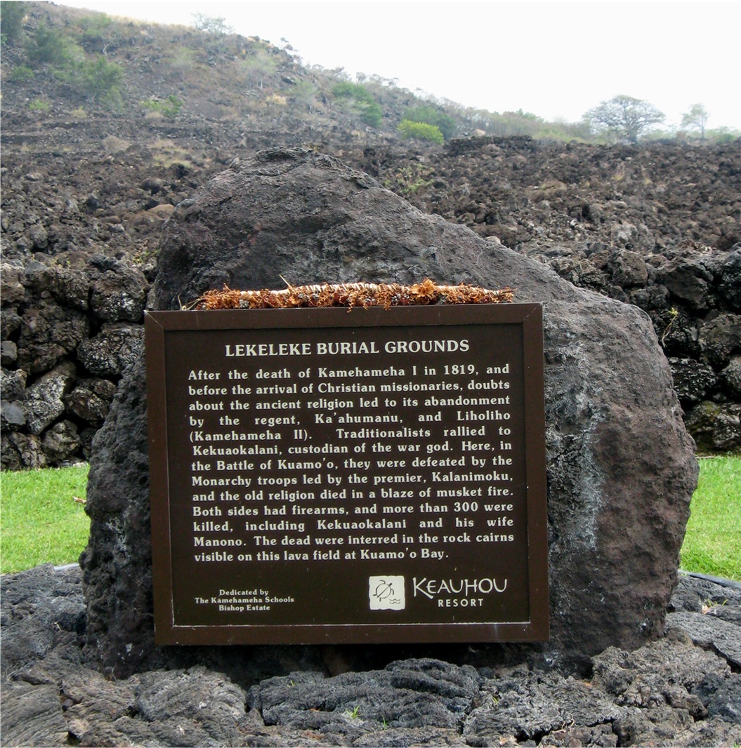
Kuamoo Burials
Monument and historic site · National Register of Historic Places · 1.5 mi
Archaeological site in Kona District, United States of America

Ho’oulu Community Farmers Market
Monument and historic site · 1.0 mi
78-128 Ehukai Street
We 09:00-14:00

5 more on the map.
Parks, trails and playgrounds6



Restaurants and cafes17






5 more on the map.
Where to stay4
Churches and places of worship6
Hale Halawai O Holualoa
Church · National Register of Historic Places · 2.8 mi
Kingdom Hall of Jehovah’s Witnesses
Place of worship · Jehovahs Witness · 1.8 mi
78-6955 Mamalahoa Highway, Holualoa
Lutheran Church of the Holy Trinity
Church · Lutheran · 2.4 mi
77-165 Lako Street, Kailua Kona
Shopping6
Gas and EV charging1
Schools, colleges and libraries8
Ke Kula O Ehunuikaimalino
School · 5.1 mi
81-1041 Konawaena School Rd, Kealakekua
Healthcare1
Map of Kahaluu-Keauhou
69 places. The map loads OpenStreetMap tiles when you open it.
Climate by month
Monthly table
| Month | High | Low | Rain | Snow |
|---|---|---|---|---|
| Jan | 80°F | 66°F | 2.9 in | 0.0 in |
| Feb | 80°F | 67°F | 2.0 in | 0.0 in |
| Mar | 81°F | 68°F | 3.3 in | 0.0 in |
| Apr | 82°F | 69°F | 5.1 in | 0.0 in |
| May | 83°F | 71°F | 4.2 in | 0.0 in |
| Jun | 84°F | 72°F | 5.4 in | 0.0 in |
| Jul | 85°F | 73°F | 5.0 in | 0.0 in |
| Aug | 86°F | 74°F | 4.7 in | 0.0 in |
| Sep | 86°F | 73°F | 4.8 in | 0.0 in |
| Oct | 85°F | 72°F | 5.1 in | 0.0 in |
| Nov | 83°F | 70°F | 2.5 in | 0.0 in |
| Dec | 81°F | 68°F | 2.7 in | 0.0 in |
U.S. Climate Normals 1991-2020 for Ke-Ahole Pt 68.13 (13 mi away), rain and snow from Lanihau 68.2, NOAA NCEI.
People and cost of living
American Community Survey 5-year estimates, 2020-2024, U.S. Census Bureau. Estimates have margins of error, larger for small towns.
Disaster history
Hawaii County has had 30 federal disaster declarations since 2000, most often for fires.
- 2026-10-07: Hurricane Lala (Hurricane)
- 2026-09-25: Tropical Storm Nolo (Tropical Storm)
- 2026-09-01: Earthquake (Earthquake)
- 2026-08-25: Hurricane Lala (Tropical Storm)
- 2026-07-26: Kawaihae Road Fire (Fire)
- 2026-04-07: Severe Storms, Flooding, Landslides, And Mudslides (Flood)
OpenFEMA disaster declarations summaries.
Getting there and nearby towns
Ellison Onizuka Kona International Airport at Keāhole (KOA) is the nearest airport with scheduled flights listed in OpenStreetMap, 13 miles away.
- Honalo 4 mi east, about 6 min by car
- Kealakekua 4 mi southeast, about 7 min by car
- Kailua 6 mi northwest, about 9 min by car
- Captain Cook 7 mi southeast, about 11 min by car
- Holualoa 7 mi north, about 11 min by car
- Honaunau-Napoopoo 11 mi southeast, about 17 min by car
- Kaloko 11 mi north, about 17 min by car
- Kaiminani 13 mi north, about 21 min by car
- Waikoloa Village 27 mi north, about 44 min by car
- Hawaiian Ocean View 35 mi south, about 56 min by car
Drive times are estimates from straight-line distance, not routes.
Local news
Headlines from INDB, the NEMICO news database.
Reviews, tips and questions
Loading what members have shared...
Sources and licences
- NCES EDGE (Public domain): public schools
- NOAA NCEI U.S. Climate Normals 1991-2020 (Public domain): climate by month
- OpenFEMA (Public domain): disaster declarations
- OpenStreetMap contributors (ODbL 1.0): places, airports, map data
- U.S. Census Bureau (Public domain): population, income, housing, education, commute
- Wikidata (CC0 1.0): elevation, founding date, time zone, website, landmarks and historic places
- Wikimedia Commons (see each image): photos
- Wikipedia (CC BY-SA 4.0): overview and history text
Photo credits
- Hale Halawai o Holualoa, W Nowicki, CC BY 3.0
- Kuamo'o Burial Memorial, W Nowicki, CC BY 3.0
- Kahaluu Bay, W Nowicki, CC BY 3.0
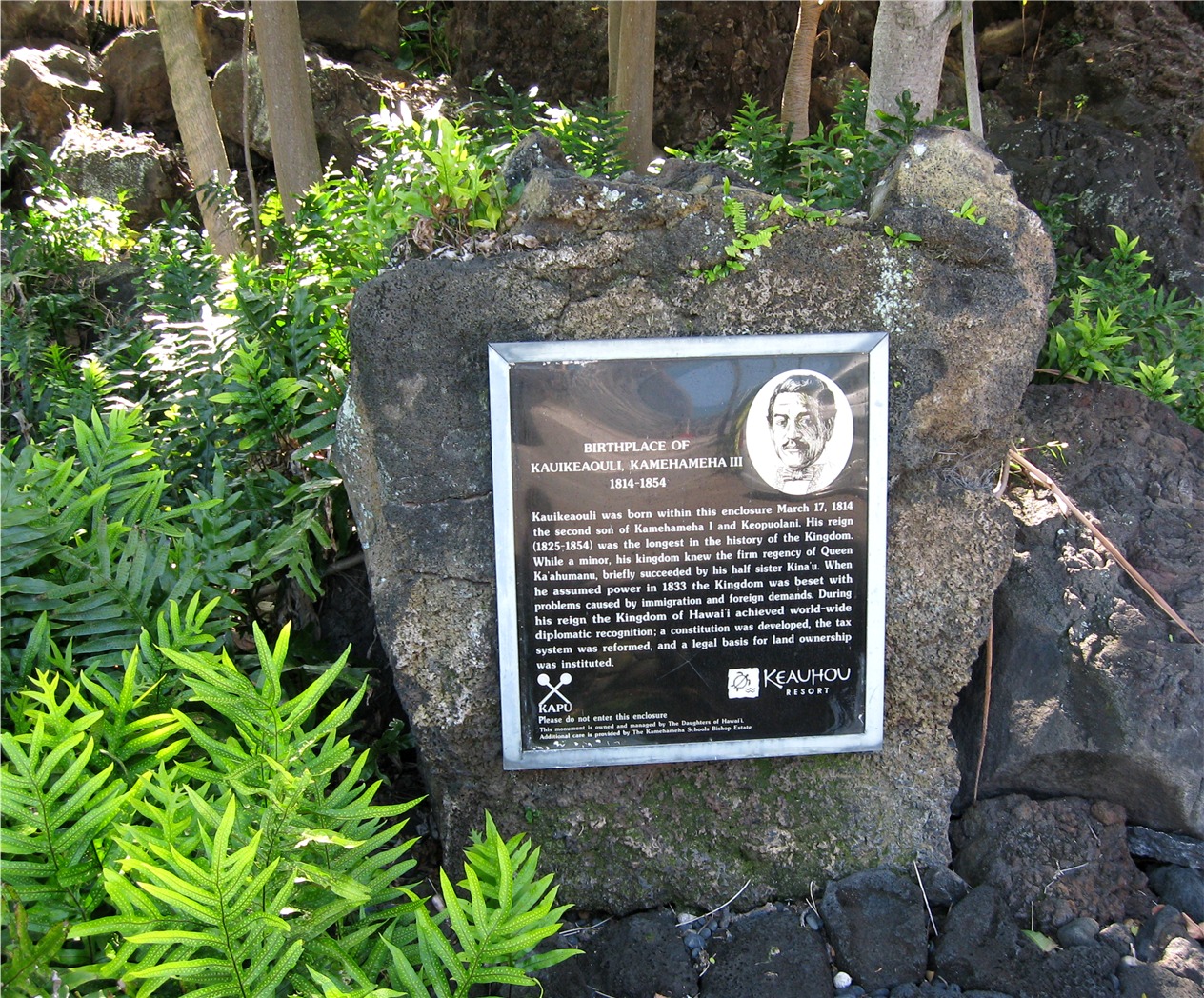
- Kamehameha III's Birthplace, W Nowicki, CC BY 3.0
- Daifukuji Soto Zen Mission, W Nowicki, CC BY 3.0
- Kamoa Point, Kona, W Nowicki, CC BY 3.0
- Big Island Bouquet, Keauhou Farmers market - panoramio, zak11527, CC BY-SA 3.0
- View of Pacific Ocean from Holualoa, Hawaii (4529710754), Ken Lund from Reno, Nevada, USA, CC BY-SA 2.0
- View of Pacific Ocean from Holualoa, Hawaii (4529085529), Ken Lund from Reno, Nevada, USA, CC BY-SA 2.0
- View of Pacific Ocean from Holualoa, Hawaii (4529082413), Ken Lund from Reno, Nevada, USA, CC BY-SA 2.0
- Scolopendra subspinipes 264968029, J. Roe, CC BY 4.0
- The paddling surfers under crepuscular rays, Brocken Inaglory, CC BY-SA 3.0
- Kahaluu Heiau, W Nowicki, CC BY 3.0
- Keauhou Holua, W Nowicki, CC BY 3.0
- Kohala Coast 2006 - panoramio, Annette Teng, CC BY 3.0
- Hawaii (5496272890), Nan Palmero from San Antonio, TX, USA, CC BY 2.0
- Hawaii (5496273214), Nan Palmero from San Antonio, TX, USA, CC BY 2.0
- Hawaii (5495680739), Nan Palmero from San Antonio, TX, USA, CC BY 2.0
- Hawaii (5496272438), Nan Palmero from San Antonio, TX, USA, CC BY 2.0
- Hawaii (5495681263), Nan Palmero from San Antonio, TX, USA, CC BY 2.0
- Hawaii (5495683339), Nan Palmero from San Antonio, TX, USA, CC BY 2.0
- Isognomon perna 286713848, Daniel Das, CC0
- Isognomon perna 286713902, Daniel Das, CC0
- Isognomon perna 286713804, Daniel Das, CC0
- Isognomon perna 286714000, Daniel Das, CC0
- Isognomon perna 286713954, Daniel Das, CC0
- Isognomon californicus 286714059, Daniel Das, CC0
- Flickr - brewbooks - Hibiscus (1), brewbooks from near Seattle, USA, CC BY-SA 2.0
- Flickr - brewbooks - Hibiscus, brewbooks from near Seattle, USA, CC BY-SA 2.0
- Flickr - brewbooks - Crinum amabile - Spider Lily (1), brewbooks from near Seattle, USA, CC BY-SA 2.0
- Flickr - brewbooks - Crinum amabile - Spider Lily, brewbooks from near Seattle, USA, CC BY-SA 2.0
- Keauhou Bay, Hawaii (2403916414), brewbooks from near Seattle, USA, CC BY-SA 2.0
- Keauhau Bay Panorama 1 (2405259203), brewbooks from near Seattle, USA, CC BY-SA 2.0
- Keauhau Bay Panorama 2 (2406094116), brewbooks from near Seattle, USA, CC BY-SA 2.0
- Turtle basking, Keauhou Bay, Hawaii (2404996716), brewbooks from near Seattle, USA, CC BY-SA 2.0
- Turtles at Keauhau Bay (2405275077), brewbooks from near Seattle, USA, CC BY-SA 2.0
- Keauhau Bay (2406104350), brewbooks from near Seattle, USA, CC BY-SA 2.0
- Turtle swimming, Keauhou Bay, Hawaii (2404998298), brewbooks from near Seattle, USA, CC BY-SA 2.0
- Keauhou Bay, Hawaii (2404992224), brewbooks from near Seattle, USA, CC BY-SA 2.0
- Turtle swimming, Keauhou Bay, Hawaii (2404171235), brewbooks from near Seattle, USA, CC BY-SA 2.0


Page built October 30, 2026. Spotted a mistake? Tell us or suggest a place.