
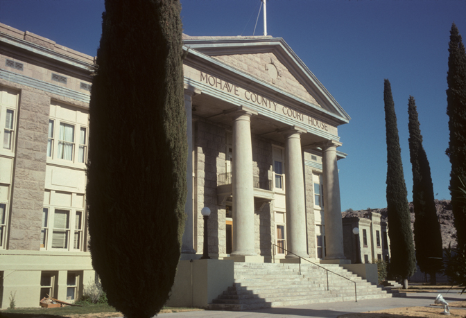


Kingman, Arizona
Kingman is a city of 34,375 people in Mohave County, Arizona, founded in 1952.
Why visit Kingman
Townapedia lists 69 museums and landmarks, 19 parks and trails, 63 places to eat, 38 places to stay and 5 attractions in and around town.
Highlights include Beale Street Theater, C-A-L Ranch Stores, Kingman Railroad Museum and Bonelli House.
July is the warmest month, with average highs of 99°F; December lows average 30°F.
Weather in Kingman
Forecast from the National Weather Service. Full forecast
About Kingman
Kingman is a city in and the county seat of Mohave County, Arizona, United States. It is named after Lewis Kingman, an engineer for the Atlantic and Pacific Railroad. The population was 32,689 as of the 2020 census, and was estimated at 35,829 in 2025.
From the Wikipedia article Kingman, Arizona (this version), under CC BY-SA 4.0.
Things to do5



Museums and landmarks69

Kingman Railroad Museum
Museum · 3.1 mi
Children under 12 and active duty military are free.
402 East Andy Devine Avenue, Kingman
Fr-Su 10:00-16:00

Bonelli House
Museum · National Register of Historic Places · 2.9 mi
Museum
430 East Spring Street, Kingman

George R. Kayser House
Monument and historic site · National Register of Historic Places · 2.8 mi
Historic house in Arizona, United States

Mohave Museum of History and Arts
Museum · 3.4 mi
Museum in Kingman, Arizona, US, operated by Mohave County Historical Society
Mo-Fr 09:00-17:00; Sa 13:00-17:00

Armour and Jacobson Building
Monument and historic site · National Register of Historic Places · 3.0 mi
United States historic place

Arthur F. Black House
Monument and historic site · National Register of Historic Places · 3.1 mi
Historic house in Arizona, United States


AT&T Building
Monument and historic site · National Register of Historic Places · 3.0 mi
Office building in Kingman, Arizona
Atchison, Topeka and Santa Fe Railway 3759
Monument and historic site · National Register of Historic Places · 3.3 mi
Preserved American 4-8-4 locomotive (ATSF 3751 class)
Building at 218 Spring
Monument and historic site · National Register of Historic Places · 3.0 mi
Building in Arizona, United States
Charles Ziemer House
Monument and historic site · National Register of Historic Places · 2.9 mi
Historic house in Arizona, United States
Desert Power & Water Co.
Monument and historic site · National Register of Historic Places · 3.3 mi
United States historic place
Dr. David S. Livingston House
Monument and historic site · National Register of Historic Places · 3.2 mi
Historic house in Kingman, Arizona
57 more on the map.
Parks, trails and playgrounds19

Cerbat Cliffs Golf Course (Kingman Municipal)
Golf course · 2.3 mi
18 hole Par 71
1001 Gates Avenue, Kingman

White Cliff Wagon Road trail network
Hiking and trails · 2.8 mi
White Cliffs Road, Kingman

7 more on the map.
Restaurants and cafes63


Mattina's Ristorante Italiano
Restaurant · Italian · 3.0 mi
318 East Oak Street, Kingman
Mo-Sa 16:00-21:00; Su 16:00-20:00
Bankog Thai Cuisine
Restaurant · Asian · 3.4 mi
208 W Andy Devine Avenue
Mo-Sa 11:00-20:00

Mr. D'z
Restaurant · Burger · 3.3 mi
105 East Andy Devine Avenue, Kingman
07:00-21:00

Federico's
Restaurant · Mexican · 3.4 mi
401 Beale Street, Kingman
Mo-We 09:00-22:00, Th-Sa 08:00-22:00, Su 09:00-22:00

Keto Keto Carnivore
Bakery · 2.9 mi
713 East Andy Devine Avenue, Kingman
Tu-Sa 08:00-15:00
Pizza Hut
Restaurant · Pizza · 1.4 mi
Miami Avenue
Su-Th 10:00-00:00; Fr-Sa 10:00-01:00
51 more on the map.
History
Lt. Edward Fitzgerald Beale, a U.S. Navy officer in the service of the Army Corps of Topographical Engineers, was ordered by the U.S. War Department to build a federal wagon road across the 35th parallel. His secondary orders were to test the feasibility of the use of camels as pack animals in the Southwestern desert. Beale traveled through the present-day Kingman in 1857 surveying the road and in 1859 to build the road. Beale's Wagon Road became part of U.S. Route 66 and later Interstate 40. Remnants of the wagon road can still be seen in White Cliffs Canyon in Kingman.
Kingman was founded in 1882 before statehood, in Arizona Territory. Situated in the Hualapai Valley between the Cerbat and Hualapai mountain ranges, Kingman had its modest beginnings as a simple railroad siding near Beale Springs. Civil engineer Lewis Kingman supervised the building of the railroad from Winslow to Beale Springs. This spring had been used by Native Americans living in the area for centuries.
From the History section of Kingman, Arizona on Wikipedia, under CC BY-SA 4.0.
Where to stay38
Best Western Plus a Wayfarer's Inn And Suites
Motel and hotel · 0.5 mi
2815 East Andy Devine Avenue, Kingman
Churches and places of worship12
Saint John's Methodist Episcopal Church
Church · National Register of Historic Places · 2.9 mi
Church of the Nazarene
Church · Nazarene · 3.4 mi
4715 Stockton Hill Road, Kingman
Trinity Episcopal Church
Church · Protestant · 2.9 mi
425 East Spring Street, Kingman
Shopping13
Gas and EV charging30
Schools, colleges and libraries30
Kingman Academy of Learning - High School
School · 1.1 mi
3420 N Burbank St, Kingman
Kingman Academy of Learning - Intermediate School
School · 0.9 mi
3419 Harrison St, Kingman
Kingman Academy of Learning - Middle School
School · 0.9 mi
3269 Harrison St, Kingman
Kingman Academy of Learning - Primary School
School · 1.0 mi
3400 N Burbank St, Kingman
Kingman Online Learning Academy (Kola) Elementary School
School
3033 Macdonald Ave, Kingman
Kingman Online Learning Academy (Kola) High School
School
3033 Macdonald Ave, Kingman
Kingman Online Learning Academy (Kola) Middle School
School
3033 Macdonald Ave, Kingman
Healthcare7
Map of Kingman
250 places. The map loads OpenStreetMap tiles when you open it.
Climate by month
Monthly table
| Month | High | Low | Rain |
|---|---|---|---|
| Jan | 57°F | 31°F | 1.0 in |
| Feb | 61°F | 33°F | 1.0 in |
| Mar | 67°F | 38°F | 0.6 in |
| Apr | 75°F | 43°F | 0.5 in |
| May | 85°F | 53°F | 0.1 in |
| Jun | 95°F | 62°F | 0.1 in |
| Jul | 99°F | 70°F | 0.9 in |
| Aug | 97°F | 69°F | 0.9 in |
| Sep | 91°F | 60°F | 1.0 in |
| Oct | 79°F | 48°F | 0.7 in |
| Nov | 66°F | 36°F | 0.6 in |
| Dec | 56°F | 30°F | 0.7 in |
U.S. Climate Normals 1991-2020 for Kingman Mohave Co Ap 72370 (5 mi away), NOAA NCEI.
People and cost of living
American Community Survey 5-year estimates, 2020-2024, U.S. Census Bureau. Estimates have margins of error, larger for small towns.
Disaster history
Mohave County has had 9 federal disaster declarations since 2000, most often for fires.
- 2020-04-04: Covid-19 Pandemic (Biological)
- 2020-03-13: Covid-19 (Biological)
- 2015-08-09: Willow Fire (Fire)
- 2013-07-02: Dean Peak Fire (Fire)
- 2010-03-18: Severe Winter Storms And Flooding (Severe Storm)
- 2005-09-12: Hurricane Katrina Evacuation (Hurricane)
OpenFEMA disaster declarations summaries.
Getting there and nearby towns
Kingman Airport (IGM) is the nearest airport with scheduled flights listed in OpenStreetMap, 5 miles away.
- New Kingman-Butler 3 mi north, about 5 min by car
- Lazy Y U 6 mi southeast, about 10 min by car
- So-Hi 8 mi west, about 13 min by car
- Walnut Creek 9 mi southwest, about 14 min by car
- Golden Valley 13 mi west, about 20 min by car
- Valle Vista 16 mi northeast, about 25 min by car
- Hackberry 18 mi northeast, about 29 min by car
- Bullhead City 31 mi west, about 51 min by car
- Fort Mohave 35 mi southwest, about 57 min by car
- Lake Havasu City 52 mi south, about 1 h 30 min by car
Drive times are estimates from straight-line distance, not routes.
Local news
Headlines from INDB, the NEMICO news database.
Reviews, tips and questions
Loading what members have shared...
Sources and licences
- NCES EDGE (Public domain): public schools
- NOAA NCEI U.S. Climate Normals 1991-2020 (Public domain): climate by month
- OpenFEMA (Public domain): disaster declarations
- OpenStreetMap contributors (ODbL 1.0): places, airports, map data
- U.S. Census Bureau (Public domain): population, income, housing, education, commute
- Wikidata (CC0 1.0): elevation, founding date, time zone, website, landmarks and historic places
- Wikimedia Commons (see each image): photos
- Wikipedia (CC BY-SA 4.0): overview and history text
Photo credits
- Kingman courthouse, Calvin Beale, Public domain
- Mohave Museum of History and Arts 22, NearEMPTiness, CC BY-SA 4.0
- George R. Kayser House, Mx. Granger, CC0
- Bonelli House, Rayc, CC BY-SA 3.0
- Mohave County Hospital (site) NRHP 86001165 Mohave County, AZ, Jon Roanhaus, CC BY-SA 3.0
- Kingman-House-R.L. Anderson House-1915, Marine 69-71, CC BY-SA 4.0
- 704 E Oak St, Kingman, Arizona, Rayc, CC BY-SA 4.0
- TyrellHouseKingman, Rayc, CC BY-SA 3.0
- AJBkingman, Rayc, CC BY-SA 3.0
- Kingman Commercial HD NRHP 86001153 Mohave County, AZ, Jon Roanhaus, CC BY-SA 3.0
- BlakeleyW-1, Rob Chilcoat, CC BY-SA 4.0
- Householder House NRHP 86001149 Mohave County, AZ, Jon Roanhaus, CC BY-SA 3.0
- Masonic Temple NRHP 86001164 Mohave County, AZ, Jon Roanhaus, CC BY-SA 3.0
- Saint John's Methodist Episcopal Church Kingman, Arizona, Rayc, CC BY-SA 3.0
- Armour and Jacobson Building, Rayc, CC BY-SA 3.0
- Kingman Army Air Forces Flexible Gunnery School Tower Radio, Elljay69, CC BY-SA 4.0
- Dr. Toler White House NRHP 86001176 Mohave County, AZ, Jon Roanhaus, CC BY-SA 3.0
- Sargent House NRHP 86001167 Mohave County, AZ, Jon Roanhaus, CC BY-SA 3.0
- Raymond Carr House NRHP 86001118 Mohave County, AZ, Jon Roanhaus, CC BY-SA 3.0
- Little Red Schoolhouse Kingman Arizona Circa 1900, Unknown author Unknown author, Public domain
- ATTkingman, Rayc, CC BY-SA 3.0
- 105Oakstkingman, Rayc, CC BY-SA 4.0
- Van Marter Building NRHP 86001174 Mohave County, AZ, Jon Roanhaus, CC BY-SA 3.0
- Mahoney House NRHP 86001163 Mohave County, AZ, Jon Roanhaus, CC BY-SA 3.0
- 527 Pine Street NRHP 86001145 Mohave County, AZ, Jon Roanhaus, CC BY-SA 3.0
- Hubbs House NRHP 78000554 Mohave County, AZ, Jon Roanhaus, CC BY-SA 3.0
- Kingman-Building-U.S. Post Office-1935, Marine 69-71, CC BY-SA 4.0
- Sullivan Lodging House NRHP 86001168 Mohave County, AZ, Jon Roanhaus, CC BY-SA 3.0
- Elliott House NRHP 86001139 Mohave County, AZ, Jon Roanhaus, CC BY-SA 3.0


Page built October 30, 2026. Spotted a mistake? Tell us or suggest a place.