
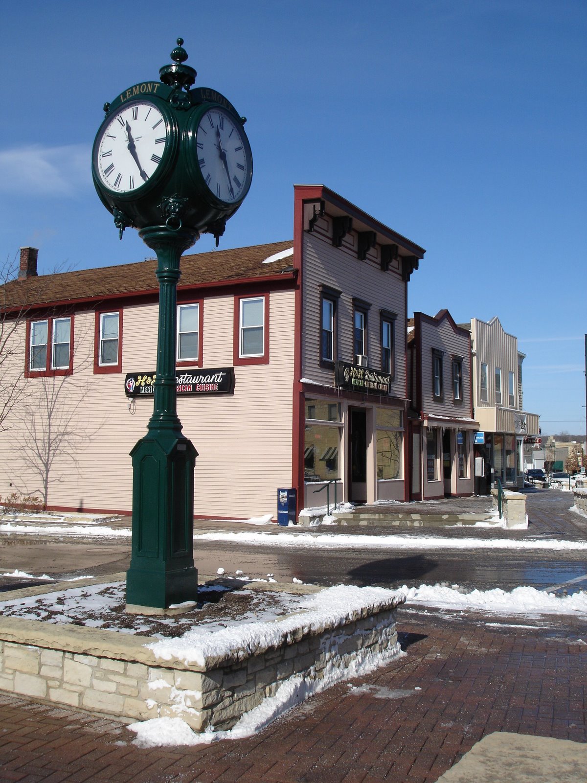


Lemont, Illinois
Lemont is a village of 17,820 people in Cook County, Illinois, founded in 1836.
Why visit Lemont
Townapedia lists 8 museums and landmarks, 34 parks and trails, 44 places to eat, 1 place to stay and 9 attractions in and around town.
Highlights include Des Plaines River Valley Bridge, High Road Bridge, Chicago Sanitary and Ship Canal and Lemont Downtown Historic District.
July is the warmest month, with average highs of 90°F; January lows average 15°F.
Weather in Lemont
Forecast from the National Weather Service. Full forecast
About Lemont
Lemont is a village located in Cook, DuPage, and Will counties in the U.S. state of Illinois, and is a south-west suburb of Chicago. The population was 17,629 as of the 2020 census. The village is situated on a hillside along the south banks of the Des Plaines River. It overlooks Waterfall Glen's Midwestern Bluff Savanna on the opposite side.
From the Wikipedia article Lemont, Illinois (this version), under CC BY-SA 4.0.
Things to do9

Des Plaines River Valley Bridge
Bridge · 2.3 mi
Bridge in United States of America


Old Chicago
Monument and historic site · 4.5 mi
Former shopping mall and indoor amusement park in Bolingbrook, Illinois, United States
Sag Bridge
Bridge · 3.0 mi
Locale in Cook County, Illinois, United States

Waterfall Glen Forest Preserve
Waterfall · 4.0 mi
Forest preserve in Illinois, U.S


Museums and landmarks8
Chicago Sanitary and Ship Canal
Monument and historic site · National Register of Historic Places · 3.7 mi
Canal in Illinois, United States of America

Lemont Downtown Historic District
Monument and historic site · National Register of Historic Places · 1.0 mi
Historic district in Illinois, United States

St. James Catholic Church and Cemetery
Monument and historic site · National Register of Historic Places · 3.4 mi
Church and cemetery in Lemont, Illinois, United States


Lemont Central Grade School
Monument and historic site · National Register of Historic Places · 0.8 mi

Lemont Area Historical Society Museum
Museum · 0.9 mi
360 Lemont Street, Lemont
The Forge: Lemont Quarries
Monument and historic site · 1.1 mi
1001 Main Street, Lemont
Parks, trails and playgrounds34



22 more on the map.
Restaurants and cafes44





32 more on the map.
History
Before European settlers arrived in Lemont, Native Americans traveled the Des Plaines River in birch bark canoes on trading trips between the Mississippi River and Lake Michigan. The native Potawatomi lived off the land in this area, directly using natural resources for food, shelter, clothing and medicine. In the 18th century, French voyageurs traveled down the Des Plaines River, trading Native Americans metal, beads and cloth for animal furs.
Lemont was originally known as Keepataw (after a Potawatomi chief) and a post office was established in 1840 as Keepatau. After that, it was named Athens and then Palmyra. The name Lemont (literally, 'the mountain' in French) was chosen in 1850 at the suggestion of Lemuel Brown, the postmaster and justice of the peace, or perhaps by his brother Nathaniel Brown.
From the History section of Lemont, Illinois on Wikipedia, under CC BY-SA 4.0.
Where to stay1
Churches and places of worship13
Lemont Methodist Episcopal Church
Church · National Register of Historic Places · 0.9 mi
Blessed Jurgis Matulaitis Lithuanian Catholic Mission
Church · Catholic · 0.5 mi
Shopping11
Gas and EV charging2
Schools, colleges and libraries52
Healthcare2
Map of Lemont
176 places. The map loads OpenStreetMap tiles when you open it.
Climate by month
Monthly table
| Month | High | Low | Rain |
|---|---|---|---|
| Jan | 33°F | 15°F | 2.3 in |
| Feb | 37°F | 18°F | 2.0 in |
| Mar | 49°F | 28°F | 2.5 in |
| Apr | 62°F | 39°F | 4.1 in |
| May | 73°F | 50°F | 5.0 in |
| Jun | 84°F | 60°F | 4.7 in |
| Jul | 90°F | 64°F | 4.1 in |
| Aug | 87°F | 63°F | 4.5 in |
| Sep | 80°F | 55°F | 3.5 in |
| Oct | 65°F | 42°F | 3.7 in |
| Nov | 50°F | 31°F | 2.7 in |
| Dec | 38°F | 21°F | 2.4 in |
U.S. Climate Normals 1991-2020 for Little Red School Hse (6 mi away), NOAA NCEI.
People and cost of living
American Community Survey 5-year estimates, 2020-2024, U.S. Census Bureau. Estimates have margins of error, larger for small towns.
Disaster history
Cook County has had 12 federal disaster declarations since 2000, most often for severe storms.
- 2024-09-20: Severe Storms, Tornadoes, Straight-Line Winds, And Floodng (Flood)
- 2023-11-20: Severe Storms And Flooding (Flood)
- 2023-08-15: Severe Storms And Flooding (Severe Storm)
- 2020-03-26: Covid-19 Pandemic (Biological)
- 2020-03-13: Covid-19 (Biological)
- 2013-05-10: Severe Storms, Straight-Line Winds, And Flooding (Flood)
OpenFEMA disaster declarations summaries.
Getting there and nearby towns
Lewis University Airport (LOT) is the nearest airport with scheduled flights listed in OpenStreetMap, 7 miles away.
- Homer Glen 5 mi south, about 7 min by car
- Darien 5 mi north, about 9 min by car
- Bolingbrook 6 mi west, about 10 min by car
- Burr Ridge 6 mi northeast, about 10 min by car
- Downers Grove 9 mi north, about 15 min by car
- Hickory Hills 9 mi northeast, about 14 min by car
- Crest Hill 9 mi southwest, about 15 min by car
- Hinsdale 10 mi north, about 16 min by car
- Justice 10 mi northeast, about 16 min by car
- Naperville 11 mi northwest, about 17 min by car
Drive times are estimates from straight-line distance, not routes.
Local news
Headlines from INDB, the NEMICO news database.
Reviews, tips and questions
Loading what members have shared...
Sources and licences
- NCES EDGE (Public domain): public schools
- NOAA NCEI U.S. Climate Normals 1991-2020 (Public domain): climate by month
- OpenFEMA (Public domain): disaster declarations
- OpenStreetMap contributors (ODbL 1.0): places, airports, map data
- U.S. Census Bureau (Public domain): population, income, housing, education, commute
- Wikidata (CC0 1.0): elevation, founding date, time zone, website, landmarks and historic places
- Wikimedia Commons (see each image): photos
- Wikipedia (CC BY-SA 4.0): overview and history text
Photo credits
- Lemont IL Downtown Clock, Ryanmcv, Public domain
- StJamesLemont, Teemu08 at en.wikipedia, CC BY-SA 3.0
- Lemont Methodist Episcopal Church, Teemu08 ( talk ), CC BY-SA 3.0
- Charles Fruhauf Building, 107 Stephens, Lemont, Illinois, Jim Roberts, CC BY-SA 4.0
- Lemont Central Grade School, Teemu08 ( talk ), CC BY-SA 3.0
- Waterfall Glen Forest Preserve, Timothy P Frakes, CC BY-SA 3.0
- Des Plaines River Valley Bridge, Lpangelrob, CC BY 3.0
Page built October 30, 2026. Spotted a mistake? Tell us or suggest a place.