


Why visit Leonia
Townapedia lists 63 museums and landmarks, 36 parks and trails, 121 places to eat, 8 places to stay and 5 attractions in and around town.
Highlights include IPIC Theaters, Anderson Street Bridge, 181st Street and 168th Street.
July is the warmest month, with average highs of 87°F; January lows average 26°F.
Weather in Leonia
Forecast from the National Weather Service. Full forecast
About Leonia
Leonia is a borough in Bergen County, in the U.S. state of New Jersey. As of the 2020 United States census, the borough's population was 9,304, an increase of 367 (+4.1%) from the 2010 census count of 8,937, which in turn reflected an increase of 23 (+0.3%) from the 8,914 counted in the 2000 census. The borough is a suburb of New York City, near the western approach to the George Washington Bridge.
From the Wikipedia article Leonia, New Jersey (this version), under CC BY-SA 4.0.
Things to do5


Anderson Street Bridge
Bridge · 3.2 mi
Bridge in United States of America
Bergen Performing Arts Center
Cinema and theater · 2.3 mi
Theater and former movie theater in Englewood, New Jersey, United States
Museums and landmarks63

181st Street
Monument and historic site · National Register of Historic Places · 2.8 mi
New York City IND Eighth Avenue Line subway station

168th Street
Monument and historic site · National Register of Historic Places · 3.0 mi
New York City subway station

190th Street
Monument and historic site · National Register of Historic Places · 2.9 mi
New York City IND Eighth Avenue Line subway station

555 Edgecombe Avenue
Monument and historic site · National Register of Historic Places · 3.3 mi
Apartment building in Manhattan, New York
Adam Vandelinda House
Monument and historic site · National Register of Historic Places · 1.6 mi
House in Teaneck, New Jersey
Alcoa Edgewater Works
Monument and historic site · National Register of Historic Places · 3.0 mi
Demolished factory in Edgewater, New Jersey

Anderson Outkitchen
Monument and historic site · National Register of Historic Places · 3.2 mi
House in Hackensack, New Jersey
Audubon Terrace
Monument and historic site · National Register of Historic Places · 3.0 mi
Historic district in New York City, United States of America

Banta-Coe House
Monument and historic site · National Register of Historic Places · 3.1 mi
Historic house in New Jersey, United States
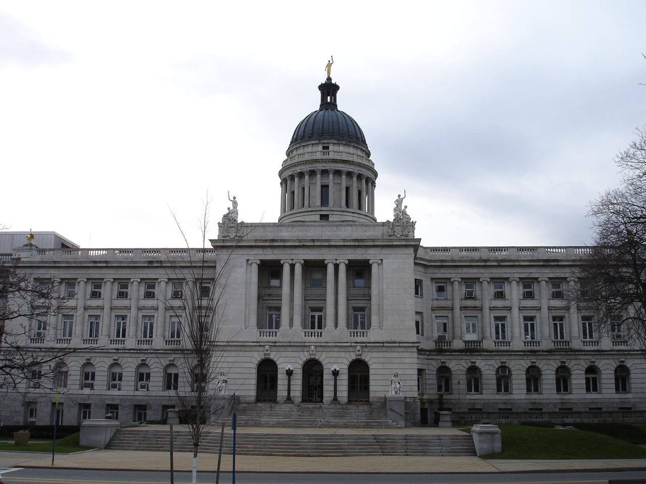
Bergen County Court House
Monument and historic site · National Register of Historic Places · 3.1 mi
Municipal edifice in New Jersey

Bethune Gardens
Monument and historic site · National Register of Historic Places · 3.2 mi
Public housing development in Manhattan, New York


Binghamton
Monument and historic site · National Register of Historic Places · 3.1 mi
Ferry ship
51 more on the map.
Parks, trails and playgrounds36

Fort Washington Park
Park · 2.4 mi
Public park in Manhattan, New York
Mitchell Square Park
Park · 3.0 mi
Public park in Manhattan, New York
24 more on the map.
Restaurants and cafes121

Paris Baguette
Cafe · American, Breakfast, Cake, French, Ice Cream, Sandwich · 1.3 mi
185 Main Street, Fort Lee
Mo-Su 07:00-22:00


Q Tea Tapas
Cafe · Poke, Bubble Tea, Crepe · 1.2 mi
242 Main Street, Fort Lee
Mo 11:30-20:30;Tu-Th 11:30-21:30;Fr-Su 11:30-22:00
Starbucks
Cafe · Coffee Shop · 1.3 mi
1605 Lemoine Avenue, Whitman Plaza
Mo-Fr 04:30-21:00; Sa-Su 05:00-21:00
109 more on the map.
History
Leonia's original inhabitants were the Hackensack tribe (Ashkineshacky) of Native Americans. The population was about 1,000 before the Europeans settled in the area. At the time of the American Revolutionary War, Leonia was known as part of the English Neighborhood, a name that survives in neighboring Englewood. It was settled in 1668 mainly by Dutch and English farmers, making it one of the oldest communities in the state. A third of the population was African slaves. It was on the western slope of the Palisades, and started as a quiet farming community. Leonia's proximity to New York City and its major universities, theaters, and performing venues contributed to its place in the world of art and academics, with many artists and leading thinkers living there in the 20th century.
The local economy that had focused on agriculture underwent economic and cultural growth during the late 19th century, marked by the introduction of train service. Leonia was originally called West Fort Lee. In 1865, J. Vreeland Moore and other town leaders chose the name "Leonia" in honor of American Revolutionary War General Charles Lee, for whom Fort Lee is named.
From the History section of Leonia, New Jersey on Wikipedia, under CC BY-SA 4.0.
Where to stay8
Holiday Inn GW Bridge-Fort Lee NYC Area
Motel and hotel · 0.8 mi
2339 Route 4 East, Fort Lee
Churches and places of worship34
Dutch Reformed Church in the English Neighborhood
Church · National Register of Historic Places · 2.4 mi
Holy Cross Armenian Apostolic Church (New York City)
Church · 3.1 mi
Shopping20
Gas and EV charging25
Schools, colleges and libraries63
Bergen Arts And Sciences Charter School
School · 5.8 mi
200 Macarthur Avenue, Garfield
Bergen County Technical High School - Teterboro
School · 3.5 mi
504 Route 46 West, Teterboro
Healthcare13
Passport Health Englewood Travel Clinic
Clinic and pharmacy · 1.5 mi
401A South Van Brunt Street, Englewood
Map of Leonia
250 places. The map loads OpenStreetMap tiles when you open it.
Climate by month
Monthly table
| Month | High | Low | Rain |
|---|---|---|---|
| Jan | 40°F | 26°F | 3.3 in |
| Feb | 43°F | 27°F | 2.8 in |
| Mar | 51°F | 34°F | 4.1 in |
| Apr | 62°F | 44°F | 4.0 in |
| May | 73°F | 53°F | 3.9 in |
| Jun | 82°F | 63°F | 4.2 in |
| Jul | 87°F | 69°F | 4.5 in |
| Aug | 85°F | 67°F | 4.2 in |
| Sep | 78°F | 60°F | 4.1 in |
| Oct | 67°F | 48°F | 3.7 in |
| Nov | 56°F | 38°F | 3.3 in |
| Dec | 45°F | 31°F | 4.1 in |
U.S. Climate Normals 1991-2020 for Teterboro Ap (4 mi away), NOAA NCEI.
People and cost of living
American Community Survey 5-year estimates, 2020-2024, U.S. Census Bureau. Estimates have margins of error, larger for small towns.
Disaster history
Bergen County has had 21 federal disaster declarations since 2000, most often for hurricanes.
- 2021-09-05: Remnants Of Hurricane Ida (Hurricane)
- 2021-09-02: Remnants Of Hurricane Ida (Hurricane)
- 2020-12-11: Tropical Storm Isaias (Hurricane)
- 2020-03-25: Covid-19 Pandemic (Biological)
- 2020-03-13: Covid-19 (Biological)
- 2018-06-08: Severe Winter Storm And Snowstorm (Severe Storm)
OpenFEMA disaster declarations summaries.
Getting there and nearby towns
Teterboro Airport (TEB) is the nearest airport with scheduled flights listed in OpenStreetMap, 4 miles away.
- Palisades Park 1 mi south, about 2 min by car
- Fort Lee 1 mi southeast, about 2 min by car
- Ridgefield Park 2 mi west, about 3 min by car
- Englewood 2 mi northeast, about 3 min by car
- Bogota 2 mi west, about 4 min by car
- Cliffside Park 3 mi south, about 5 min by car
- Edgewater 3 mi south, about 4 min by car
- Ridgefield 3 mi southwest, about 4 min by car
- Little Ferry 3 mi southwest, about 4 min by car
- Englewood Cliffs 3 mi northeast, about 4 min by car
Drive times are estimates from straight-line distance, not routes.
Local news
Headlines from INDB, the NEMICO news database.
Reviews, tips and questions
Loading what members have shared...
Sources and licences
- NCES EDGE (Public domain): public schools
- NOAA NCEI U.S. Climate Normals 1991-2020 (Public domain): climate by month
- OpenFEMA (Public domain): disaster declarations
- OpenStreetMap contributors (ODbL 1.0): places, airports, map data
- U.S. Census Bureau (Public domain): population, income, housing, education, commute
- Wikidata (CC0 1.0): elevation, founding date, time zone, website, landmarks and historic places
- Wikimedia Commons (see each image): photos
- Wikipedia (CC BY-SA 4.0): overview and history text
Photo credits
- LeoniaBoroughHall, Seidenstud, CC BY 2.5
- 181 St IND SB platform jeh, Jim.henderson, CC BY-SA 4.0
- James VandelindaHouse, KForce at en.wikipedia, CC BY-SA 3.0
- Zabriskie-Kipp-Cadmus House, Alansohn at en.wikipedia, CC BY-SA 3.0
- JOHN G. BENSON HOUSE, ENGLEWOOD, BERGEN COUNTY, NJ, JERRYE & ROY KLOTZ, M.D., CC BY-SA 4.0
- LeoniaDrillHall, KForce at en.wikipedia, CC BY-SA 3.0
- Fourth Church of Christ, Scientist 2012-09-11 23-54-07, karel.teifer, CC BY-SA 3.0
- Washington Heights Apr 2026 23, Epicgenius, CC BY-SA 4.0
- NYPL Fort Washington Branch, Beyond My Ken, Public domain
- TeaneckNJ BrinkerhoffDemarestHouse, Magicpiano, CC BY-SA 4.0
- ST. PAUL'S EPISCOPAL CHURCH, ENGLEWOOD, BERGEN COUNTY, NJ, JERRYE & ROY KLOTZ M.D., CC BY-SA 4.0
- Jumel Terrace Historic District 439-451 West 162nd Street, Beyond My Ken, CC BY-SA 4.0
- HackensackChurchOnTheGreen, The original uploader was KForce at English Wikipedia ., CC BY-SA 3.0
- Mary McLeod Bethune Gardens NYCHA jeh, Jim.henderson, CC0
- Dyckman-Hillsde Substation from Hillside Avenue, Beyond My Ken, CC BY-SA 4.0
- 2014 Fort Washington Armory entrance, Beyond My Ken, CC BY-SA 4.0
- HispanicSocietyofAmerica, Asaavedra32, CC BY-SA 3.0
- 190th Street IND Eighth Avenue 2, Gryffindor, CC BY-SA 3.0
- Binghamton Ferry, Hisland7, CC BY-SA 3.0
- North Presbyterian Church, 155th Street, Manhattan, Unknown photographer Unknown photographer, Public domain
- Church of the Intercession (Manhattan), Beyond My Ken, CC BY-SA 4.0
- Duke-ellington, Dmadeo, CC BY-SA 3.0
- GETHSEMANE CEMETERY, LITTLE FERRY, BERGEN COUNTY, JERRYE & ROY KLOTZ, M.D., CC BY-SA 4.0
- BantaCoe, KForce, CC BY-SA 3.0
- Ft Wash Hts Presb Wadsworth Av 174 jeh, Jim.henderson, CC0
- ThomasDemarestHouse, Unknown author Unknown author, Public domain
- Woman's Club of Englewood, NJ - 2026, Zeete, CC BY-SA 4.0
- ANDERSON OUTKITCHEN, HACKENSACK, BERGEN COUNTY, JERRYE & ROY KLOTZ, M.D., CC BY-SA 4.0
- Dyckman Street Both Platforms (Bway-7th Avenue), Harrison Leong, CC BY-SA 3.0
- 2014 Morris-Jumel Mansion from southwest, Beyond My Ken, CC BY-SA 4.0
- Wash Br Harlem water jeh, Jim.henderson, Public domain
- BergenCountyCourtHouse2, KForce at English Wikipedia, CC BY-SA 3.0
- High Bridge jeh, Jim.henderson, Public domain
- PAULISON-CHRISTIE HOUSE, RIDGEFIELD PARK. BERGEN COUNTY,NJ, JERRYE & ROY KLOTZ, M.D., CC BY-SA 4.0
- USS Ling;0829702, USN, Public domain
- Edgewater Boro Hall postcard, Unknown author Unknown author, Public domain
- USPO Inwood Station, Beyond My Ken, CC BY-SA 4.0
- St Walburga 140th St from NW, Smallbones, CC0
- Edgewater Library, Hisland7, CC BY-SA 3.0
- DutchReformedChurchRidgefield, KForce at en.wikipedia, CC BY-SA 3.0


Page built October 30, 2026. Spotted a mistake? Tell us or suggest a place.