

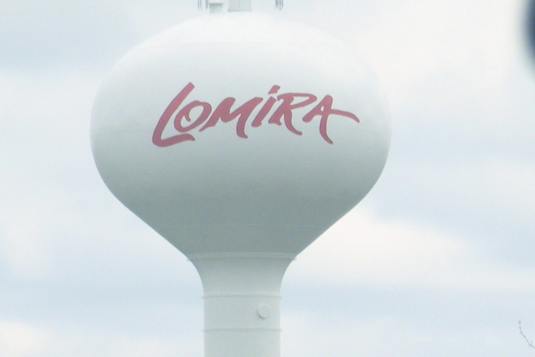


Lomira, Wisconsin
Lomira is a village of 2,675 people in Dodge County, Wisconsin, founded in 1849.
Why visit Lomira
Townapedia lists 1 museum or landmark, 4 parks and trails, 3 places to eat and 1 place to stay in and around town.
Highlights include W. H. Boller Meat Market and Residence.
July is the warmest month, with average highs of 82°F; January lows average 12°F.
Weather in Lomira
Forecast from the National Weather Service. Full forecast
About Lomira
Lomira is a village in Dodge County, Wisconsin, United States. The population was 2,678 at the 2020 census. The village is located within the Town of Lomira, at the crossroads of State Highways 49, 67 and 175, U.S. Route 41 and Interstate 41.
From the Wikipedia article Lomira, Wisconsin (this version), under CC BY-SA 4.0.
Museums and landmarks1


W. H. Boller Meat Market and Residence
Monument and historic site · National Register of Historic Places
Commercial building in Lomira, Wisconsin
Parks, trails and playgrounds4

Restaurants and cafes3

Taqueria El Toro
Restaurant · Mexican · 0.6 mi
580 East Avenue, Lomira

Where to stay1

History
The early history of the Village of Lomira is closely interwoven with the Town of Lomira. Prior to the arrival of white settlers, the son of Chief Black Hawk supposedly camped in the vicinity while blazing a trail from Milwaukee to Green Bay. There is no record of a settlement at Lomira prior to 1849. It was originally called Springfield, but in 1849, the name was changed to Lomira. Local lore says the village is a namesake of Elmira Schoonover, daughter of Sam Schoonover, an early settler. The first Post Office was established on May 11, 1849.
A petition for incorporation of the village of Lomira was made to the circuit court of Dodge County on March 24, 1899. The petition described the designated territory of "433 residents" as "containing a large number of stores, saloons, residences, elevators, hotels, blacksmith shops, cheese factory, planing mill and other places of business, and that the same is a railroad station." Copies of the petition were posted in the saloons of F. Kauper and Peter Greiten, and in the store and office of Peter Wolf, "all of which said places are public places." Petitioners presented the incorporation order at a special term of the circuit court held in the city of Waukesha, Wisconsin on May 9, 1899. Records of the public election on June 3, 1899, show 104 ballots were cast, of which 58 were for incorporation and 45 against.
From the History section of Lomira, Wisconsin on Wikipedia, under CC BY-SA 4.0.
Churches and places of worship1
Shopping1
Gas and EV charging1
Schools, colleges and libraries8
Healthcare1
Map of Lomira
21 places. The map loads OpenStreetMap tiles when you open it.
Climate by month
Monthly table
| Month | High | Low | Rain |
|---|---|---|---|
| Jan | 26°F | 12°F | 1.4 in |
| Feb | 31°F | 15°F | 1.2 in |
| Mar | 42°F | 25°F | 1.9 in |
| Apr | 56°F | 36°F | 3.2 in |
| May | 68°F | 48°F | 3.6 in |
| Jun | 78°F | 58°F | 4.5 in |
| Jul | 82°F | 63°F | 3.8 in |
| Aug | 79°F | 62°F | 3.5 in |
| Sep | 72°F | 53°F | 3.0 in |
| Oct | 59°F | 42°F | 2.8 in |
| Nov | 44°F | 30°F | 1.9 in |
| Dec | 32°F | 18°F | 1.5 in |
U.S. Climate Normals 1991-2020 for Fond Du Lac 2 Sw (12 mi away), NOAA NCEI.
People and cost of living
American Community Survey 5-year estimates, 2020-2024, U.S. Census Bureau. Estimates have margins of error, larger for small towns.
Disaster history
Dodge County has had 8 federal disaster declarations since 2000, most often for severe storms.
- 2020-04-04: Covid-19 Pandemic (Biological)
- 2020-03-13: Covid-19 (Biological)
- 2011-04-05: Severe Winter Storm And Snowstorm (Snowstorm)
- 2008-06-14: Severe Storms, Tornadoes, And Flooding (Severe Storm)
- 2008-03-19: Record Snow And Near Record Snow (Snowstorm)
- 2005-09-13: Hurricane Katrina Evacuation (Hurricane)
OpenFEMA disaster declarations summaries.
Getting there and nearby towns
Fond du Lac County Airport (FLD) is the nearest airport with scheduled flights listed in OpenStreetMap, 12 miles away.
- Theresa 5 mi south, about 9 min by car
- Kekoskee 10 mi southwest, about 15 min by car
- Fond du Lac 12 mi north, about 20 min by car
- Kewaskum 12 mi southeast, about 19 min by car
- Horicon 14 mi southwest, about 23 min by car
- Waupun 15 mi west, about 24 min by car
- West Bend 18 mi southeast, about 29 min by car
- St. Peter 18 mi north, about 28 min by car
- Hartford 19 mi south, about 31 min by car
- Juneau 19 mi southwest, about 30 min by car
Drive times are estimates from straight-line distance, not routes.
Local news
Headlines from INDB, the NEMICO news database.
Reviews, tips and questions
Loading what members have shared...
Sources and licences
- NCES EDGE (Public domain): public schools
- NOAA NCEI U.S. Climate Normals 1991-2020 (Public domain): climate by month
- OpenFEMA (Public domain): disaster declarations
- OpenStreetMap contributors (ODbL 1.0): places, airports, map data
- U.S. Census Bureau (Public domain): population, income, housing, education, commute
- Wikidata (CC0 1.0): elevation, founding date, time zone, website, landmarks and historic places
- Wikimedia Commons (see each image): photos
- Wikipedia (CC BY-SA 4.0): overview and history text
Photo credits
- LomiraWisconsinDowntown, Royalbroil, CC BY-SA 3.0
- Lomira Tower 2 - panoramio, Corey Coyle, CC BY 3.0
- Lomira Tower 1 - panoramio, Corey Coyle, CC BY 3.0
- WHBollerMeatMarketAndResidenceLomiraWisconsin, Royalbroil, CC BY-SA 3.0
Page built October 30, 2026. Spotted a mistake? Tell us or suggest a place.