
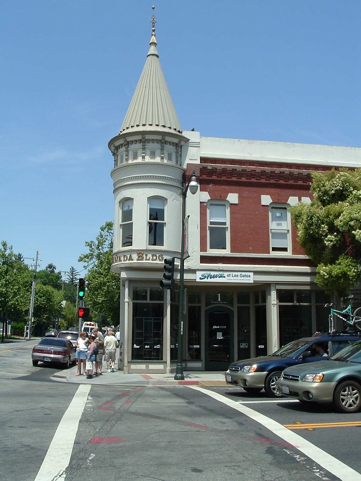


Los Gatos, California
Los Gatos is a town of 32,786 people in Santa Clara County, California.
Why visit Los Gatos
Townapedia lists 31 museums and landmarks, 36 parks and trails, 177 places to eat, 9 places to stay and 12 attractions in and around town.
Highlights include Los Gatos Theatre, Blossom Hill, Earl and Virginia Young House and John Steinbeck House.
July is the warmest month, with average highs of 85°F; January lows average 40°F.
Weather in Los Gatos
Forecast from the National Weather Service. Full forecast
About Los Gatos
Los Gatos (US: ; Spanish: [loz ˈɣatos]; Spanish for 'The Cats') is an incorporated town in Santa Clara County, California, United States. The population was 33,529 at the 2020 census. The U.S. Census Bureau estimated the population of Los Gatos at 32,576 as of July 1, 2025.
From the Wikipedia article Los Gatos, California (this version), under CC BY-SA 4.0.
Things to do12


Museums and landmarks31

Earl and Virginia Young House
Monument and historic site · National Register of Historic Places · 2.4 mi
Historic house in Campbell, California, USA.
1888 White Oaks Road, Campbell

John Steinbeck House
Monument and historic site · National Register of Historic Places · 2.4 mi
House in Monte Sereno, California
16250 Greenwood Lane, Monte Sereno


Ainsley House
Museum · National Register of Historic Places · 4.3 mi
Historic house museum in Campbell, California, United States

Campbell High School
Monument and historic site · National Register of Historic Places · 4.2 mi
School in Campbell, Santa Clara County, California, United States
Campbell Union Grammar School
Monument and historic site · National Register of Historic Places · 4.2 mi
Historic building in Campbell, California, US

Capt. James A. Hamilton House
Monument and historic site · National Register of Historic Places · 4.0 mi
Historic house in California, United States

Fairglen Additions
Monument and historic site · National Register of Historic Places · 4.7 mi
Tract housing located in San Jose, California, USA.

Forbes Mill
Museum · National Register of Historic Places · 1.4 mi
Historic place in California, United States

Galindo-Leigh House
Monument and historic site · National Register of Historic Places · 4.4 mi
Historic house in California, United States

Kotani-en
Monument and historic site · National Register of Historic Places · 3.2 mi
Classical Japanese residence in Santa Clara County, California, United States

Los Gatos Historic Commercial District
Monument and historic site · National Register of Historic Places · 1.5 mi
Designated U.S. Historic District area of the city of Los Gatos, California, USA.
19 more on the map.
Parks, trails and playgrounds36
Vasona Lake County Park
Park · 1.2 mi
County park in Los Gatos, California, United States
333 Blossom Hill Road, Los Gatos
08:00-sunset




Montalvo Arts Center
Park · National Register of Historic Places · 4.2 mi
Historic house in Saratoga, California
El Sereno Open Space Preserve
Park · 3.8 mi
Open space preserve in Santa Clara County, California, United States
Los Gatos Creek County Park
Park · 3.0 mi
County park in Campbell, California, United States
24 more on the map.
Restaurants and cafes177


Campo Di Bocci
Restaurant · Italian · 1.3 mi
560 University Avenue, Los Gatos
Su-Th 10:00-23:00, Fr-Sa 10:00-24:00
Coup de Thai
Restaurant · Thai · 1.5 mi
137 North Santa Cruz Avenue
Mo-Th 11:30-14:30,16:30-21:00; Fr 11:30-14:30,16:30-21:30; Sa...

Eleven College Ave
Diner · American · 1.4 mi
11 College Avenue, Los Gatos
We-Sa 17:00-22:00; Su 17:00-20:30
Forbes Mill Steakhouse
Restaurant · Steak House · 1.5 mi
206 North Santa Cruz Avenue, Los Gatos
Su-Th 17:00-21:00; Fr-Sa 17:00-22:00
Kamakura
Restaurant · Japanese · 1.5 mi
135 North Santa Cruz Avenue
Mo-Fr 11:00-14:30,17:00-22:00; Sa 12:00-22:00; Su 12:00-21:30
Lanna Thai Cuisine
Restaurant · Thai · 2.8 mi
2043 Camden Avenue, San Jose
Mo-Fr 11:00-14:00,16:00-21:00; Sa 12:00-21:00; Su 12:00-20:30
Loma Brewing Company
Restaurant · American, Pizza, Brewery, Drinks, Barbecue, Beer, Cocktails · 1.5 mi
130 North Santa Cruz Avenue
Mo 15:00-21:00; Tu,We 11:30-21:00; Th 11:30-22:00; Fr 11:30-23:00;...
Mooyah
Restaurant · Burger · 1.7 mi
15529 Union Avenue, Los Gatos
Su-Th 11:00-21:00, Fr-Sa 11:00-22:00
Mountain Mike's
Restaurant · Pizza · 2.8 mi
3155 South Bascom Avenue, Campbell
Mo-Th 10:00-23:00; Fr-Sa 10:00-24:00; Su 10:00-23:00
NORTH - Seasonal Vietnamese Cuisine and Bar
Restaurant · Vietnamese, Bar · 1.5 mi
133 North Santa Cruz Avenue
Tu-Fr 11:00-14:30,17:00-22:00; Sa 11:30-15:00,17:00-22:00; Su...
165 more on the map.
Where to stay9
Churches and places of worship41
First Korean American Baptist Church/Church of Holy Vision
Church · Baptist · 2.7 mi
2038 Camden Avenue, San Jose
Shopping31
Gas and EV charging24
Schools, colleges and libraries77
Saint Frances Cabrini Church and School
School · Roman Catholic · 2.6 mi
Healthcare41
Children's Healthcare Organization Of Northern California - Pediatric Hospital
Hospital · 2.3 mi
3777 South Bascom Avenue, Campbell
Kaiser Permanente Campbell Medical Offices
Clinic and pharmacy · 2.8 mi
220 East Hacienda Avenue, Campbell
Map of Los Gatos
250 places. The map loads OpenStreetMap tiles when you open it.
Climate by month
Monthly table
| Month | High | Low | Rain | Snow |
|---|---|---|---|---|
| Jan | 58°F | 40°F | 5.0 in | 0.0 in |
| Feb | 62°F | 41°F | 4.9 in | 0.0 in |
| Mar | 66°F | 43°F | 3.4 in | 0.0 in |
| Apr | 70°F | 45°F | 1.4 in | 0.0 in |
| May | 76°F | 49°F | 0.5 in | 0.0 in |
| Jun | 82°F | 52°F | 0.1 in | 0.0 in |
| Jul | 85°F | 56°F | 0.0 in | 0.0 in |
| Aug | 84°F | 56°F | 0.0 in | 0.0 in |
| Sep | 83°F | 54°F | 0.1 in | 0.0 in |
| Oct | 76°F | 49°F | 0.8 in | 0.0 in |
| Nov | 65°F | 43°F | 2.0 in | 0.0 in |
| Dec | 58°F | 40°F | 4.0 in | 0.0 in |
U.S. Climate Normals 1991-2020 for Los Gatos (0 mi away), NOAA NCEI.
People and cost of living
American Community Survey 5-year estimates, 2020-2024, U.S. Census Bureau. Estimates have margins of error, larger for small towns.
Disaster history
Santa Clara County has had 14 federal disaster declarations since 2000, most often for fires.
- 2023-04-03: Severe Winter Storms, Straight-Line Winds, Flooding, Landslides, And Mudslides (Severe Storm)
- 2023-03-10: Severe Winter Storms, Flooding, Landslides, And Mudslides (Flood)
- 2023-01-14: Severe Winter Storms, Flooding, Landslides, And Mudslides (Flood)
- 2023-01-09: Severe Winter Storms, Flooding, And Mudslides (Flood)
- 2020-08-22: Wildfires (Fire)
- 2020-08-21: Scu Ligtning Complex Fire (Fire)
OpenFEMA disaster declarations summaries.
Getting there and nearby towns
San José Mineta International Airport (SJC) is the nearest airport with scheduled flights listed in OpenStreetMap, 9 miles away.
- Campbell 4 mi north, about 6 min by car
- Saratoga 5 mi northwest, about 8 min by car
- Cupertino 8 mi northwest, about 13 min by car
- San Jose 9 mi northeast, about 15 min by car
- Santa Clara 10 mi north, about 15 min by car
- Sunnyvale 12 mi north, about 19 min by car
- Los Altos 12 mi northwest, about 20 min by car
- Scotts Valley 12 mi south, about 20 min by car
- Alum Rock 12 mi northeast, about 20 min by car
- Mountain View 14 mi northwest, about 22 min by car
Drive times are estimates from straight-line distance, not routes.
Local news
Headlines from INDB, the NEMICO news database.
Reviews, tips and questions
Loading what members have shared...
Sources and licences
- NCES EDGE (Public domain): public schools
- NOAA NCEI U.S. Climate Normals 1991-2020 (Public domain): climate by month
- OpenFEMA (Public domain): disaster declarations
- OpenStreetMap contributors (ODbL 1.0): places, airports, map data
- U.S. Census Bureau (Public domain): population, income, housing, education, commute
- Wikidata (CC0 1.0): elevation, founding date, time zone, website, landmarks and historic places
- Wikimedia Commons (see each image): photos
- Wikipedia (CC BY-SA 4.0): overview and history text
Photo credits
- Lacanadabuilding, Mike24 at en.wikipedia, CC BY-SA 3.0
- Los Gatos Togos, T308, CC BY-SA 4.0
- Los Gatos High School - 2658184735, roarofthefour, CC BY-SA 2.0
- Vasona park, Mike24 at English Wikipedia, CC BY-SA 3.0
- Earl and Virginia Young House as of 2012, Gerosch, CC BY-SA 3.0
- Campbell High School01, Flickr user roarofthefour, CC BY-SA 2.0
- Forbes Mill, David Sawyer, CC BY-SA 2.0
- Ainsley House, JaGa, CC BY-SA 3.0
- USA-Saratoga-Foothill Club, EugeneZelenko, CC BY-SA 4.0
- Yung See San Fong House, Jane Lidz, Public domain
- Eichler with square plan with an atrium situated between the garage and the bedroom, Greghenderson2006, CC BY-SA 4.0
- VillaMontalvoMansion, Frecklefoot, CC BY-SA 3.0
- CA-Saratoga-Warner Hutton House, Elan5, CC BY-SA 3.0
- USA-Los Gatos-La Cañada Building-3, Eugene Zelenko, CC BY-SA 4.0
- USA-Los Gatos-McCullagh-Jones House, Eugene Zelenko, CC BY-SA 4.0
- Kotani-en Japanese residence, Gregory Ford Henderson, CC BY-SA 4.0
- USA-Saratoga-Village Library, EugeneZelenko, CC BY-SA 4.0
- Captain James A. Hamilton House, on 2295 Bascom Ave., Elan5, CC BY-SA 3.0
- Galindo-Leigh House, 140 S. Peter Dr., Campbell, CA 9-30-2012 12-29-45 PM, Sanfranman59, CC BY-SA 3.0
- Highway 85 Saratoga, Chevy111, CC BY-SA 4.0
- 2023 Track - SCVAL Finals - 2023-05-06-13-18-22-3 (52878163796), Malcolm Slaney, CC BY 2.0
- 2023 Track - SCVAL Finals - 2023-05-06-14-20-11 (52878388459), Malcolm Slaney, CC BY 2.0
- 2023 Track - SCVAL Finals - 2023-05-06-14-20-05 (52877647507), Malcolm Slaney, CC BY 2.0
- 2023 Track - SCVAL Finals - 2023-05-06-14-11-11-6 (52878592055), Malcolm Slaney, CC BY 2.0
- 2023 Track - SCVAL Finals - 2023-05-06-14-26-33-3 (52878393199), Malcolm Slaney, CC BY 2.0
- 2023 Track - SCVAL Finals - 2023-05-06-13-35-50 (52878562345), Malcolm Slaney, CC BY 2.0
- 2023 Track - SCVAL Finals - 2023-05-06-13-17-14-2 (52878609728), Malcolm Slaney, CC BY 2.0
- 2023 Track - SCVAL Finals - 2023-05-06-14-12-16 (52878213661), Malcolm Slaney, CC BY 2.0
- 2023 Track - SCVAL Finals - 2023-05-06-14-25-40-2 (52878611740), Malcolm Slaney, CC BY 2.0
- 2023 Track - SCVAL Finals - 2023-05-06-13-24-41-5 (52878549810), Malcolm Slaney, CC BY 2.0
- 2023 Track - SCVAL Finals - 2023-05-06-14-19-05-3 (52875647652), Malcolm Slaney, CC BY 2.0
- 2023 Track - SCVAL Finals - 2023-05-06-14-20-17-4 (52878608480), Malcolm Slaney, CC BY 2.0
- 2023 Track - SCVAL Finals - 2023-05-06-13-24-18-3 (52878169016), Malcolm Slaney, CC BY 2.0
- 2023 Track - SCVAL Finals - 2023-05-06-14-11-05-2 (52877631042), Malcolm Slaney, CC BY 2.0
- 2023 Track - SCVAL Finals - 2023-05-06-13-25-53 (52878550985), Malcolm Slaney, CC BY 2.0
- Lights in Vasona - panoramio, Dicie Hinaga, CC BY 3.0
- Light on the School, roarofthefour, CC BY-SA 2.0
- Billy Jones Railroad in Vasona Lake Park (25450475603), Don DeBold from San Jose, CA, USA, CC BY 2.0
- Billy Jones Wildcat Railroad - panoramio, Michal Cierniak, CC BY-SA 3.0
- Vasona Lake County Park Meadow, Gregory Ford Henderson, CC BY-SA 4.0


Page built October 30, 2026. Spotted a mistake? Tell us or suggest a place.