




Why visit Lyons
Townapedia lists 16 museums and landmarks, 10 parks and trails and 9 places to eat in and around town.
Highlights include Bernardsville, Boudinot-Southard Farmstead, Coakley-Russo Memorial Golf Course and Lord Stirling Park.
July is the warmest month, with average highs of 86°F; January lows average 19°F.
Weather in Lyons
Forecast from the National Weather Service. Full forecast
About Lyons
Lyons is an unincorporated community and census-designated place (CDP) located within Bernards Township, in Somerset County, in the U.S. state of New Jersey. As of the 2020 census, Lyons had a population of 5,345. Lyons is 2.5 miles (4.0 km) south-southeast of Bernardsville. Lyons has a post office with ZIP Code 07939.
From the Wikipedia article Lyons, New Jersey (this version), under CC BY-SA 4.0.
Museums and landmarks16

Bernardsville
Monument and historic site · National Register of Historic Places · 2.8 mi
NJ Transit rail station

Boudinot-Southard Farmstead
Monument and historic site · National Register of Historic Places · 2.4 mi
Historic farm in Somerset County, New Jersey

Boyle–Hudspeth-Benson House
Monument and historic site · National Register of Historic Places · 1.3 mi
Historic New Jersey house

Brick Academy
Museum · National Register of Historic Places · 1.8 mi
Historic school building in Basking Ridge, New Jersey

John Parker Tavern
Monument and historic site · National Register of Historic Places · 2.8 mi
Historic building in Bernardsville, New Jersey

Kennedy-Martin-Stelle Farmstead
Monument and historic site · National Register of Historic Places · 1.9 mi
Historic farm in Somerset County, New Jersey
Lord Stirling Manor Site
Monument and historic site · National Register of Historic Places · 1.3 mi
Historic site in Bernards Township, New Jersey

Lyons
Monument and historic site · National Register of Historic Places
New Jersey Transit rail station
Lyons VA Medical Center
Monument and historic site · National Register of Historic Places · 1.0 mi
Hospital in Lyons, New Jersey
Millington
Monument and historic site · National Register of Historic Places · 1.4 mi
NJ Transit rail station


4 more on the map.
Parks, trails and playgrounds10



Restaurants and cafes9

Blue Cafe
Restaurant · European, American · 1.7 mi
60 South Finley Avenue, Basking Ridge
Tu-Th 08:00-15:00; Fr-Su 07:30-15:00

Millington Station Cafe
Cafe · Diner · 1.4 mi
1931 Long Hill Road, Millington
Mo-Sa 07:00-15:00; Su 08:00-13:00
Ridge
Restaurant · Italian · 1.7 mi
25 South Finley Avenue, Basking Ridge
Mo-Sa 11:00-22:00; Su 12:00-21:00

Washington House
Diner · American · 1.7 mi
55 South Finley Avenue, Basking Ridge
Tu-Sa 11:00-22:00; Su 11:00-21:00


Dunkin'
Fast food · Donut, Coffee Shop · 2.0 mi
415 King George Road, Basking Ridge
Mo-Sa 05:00-20:00; Su 06:00-20:00
Churches and places of worship12

Basking Ridge Presbyterian Church
Church · Presbyterian Church Usa · 1.8 mi
1 East Oak Street, Basking Ridge
Mo-Th 09:00-16:00

Mount Bethel Baptist Meetinghouse
Church · National Register of Historic Places · 3.5 mi
Historic church building in Somerset County, New Jersey

Presbyterian Church in Basking Ridge
Church · National Register of Historic Places · 1.8 mi
Church building in Basking Ridge, New Jersey


St. Bernard's Church and Parish House
Church · National Register of Historic Places · 3.1 mi
Historic church building in Bernardsville, New Jersey
Bishop Janes United Methodist Church
Church · Methodist · 1.8 mi
22 South Finley Avenue, Basking Ridge

History
The area called Lyons is remembered for the David Lyon farm which was a large part of the area.
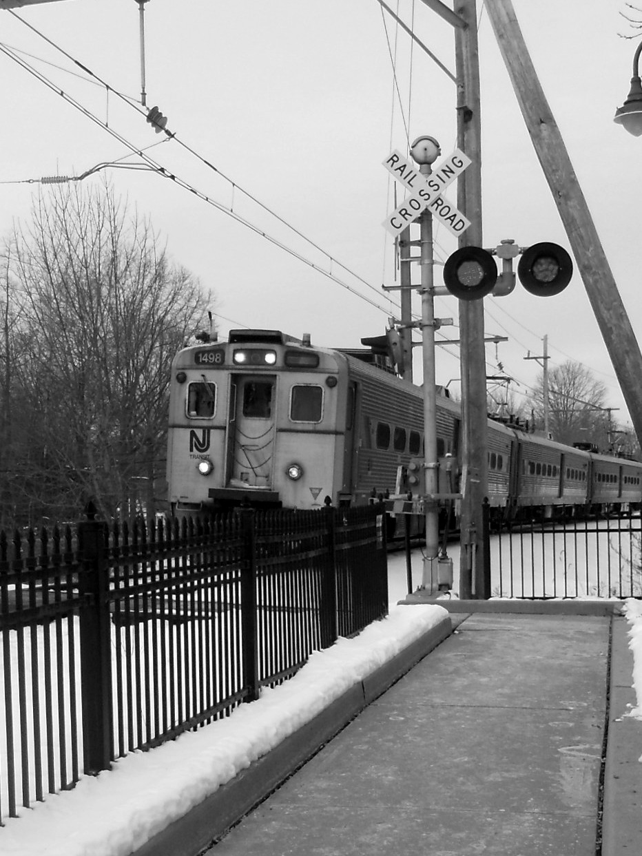
Lyons Depot - This one-story Tudor Revival and Mission Revival style structure was built in 1931. It is faced with stucco and brick and has limestone trim with carved rosette ornamentation at the gable ends. It was designed by Delaware Lackawanna and Western Railroad (DL&W) architect D.T. Mack or one of his staff. It was built largely to accommodate the growing number of visitors to Veterans Hospital. It was the last station built on the Gladstone Branch. Is now owned by Bernards Township.
Lyons Train Station state and national historic registry - NR 6-22-84 SR 3-17-84
Groundbreaking started on the Lyons VA Hospital on July 11, 1929.
The first patients arrived at the Lyons facility on November 12, 1930, having been transferred from the Bronx VA Hospital in New York City. By July 1931 a total of 415 patients were living and receiving therapy at the hospital.
The Lyons VA Medical Center was the only VA hospital in the state until one in East Orange opened in 1952. It was listed on the NRHP as the Lyons Veterans Administration Hospital Historic District in 2013.
There is a Lyons Fire Department and it's on the grounds of the Lyons VA.
From the History section of Lyons, New Jersey on Wikipedia, under CC BY-SA 4.0.
Shopping2
Gas and EV charging4
Schools, colleges and libraries38
Bedminster Township Public School
School · 5.0 mi
234 Somerville Road, Bedminster
Developmental Learning Center Warren
School · 3.3 mi
217 Mountain View Road, Warren
Healthcare1
VA New Jersey Health Care System - Lyons Campus
Hospital · 0.9 mi
151 Knollcroft Road, Lyons
Map of Lyons
92 places. The map loads OpenStreetMap tiles when you open it.
Climate by month
Monthly table
| Month | High | Low | Rain |
|---|---|---|---|
| Jan | 39°F | 19°F | 3.5 in |
| Feb | 41°F | 20°F | 2.8 in |
| Mar | 50°F | 27°F | 4.1 in |
| Apr | 62°F | 36°F | 4.0 in |
| May | 72°F | 46°F | 3.4 in |
| Jun | 80°F | 56°F | 4.2 in |
| Jul | 86°F | 62°F | 4.7 in |
| Aug | 83°F | 60°F | 3.7 in |
| Sep | 77°F | 53°F | 4.3 in |
| Oct | 64°F | 41°F | 4.3 in |
| Nov | 54°F | 31°F | 3.2 in |
| Dec | 43°F | 24°F | 4.4 in |
U.S. Climate Normals 1991-2020 for Somerville 4 Nw (7 mi away), NOAA NCEI.
People and cost of living
American Community Survey 5-year estimates, 2020-2024, U.S. Census Bureau. Estimates have margins of error, larger for small towns.
Disaster history
Somerset County has had 18 federal disaster declarations since 2000, most often for hurricanes.
- 2021-09-05: Remnants Of Hurricane Ida (Hurricane)
- 2021-09-02: Remnants Of Hurricane Ida (Hurricane)
- 2020-03-25: Covid-19 Pandemic (Biological)
- 2020-03-13: Covid-19 (Biological)
- 2018-06-08: Severe Winter Storm And Snowstorm (Severe Storm)
- 2016-03-14: Severe Winter Storm And Snowstorm (Severe Storm)
OpenFEMA disaster declarations summaries.
Getting there and nearby towns
Morristown Municipal Airport (MMU) is the nearest airport with scheduled flights listed in OpenStreetMap, 11 miles away.
- Basking Ridge 2 mi north, about 3 min by car
- Liberty Corner 2 mi southwest, about 4 min by car
- Bernardsville 4 mi northwest, about 7 min by car
- The Hills 4 mi southwest, about 7 min by car
- Gillette 5 mi east, about 8 min by car
- Martinsville 6 mi south, about 9 min by car
- Green Knoll 6 mi southwest, about 10 min by car
- Bedminster 6 mi west, about 9 min by car
- North Plainfield 7 mi southeast, about 11 min by car
- New Providence 8 mi east, about 12 min by car
Drive times are estimates from straight-line distance, not routes.
Local news
Headlines from INDB, the NEMICO news database.
Reviews, tips and questions
Loading what members have shared...
Sources and licences
- NCES EDGE (Public domain): public schools
- NOAA NCEI U.S. Climate Normals 1991-2020 (Public domain): climate by month
- OpenFEMA (Public domain): disaster declarations
- OpenStreetMap contributors (ODbL 1.0): places, airports, map data
- U.S. Census Bureau (Public domain): population, income, housing, education, commute
- Wikidata (CC0 1.0): elevation, founding date, time zone, website, landmarks and historic places
- Wikimedia Commons (see each image): photos
- Wikipedia (CC BY-SA 4.0): overview and history text
Photo credits
- Main Building, VA Medical Center, Lyons, NJ, Zeete, CC BY-SA 4.0
- Somerset CR 613 sb at CR 640, Lyons, NJ, Oct. 2026, Mr. Matté, CC BY-SA 4.0
- Lyons Train Station, Jared Kofsky/PlaceNJ.com, CC BY-SA 3.0
- Lyons Station NJ, Jared Kofsky/PlaceNJ.com, CC BY-SA 3.0
- Recreation Building, Lyons VA Medical Center, NJ, Zeete, CC BY-SA 4.0
- Lest We Forget plaque, Lyons VA Medical Center, NJ, Zeete, CC BY-SA 4.0
- Ambulatory Care Center, Lyons VA Medical Center, NJ, Zeete, CC BY-SA 4.0
- Acute Building, Lyons VA Medical Center, NJ, Zeete, CC BY-SA 4.0
- Main Building, VA Medical Center, Lyons, NJ - detail, Zeete, CC BY-SA 4.0
- Brick Academy, Basking Ridge, NJ, south view, Zeete, CC BY-SA 3.0
- John Parker Tavern, Bernardsville, NJ, Zeete, CC BY-SA 4.0
- Presbyterian Church in Basking Ridge, NJ, south view, Zeete, CC BY-SA 3.0
- Bernardsville Station, Adam Moss, CC BY-SA 2.0
- Boudinot-Southard Farmstead, Bernards Township, NJ - farmhouse, Zeete, CC BY-SA 4.0
- Mount Bethel Baptist Meetinghouse, Somerset County, NJ, Zeete, CC BY-SA 4.0
- Lyons Station - facing westbound, Adam Moss, CC BY-SA 2.0
- St. Bernard's Church, Bernardsville, NJ, Zeete, CC BY-SA 4.0
- Kennedy Martin Stelle Farmstead, Jess Aggabao, CC BY-SA 4.0
- USGA Museum, Liberty Corner, NJ, Zeete, CC BY-SA 4.0
- Somerset, NJ CR 640 eb at CR 613, Oct. 2026, Mr. Matté, CC BY-SA 4.0
- Strange world part one, Wendelin Jacober, CC BY 2.0
- Horsetails around a stream-culvert, Simplificationalizer, CC0
- Ridge High School, Basking Ridge, NJ (1), Oct. 2026, Mr. Matté, CC BY-SA 4.0
- Ridge High School, Basking Ridge, NJ (2), Oct. 2026, Mr. Matté, CC BY-SA 4.0
- Bernards Township, NJ War Memorial, April 2026, Mr. Matté (if there is an issue with this image, contact me using this image's Commons talk page , my Commons user talk page , or my English Wikipedia user talk page ; I'll know about it a lot faster), CC BY-SA 4.0
- Somerset CR 657 nb in Bernards Township, NJ, April 2026, Mr. Matté (if there is an issue with this image, contact me using this image's Commons talk page , my Commons user talk page , or my English Wikipedia user talk page ; I'll know about it a lot faster), CC BY-SA 4.0
- 206 - 2008 IC CE 300, 2008ICBE200, CC BY 4.0
- Davis Bridge 20111008-jag9889, Jag9889, CC BY-SA 4.0
- Millington Trestle 20111006-jag9889, Jag9889, CC BY-SA 4.0
- 2018-05-30 13 21 44 View east along Somerset County Route 512 (Valley Road) at Somerset County Route 613 (Stonehouse Road) in Bernards Township, Somerset County, New Jersey, Famartin, CC BY-SA 4.0
- Bernards Township, NJ municipal building, April 2026, Mr. Matté (if there is an issue with this image, contact me using this image's Commons talk page , my Commons user talk page , or my English Wikipedia user talk page ; I'll know about it a lot faster), CC BY-SA 4.0
- Lord Sterling Park barns, Basking Ridge, NJ, April 2026, Mr. Matté (if there is an issue with this image, contact me using this image's Commons talk page , my Commons user talk page , or my English Wikipedia user talk page ; I'll know about it a lot faster), CC BY-SA 4.0
- Italian sausage, Navin75, CC BY-SA 2.0
- Lord Stirling Manor site, Basking Ridge, NJ - foundation, Zeete, CC BY-SA 4.0
- St. James Roman Catholic Church, Basking Ridge, NJ, Oct. 2026, Mr. Matté, CC BY-SA 4.0
- 2020-10-14 08 50 17 View west along Somerset County Route 512 (Valley Road) at Arbor Circle in Bernards Township, Somerset County, New Jersey, Famartin, CC BY-SA 4.0
- Stone House Road Bridge 20111008-jag9889, Jag9889, CC BY-SA 4.0
- Millington NJ Station, Jared Kofsky/PlaceNJ.com, CC BY-SA 3.0
- 2018-05-29 09 35 25 View north along Interstate 287 between Exit 26 and Exit 30 in Bernards Township, Somerset County, New Jersey, Famartin, CC BY-SA 4.0
- Chabad of Greater Somerset County - 05, Oleg Yunakov, CC BY-SA 4.0


Page built October 30, 2026. Spotted a mistake? Tell us or suggest a place.