
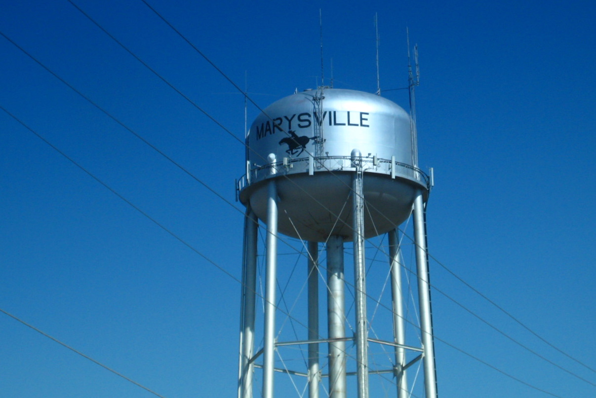


Marysville, Kansas
Marysville is a city of 3,422 people in Marshall County, Kansas, founded in 1855.
Why visit Marysville
Townapedia lists 8 museums and landmarks, 4 parks and trails, 18 places to eat, 4 places to stay and 1 attraction in and around town.
Highlights include Astro 3 Theatre, Charles Koester House and Koester Block Historic District.
July is the warmest month, with average highs of 90°F; January lows average 15°F.
Weather in Marysville
Forecast from the National Weather Service. Full forecast
About Marysville
Marysville is a city in and the county seat of Marshall County, Kansas, United States. As of the 2020 census, the population of the city was 3,447.
From the Wikipedia article Marysville, Kansas (this version), under CC BY-SA 4.0.
Things to do1

Museums and landmarks8

Charles Koester House
Monument and historic site · National Register of Historic Places · 0.4 mi
House in Marysville, Kansas


Koester Block Historic District
Monument and historic site · National Register of Historic Places · 0.4 mi
Historic district in Marysville, Kansas
Marshall County Courthouse
Monument and historic site · National Register of Historic Places
Historic courthouse in Marysville, Kansas, United States of America
Marysville station
Monument and historic site · National Register of Historic Places · 0.5 mi

Parks, trails and playgrounds4


Restaurants and cafes18

El Ranchero
Restaurant · Mexican · 0.7 mi
410 Broadway Street, Marysville
Mo-Th 11:00-21:00; Fr, Sa 11:00-22:00; Su 11:00-15:00
New China Buffet
Restaurant · Chinese · 0.5 mi
710 Broadway Street, Marysville
Mo-Sa 07:00-21:00; We 07:00-14:00; Su 10:00-14:00
The Korner Bistro & Diner
Restaurant · 0.5 mi
814 Broadway Street, Marysville


6 more on the map.
History
Marysville was laid out in 1855 by Francis J. Marshall, and designated in that same year the county seat. It was incorporated as a city in 1861.
Marysville was located on the Oregon Trail and the route of the Pony Express, the St. Joe Road, the Overland Stage, The Military Road, and the Otoe-Missouria Trail. British explorer Richard Francis Burton en route to California in 1860 noted: "Passing by Marysville, in old maps Palmetto City, a country-town which thrives by selling whiskey to ruffians of all descriptions ..." The old Pony Express Station still stands in downtown Marysville. In Beyond the Mississippi (1867), Albert D. Richardson, who passed through Marysville in 1860, wrote that the town—which was named after the Border Ruffian Marshall's wife—"had 50 houses and was famed for whisky and shooting affrays."
Marysville owed much of its prosperity to the Union Pacific Railroad, which became a major employer. But as the city grew along the railroad most of the community was across the tracks from a good part of downtown. As rail traffic increased, vehicular delays were estimated at 7.5 to 8 hours per day at the five grade crossings, which also affected emergency vehicles. In 2006 the main line was moved out of the center of town to a bypass to the south and west, with grade separations for US-36 and US-77.
From the History section of Marysville, Kansas on Wikipedia, under CC BY-SA 4.0.
Where to stay4
Churches and places of worship5
Saint Paul's Episcopal Church
Church · Episcopal · 0.4 mi
309 North 10th Street, Marysville
Shopping7
Gas and EV charging4
Schools, colleges and libraries9
Healthcare3
Map of Marysville
63 places. The map loads OpenStreetMap tiles when you open it.
Climate by month
Monthly table
| Month | High | Low | Rain | Snow |
|---|---|---|---|---|
| Jan | 38°F | 15°F | 0.8 in | 4.9 in |
| Feb | 43°F | 19°F | 1.1 in | 4.3 in |
| Mar | 55°F | 30°F | 2.1 in | 1.5 in |
| Apr | 66°F | 40°F | 3.1 in | 0.7 in |
| May | 76°F | 52°F | 4.9 in | 0.0 in |
| Jun | 86°F | 62°F | 4.9 in | 0.0 in |
| Jul | 90°F | 67°F | 4.7 in | 0.0 in |
| Aug | 89°F | 64°F | 3.6 in | 0.0 in |
| Sep | 81°F | 54°F | 3.3 in | 0.0 in |
| Oct | 69°F | 41°F | 2.5 in | 0.1 in |
| Nov | 54°F | 30°F | 1.5 in | 1.0 in |
| Dec | 42°F | 20°F | 1.2 in | 3.3 in |
U.S. Climate Normals 1991-2020 for Marysville (0 mi away), NOAA NCEI.
People and cost of living
American Community Survey 5-year estimates, 2020-2024, U.S. Census Bureau. Estimates have margins of error, larger for small towns.
Disaster history
Marshall County has had 16 federal disaster declarations since 2000, most often for severe storms.
- 2026-09-01: Severe Storms, Straight-Line Winds, Tornadoes, And Flooding (Severe Storm)
- 2022-02-17: Severe Storms And Straight Line Winds (Severe Storm)
- 2020-03-29: Covid-19 Pandemic (Biological)
- 2020-03-13: Covid-19 (Biological)
- 2019-06-20: Severe Storms, Straight-Line Winds, Tornadoes, Flooding,Landslides,And Mudslides (Severe Storm)
- 2019-05-28: Tornadoes And Flooding (Severe Storm)
OpenFEMA disaster declarations summaries.
Getting there and nearby towns
Beatrice Municipal Airport (BIE) is the nearest airport with scheduled flights listed in OpenStreetMap, 32 miles away.
- Blue Rapids 11 mi south, about 18 min by car
- Waterville 12 mi southwest, about 19 min by car
- Hanover 13 mi west, about 21 min by car
- Frankfort 15 mi southeast, about 24 min by car
- Beatrice 30 mi north, about 49 min by car
- Clay Center 41 mi southwest, about 1 h by car
- Manhattan 45 mi south, about 1 h 15 min by car
- Fort Riley 52 mi south, about 1 h 30 min by car
- Belleville 53 mi west, about 1 h 30 min by car
- Holton 55 mi southeast, about 1 h 30 min by car
Drive times are estimates from straight-line distance, not routes.
Local news
Headlines from INDB, the NEMICO news database.
Reviews, tips and questions
Loading what members have shared...
Sources and licences
- NCES EDGE (Public domain): public schools
- NOAA NCEI U.S. Climate Normals 1991-2020 (Public domain): climate by month
- OpenFEMA (Public domain): disaster declarations
- OpenStreetMap contributors (ODbL 1.0): places, airports, map data
- U.S. Census Bureau (Public domain): population, income, housing, education, commute
- Wikidata (CC0 1.0): elevation, founding date, time zone, website, landmarks and historic places
- Wikimedia Commons (see each image): photos
- Wikipedia (CC BY-SA 4.0): overview and history text
Photo credits
- Watertower marysville kansas 2009, shannonpatrick17, CC BY 2.0
- Charles Koester House Marysville Kansas front view 01, SharonPapierdreams, CC BY-SA 4.0
- Pony Express Marysville KS, Smallbones, Public domain
- Marysville Union Pacific Depot Kansas side view, SharonPapierdreams, CC BY-SA 4.0
- Marysville Union Pacific Depot Kansas front detail, SharonPapierdreams, CC BY-SA 4.0
- Marysville Union Pacific Depot Kansas front view, SharonPapierdreams, CC BY-SA 4.0
- -KANSAS-A-0010- Marysville Dam (52583950059), WaterArchives.org from Las Cruces, New Mexico, United States, CC BY-SA 2.0
- Las Cabanas, 908 Elm St, Marysville, KS (5100507244), shannonpatrick17 from Swanton, Nebraska, U.S.A., CC BY 2.0
- Marshall Co KS Courthouse, Smallbones, Public domain
- Koester House Mville KS, Smallbones, Public domain


Page built October 30, 2026. Spotted a mistake? Tell us or suggest a place.