


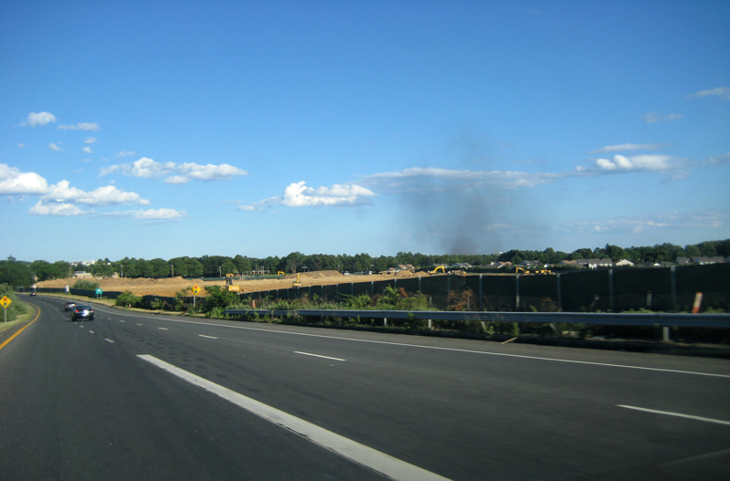


Melville, New York
Melville is a community of 19,714 people in Suffolk County, New York.
Why visit Melville
Townapedia lists 51 museums and landmarks, 84 parks and trails, 69 places to eat, 8 places to stay and 10 attractions in and around town.
Highlights include Adventureland, Showcase Cinema de Lux Farmingdale, American Airpower Museum and Carll House.
July is the warmest month, with average highs of 83°F; January lows average 25°F.
Weather in Melville
Forecast from the National Weather Service. Full forecast
About Melville
Melville is an affluent hamlet and census-designated place (CDP) in the town of Huntington in Suffolk County, on Long Island, in New York, United States. The population was 19,284 at the time of the 2020 census.
From the Wikipedia article Melville, New York (this version), under CC BY-SA 4.0.
Things to do10

Adventureland
Monument and historic site · 2.2 mi
Amusement park in East Farmingdale, New York, USA
2245 Broadhollow Road, East Farmingdale




Museums and landmarks51


Carll House
Monument and historic site · National Register of Historic Places · 4.1 mi
Historic house on Deer Park Avenue, Huntington, New York

Chichester's Inn
Monument and historic site · National Register of Historic Places · 2.7 mi
Historic inn in New York, United States

Dowden Tannery
Monument and historic site · National Register of Historic Places · 4.4 mi
Historic building in Cold Spring Harbor, New York, United States

Eliphas Buffett House
Monument and historic site · National Register of Historic Places · 4.2 mi
Historic house in New York, United States
Ezra Carll Homestead
Monument and historic site · National Register of Historic Places · 3.2 mi
Huntington Station, New York, NRHP-listed

Farmingdale station
Monument and historic site · National Register of Historic Places · 3.7 mi
Railway station in Farmingdale, New York
Halsey Estate-Tallwood
Monument and historic site · National Register of Historic Places · 3.2 mi
Historic house in New York, United States

Henry Smith Farmstead
Monument and historic site · National Register of Historic Places · 5.0 mi
Historic house in New York, United States
Hewlett House
Monument and historic site · National Register of Historic Places · 4.4 mi
NRHP-listed, in Suffolk County

Jacob Smith House
Monument and historic site · National Register of Historic Places · 2.6 mi
Historic house in New York, United States
John Bumpstead House
Monument and historic site · National Register of Historic Places · 4.9 mi
Historic house in New York, United States
39 more on the map.
Parks, trails and playgrounds84


Walt Whitman Birthplace State Historic Site
Park · National Register of Historic Places · 2.4 mi
Site in Huntington, New York

Captain Kathy Mazza Memorial Park
Park · 4.4 mi
Park and memorial in South Farmingdale, Nassau County, New York, United States
Captain Omer Neutra Memorial Park
Park · 4.3 mi
Park in Plainview, Nassau County, New York, United States

Plainview-Old Bethpage Community Park
Park · 2.9 mi
175 Washington Avenue, Plainview
sunrise-sunset
72 more on the map.
Restaurants and cafes69

Umberto's Of Farmingdale
Restaurant · Italian · 3.0 mi
Umberto's Of Farmingdale is a family-owned Italian restaurant serving authentic Italian food and Neapolitan pizza in New York since...
211 Airport Plaza Blvd, Farmingdale
Mo-Th, Su 11:00-21:00; Fr-Sa 11 :00-21:30
IHOP
Restaurant · Breakfast, Pancake · 3.1 mi
201 Airport Plaza Boulevard, East Farmingdale
Mo-Th,Su 07:00-22:00; Fr,Sa 07:00-23:00

Starbucks
Cafe · Coffee Shop · 0.7 mi
64 Broadhollow Road, Melville
Mo-Fr 06:00-19:30; Sa-Su 06:00-18:00
Gastronomy Restaurant
Restaurant · American Restaurant, Sandwich · 2.8 mi
230 Walt Whitman Road, Huntington Station
Mo-Th 11:00-21:00; Fr-Sa 11:00-22:00; Su 11:00-17:00
57 more on the map.
History
The area was known to the Native Americans as Sunsquams. In the 17th century, it was named Samuel Ketcham's Valley, after one of the earliest natives living there. It was later known as Sweet Hollow, likely due to the large population of honey bees and the honey found in the trees.
In 1829, a Presbyterian church was built at the corner of Old Country and Sweet Hollow Roads.
In 1909, a trolley line to Huntington was established as an extension of the Huntington Trolley Spur that went south to Amityville and had a connection to Babylon. There were six fare zones, one of which was the Duryea Farm in Melville. A decade later, the line was closed after farmers complained that noise from the trolley frightened their animals. Buses then provided local transportation after the trolley line closed. The growing use of private cars later further reduced demand for the trolley line.
The Presbyterian church was in continuous use until 1930. It reopened in 1944 for the funeral of Edward Baylis and has been in use since then. The church was moved 1 mile (1.6 km) to the west in 1977.
From the History section of Melville, New York on Wikipedia, under CC BY-SA 4.0.
Where to stay8
Four Points by Sheraton
Motel and hotel · 2.0 mi
333 South Service Road, Plainview
Hilton Long Island/Huntington
Motel and hotel · 1.5 mi
598 Broadhollow Road, Melville
Homewood Suites by Hilton
Motel and hotel · 1.8 mi
1585 Round Swamp Road, Melville
Marriott Melville Long Island
Motel and hotel · 0.7 mi
1350 Walt Whitman Road, Melville
Churches and places of worship15
Sweet Hollow Presbyterian Church Parsonage
Church · National Register of Historic Places · 0.9 mi
BAPS Temple and Center
Place of worship · Hindu · 1.3 mi
2 Deshon Drive, Melville
Presbyterian Church of Sweet Hollow
Church · Presbyterian · 1.2 mi
95 Country Road, Melville
The Church of Jesus Christ of Latter-day Saints
Church · Mormon · 2.8 mi
160 Washington Avenue, Plainview
Shopping23
Gas and EV charging21
Schools, colleges and libraries63
Long Island School for the Gifted
School · 2.9 mi
165 Pidgeon Hill Road, South Huntington
Plainview-Old Bethpage John F. Kennedy High School
School · 2.7 mi
50 Kennedy Drive, Plainview
South Huntington Public Library
Library · 2.9 mi
145 Pidgeon Hill Road, South Huntington
Healthcare3
Passport Health Melville Travel Clinic
Clinic and pharmacy · 0.6 mi
150 Broad Hollow Road, Melville
Map of Melville
250 places. The map loads OpenStreetMap tiles when you open it.
Climate by month
Monthly table
| Month | High | Low | Rain |
|---|---|---|---|
| Jan | 39°F | 25°F | 2.7 in |
| Feb | 41°F | 26°F | 2.0 in |
| Mar | 48°F | 33°F | 3.5 in |
| Apr | 58°F | 42°F | 3.6 in |
| May | 68°F | 51°F | 3.2 in |
| Jun | 77°F | 61°F | 3.5 in |
| Jul | 83°F | 68°F | 3.0 in |
| Aug | 82°F | 67°F | 3.2 in |
| Sep | 75°F | 60°F | 3.7 in |
| Oct | 64°F | 48°F | 3.4 in |
| Nov | 53°F | 38°F | 2.9 in |
| Dec | 44°F | 31°F | 3.6 in |
U.S. Climate Normals 1991-2020 for Farmingdale Ap (3 mi away), NOAA NCEI.
People and cost of living
American Community Survey 5-year estimates, 2020-2024, U.S. Census Bureau. Estimates have margins of error, larger for small towns.
Disaster history
Suffolk County has had 25 federal disaster declarations since 2000, most often for hurricanes.
- 2024-10-21: Severe Storm And Flooding (Severe Storm)
- 2024-08-25: Severe Storm And Flooding (Severe Storm)
- 2023-03-15: Severe Winter Storm And Snowstorm (Snowstorm)
- 2021-09-05: Remnants Of Hurricane Ida (Hurricane)
- 2021-09-02: Remnants Of Hurricane Ida (Hurricane)
- 2021-08-22: Hurricane Henri (Hurricane)
OpenFEMA disaster declarations summaries.
Getting there and nearby towns
Republic Airport (FRG) is the nearest airport with scheduled flights listed in OpenStreetMap, 4 miles away.
- Dix Hills 4 mi east, about 6 min by car
- Huntington Station 4 mi north, about 7 min by car
- Bethpage 5 mi southwest, about 7 min by car
- Deer Park 5 mi east, about 8 min by car
- Elwood 6 mi northeast, about 9 min by car
- Hicksville 6 mi west, about 10 min by car
- Greenlawn 6 mi north, about 10 min by car
- Huntington 6 mi north, about 10 min by car
- Levittown 7 mi southwest, about 11 min by car
- Lindenhurst 7 mi south, about 11 min by car
Drive times are estimates from straight-line distance, not routes.
Local news
Headlines from INDB, the NEMICO news database.
Reviews, tips and questions
Loading what members have shared...
Sources and licences
- NCES EDGE (Public domain): public schools
- NOAA NCEI U.S. Climate Normals 1991-2020 (Public domain): climate by month
- OpenFEMA (Public domain): disaster declarations
- OpenStreetMap contributors (ODbL 1.0): places, airports, map data
- U.S. Census Bureau (Public domain): population, income, housing, education, commute
- Wikidata (CC0 1.0): elevation, founding date, time zone, website, landmarks and historic places
- Wikimedia Commons (see each image): photos
- Wikipedia (CC BY-SA 4.0): overview and history text
Photo credits
- Melville FD jeh, Jim.henderson, CC0
- LSI Computer Systems Melville jeh, Jim.henderson, CC0
- ULMelville jeh, Jim.henderson, CC0
- SouthServieRoad495Melville, Scott Kraft, CC BY-SA 2.0
- Field & Stream in Melville, NY, Mar 2019, CHICHI7YT, CC BY-SA 4.0
- Newsday Melville jeh, Jim.henderson, CC0
- WALT WHITMAN HOUSE, JERRYE & ROY KLOTZ MD, CC BY-SA 3.0
- LI Natl Cemetery jeh, Jim.henderson, CC0
- Eliphas Buffett House, Muncharelli, CC BY-SA 3.0
- Joseph Buffett House, Muncharelli, CC BY-SA 3.0
- John Rogers House; Half Hollow Hills, New York, DanTD, CC BY-SA 4.0
- John Coltrane House in 2009, Muncharelli, CC BY-SA 3.0
- Henry Smith (now John Gardiner) Farmstead, DanTD, CC BY-SA 4.0
- Jacob Smith House; West Hills, NY, DanTD, CC BY-SA 4.0
- Oheka Castle 0818b, Gryffindor, CC BY-SA 3.0
- Dowden Tannery, Muncharelli, CC BY-SA 3.0
- John Everit House; Melville, New York-1, DanTD, CC BY-SA 4.0
- Chichester's Inn, Daniel Case, CC BY-SA 3.0
- Farmingdale LIRR Station West Platform, DanTD ( talk ), CC BY-SA 3.0
- Old Bethpage Village Restoration Powell House Original Building, Bonnachoven, CC0
- Adventureland from NB NY 110, DanTD, CC BY-SA 4.0
- Discover Huntington jeh, Jim.henderson, CC0
- True Life Love Story, Mona416, CC BY-SA 4.0
- Jewel 110 3, Sho04, Public domain
- At Long Island 2025 223, Photograph by Mike Peel ( www.mikepeel.net )., CC BY-SA 4.0
- Jewel 110 2, Sho04, Public domain
- At New York City 2024 135, Photograph by Mike Peel ( www.mikepeel.net )., CC BY-SA 4.0
- At Long Island 2025 224, Photograph by Mike Peel ( www.mikepeel.net )., CC BY-SA 4.0
- At New York City 2024 133, Photograph by Mike Peel ( www.mikepeel.net )., CC BY-SA 4.0
- At New York City 2024 134, Photograph by Mike Peel ( www.mikepeel.net )., CC BY-SA 4.0
- At New York City 2024 136, Photograph by Mike Peel ( www.mikepeel.net )., CC BY-SA 4.0
- ISS043-E-162237 - View of Earth, Earth Science and Remote Sensing Unit , Lyndon B. Johnson Space Center, Public domain
- ISS019-E-19936 - View of Earth, Earth Science and Remote Sensing Unit , Lyndon B. Johnson Space Center, Public domain
- ISS018-E-33471 - View of Earth, Earth Science and Remote Sensing Unit , Lyndon B. Johnson Space Center, Public domain
- ISS043-E-162236 - View of Earth, Earth Science and Remote Sensing Unit , Lyndon B. Johnson Space Center, Public domain
- ISS043-E-162235 - View of Earth, Earth Science and Remote Sensing Unit , Lyndon B. Johnson Space Center, Public domain
- ISS040-E-17158 - View of Earth, Earth Science and Remote Sensing Unit , Lyndon B. Johnson Space Center, Public domain
- ISS040-E-16289 - View of Earth, Earth Science and Remote Sensing Unit , Lyndon B. Johnson Space Center, Public domain
- ISS047-E-67344 - View of Earth, Earth Science and Remote Sensing Unit , Lyndon B. Johnson Space Center, Public domain
- ISS040-E-17157 - View of Earth, Earth Science and Remote Sensing Unit , Lyndon B. Johnson Space Center, Public domain


Page built October 30, 2026. Spotted a mistake? Tell us or suggest a place.