


Merced, California
Merced is a city of 91,953 people in Merced County, California, founded in 1889.
Why visit Merced
Townapedia lists 14 museums and landmarks, 45 parks and trails, 134 places to eat, 22 places to stay and 11 attractions in and around town.
Highlights include Merced Theatre, Merced Theater, Merced County Courthouse Museum and Bank of Italy.
July is the warmest month, with average highs of 95°F; December lows average 36°F.
Weather in Merced
Forecast from the National Weather Service. Full forecast
About Merced
Merced ( mur-SED; from Spanish for 'Mercy', pronounced [meɾˈseð]) is a city in and the county seat of Merced County, California, United States, in the San Joaquin Valley. As of the 2020 census, the city had a population of 86,333, up from 78,958 in 2010. Incorporated on April 1, 1889, Merced is a charter city that operates under a council–manager government. It is named after the Merced River, which flows nearby.
From the Wikipedia article Merced, California (this version), under CC BY-SA 4.0.
Things to do11

Merced Theatre
Cinema and theater · National Register of Historic Places · 0.9 mi
Theater and movie theater in Merced, California, United States

University of California, Merced
School · 4.6 mi
Public university in Merced County, California, United States


Museums and landmarks14


Bank of Italy
Monument and historic site · National Register of Historic Places · 1.0 mi
Building in Merced, California

Buhach Grammar School
Monument and historic site · National Register of Historic Places · 6.0 mi
School building in Merced, United States of America

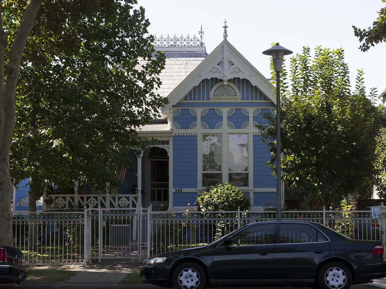
Kaehler-Rector House
Monument and historic site · National Register of Historic Places · 0.4 mi
Historic house in California, United States
Leggett House
Monument and historic site · National Register of Historic Places · 0.6 mi
Historic house in California, United States

Maj. George Beecher Cook House
Monument and historic site · National Register of Historic Places · 0.6 mi
Historic house in California, United States

Merced County Courthouse
Monument and historic site · National Register of Historic Places · 0.8 mi
County courthouse in Merced, United States of America
Merced County High School
Monument and historic site · National Register of Historic Places · 0.7 mi
High school in Merced, California
Thomas H. Leggett House
Monument and historic site · National Register of Historic Places · 0.6 mi
Merced, California, listed on the NRHP in Merced County, California

Tioga Hotel
Monument and historic site · National Register of Historic Places · 1.1 mi
Historic building in Merced, California, US


United States Post Office (Merced, California)
Monument and historic site · National Register of Historic Places · 0.9 mi
Post office in Merced, United States of America
Agricultural Museum Of Merced County
Museum · 3.7 mi
4498 East Highway 140, Merced
2 more on the map.
Parks, trails and playgrounds45

33 more on the map.
Restaurants and cafes134

Lovers Deli
Restaurant · Sandwich · 1.0 mi
426 West Main Street
Fr-Sa 11:30-21:00; Su 12:00-17:00; Tu-Th 11:30-20:00

Toni’s Courtyard Café & Bakery
Restaurant · Regional · 1.0 mi
516 West 18th Street, Merced
Mo-Fr 07:00-10:30,11:00-15:00; Sa 08:00-11:30,12:00-14:00

Me-n-Ed's Neighborhood Pizza Parlor
Restaurant · Pizza · 1.3 mi
Laid back brick-oven pizzeria chain.
3524 G Street, Merced
Su-Th 11:00-19:00; Fr,Sa 11:00-22:00

China Caff
Restaurant · Chinese
2840 G Street, Merced
Mo-Sa 11:00-21:00; Su 12:00-21:00; Su[2,-1] off
Em-Tea
Cafe · Bubble Tea · 1.4 mi
3570 G Street, Merced
Mo-Su 11:00-23:00
122 more on the map.
History
The first Merced post office opened in 1870. Merced incorporated in 1889.
During World War II, the Merced County fairgrounds were the site of a temporary "assembly center" where Japanese Americans were detained after being removed from their West Coast homes under Executive Order 9066. 4,669 men, women and children from central California (with most coming from Merced County) were confined in the Merced Assembly Center from May 6 to September 15, 1942, when they were transferred to the more permanent Granada internment camp in Colorado.
Since 2005, Merced has been home to the University of California, Merced. Historic cultural attractions in the city include The Mainzer Theater which is known for its historic and architectural value, the County Courthouse Museum c. 1889, the Merced Multicultural Arts Center and the County Library.
Also within a short distance from the city limits are the Castle Air Museum, Lake Yosemite, and Merced Falls. The city of Merced along with its surrounding cities are serviced by the Merced Sun-Star and the Merced County Times. The Merced Sun-Star daily newspaper has a circulation of 14,219 daily and 18,569 Saturday in the Merced area. The paper was sold to U.S. Media in 1985 and was acquired by The McClatchy Company in January 2004.
From the History section of Merced, California on Wikipedia, under CC BY-SA 4.0.
Where to stay22
Holiday Inn Express & Suites Merced - Yosemite National Park Area
Motel and hotel · 2.0 mi
151 South Parsons Avenue, Merced
Churches and places of worship72
Merced Bethel Seventh Day Adventist Church
Church · Seventh Day Adventist · 1.9 mi
810 T Street, Merced
The Church of Jesus Christ of Latter-day Saints
Church · Mormon · 1.5 mi
1080 East Yosemite Avenue, Merced
African Methodist Episcopal Zion
Church · African Methodist Episcopal Zion · 1.7 mi
742 N Street, Merced
Central Presbyterian Church
Church · Presbyterian · 0.8 mi
520 West 20th Street, Merced
Faith Mission Ministries Inc
Church · Baptist · 1.1 mi
909 West 18th Street, Merced
Shopping36
Gas and EV charging31
Schools, colleges and libraries75
Healthcare13
Evergreen Care Medical
Clinic and pharmacy · 0.9 mi
900 West Olive Avenue, Merced
Hylond Healthcare & Rehab. Center
Clinic and pharmacy · 0.7 mi
3170 M Street, Merced
Children's Medical Clinic Of Merced
Clinic and pharmacy · 0.9 mi
143 West Main Street, Merced
Mercy Medical Center Merced Dominican Campus
Clinic and pharmacy · 0.4 mi
2740 M Street, Merced
Olivewood One Professional Center
Clinic and pharmacy · 0.9 mi
860 West Olive Avenue, Merced
Map of Merced
250 places. The map loads OpenStreetMap tiles when you open it.
Climate by month
Monthly table
| Month | High | Low | Rain | Snow |
|---|---|---|---|---|
| Jan | 54°F | 37°F | 2.7 in | 0.0 in |
| Feb | 61°F | 39°F | 2.2 in | 0.0 in |
| Mar | 66°F | 42°F | 1.9 in | 0.0 in |
| Apr | 73°F | 46°F | 1.0 in | 0.0 in |
| May | 82°F | 52°F | 0.6 in | 0.0 in |
| Jun | 89°F | 57°F | 0.1 in | 0.0 in |
| Jul | 95°F | 62°F | 0.0 in | 0.0 in |
| Aug | 94°F | 60°F | 0.0 in | 0.0 in |
| Sep | 89°F | 56°F | 0.1 in | 0.0 in |
| Oct | 79°F | 49°F | 0.7 in | 0.0 in |
| Nov | 64°F | 41°F | 1.2 in | 0.0 in |
| Dec | 55°F | 36°F | 2.0 in | 0.0 in |
U.S. Climate Normals 1991-2020 for Merced Hcn (3 mi away), NOAA NCEI.
People and cost of living
American Community Survey 5-year estimates, 2020-2024, U.S. Census Bureau. Estimates have margins of error, larger for small towns.
Disaster history
Merced County has had 11 federal disaster declarations since 2000, most often for floods.
- 2023-04-03: Severe Winter Storms, Straight-Line Winds, Flooding, Landslides, And Mudslides (Severe Storm)
- 2023-03-10: Severe Winter Storms, Flooding, Landslides, And Mudslides (Flood)
- 2023-01-14: Severe Winter Storms, Flooding, Landslides, And Mudslides (Flood)
- 2023-01-09: Severe Winter Storms, Flooding, And Mudslides (Flood)
- 2020-03-22: Covid-19 Pandemic (Biological)
- 2020-03-13: Covid-19 (Biological)
OpenFEMA disaster declarations summaries.
Getting there and nearby towns
Merced Regional Airport/Macready Field (MCE) is the nearest airport with scheduled flights listed in OpenStreetMap, 3 miles away.
- Atwater 7 mi west, about 12 min by car
- Winton 10 mi northwest, about 15 min by car
- Livingston 15 mi west, about 24 min by car
- Chowchilla 18 mi southeast, about 30 min by car
- Delhi 19 mi northwest, about 30 min by car
- Turlock 25 mi northwest, about 41 min by car
- Los Banos 27 mi southwest, about 43 min by car
- Newman 30 mi west, about 49 min by car
- Madera 32 mi southeast, about 51 min by car
- Ceres 34 mi northwest, about 54 min by car
Drive times are estimates from straight-line distance, not routes.
Local news
Headlines from INDB, the NEMICO news database.
Reviews, tips and questions
Loading what members have shared...
Sources and licences
- NCES EDGE (Public domain): public schools
- NOAA NCEI U.S. Climate Normals 1991-2020 (Public domain): climate by month
- OpenFEMA (Public domain): disaster declarations
- OpenStreetMap contributors (ODbL 1.0): places, airports, map data
- U.S. Census Bureau (Public domain): population, income, housing, education, commute
- Wikidata (CC0 1.0): elevation, founding date, time zone, website, landmarks and historic places
- Wikimedia Commons (see each image): photos
- Wikipedia (CC BY-SA 4.0): overview and history text
Photo credits
- Merced Theatre, Mark Miller, CC BY-SA 3.0
- Tioga Hotel - Merced California, Publichall, CC BY-SA 3.0
- Bank of Italy Merced facade remade, Scott Moore, CC BY 2.0
- Leggett House1, Saeidb, CC BY-SA 3.0
- Merced County High School, Saeidb, CC BY-SA 3.0
- Thomas H. Leggett House, Saeidb, CC BY-SA 3.0
- US Post Office Merced, Saeidb, CC BY-SA 3.0
- KR House Merced, William Hoffknecht, CC BY-SA 3.0
- Maj. George Beecher Cook House2, Saeidb, CC BY-SA 3.0
- Buhach Grammar School, Saeidb, CC BY-SA 3.0
Page built October 30, 2026. Spotted a mistake? Tell us or suggest a place.