


Minneapolis, Minnesota
Minneapolis is a city of 427,246 people in Hennepin County, Minnesota, founded in 1850.
Why visit Minneapolis
Townapedia lists 117 museums and landmarks, 34 parks and trails, 302 places to eat, 32 places to stay and 30 attractions in and around town.
Highlights include State Theatre, Mixed Blood Theatre, 430 Oak Grove and Abbott Apartments.
July is the warmest month, with average highs of 83°F; January lows average 8°F.
Weather in Minneapolis
Forecast from the National Weather Service. Full forecast
About Minneapolis
Minneapolis is a city in Hennepin County, Minnesota, United States, and its county seat. With a population of 429,954 as of the 2020 census, it is the state's most populous city. Located in the state's center near the eastern border, it occupies both banks of the Upper Mississippi River and adjoins Saint Paul, the state capital of Minnesota. Minneapolis, Saint Paul, and the surrounding area are collectively known as the Twin Cities, a metropolitan area with 3.69 million residents.
From the Wikipedia article Minneapolis (this version), under CC BY-SA 4.0.
Things to do30


18 more on the map.
Museums and landmarks117

Abbott Apartments
Monument and historic site · 0.4 mi
Old Abbott Hospital, constructed in 1910, with additions in 1919, 1938, 1954, and 1957.
110 East 18th Street, Minneapolis

American Swedish Institute
Museum · National Register of Historic Places · 0.6 mi
Swedish-American institute in Minneapolis, Minnesota, USA
2600 Park Avenue, Minneapolis
Tu-We,Fr-Su 10:00-16:00; Th 10:00-20:00; Mo off; Jan 01 off;...

Walker Art Center
Museum · 1.0 mi
1750 Hennepin Avenue South, Minneapolis
Th 10:00-21:00; We,Fr-Su 10:00-17:00
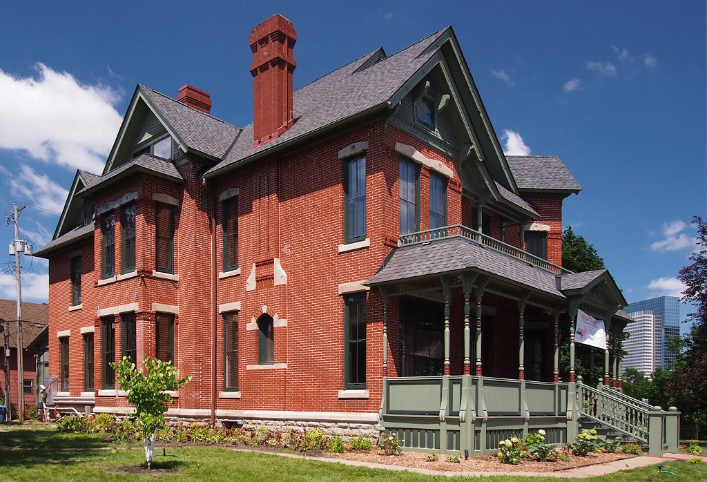
Amos B. Coe House
Monument and historic site · National Register of Historic Places
House in Minneapolis, Minnesota
1700 3rd Avenue South, Minneapolis

Architects and Engineers Building
Monument and historic site · National Register of Historic Places · 0.6 mi
Office building in downtown Minneapolis, Minnesota, United States
1200 2nd Avenue South, Minneapolis

Bardwell–Ferrant House
Monument and historic site · National Register of Historic Places · 0.5 mi
House
2500 Portland Avenue, Minneapolis

Cowles Center for Dance and the Performing Arts
Monument and historic site · National Register of Historic Places · 1.2 mi
Performing arts center in Minneapolis, Minnesota, United States

Elisha and Lizzie Morse Jr. House
Monument and historic site · National Register of Historic Places · 0.6 mi
Historic house in Minnesota, United States
2325-2327 Pillsbury Avenue, Minneapolis


Farmers and Mechanics Savings Bank
Monument and historic site · National Register of Historic Places · 1.1 mi
Building in Minneapolis, Minnesota
115 South 4th Street, Minneapolis
Flour Exchange Building
Monument and historic site · 1.1 mi
310 4th Avenue South, Minneapolis
Mo-Fr 07:00-17:00
105 more on the map.
Parks, trails and playgrounds34


US Bank Stadium
Sports field and stadium · 0.9 mi
401 Chicago Avenue, Minneapolis
22 more on the map.
Restaurants and cafes302

Starbucks
Cafe · Coffee Shop · 0.9 mi
80 South 8th Street, Minneapolis
Mo-Fr 06:00-17:30; Sa 07:00-16:00; Su off

Baba's Hummus House & Mana'eesh Bakery
Cafe · Middle Eastern, Coffee · 1.0 mi
Palestinian inspired hummus bowls and mana’eesh, Middle Eastern flatbread.
2220 Lyndale Avenue South, Minneapolis
Mo-Th 11:00-20:00; Fr 11:00-21:00; Sa 10:00-21:00; Su 10:00-20:00
Bob's Java Hut
Cafe · Coffee · 1.2 mi
Coffee shop serving espresso drinks & light bites in a colorful retro-diner-meets-biker-bar space.
2651 Lyndale Avenue South, Minneapolis
Mo-Fr 07:00-18:00; Sa-Su 08:00-18:00
Christos
Restaurant · Greek · 0.8 mi
Popular taverna features a variety of traditional Greek dishes in a casual white-tablecloth setting.
2632 Nicollet Avenue, Minneapolis
Mo-Su 11:00-20:00
Disco Death Records
Cafe · Coffee Shop · 1.1 mi
Coffee and music(vinyl, CD, etc)
721 West 26th Street, Minneapolis
Mo-Su 07:00-19:00
Dreamstate Cafe
Restaurant · Coffee Shop, Pasta, Soup, Burger, American, Brunch · 1.1 mi
A 100% plant based cafe & bar
2558 Lyndale Avenue South, Minneapolis
Mo-Fr 11:00-22:00; Sa-Su 09:00-22:00
Jasmine Vietnamese Restaurant
Restaurant · Vietnamese · 0.7 mi
Pint-sized eatery doling out classic Vietnamese dishes in utilitarian surroundings.
2532 Nicollet Avenue, Minneapolis
Tu-Sa 11:00-20:30
Leaning Tower of Pizza
Restaurant · Pizza, Italian · 1.0 mi
Long-standing pizzeria with late-night hours serving up basic Italian dishes in a no-frills setting. Trivia on Tuesdays at 7:30PM.
2324 Lyndale Avenue South, Minneapolis
Mo-Fr 16:00-02:00, Sa,Su 12:00-02:00
Lu's Sandwiches
Restaurant · Vietnamese, Sandwich · 0.8 mi
Family-run Vietnamese fast-food shop selling banh mi sandwiches, bubble tea & other snacks.
2624 Nicollet Avenue, Minneapolis
Mo-Sa 10:00-20:00; Su 10:00-18:00
290 more on the map.
Where to stay32
Rand Tower Hotel, Minneapolis, a Tribute Portfolio Hotel
Motel and hotel · 1.0 mi
527 Marquette Avenue, Minneapolis
Holiday Inn Express Minneapolis Downtown Convention Center
Motel and hotel · 0.6 mi
225 South Eleventh Street, Minneapolis
Hotel Ivy, a Luxury Collection Hotel, Minneapolis
Motel and hotel · 0.6 mi
201 South 11th Street, Minneapolis
Churches and places of worship35
Hennepin Avenue United Methodist Church
Church · United Methodist · 1.0 mi
511 Groveland Avenue, Minneapolis
Basilica of Saint Mary
Church · Roman Catholic · National Register of Historic Places · 1.1 mi
88 17th Street North, Minneapolis
Minneapolis First Seventh-day Adventist Church
Church · Seventh Day Adventist · 0.5 mi
2315 Nicollet Avenue, Minneapolis
Shopping37
Gas and EV charging4
Schools, colleges and libraries64
Healthcare25
Passport Health Minneapolis Travel Clinic
Clinic and pharmacy · 1.0 mi
400 South 4th Street, Minneapolis
Map of Minneapolis
250 places. The map loads OpenStreetMap tiles when you open it.
Climate by month
Monthly table
| Month | High | Low | Rain |
|---|---|---|---|
| Jan | 22°F | 8°F | 0.9 in |
| Feb | 27°F | 12°F | 0.9 in |
| Mar | 40°F | 24°F | 1.6 in |
| Apr | 55°F | 36°F | 3.3 in |
| May | 69°F | 49°F | 4.3 in |
| Jun | 79°F | 58°F | 4.8 in |
| Jul | 83°F | 64°F | 4.6 in |
| Aug | 80°F | 62°F | 4.5 in |
| Sep | 72°F | 54°F | 3.4 in |
| Oct | 56°F | 40°F | 3.0 in |
| Nov | 40°F | 27°F | 1.7 in |
| Dec | 27°F | 15°F | 1.3 in |
U.S. Climate Normals 1991-2020 for Lower St Anthony Falls (1 mi away), NOAA NCEI.
People and cost of living
American Community Survey 5-year estimates, 2020-2024, U.S. Census Bureau. Estimates have margins of error, larger for small towns.
Disaster history
Hennepin County has had 10 federal disaster declarations since 2000, most often for floods.
- 2020-04-07: Covid-19 Pandemic (Biological)
- 2020-03-13: Covid-19 (Biological)
- 2016-11-02: Severe Storms And Flooding (Flood)
- 2014-07-21: Severe Storms, Straight-Line Winds, Flooding, Landslides, And Mudslides (Flood)
- 2013-07-25: Severe Storms, Straight-Line Winds, And Flooding (Severe Storm)
- 2011-06-07: Severe Storms And Tornadoes (Severe Storm)
OpenFEMA disaster declarations summaries.
Getting there and nearby towns
Minneapolis-Saint Paul International Airport (MSP) is the nearest airport with scheduled flights listed in OpenStreetMap, 6 miles away.
- Lauderdale 4 mi northeast, about 6 min by car
- St. Louis Park 5 mi west, about 8 min by car
- Golden Valley 5 mi northwest, about 8 min by car
- Falcon Heights 5 mi east, about 8 min by car
- Robbinsdale 5 mi northwest, about 8 min by car
- St. Anthony 5 mi northeast, about 9 min by car
- Richfield 6 mi south, about 10 min by car
- Columbia Heights 6 mi north, about 10 min by car
- Edina 7 mi southwest, about 11 min by car
- St. Paul 8 mi east, about 13 min by car
Drive times are estimates from straight-line distance, not routes.
Local news
Headlines from INDB, the NEMICO news database.
Reviews, tips and questions
Loading what members have shared...
Sources and licences
- NCES EDGE (Public domain): public schools
- NOAA NCEI U.S. Climate Normals 1991-2020 (Public domain): climate by month
- OpenFEMA (Public domain): disaster declarations
- OpenStreetMap contributors (ODbL 1.0): places, airports, map data
- U.S. Census Bureau (Public domain): population, income, housing, education, commute
- Wikidata (CC0 1.0): elevation, founding date, time zone, website, landmarks and historic places
- Wikimedia Commons (see each image): photos
- Wikipedia (CC BY-SA 4.0): overview and history text
Photo credits
- 2008-0712-MPLS-panorama, Bobak Ha'Eri, CC BY 3.0
- Minneapolis neighborhood Ventura Village (52209311529), Fibonacci Blue from Minnesota, USA, CC BY 2.0
- Minneapolis Skyline from Franklin Avenue Bridge - panoramio, Bohao Zhao, CC BY 3.0
- Downtown Minneapolis - Morning Skyline (36997726022), Tony Webster from Minneapolis, Minnesota, United States, CC BY-SA 2.0
- Race and ethnicity 2010- Minneapolis (5560453662), Eric Fischer, CC BY-SA 2.0
- Interstate 35W - Minneapolis, MN - panoramio (1), Gabriel Vanslette, CC BY 3.0
- Minneapolis neighborhood- Whittier, Fibonacci Blue, CC BY 2.0
- Minneapolis neighborhood Ventura Village (52209064263), Fibonacci Blue from Minnesota, USA, CC BY 2.0
- Minneapolis neighborhood Ventura Village (52209093373), Fibonacci Blue from Minnesota, USA, CC BY 2.0
- House Teardown Minneapolis (54118958542), Tony Webster, CC BY 2.0
- Franklin & Park Demolition, Minneapolis (17403763922), Tony Webster from Minneapolis, Minnesota, United States, CC BY 2.0
- Demolition of Home in Minneapolis (54126617172), Tony Webster, CC BY 2.0
- I 94 - Minneapolis, MN - panoramio (16), Gabriel Vanslette, CC BY 3.0
- I 94 - Minneapolis, MN - panoramio (17), Gabriel Vanslette, CC BY 3.0
- I 94 - Minneapolis, MN - panoramio (19), Gabriel Vanslette, CC BY 3.0
- Minneapolis, MN - panoramio (79), Gabriel Vanslette, CC BY 3.0
- 35W N into Minneapolis - panoramio, Jimmy Selix, CC BY-SA 3.0
- Third Avenue Food Market - Stevens Square Minneapolis in winter (17628358903), Tony Webster from Minneapolis, Minnesota, United States, CC BY 2.0
- Church of Saint Stephen - Minneapolis 02, Farragutful, CC BY-SA 4.0
- Church of Saint Stephen interior - Minneapolis 02, Farragutful, CC BY-SA 4.0
- Church of Saint Stephen - Minneapolis 01, Farragutful, CC BY-SA 4.0
- Church of Saint Stephen interior - Minneapolis 06, Farragutful, CC BY-SA 4.0
- Church of Saint Stephen interior - Minneapolis 03, Farragutful, CC BY-SA 4.0
- Church of Saint Stephen interior - Minneapolis 05, Farragutful, CC BY-SA 4.0
- Church of Saint Stephen interior - Minneapolis 01, Farragutful, CC BY-SA 4.0
- Church of Saint Stephen interior - Minneapolis 04, Farragutful, CC BY-SA 4.0
- Church of Saint Stephen - Minneapolis 03, Farragutful, CC BY-SA 4.0
- Church of Saint Stephen interior - Minneapolis 07, Farragutful, CC BY-SA 4.0
- Minneapolis (49674291772), Chad Davis, CC BY-SA 2.0
- American Swedish Institute, McGhiever, CC BY-SA 4.0
- 2008-0705-BasilicaStMary, Bobak Ha'Eri, CC BY 3.0
- Bardwell-Ferrant House, McGhiever, CC BY-SA 4.0
- Amos B. Coe House, McGhiever, CC BY-SA 3.0
- Architects & Engineers Building, McGhiever, CC BY 4.0
- Schubert Theater from East, Abiodork, CC BY-SA 3.0
- 1891 Farmers and Mechanics Savings Bank, McGhiever, CC BY-SA 3.0
- Minneapolis Armory, Tim Kiser ( w:User:Malepheasant ), CC BY-SA 2.5
- Elisha-Lizzie Morse House 4, Elkman, CC BY-SA 4.0
- Fortsnellinggrounds, en:User:The Statue With The Dictionary, CC BY-SA 3.0
- Midtown Exchange, McGhiever, CC BY-SA 4.0


Page built October 30, 2026. Spotted a mistake? Tell us or suggest a place.