
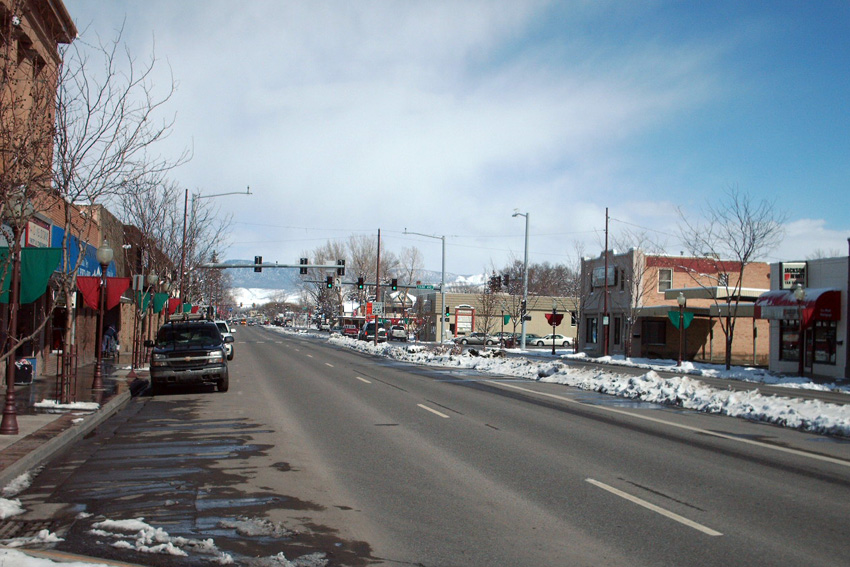


Montrose, Colorado
Montrose is a city of 21,044 people in Montrose County, Colorado, founded in 1882.
Why visit Montrose
Townapedia lists 17 museums and landmarks, 22 parks and trails, 69 places to eat, 17 places to stay and 7 attractions in and around town.
Highlights include The Star Drive-In, Fox Theater, Museum of the Mountain West and Ute Indian Museum.
July is the warmest month, with average highs of 90°F; January lows average 18°F, and about 22 inches of snow fall in a normal year.
Weather in Montrose
Forecast from the National Weather Service. Full forecast
About Montrose
Montrose is a home rule municipality that is the county seat of and the most populous municipality in Montrose County, Colorado, United States. The city population was 20,291 at the 2020 census, within a total area of 18.5 square miles. The main road that leads in and out of Montrose is U.S. Highway 50.
From the Wikipedia article Montrose, Colorado (this version), under CC BY-SA 4.0.
Things to do7


Straw Hat Farm Market & Kitchen Store
Farm and orchard · 1.1 mi
514 South 1st Street

Museums and landmarks17

Museum of the Mountain West
Museum · 2.8 mi
History museum in Montrose, Colorado
68169 East Miami Road, Montrose
Nov 01 - Mar 31 Tu-Sa 09:30-16:00; Apr 01 - Oct 31 Mo-Sa...

Ute Indian Museum
Museum · 2.4 mi
History museum in Montrose, Colorado
17253 Chipeta Road, Montrose
Mo-Sa 09:00-16:30; Su 11:00-16:00

Benevolent and Protective Order of Elks Lodge
Monument and historic site · National Register of Historic Places · 1.1 mi
Building in Colorado, United States of America

Denver and Rio Grande Depot
Monument and historic site · National Register of Historic Places · 1.3 mi
Train station in Montrose, Colorado

Fetz-Keller Ranch
Monument and historic site · National Register of Historic Places · 4.3 mi
Ranch in Montrose County, Colorado

Montrose County Courthouse
Monument and historic site · National Register of Historic Places · 1.1 mi
County courthouse in Colorado, United States of America

Montrose Masonic Temple, Lodge No. 63
Monument and historic site · National Register of Historic Places · 1.2 mi
Masonic temple in Montrose, United States of America

Thomas B. Townsend House
Monument and historic site · National Register of Historic Places · 0.9 mi
Historic house in Montrose, Colorado, United States


U.S. Bureau of Reclamation Project Office Building
Monument and historic site · National Register of Historic Places · 1.6 mi
Historic district in Colorado, United States of America
Montrose County Historical Museum
Museum · 1.3 mi
History museum in Montrose, Colorado
J.V. Lathrop House
Monument and historic site · 1.2 mi
718 East Main Street, Montrose
5 more on the map.
Parks, trails and playgrounds22


Montrose Water Sports Park
Sports field and stadium · 1.2 mi
The WSP has a gradient of 11 feet for 1/5 miles, supporting a leisurely run with natural obstacles and six drop structures....
Mo-Su 05:00-23:00

Centennial Plaza
Park · 1.1 mi
Park shelter reservations are available.
15-99 South Uncompahgre Avenue, Montrose
10 more on the map.
Restaurants and cafes69

Camp Robber
Restaurant · American, Mexican, Tex-Mex · 1.2 mi
1515 Ogden Road
Mo-Sa 11:00-20:30; Su off

Guru's Nepalese Restaurant
Restaurant · Indian · 1.2 mi
448 East Main Street, Montrose
Mo-Fr 11:00-14:30,17:00-21:00; Sa,Su 17:00-21:00
Ray’s Corner Cafe
Restaurant · 1.2 mi
347 East Main Street, Montrose
Mo-Sa 08:00-14:00,16:00-21:00; Sa 10:00-14:00
57 more on the map.
History
Montrose was incorporated on May 2, 1882, and named after the Marquis of Montrose, immortalized in Sir Walter Scott's novel A Legend of Montrose by Oliver D. "Pappy" Loutzenhizer and Joseph Selig. The Denver & Rio Grande railroad was built west toward Grand Junction and reached Montrose later in 1882, and the town became an important regional shipping center. A branch railroad line served the mineral-rich San Juan Mountains to the south.
In 1909, the U.S. government completed construction of the Gunnison Tunnel, located east of Montrose. It provided irrigation water from the Gunnison River in the Black Canyon to the Uncompahgre Valley, helping turn Montrose into an agricultural hub. The Uncompahgre Project is one of the oldest of those in the area by the U.S. Bureau of Reclamation.
From the History section of Montrose, Colorado on Wikipedia, under CC BY-SA 4.0.
Where to stay17
Churches and places of worship21
Methodist Episcopal Church of Montrose
Church · National Register of Historic Places · 1.1 mi
The Church of Jesus Christ of Latter-day Saints
Church · Mormon
1521 South Hillcrest Drive, Montrose
United Church of Christ - Hillcrest Congregational Worship
Church · United Church Of Christ · 0.9 mi
All Saints Anglican Church
Church · Anglican · 0.5 mi
2057 South Townsend Avenue, Montrose
Shopping14
Gas and EV charging14
Schools, colleges and libraries19
Healthcare5
Map of Montrose
205 places. The map loads OpenStreetMap tiles when you open it.
Climate by month
Monthly table
| Month | High | Low | Rain | Snow |
|---|---|---|---|---|
| Jan | 40°F | 18°F | 0.5 in | 4.7 in |
| Feb | 46°F | 23°F | 0.5 in | 3.9 in |
| Mar | 57°F | 30°F | 0.7 in | 2.2 in |
| Apr | 64°F | 37°F | 0.8 in | 0.6 in |
| May | 74°F | 45°F | 0.8 in | 0.0 in |
| Jun | 86°F | 53°F | 0.5 in | 0.0 in |
| Jul | 90°F | 59°F | 0.9 in | 0.0 in |
| Aug | 87°F | 58°F | 1.1 in | 0.0 in |
| Sep | 79°F | 49°F | 1.2 in | 0.0 in |
| Oct | 66°F | 37°F | 1.0 in | 0.5 in |
| Nov | 52°F | 27°F | 0.7 in | 2.7 in |
| Dec | 41°F | 18°F | 0.6 in | 6.9 in |
U.S. Climate Normals 1991-2020 for Montrose #2 Hcn (2 mi away), NOAA NCEI.
People and cost of living
American Community Survey 5-year estimates, 2020-2024, U.S. Census Bureau. Estimates have margins of error, larger for small towns.
Disaster history
Montrose County has had 5 federal disaster declarations since 2000, most often for biologicals.
- 2020-03-28: Covid-19 Pandemic (Biological)
- 2020-03-13: Covid-19 (Biological)
- 2005-09-05: Hurricane Katrina Evacuation (Coastal Storm)
- 2002-07-15: Co - Burn Canyon Fire - 07/15/02 (Fire)
- 2002-06-19: Wildfires (Fire)
OpenFEMA disaster declarations summaries.
Getting there and nearby towns
Montrose Regional Airport (MTJ) is the nearest airport with scheduled flights listed in OpenStreetMap, 4 miles away.
- Olathe 12 mi northwest, about 19 min by car
- Loghill Village 19 mi south, about 31 min by car
- Crawford 21 mi northeast, about 34 min by car
- Ridgway 22 mi south, about 36 min by car
- Delta 23 mi northwest, about 38 min by car
- Hotchkiss 24 mi north, about 39 min by car
- Orchard City 25 mi north, about 40 min by car
- Cedaredge 30 mi north, about 48 min by car
- Paonia 31 mi northeast, about 50 min by car
- Clifton 53 mi northwest, about 1 h 30 min by car
Drive times are estimates from straight-line distance, not routes.
Local news
Headlines from INDB, the NEMICO news database.
Reviews, tips and questions
Loading what members have shared...
Sources and licences
- NCES EDGE (Public domain): public schools
- NOAA NCEI U.S. Climate Normals 1991-2020 (Public domain): climate by month
- OpenFEMA (Public domain): disaster declarations
- OpenStreetMap contributors (ODbL 1.0): places, airports, map data
- U.S. Census Bureau (Public domain): population, income, housing, education, commute
- Wikidata (CC0 1.0): elevation, founding date, time zone, website, landmarks and historic places
- Wikimedia Commons (see each image): photos
- Wikipedia (CC BY-SA 4.0): overview and history text
Photo credits
- MontroseMain-1, Felipecbg at English Wikipedia, CC BY 2.5
- StMary in Montrose, Always dreamin, CC BY-SA 4.0
- Main Street in Montrose, Colorado 20191229 110127, SecretName101, CC BY-SA 4.0
- Colorado GOP - Conservative Campaign Signs - Montrose (52470348303), Tony Webster, CC BY-SA 2.0
- Montrose Fruit & Produce Association Bldg, Colorado Birder, CC BY-SA 4.0
- Montrose, Colorado (9179279977), Ken Lund from Reno, Nevada, USA, CC BY-SA 2.0
- Montrose, Colorado (9179279073), Ken Lund from Reno, Nevada, USA, CC BY-SA 2.0
- Montrose, Colorado (9181495198), Ken Lund from Reno, Nevada, USA, CC BY-SA 2.0
- Montrose, Colorado (9181493828), Ken Lund from Reno, Nevada, USA, CC BY-SA 2.0
- Ute Indian Museum, Denverjeffrey, CC BY 3.0
- Montrose County Courthouse, Jeffrey Beall, CC BY 3.0
- Denver and Rio Grande Depot - Montrose 2, ChuckCars, CC BY 2.0
- Thomas B. Townsend House, Jeffrey Beall, CC BY 3.0
- Methodist Episcopal Church of Montrose, Jeffrey Beall, CC BY 3.0
- Benevolent and Protective Order of Elks Lodge (Montrose, Colorado), Jeffrey Beall, CC BY 3.0
- U.S. Bureau of Reclamation Project Office Building, Jeffrey Beall, CC BY 3.0
- Montrose Masonic Temple, Lodge No. 63, Jeffrey Beall, CC BY 3.0
- Notch-leaf Scorpionweed (Phacelia crenulata) inflorescence, Kollibri1969, CC BY-SA 4.0
- Trains before coming to Knott's Berry Farm, Orange County Archives, CC BY 2.0
- Cinephile list at Telluride Film Festival 2024, Jennifer 8. Lee, CC BY-SA 4.0
- Ute Memorial Site, Jeffrey Beall, CC BY 3.0
- ISS052-E-8274 - View of Earth, Earth Science and Remote Sensing Unit , Lyndon B. Johnson Space Center, Public domain
- ISS023-E-11964 - View of Earth, Earth Science and Remote Sensing Unit , Lyndon B. Johnson Space Center, Public domain
- ISS052-E-8275 - View of Earth, Earth Science and Remote Sensing Unit , Lyndon B. Johnson Space Center, Public domain
- ISS023-E-11963 - View of Earth, Earth Science and Remote Sensing Unit , Lyndon B. Johnson Space Center, Public domain


Page built October 30, 2026. Spotted a mistake? Tell us or suggest a place.