


Moonachie, New Jersey
Moonachie is a borough of 3,126 people in Bergen County, New Jersey, founded in May 3, 1910.
Why visit Moonachie
Townapedia lists 24 museums and landmarks, 4 parks and trails, 53 places to eat, 12 places to stay and 8 attractions in and around town.
Highlights include Court Street Bridge, Gregory Avenue Bridge, Aviation Hall of Fame and Museum of New Jersey and Anderson Outkitchen.
July is the warmest month, with average highs of 87°F; January lows average 26°F.
Weather in Moonachie
Forecast from the National Weather Service. Full forecast
About Moonachie
Moonachie (English pronunciation: /muːˈnɑːki/ ) is a borough in Bergen County, in the U.S. state of New Jersey, in the Hackensack River watershed. As of the 2020 United States census, the borough's population was 3,133, an increase of 425 (+15.7%) from the 2010 census count of 2,708, which in turn reflected a decline of 46 (−1.7%) from the 2,754 counted in the 2000 census.
From the Wikipedia article Moonachie, New Jersey (this version), under CC BY-SA 4.0.
Things to do8

Court Street Bridge
Bridge · 2.8 mi
Bridge in Hackensack and Bogota, New Jersey

Gregory Avenue Bridge
Bridge · 3.4 mi
Bridge in United States of America

Market Street Bridge
Bridge · 3.3 mi
Bridge in Passaic & Wallington, New Jersey


Monroe Street Bridge
Bridge · 3.4 mi
Bridge in Passaic and Garfield, New Jersey, United States

Passaic Street Bridge
Bridge · 3.2 mi
Steel girder road bridge across the Lower Passaic River in northern New Jersey

Union Avenue Bridge
Bridge · 3.4 mi
Bridge in United States of America

Williams Center
Cinema and theater · 2.6 mi
Theater and movie theater in Rutherford, New Jersey, United States
Museums and landmarks24

Aviation Hall of Fame and Museum of New Jersey
Museum · 0.8 mi
Aviation museum in Teterboro, New Jersey
400 Fred Wehran Drive, Teterboro

Anderson Outkitchen
Monument and historic site · National Register of Historic Places · 3.3 mi
House in Hackensack, New Jersey
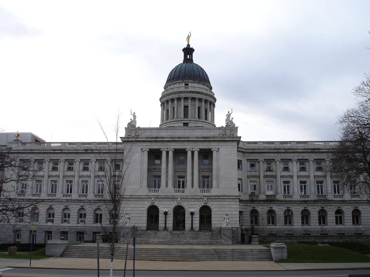
Bergen County Court House
Monument and historic site · National Register of Historic Places · 2.6 mi
Municipal edifice in New Jersey

Bogert House
Monument and historic site · National Register of Historic Places · 3.2 mi
Historic house in New Jersey, United States

Brinkerhoff House
Monument and historic site · National Register of Historic Places · 1.4 mi
Historic house in Wood-Ridge, New Jersey, USA

Brinkerhoff-Demarest House
Monument and historic site · National Register of Historic Places · 3.4 mi
Teaneck, New Jersey, listed on the NRHP in Bergen County

Caspar Westervelt House
Monument and historic site · National Register of Historic Places · 2.9 mi
Building in New Jersey, United States

Civil War Drill Hall and Armory
Monument and historic site · National Register of Historic Places · 3.3 mi
Arsenal in New Jersey, United States of America
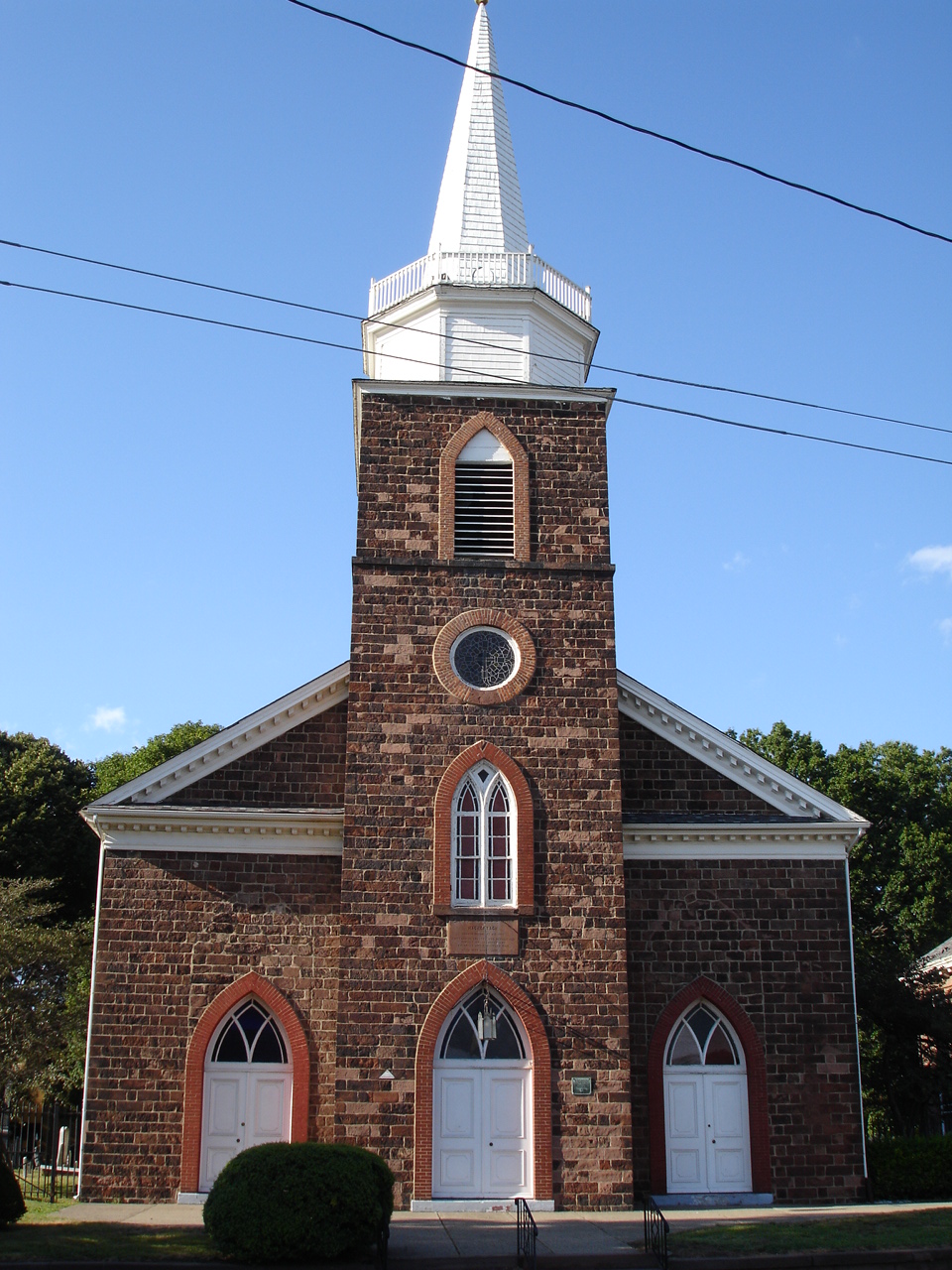
First Reformed Dutch Church
Monument and historic site · National Register of Historic Places · 2.7 mi
Historic church in Hackensack, New Jersey, United States

Fridolin Arnault House
Monument and historic site · National Register of Historic Places · 1.6 mi
Historic house in New Jersey, United States


Gethsemane Cemetery
Monument and historic site · National Register of Historic Places · 1.3 mi
Cemetery in New Jersey

Iviswold
Monument and historic site · National Register of Historic Places · 2.9 mi
Building in New Jersey, United States
12 more on the map.
Parks, trails and playgrounds4



Restaurants and cafes53

Al Toro
Restaurant · Mexican · 1.4 mi
187 Hackensack Street, Wood-Ridge
Su-Th 11:00-22:00; Fr,Sa 11:00-23:00


Jersey Pizza Co.
Restaurant · Pizza · 1.4 mi
200 Hackensack Street, Wood-Ridge
41 more on the map.
Where to stay12
Residence Inn East Rutherford Meadowlands
Motel and hotel · 1.6 mi
10 Murray Hill Parkway, East Rutherford
SpringHill Suites East Rutherford Meadowlands/Carlstadt
Motel and hotel · 1.4 mi
192 Paterson Plank Road, Carlstadt
Fairfield Inn East Rutherford Meadowlands
Motel and hotel · 1.6 mi
850 Paterson Plank Road, East Rutherford
Holiday Inn Express & Suites Meadowlands Area
Motel and hotel · 1.6 mi
100 Paterson Plank Road, Carlstadt
Churches and places of worship9
Dutch Reformed Church in the English Neighborhood
Church · National Register of Historic Places · 2.4 mi
Shopping2
Gas and EV charging14
Schools, colleges and libraries51
Bergen Arts And Sciences Charter School
School · 3.1 mi
200 Macarthur Avenue, Garfield
Bergen County Technical High School - Teterboro
School · 1.3 mi
504 Route 46 West, Teterboro
Healthcare3
Map of Moonachie
180 places. The map loads OpenStreetMap tiles when you open it.
Climate by month
Monthly table
| Month | High | Low | Rain |
|---|---|---|---|
| Jan | 40°F | 26°F | 3.3 in |
| Feb | 43°F | 27°F | 2.8 in |
| Mar | 51°F | 34°F | 4.1 in |
| Apr | 62°F | 44°F | 4.0 in |
| May | 73°F | 53°F | 3.9 in |
| Jun | 82°F | 63°F | 4.2 in |
| Jul | 87°F | 69°F | 4.5 in |
| Aug | 85°F | 67°F | 4.2 in |
| Sep | 78°F | 60°F | 4.1 in |
| Oct | 67°F | 48°F | 3.7 in |
| Nov | 56°F | 38°F | 3.3 in |
| Dec | 45°F | 31°F | 4.1 in |
U.S. Climate Normals 1991-2020 for Teterboro Ap (1 mi away), NOAA NCEI.
People and cost of living
American Community Survey 5-year estimates, 2020-2024, U.S. Census Bureau. Estimates have margins of error, larger for small towns.
Disaster history
Bergen County has had 21 federal disaster declarations since 2000, most often for hurricanes.
- 2021-09-05: Remnants Of Hurricane Ida (Hurricane)
- 2021-09-02: Remnants Of Hurricane Ida (Hurricane)
- 2020-12-11: Tropical Storm Isaias (Hurricane)
- 2020-03-25: Covid-19 Pandemic (Biological)
- 2020-03-13: Covid-19 (Biological)
- 2018-06-08: Severe Winter Storm And Snowstorm (Severe Storm)
OpenFEMA disaster declarations summaries.
Getting there and nearby towns
Teterboro Airport (TEB) is the nearest airport with scheduled flights listed in OpenStreetMap, 1 miles away.
- Carlstadt 1 mi south, about 2 min by car
- Little Ferry 1 mi east, about 2 min by car
- Wood-Ridge 2 mi west, about 3 min by car
- Hasbrouck Heights 2 mi northwest, about 3 min by car
- Ridgefield Park 2 mi northeast, about 4 min by car
- East Rutherford 2 mi southwest, about 4 min by car
- Ridgefield 2 mi east, about 4 min by car
- Wallington 3 mi west, about 4 min by car
- Lodi 3 mi northwest, about 5 min by car
- Bogota 3 mi northeast, about 4 min by car
Drive times are estimates from straight-line distance, not routes.
Local news
Headlines from INDB, the NEMICO news database.
Reviews, tips and questions
Loading what members have shared...
Sources and licences
- NCES EDGE (Public domain): public schools
- NOAA NCEI U.S. Climate Normals 1991-2020 (Public domain): climate by month
- OpenFEMA (Public domain): disaster declarations
- OpenStreetMap contributors (ODbL 1.0): places, airports, map data
- U.S. Census Bureau (Public domain): population, income, housing, education, commute
- Wikidata (CC0 1.0): elevation, founding date, time zone, website, landmarks and historic places
- Wikimedia Commons (see each image): photos
- Wikipedia (CC BY-SA 4.0): overview and history text
Photo credits
- NJT x Hackensack R fr Bergen Bv Park Av Ridgefield jeh, Jim.henderson, CC0
- CR 503 nb at Rooney Place, Moonachie, NJ, Oct. 2024, Mr. Matté (if there is an issue with this image, contact me using this image's Commons talk page , my Commons user talk page , or my English Wikipedia user talk page ; I'll know about it a lot faster), CC BY-SA 4.0
- 2018-07-22 19 09 49 View south along Bergen County Route 503 (Moonachie Road) at Garden Street in Moonachie, Bergen County, New Jersey, Famartin, CC BY-SA 4.0
- Moonachie, NJ rescue squad, Oct. 2024, Mr. Matté (if there is an issue with this image, contact me using this image's Commons talk page , my Commons user talk page , or my English Wikipedia user talk page ; I'll know about it a lot faster), CC BY-SA 4.0
- Moonachie, NJ fire department, Oct. 2024, Mr. Matté (if there is an issue with this image, contact me using this image's Commons talk page , my Commons user talk page , or my English Wikipedia user talk page ; I'll know about it a lot faster), CC BY-SA 4.0
- 2018-09-23 12 51 48 View south along Bergen County Route 503 (Moonachie Road) between Park Street and Joseph Street in Moonachie, Bergen County, New Jersey, Famartin, CC BY-SA 4.0
- 2018-07-22 19 03 42 View north along Bergen County Route 503 (Moonachie Road) at Bergen County Route 36 (Moonachie Avenue-Empire Boulevard) in Moonachie, Bergen County, New Jersey, Famartin, CC BY-SA 4.0
- 2018-09-23 12 48 18 View north along Bergen County Route 503 (Moonachie Road) at Bergen County Route 36 (Moonachie Avenue-Empire Boulevard) in Moonachie, Bergen County, New Jersey, Famartin, CC BY-SA 4.0
- CR 503 nb at Park Street, Moonachie, NJ, Oct. 2024, Mr. Matté (if there is an issue with this image, contact me using this image's Commons talk page , my Commons user talk page , or my English Wikipedia user talk page ; I'll know about it a lot faster), CC BY-SA 4.0
- 2018-07-22 19 04 53 View south along Bergen County Route 503 (Washington Avenue) at Bergen County Route 36 (Moonachie Avenue-Empire Boulevard) in Carlstadt, Bergen County, New Jersey, Famartin, CC BY-SA 4.0
- 2018-09-23 12 37 53 View south along Bergen County Route 503 (Washington Avenue) at Bergen County Route 36 (Moonachie Avenue-Empire Boulevard) in Carlstadt, Bergen County, New Jersey, Famartin, CC BY-SA 4.0
- 2018-09-23 12 39 33 View south along Bergen County Route 503 (Washington Avenue) between Bergen County Route 36 (Moonachie Avenue-Empire Boulevard) and Commerce Boulevard in Carlstadt, Bergen County..., Famartin, CC BY-SA 4.0
- CASPAR WESTERVELT HOUSE, TEANECK, BERGEN COUNTY, NJ, JERRYE & ROY KLOTZ, M.D., CC BY-SA 4.0
- James VandelindaHouse, KForce at en.wikipedia, CC BY-SA 3.0
- YereanceKettelhouse, Rhvanwinkle at English Wikipedia, CC BY-SA 3.0
- LeoniaDrillHall, KForce at en.wikipedia, CC BY-SA 3.0
- TeaneckNJ BrinkerhoffDemarestHouse, Magicpiano, CC BY-SA 4.0
- YEREANCE-BERRY HOUSE, RUTHERFORD, BERGEN COUNTY, JERRYE & ROY KLOTZ, M.D., CC BY-SA 4.0
- RutherfordNJ WomensClub2, Magicpiano, CC BY-SA 4.0
- Rutherford Station - January 2015, Adam Moss, CC BY-SA 2.0
- HackensackChurchOnTheGreen, The original uploader was KForce at English Wikipedia ., CC BY-SA 3.0
- KIP HOMESTEAD, RUTHERFORD, BERGEN COUNTY, NJ, JERRYE & ROY KLOTZ M.D., CC BY-SA 4.0
- GETHSEMANE CEMETERY, LITTLE FERRY, BERGEN COUNTY, JERRYE & ROY KLOTZ, M.D., CC BY-SA 4.0
- ANDERSON OUTKITCHEN, HACKENSACK, BERGEN COUNTY, JERRYE & ROY KLOTZ, M.D., CC BY-SA 4.0
- BergenCountyCourtHouse2, KForce at English Wikipedia, CC BY-SA 3.0
- PAULISON-CHRISTIE HOUSE, RIDGEFIELD PARK. BERGEN COUNTY,NJ, JERRYE & ROY KLOTZ, M.D., CC BY-SA 4.0
- USS Ling;0829702, USN, Public domain
- FRIDOLIN ARNAULT HOUSE, WOOD-RIDGE, BERGEN COUNTY NJ, JERRYE & ROY KLOTZ, M.D., CC BY-SA 4.0
- DutchReformedChurchRidgefield, KForce at en.wikipedia, CC BY-SA 3.0
- BogertHouse, KForce at en.wikipedia, CC BY-SA 3.0
- WILLIAM CARLOS WILLIAMS HOUSE, RUTHERFORD, BERGEN COUNTY, NJ, JERRYE & ROY KLOTZ M.D., CC BY-SA 4.0
- Wood-Ridge library, TimSPC at English Wikipedia, Public domain
- Passaic Street Bridge 20111002-jag9889, Jag9889, CC BY-SA 4.0
- CourtStreetBridgeHackensck River2, Hudconja, CC BY-SA 3.0
- THE WILLIAMS CENTER AND SKYLINE, TRexEditorNJ, CC BY-SA 4.0
- Midtown aka Salem St Bridge Hackensack River 01, Hudconja, CC BY-SA 3.0
- Monroe Street Bridge 20100829, Jag9889, CC BY-SA 4.0
- Union Ave Bridge 20070717-jag9889, Jag9889, CC BY-SA 4.0
- Market Street Bridge 20100829, Jag9889, CC BY-SA 4.0
- Maxima Alerta performing at a SOLD OUT concert at La Havana 59, Actor1962, CC BY-SA 4.0


Page built October 30, 2026. Spotted a mistake? Tell us or suggest a place.