


Moraine, Ohio
Moraine is a city of 6,536 people in Montgomery County, Ohio, founded in 1957.
Why visit Moraine
Townapedia lists 18 museums and landmarks, 31 parks and trails, 36 places to eat and 3 attractions in and around town.
Highlights include Baum Opera House, Fraze Pavilion, Charles F. Kettering House and Dunbar Historic District.
July is the warmest month, with average highs of 87°F; January lows average 20°F.
Weather in Moraine
Forecast from the National Weather Service. Full forecast
About Moraine
Moraine is a city in Montgomery County, Ohio, United States. Situated on the banks of the Great Miami River, Moraine is an inner suburb of Dayton, Ohio and a part of the Dayton metropolitan area. The population was 6,393 at the 2020 census.
From the Wikipedia article Moraine, Ohio (this version), under CC BY-SA 4.0.
Things to do3

Baum Opera House
Cinema and theater · 4.6 mi
Theater in Miamisburg, Ohio, United States

Fraze Pavilion
Cinema and theater · 4.5 mi
Outdoor theater in Kettering, Ohio, United States
Museums and landmarks18

Charles F. Kettering House
Monument and historic site · National Register of Historic Places · 2.6 mi
Historic house in Ohio, United States

Dunbar Historic District
Monument and historic site · National Register of Historic Places · 4.3 mi
Human settlement in Dayton, Ohio, United States of America

Hawthorn Hill
Monument and historic site · National Register of Historic Places · 3.9 mi
Historic house in Ohio, United States

Kelly Family Home
Monument and historic site · National Register of Historic Places · 4.6 mi
Building in Ohio, United States

Patterson Homestead
Monument and historic site · National Register of Historic Places · 4.1 mi
Building in Ohio, United States

Paul Laurence Dunbar House
Museum · National Register of Historic Places · 4.2 mi
Historic house museum in Dayton, Ohio, USA

Rudolph Pretzinger House
Monument and historic site · National Register of Historic Places · 4.4 mi
Single-family detached home in Ohio, United States of America

St. Mary's Hall
Monument and historic site · National Register of Historic Places · 4.5 mi
Historic building at the University Of Dayton in Dayton, Ohio, United States

SunWatch Indian Village
Museum · National Register of Historic Places · 1.4 mi
Open-air museum
Woodland Cemetery and Arboretum
Monument and historic site · National Register of Historic Places · 4.6 mi
Cemetery in Dayton, Ohio

Wright Cycle Company
Monument and historic site · National Register of Historic Places · 4.2 mi
Office building in Ohio, United States of America

Wright Flyer III
Monument and historic site · National Register of Historic Places · 3.0 mi
Third powered aircraft built by the Wright brothers
6 more on the map.
Parks, trails and playgrounds31




19 more on the map.
Restaurants and cafes36

Legacy Pancake House
Diner · American · 1.6 mi
489 E Dixie Drive
Mo-Sa 06:00-18:30; Su 06:00-15:00; PH closed

The Blue Berry Cafe
Restaurant · Brunch · 2.4 mi
2932 South Dixie Avenue, Kettering
Tu-Su 07:00-14:00

Tim Hortons
Cafe · Coffee Shop · 2.3 mi
3010 Kettering Boulevard, Moraine
Mo-Su 05:00-17:00
24 more on the map.
History
What is now the city of Moraine was once a part of Van Buren Township followed by a brief period as a part of Kettering. Much of Kettering's portion seceded in 1953 and formed the new Moraine Township. The township incorporated as a village in 1957. After annexing portions of Miami Township, Moraine incorporated as a city in 1965. Moraine later annexed parts of Jefferson Township.
Howard Johnson, the operator of the Moraine Airpark, was mayor of the city from 1976 to 1993.
From the History section of Moraine, Ohio on Wikipedia, under CC BY-SA 4.0.
Churches and places of worship19
Jacob's Church
Church · National Register of Historic Places · 4.5 mi
Salem Bear Creek Church, Salem Evangelical Lutheran Church
Church · National Register of Historic Places · 3.7 mi
Good Samaritan Baptist Church
Church · Baptist · 2.4 mi
4230 Germantown Pike, Dayton
Shopping5
Gas and EV charging11
Schools, colleges and libraries56
Alliance Community Schools Inc. Dba Dayton Leadership Acade
School · 4.6 mi
1416 W Riverview Ave, Dayton
David H. Ponitz Career Technology Center
School · 4.2 mi
741 Washington St, Dayton
Healthcare3
Map of Moraine
182 places. The map loads OpenStreetMap tiles when you open it.
Climate by month
Monthly table
| Month | High | Low | Rain | Snow |
|---|---|---|---|---|
| Jan | 36°F | 20°F | 3.2 in | 6.9 in |
| Feb | 40°F | 23°F | 2.4 in | 1.5 in |
| Mar | 51°F | 31°F | 3.5 in | 1.7 in |
| Apr | 64°F | 41°F | 4.5 in | 0.0 in |
| May | 75°F | 53°F | 4.4 in | 0.0 in |
| Jun | 84°F | 62°F | 4.4 in | 0.0 in |
| Jul | 87°F | 66°F | 4.0 in | 0.0 in |
| Aug | 86°F | 64°F | 3.1 in | 0.0 in |
| Sep | 79°F | 56°F | 3.0 in | 0.0 in |
| Oct | 66°F | 44°F | 3.0 in | 0.0 in |
| Nov | 52°F | 33°F | 3.0 in | 0.1 in |
| Dec | 41°F | 26°F | 3.1 in | 2.1 in |
U.S. Climate Normals 1991-2020 for Dayton Mcd (5 mi away), NOAA NCEI.
People and cost of living
American Community Survey 5-year estimates, 2020-2024, U.S. Census Bureau. Estimates have margins of error, larger for small towns.
Disaster history
Montgomery County has had 10 federal disaster declarations since 2000, most often for severe storms.
- 2020-03-31: Covid-19 Pandemic (Biological)
- 2020-03-13: Covid-19 (Biological)
- 2019-06-18: Severe Storms, Straight-Line Winds, Tornadoes, Flooding, Landslides, And Mudslide (Tornado)
- 2012-06-30: Severe Storms (Severe Storm)
- 2008-10-24: Severe Wind Storm Associated With Tropical Depression Ike (Severe Storm)
- 2005-09-13: Hurricane Katrina Evacuation (Hurricane)
OpenFEMA disaster declarations summaries.
Getting there and nearby towns
Dayton–Wright Brothers Airport (MGY) is the nearest airport with scheduled flights listed in OpenStreetMap, 7 miles away.
- West Carrollton 2 mi south, about 3 min by car
- Drexel 4 mi northwest, about 6 min by car
- Kettering 5 mi east, about 8 min by car
- Miamisburg 5 mi south, about 8 min by car
- Dayton 6 mi north, about 10 min by car
- Centerville 7 mi southeast, about 11 min by car
- Fort McKinley 7 mi north, about 12 min by car
- Trotwood 8 mi northwest, about 12 min by car
- Shiloh 8 mi north, about 13 min by car
- Germantown 8 mi southwest, about 13 min by car
Drive times are estimates from straight-line distance, not routes.
Local news
Headlines from INDB, the NEMICO news database.
Reviews, tips and questions
Loading what members have shared...
Sources and licences
- NCES EDGE (Public domain): public schools
- NOAA NCEI U.S. Climate Normals 1991-2020 (Public domain): climate by month
- OpenFEMA (Public domain): disaster declarations
- OpenStreetMap contributors (ODbL 1.0): places, airports, map data
- U.S. Census Bureau (Public domain): population, income, housing, education, commute
- Wikidata (CC0 1.0): elevation, founding date, time zone, website, landmarks and historic places
- Wikimedia Commons (see each image): photos
- Wikipedia (CC BY-SA 4.0): overview and history text
Photo credits
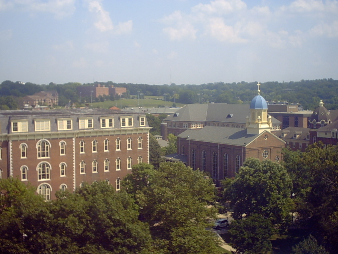
- Downtown Moraine from a Diamond, Nyttend, Public domain
- St. Mary's Hall, University of Dayton, Nyttend, Public domain
- St. Jacob's Evangelical Lutheran Church in Miamisburg, Nyttend, Public domain
- KellyFamilyHome, Photo by Greg Hume ( Greg5030 ), CC BY-SA 3.0
- RudolphPretzingerHouse, Greg5030, CC BY-SA 3.0
- Salem Bear Creek Church 2, Pjsham, CC BY-SA 3.0
- Dunbar Historic District, Nyttend, Public domain
- RubiconFarm, Greg5030 Photo by Greg Hume, CC BY-SA 3.0
- Wright Cycle Company Offices, Nyttend, Public domain
- Dunbar Home, Chris Light ( talk ), CC BY-SA 3.0
- Wright Flyer III at Carillon Park, Nyttend, Public domain
- Charles F. Kettering House, Nyttend, Public domain
- Dayton VA Medical Center, Veterans Health, Public domain
- Frazefountains, Coastermom, CC BY 3.0
- BaumOperaHouse, MarkDonna ( talk ), CC BY 3.0
- UniversityofDayton, Namtrofk, CC BY-SA 3.0
- Deeds Carillon Dayton Ohio, Csnoke, CC BY 3.0
- SunWatchVillage, Andrew Sawyer a.k.a. Asawyer sunwatch ., Public domain
- Spiranthes magnicamporum ohio, Allefant, CC BY-SA 4.0
- Spiranthes magnicamporum closeup, Allefant, CC BY-SA 4.0
- Spiranthes ovalis erostellata closeup, Allefant, CC BY-SA 4.0
- Spiranthes ovalis erostellata closeup (cropped), Allefant, CC BY-SA 4.0
- Spiranthes ovalis erostellata, Allefant, CC BY-SA 4.0
- Schuter Carpenter Shop and House 3, Pjsham, CC BY-SA 3.0
- Schuter Carpenter Shop and House 1, Pjsham, CC BY-SA 3.0
- Schuter Carpenter Shop and House 4, Pjsham, CC BY-SA 3.0
- Schuter Carpenter Shop and House 2, Pjsham, CC BY-SA 3.0
- Rose Lavelle - Playing for the Dayton Dutch Lions WPSL team (48196673776), Curt Cosenza, CC BY 2.0
- Rose Lavelle - Playing for the Dayton Dutch Lions WPSL team (48196673561), Curt Cosenza, CC BY 2.0
- Rose Lavelle - Playing for the Dayton Dutch Lions WPSL team (48196674116), Curt Cosenza, CC BY 2.0
- Rose Lavelle - Playing for the Dayton Dutch Lions WPSL team (48196725987), Curt Cosenza, CC BY 2.0
- Rose Lavelle - Playing for the Dayton Dutch Lions WPSL team (48196727807), Curt Cosenza, CC BY 2.0
- Rose Lavelle - Playing for the Dayton Dutch Lions WPSL team (48196728422), Curt Cosenza, CC BY 2.0
- Rose Lavelle - Playing for the Dayton Dutch Lions WPSL team (48196677036), Curt Cosenza, CC BY 2.0
- Rose Lavelle - Playing for the Dayton Dutch Lions WPSL team (48196675436), Curt Cosenza, CC BY 2.0
- Rose Lavelle - Playing for the Dayton Dutch Lions WPSL team (48196728147), Curt Cosenza, CC BY 2.0
- Rose Lavelle - Playing for the Dayton Dutch Lions WPSL team (48196678431), Curt Cosenza, CC BY 2.0
- Rose Lavelle - Playing for the Dayton Dutch Lions WPSL team (48196717942), Curt Cosenza, CC BY 2.0
- Rose Lavelle - Playing for the Dayton Dutch Lions WPSL team (48196725017), Curt Cosenza, CC BY 2.0
- Rose Lavelle - Playing for the Dayton Dutch Lions WPSL team (48196724532), Curt Cosenza, CC BY 2.0


Page built October 30, 2026. Spotted a mistake? Tell us or suggest a place.