


Why visit Munising
Townapedia lists 8 museums and landmarks, 9 parks and trails, 18 places to eat, 3 places to stay and 11 attractions in and around town.
Highlights include Grand Island Harbor Rear Range Light, Memorial Falls, Grand Island East Channel Light and Lobb House.
July is the warmest month, with average highs of 75°F; February lows average 12°F.
Weather in Munising
Forecast from the National Weather Service. Full forecast
About Munising
Munising is a city in the Upper Peninsula of the U.S. state of Michigan. It is the county seat of Alger County. The population was 1,986 at the 2020 census. The city is partially surrounded by Munising Township, but the two are administered autonomously.
From the Wikipedia article Munising, Michigan (this version), under CC BY-SA 4.0.
Things to do11

Grand Island Harbor Rear Range Light
Lighthouse · National Register of Historic Places · 3.4 mi
Lighthouse in Michigan, United States

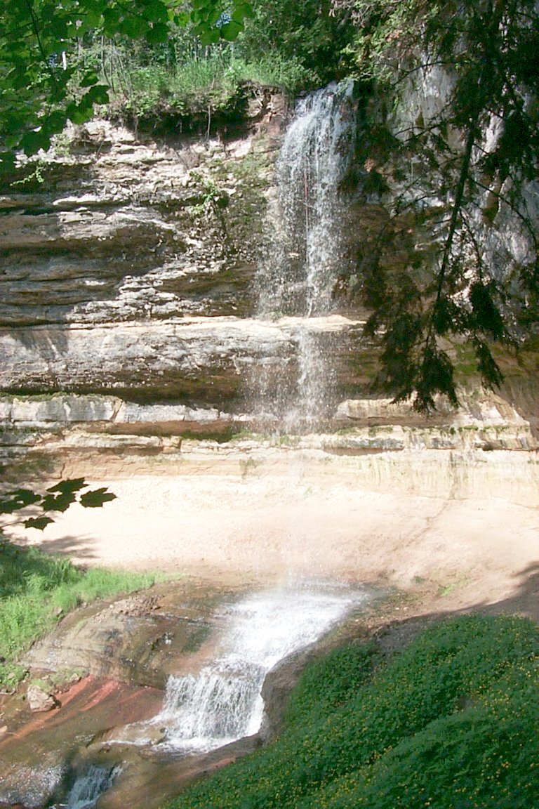




Munising Rear Range Light
Lighthouse · 2.5 mi
Lighthouse in Michigan, United States

Tannery Falls
Waterfall · 1.1 mi
Waterfall in Michigan, United States


Museums and landmarks8

Grand Island East Channel Light
Monument and historic site · National Register of Historic Places · 1.8 mi
Lighthouse in Michigan, United States

Lobb House
Monument and historic site · National Register of Historic Places · 2.3 mi
Historic house in Michigan, United States

Schoolcraft Furnace Site
Monument and historic site · National Register of Historic Places · 0.5 mi
Archaeological site in Michigan, United States


Pictured Rocks National Lakeshore Headquarters
Monument and historic site · 1.6 mi
N8391 Sand Point Road, Munising
Parks, trails and playgrounds9






Restaurants and cafes18

Falling Rock Café and Bookstore
Cafe · Ice Cream, Coffee Shop · 2.2 mi
104 East Munising Avenue
Su-Tu, Th-Fr 08:00-15:00; Sa 08:00-16:00

Eh! Burger
Restaurant · Burger, Sandwich · 2.1 mi
101 East Munising Avenue, Munising
Mo-Su 11:00-20:00
Camper's Grinds Coffee & Ice Cream
Cafe · Coffee Shop, Ice Cream · 2.2 mi
07:00-20:00


6 more on the map.
History
The area encompassing Munising has been inhabited for thousands of years by the Ojibwe and Noquet, who used the low lying grasslands opposite Grand Island to harvest blueberries and other crops. The name for the city comes from the Ojibwe word minisiing, meaning "at the island". A post office was established as the Munising post office on December 22, 1868. It was renamed as Gogarnville on October 23, 1889, when Julius Gogarn was appointed as postmaster. The office was moved to his farm. He was a German-born American Civil War veteran and first Supervisor of Munising Township. That post office continued until July 15, 1893.
From the History section of Munising, Michigan on Wikipedia, under CC BY-SA 4.0.
Where to stay3
Churches and places of worship3
Shopping2
Gas and EV charging3
Schools, colleges and libraries5
Alger Maximum Correctional Facility
School · 3.7 mi
600 Industrial Park Dr, Munising
Healthcare2
Map of Munising
64 places. The map loads OpenStreetMap tiles when you open it.
Climate by month
Monthly table
| Month | High | Low | Rain |
|---|---|---|---|
| Jan | 26°F | 13°F | 2.0 in |
| Feb | 28°F | 12°F | 1.4 in |
| Mar | 36°F | 20°F | 1.4 in |
| Apr | 46°F | 29°F | 2.3 in |
| May | 59°F | 39°F | 2.8 in |
| Jun | 68°F | 48°F | 2.8 in |
| Jul | 75°F | 55°F | 3.1 in |
| Aug | 74°F | 55°F | 2.7 in |
| Sep | 67°F | 49°F | 3.9 in |
| Oct | 55°F | 39°F | 4.1 in |
| Nov | 42°F | 29°F | 3.1 in |
| Dec | 32°F | 19°F | 2.2 in |
U.S. Climate Normals 1991-2020 for Munsing Lakeshore (2 mi away), NOAA NCEI.
People and cost of living
American Community Survey 5-year estimates, 2020-2024, U.S. Census Bureau. Estimates have margins of error, larger for small towns.
Disaster history
Alger County has had 3 federal disaster declarations since 2000, most often for biologicals.
- 2020-03-27: Covid-19 Pandemic (Biological)
- 2020-03-13: Covid-19 (Biological)
- 2005-09-07: Hurricane Katrina Evacuation (Hurricane)
OpenFEMA disaster declarations summaries.
Getting there and nearby towns
Marquette Sawyer Regional Airport (MQT) is the nearest airport with scheduled flights listed in OpenStreetMap, 37 miles away.
- Harvey 35 mi west, about 57 min by car
- K. I. Sawyer 36 mi west, about 58 min by car
- Manistique 37 mi southeast, about 1 h by car
- Marquette 38 mi west, about 1 h by car
- Gwinn 40 mi west, about 1 h by car
- Trowbridge Park 40 mi west, about 1 h by car
- Gladstone 45 mi southwest, about 1 h 15 min by car
- Negaunee 46 mi west, about 1 h 15 min by car
- Ishpeming 50 mi west, about 1 h 15 min by car
- Escanaba 52 mi southwest, about 1 h 30 min by car
Drive times are estimates from straight-line distance, not routes.
Local news
Headlines from INDB, the NEMICO news database.
Reviews, tips and questions
Loading what members have shared...
Sources and licences
- NCES EDGE (Public domain): public schools
- NOAA NCEI U.S. Climate Normals 1991-2020 (Public domain): climate by month
- OpenFEMA (Public domain): disaster declarations
- OpenStreetMap contributors (ODbL 1.0): places, airports, map data
- U.S. Census Bureau (Public domain): population, income, housing, education, commute
- Wikidata (CC0 1.0): elevation, founding date, time zone, website, landmarks and historic places
- Wikimedia Commons (see each image): photos
- Wikipedia (CC BY-SA 4.0): overview and history text
Photo credits
- Munising, Michigan (02 August 2016), Notorious4life ( talk ) ( Uploads ), CC0
- Grand Island East Channel Lighthouse 2009, Drdpw, CC BY-SA 3.0
- SchoolcraftFurnace-MunisingMI3, Andrew Jameson, CC BY-SA 3.0
- Grand Island Harbor Rear Range Light 2009, Andrew Jameson, CC BY-SA 3.0
- Lobb House Munising MI 2009, Andrew Jameson, CC BY-SA 3.0
- Munising Front Range Light, Charles W. Bash, CC BY-SA 4.0
- Memorial Falls 2, Joel Dykstra, CC BY-SA 3.0
- Munising Falls, NMMIMAJ, CC BY-SA 3.0
- Tannery Falls 5, NMMIMAJ, CC BY-SA 3.0
- Alger Falls 6, NMMIMAJ, CC BY-SA 3.0
- Munising Rear Range Light, Charles W. Bash, CC BY-SA 4.0
- Wagner Falls, Two Hearted River, CC BY-SA 3.0
Page built October 30, 2026. Spotted a mistake? Tell us or suggest a place.