


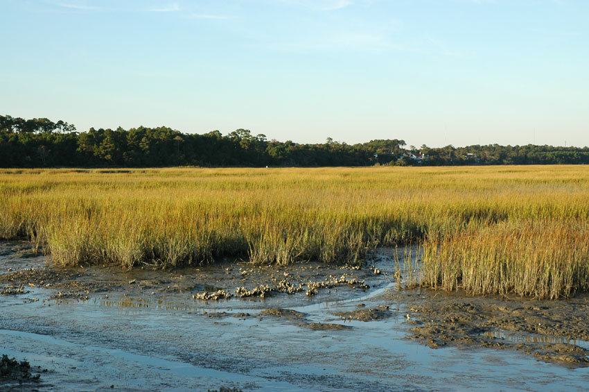

Murrells Inlet, South Carolina
Murrells Inlet is a community of 10,044 people in Georgetown County, South Carolina.
Why visit Murrells Inlet
Townapedia lists 4 museums and landmarks, 11 parks and trails, 64 places to eat and 4 places to stay in and around town.
Highlights include Atalaya Castle, Murrells Inlet Historic District, Brookgreen Gardens and TPC of Myrtle Beach.
July is the warmest month, with average highs of 88°F; January lows average 37°F.
Weather in Murrells Inlet
Forecast from the National Weather Service. Full forecast
About Murrells Inlet
Murrells Inlet is an unincorporated area and census-designated place in Georgetown County, South Carolina, United States. The population was 7,547 at the 2010 census. It is about 13 miles south of Myrtle Beach, South Carolina and 21 miles north of Georgetown, the county seat.
From the Wikipedia article Murrells Inlet, South Carolina (this version), under CC BY-SA 4.0.
Museums and landmarks4
Atalaya Castle
Monument and historic site · National Register of Historic Places · 3.4 mi
Historic house in South Carolina, United States

Murrells Inlet Historic District
Monument and historic site · National Register of Historic Places · 2.1 mi
Historic district in South Carolina, United States
Huntington Beach State Park
Museum · 3.0 mi
State park in South Carolina, United States
Parks, trails and playgrounds11

Brookgreen Gardens
Park · National Register of Historic Places · 3.5 mi
Park in Georgetown County, South Carolina, United States of America


Restaurants and cafes64

Lucky Panda
Restaurant · 2.1 mi
11911 Highway 707, Murrell's Inlet
Mo off; Tu-Sa 11:00-20:50; Su 11:55-20:50

Blue Elephant
Restaurant · Thai · 1.0 mi
4493 US 17 Business, Murrells Inlet
Mo-Fr 17:00-20:00

52 more on the map.
Where to stay4

History
The land around Murrells Inlet has a record of human settlement that goes back thousands of years, before written history. Shell mounds and archeological findings from the Atlantic Ocean to the Waccamaw River document the cultures of indigenous peoples who lived in this area. At the time of European encounter, the inhabitants included the historic Waccamaw people, who took advantage of the natural resources provided by the creeks and rivers. Wachesaw is loosely translated as "Place of Great Weeping", in reference to the burial grounds. Indian burial mounds have been found along the high bluffs at Wachesaw that contained European beads, urns and other artifacts.
The recorded history of the area begins with English colonial settlements and the land grants made by the Lords Proprietors. To encourage development of the colony of South Carolina, they granted large portions of the Waccamaw Neck to men who were willing to transport workers here and settle the land. These estates stretched from the Atlantic Ocean to the Waccamaw River. The baronies were typically tens of thousands of acres that were subdivided into long narrow plantations that ranged from 500 to 1,500 acres (200 to 610 ha).
From the History section of Murrells Inlet, South Carolina on Wikipedia, under CC BY-SA 4.0.
Churches and places of worship8
Shopping16
Gas and EV charging8
Schools, colleges and libraries6
Healthcare4
Map of Murrells Inlet
125 places. The map loads OpenStreetMap tiles when you open it.
Climate by month
Monthly table
| Month | High | Low | Rain |
|---|---|---|---|
| Jan | 57°F | 37°F | 3.7 in |
| Feb | 59°F | 39°F | 3.4 in |
| Mar | 66°F | 44°F | 4.0 in |
| Apr | 74°F | 52°F | 3.5 in |
| May | 80°F | 61°F | 3.8 in |
| Jun | 86°F | 68°F | 4.9 in |
| Jul | 88°F | 72°F | 6.0 in |
| Aug | 87°F | 71°F | 6.1 in |
| Sep | 83°F | 66°F | 7.0 in |
| Oct | 76°F | 56°F | 5.1 in |
| Nov | 66°F | 45°F | 3.0 in |
| Dec | 59°F | 39°F | 4.6 in |
U.S. Climate Normals 1991-2020 for Brookgreen Gardens (3 mi away), NOAA NCEI.
People and cost of living
American Community Survey 5-year estimates, 2020-2024, U.S. Census Bureau. Estimates have margins of error, larger for small towns.
Disaster history
Georgetown County has had 26 federal disaster declarations since 2000, most often for hurricanes.
- 2026-01-23: Severe Winter Storm (Winter Storm)
- 2024-09-29: Tropical Storm Debby (Tropical Storm)
- 2024-09-26: Hurricane Helene (Tropical Storm)
- 2024-08-05: Hurricane Debby (Tropical Storm)
- 2023-08-31: Hurricane Idalia (Hurricane)
- 2022-11-21: Hurricane Ian (Hurricane)
OpenFEMA disaster declarations summaries.
Getting there and nearby towns
Myrtle Beach International Airport (MYR) is the nearest airport with scheduled flights listed in OpenStreetMap, 11 miles away.
- Garden City 4 mi northeast, about 6 min by car
- Surfside Beach 6 mi northeast, about 9 min by car
- Litchfield Beach 7 mi southwest, about 11 min by car
- Bucksport 8 mi northwest, about 14 min by car
- Socastee 9 mi north, about 15 min by car
- Forestbrook 13 mi northeast, about 20 min by car
- Myrtle Beach 14 mi northeast, about 23 min by car
- Red Hill 15 mi north, about 25 min by car
- North Myrtle Beach 27 mi northeast, about 44 min by car
- Little River 33 mi northeast, about 53 min by car
Drive times are estimates from straight-line distance, not routes.
Local news
Headlines from INDB, the NEMICO news database.
Reviews, tips and questions
Loading what members have shared...
Sources and licences
- NCES EDGE (Public domain): public schools
- NOAA NCEI U.S. Climate Normals 1991-2020 (Public domain): climate by month
- OpenFEMA (Public domain): disaster declarations
- OpenStreetMap contributors (ODbL 1.0): places, airports, map data
- U.S. Census Bureau (Public domain): population, income, housing, education, commute
- Wikidata (CC0 1.0): elevation, founding date, time zone, website, landmarks and historic places
- Wikimedia Commons (see each image): photos
- Wikipedia (CC BY-SA 4.0): overview and history text
Photo credits
- Murrells inlet2473, Pollinator, CC BY-SA 3.0
- Sunnyside - Murrells Inlet Historic District, Upstateherd, CC BY-SA 4.0
- Myrtle Beach Clouds @ Murrells Inlet, Cprintz20, CC BY-SA 4.0
- Myrtle Beach Night @ Murrells Inlet, Cprintz20, CC BY-SA 4.0
- Atalaya5, The original uploader was Rono359 at English Wikipedia ., Public domain
- Huntington beach state park salt marsh, Original uploader was Pendragon1998 at en.wikipedia, Public domain
- Coastal Carolina Nightlife (Unsplash), Chris Herath cherath14, CC0
- Parrish's Motor Court, Upstateherd, CC BY-SA 4.0
- Atrina rigida 343956177, Alan Weakley, CC0
- Atrina rigida 151619013, kirk gardner, CC BY 4.0
- Atrina rigida 343956618, Alan Weakley, CC0
- Atrina rigida 343956676, Alan Weakley, CC0
- Atrina seminuda 158700325, Melanie Gaddy, CC0
- Atrina seminuda 158700300, Melanie Gaddy, CC0


Page built October 30, 2026. Spotted a mistake? Tell us or suggest a place.