
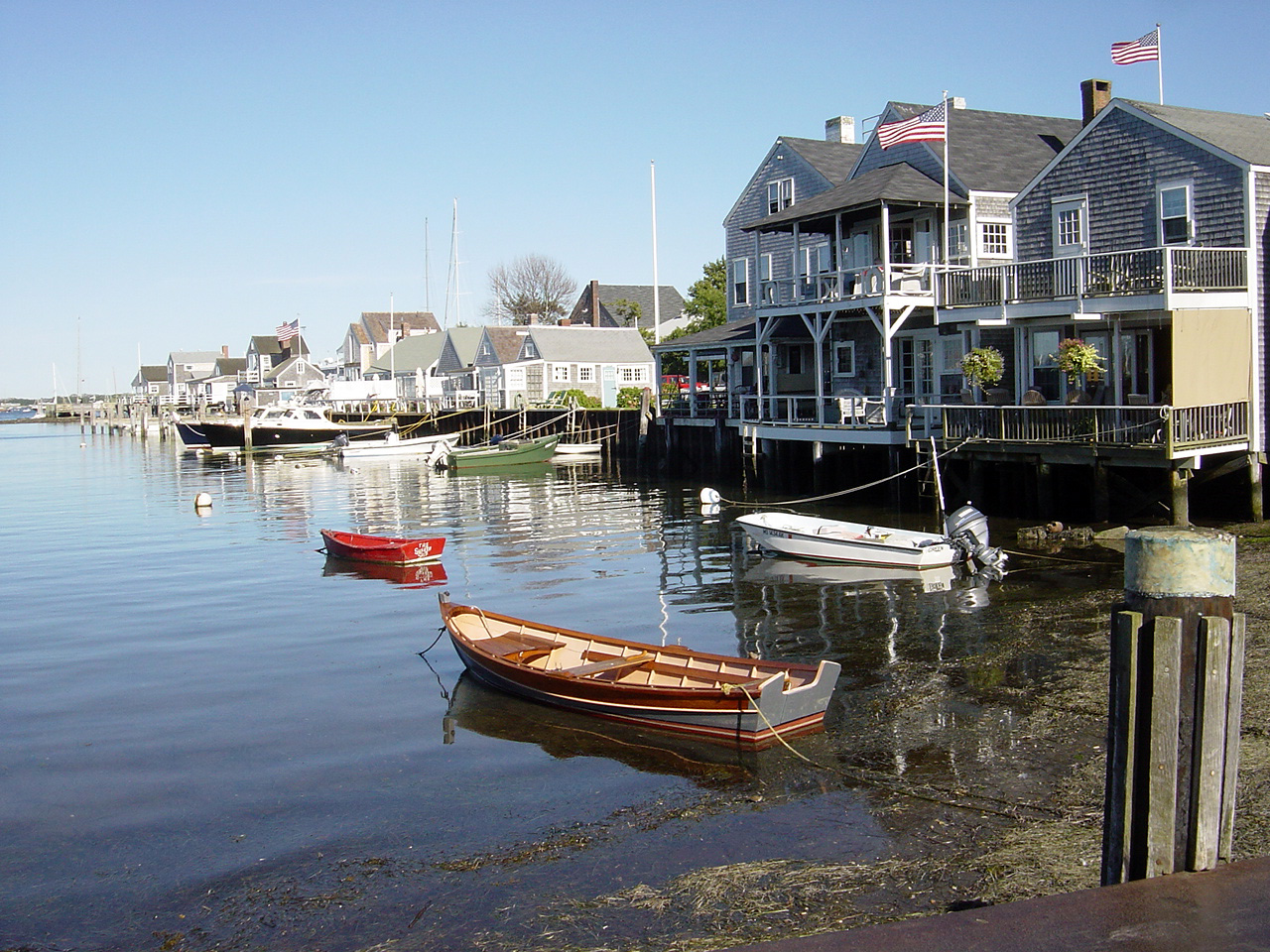


Nantucket, Massachusetts
Nantucket is a community of 10,017 people in Nantucket County, Massachusetts.
Why visit Nantucket
Townapedia lists 32 museums and landmarks, 59 parks and trails, 26 places to eat, 4 places to stay and 9 attractions in and around town.
Highlights include Maria Mitchell Aquarium, Nantucket Beacon, Brant Point Light and Jethro Coffin House.
August is the warmest month, with average highs of 76°F; January lows average 27°F.
Weather in Nantucket
Forecast from the National Weather Service. Full forecast
About Nantucket
Nantucket is a census-designated place (CDP) in the town of Nantucket in Nantucket County, Massachusetts, United States. The population was 10,166 at the 2020 census.
From the Wikipedia article Nantucket (CDP), Massachusetts (this version), under CC BY-SA 4.0.
Things to do9

Maria Mitchell Aquarium
Zoo and aquarium · 0.7 mi
Zoo in Massachusetts, USA
28 Washington Street, Nantucket

Nantucket Beacon
Lighthouse · 1.2 mi
Lighthouse in Massachusetts, United States
Nantucket Cliff Range Lights
Lighthouse · 1.6 mi
Lighthouse in Massachusetts, United States
Nantucket Harbor Range Lights
Lighthouse · 1.2 mi
Lighthouse in Massachusetts, United States


Museums and landmarks32

Brant Point Light
Lighthouse · National Register of Historic Places · 1.3 mi
Active lighthouse in Massachusetts, United States

Jethro Coffin House
Monument and historic site · National Register of Historic Places · 1.2 mi
Historic house in Massachusetts, United States
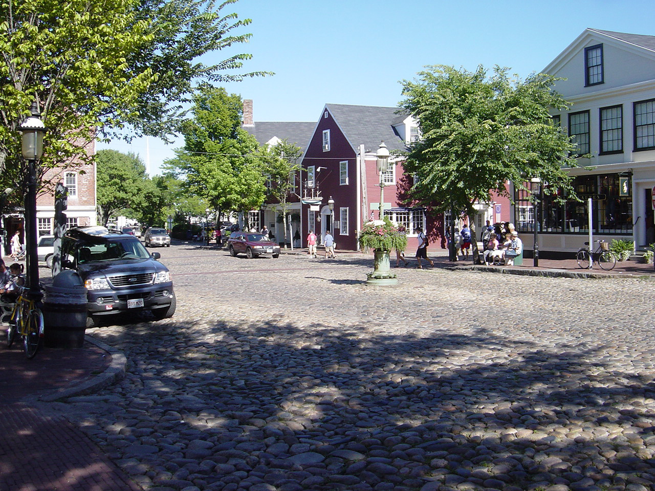
Nantucket Historic District
Monument and historic site · National Register of Historic Places · 0.8 mi
Historic district in Massachusetts, United States

The Old Mill
Monument and historic site · 0.5 mi
50 Prospect Street, Nantucket
Nantucket Lightship Basket Museum
Museum · 0.5 mi
Museum in Nantucket
20 more on the map.
Parks, trails and playgrounds59


Coskata-Coatue Wildlife Refuge
Park · 2.3 mi
Nature preserve in Massachusetts, U.S




Lost Farm Wildlife Sanctuary
Hiking and trails · 2.0 mi
Hummock Pond Road, Nantucket
sunrise-sunset

47 more on the map.
Restaurants and cafes26

Wicked Island Bakery
Cafe · Coffee Shop
7 Bayberry Court, Nantucket
Mo-Fri 06:00-12:00, Sa-Su 07:00-12:00



Brotherhood of Thieves
Restaurant · 1.0 mi
23 Broad Street, Nantucket
Mo-Su 11:30-23:00
Nantucket Wine & Spirits
Brewery and winery
31 Sparks Avenue
Mo-Sa 08:00-22:00; Su 10:00-22:00

14 more on the map.
Where to stay4
Churches and places of worship11
First Congregational Church
Church · Congregational · 1.1 mi
62 Centre Street, Nantucket
Nantucket United Methodist Church
Church · Methodist · 0.8 mi
2 Centre Street, Nantucket
Kingdom Hall of Jehovahs Witnesses
Church · Jehovahs Witness · 0.8 mi
43 Milk Street, Nantucket
Saint Marys Our Lady of the Isle Roman Catholic Church
Church · Catholic · 0.9 mi
3 Federal Street, Nantucket
Saint Pauls Episcopal Church
Church · Episcopal · 0.7 mi
16 Fair Street, Nantucket
Shopping4
Schools, colleges and libraries12
Healthcare1
Map of Nantucket
158 places. The map loads OpenStreetMap tiles when you open it.
Climate by month
Monthly table
| Month | High | Low | Rain |
|---|---|---|---|
| Jan | 40°F | 27°F | 3.2 in |
| Feb | 40°F | 27°F | 2.8 in |
| Mar | 44°F | 32°F | 3.8 in |
| Apr | 52°F | 39°F | 3.6 in |
| May | 61°F | 47°F | 3.0 in |
| Jun | 69°F | 56°F | 3.0 in |
| Jul | 75°F | 63°F | 2.7 in |
| Aug | 76°F | 62°F | 3.0 in |
| Sep | 70°F | 57°F | 3.6 in |
| Oct | 62°F | 49°F | 4.4 in |
| Nov | 53°F | 40°F | 3.8 in |
| Dec | 45°F | 32°F | 3.9 in |
U.S. Climate Normals 1991-2020 for Nantucket Mem Ap (2 mi away), NOAA NCEI.
People and cost of living
American Community Survey 5-year estimates, 2020-2024, U.S. Census Bureau. Estimates have margins of error, larger for small towns.
Disaster history
Nantucket County has had 13 federal disaster declarations since 2000, most often for hurricanes.
- 2023-09-15: Hurricane Lee (Hurricane)
- 2020-03-27: Covid-19 Pandemic (Biological)
- 2020-03-13: Covid-19 (Biological)
- 2018-06-25: Severe Winter Storm And Flooding (Severe Storm)
- 2015-04-13: Severe Winter Storm, Snowstorm, And Flooding (Severe Storm)
- 2013-04-19: Severe Winter Storm, Snowstorm, And Flooding (Severe Storm)
OpenFEMA disaster declarations summaries.
Getting there and nearby towns
Nantucket Memorial Airport (ACK) is the nearest airport with scheduled flights listed in OpenStreetMap, 2 miles away.
- Madaket 5 mi west, about 7 min by car
- Edgartown 23 mi west, about 38 min by car
- West Yarmouth 27 mi north, about 44 min by car
- Dennis Port 27 mi north, about 44 min by car
- South Yarmouth 28 mi north, about 45 min by car
- West Dennis 28 mi north, about 44 min by car
- Harwich Port 28 mi north, about 45 min by car
- Northwest Harwich 29 mi north, about 47 min by car
- Barnstable Town 30 mi northwest, about 48 min by car
- New Bedford 51 mi northwest, about 1 h 15 min by car
Drive times are estimates from straight-line distance, not routes.
Local news
Headlines from INDB, the NEMICO news database.
Reviews, tips and questions
Loading what members have shared...
Sources and licences
- NCES EDGE (Public domain): public schools
- NOAA NCEI U.S. Climate Normals 1991-2020 (Public domain): climate by month
- OpenFEMA (Public domain): disaster declarations
- OpenStreetMap contributors (ODbL 1.0): places, airports, map data
- U.S. Census Bureau (Public domain): population, income, housing, education, commute
- Wikidata (CC0 1.0): elevation, founding date, time zone, website, landmarks and historic places
- Wikimedia Commons (see each image): photos
- Wikipedia (CC BY-SA 4.0): overview and history text
Photo credits
- Nantucket-08-2004, The original uploader was Bobak at English Wikipedia ., CC BY-SA 2.5
- Old Mill Nantucket MA, Kenneth C. Zirkel, CC BY-SA 4.0
- The Old Mill Nantucket MA 2015, Kenneth C. Zirkel, CC BY-SA 4.0
- Greetings from Nantucket, Massachusetts - Large Letter Postcard (8618159885), Steve Shook from Moscow, Idaho, USA, CC BY 2.0
- Nantucket Railroad (46386500471), Trainiac from Australia, Public domain
- 2015 Nantucket MA Main Street view, Kenneth C. Zirkel, CC BY-SA 4.0
- QuakerMeetingHouseNantucket, DanielPenfield, CC BY-SA 4.0
- 97MainStreetNantucket, DanielPenfield, CC BY-SA 4.0
- 95MainStreetNantucket, DanielPenfield, CC BY-SA 4.0
- Peleg Cogeshall House. 1774 Nantucket Island, Bobkulin, CC BY-SA 4.0
- HadwenHouseObliqueNantucket, DanielPenfield, CC BY-SA 4.0
- 93MainStreetNantucket, DanielPenfield, CC BY-SA 4.0
- ThreeBricksNantucket, DanielPenfield, CC BY-SA 4.0
- HadwenHouseFrontNantucket, DanielPenfield, CC BY-SA 4.0
- Second Congregational Meeting House Nantucket, Kenneth C. Zirkel, CC BY-SA 4.0
- Plaque, Capt Pollard house (Moby Dick), Nantucket, Massachusetts, Le grand Cricri, CC BY-SA 3.0
- Nantucket Wharf by Don Ramey Logan, Don Ramey Logan, CC BY-SA 4.0
- CoffinSchoolNantucket, DanielPenfield, CC BY-SA 4.0
- Nantucket Main Street July 2018, Mrynes, CC BY-SA 4.0
- PacificClubNantucket, DanielPenfield, CC BY-SA 4.0
- Wannacomet Water Company marker, Nantucket, MA, USA, Le grand Cricri, CC BY-SA 3.0
- 20180524 - 15 - Nantucket, MA, Andre Carrotflower, CC BY-SA 4.0
- Nantuckett school bus, Richard Taylor, CC BY 2.0
- Brant Point Light, oblique, Denimadept, CC BY-SA 3.0
- Sum04-118, The original uploader was Bobak at English Wikipedia ., CC BY-SA 2.5
- Maria Mitchell Aquarium Exterior, Neddy1234, CC BY-SA 3.0
- Great Point Light, Denimadept, CC BY-SA 3.0
- "i'ma here" - panoramio, Henry P. Gray, CC BY-SA 3.0
- Damage on Hydrangea macrophylla in New England - 51565655281, m.borden, CC BY-SA 2.0
- Damage on Hydrangea macrophylla in New England, m.borden, CC BY-SA 2.0
- Damage on Hydrangea macrophylla in New England - 51566345434, m.borden, CC BY-SA 2.0
- Steps to the mill - panoramio, Henry P. Gray, CC BY-SA 3.0
- Wheel on the cobbles - panoramio, Henry P. Gray, CC BY-SA 3.0
- Chaetopsis apicalis, Teá Montagna, CC BY 4.0
- Prokelisia dolus, Teá Montagna, CC BY 4.0
- Longfinnedsquidmma, Neddy1234, CC BY-SA 3.0
- Mmaaquarium, Neddy1234, CC BY-SA 3.0
- Butterflyfishmma, Neddy1234, CC BY-SA 3.0
- FrilledAnemone, Neddy1234, CC BY-SA 3.0
- Lydia S. Hinchman House, McNugget240, CC0


Page built October 30, 2026. Spotted a mistake? Tell us or suggest a place.