


North Conway, New Hampshire
North Conway is a community of 2,041 people in Carroll County, New Hampshire.
Why visit North Conway
Townapedia lists 16 museums and landmarks, 20 parks and trails, 55 places to eat, 24 places to stay and 13 attractions in and around town.
Highlights include Mountain Valley Mall Cinema, Cranmore Mountain Resort, Eastern Slope Inn and New England Ski Museum.
July is the warmest month, with average highs of 81°F; January lows average 10°F, and about 84 inches of snow fall in a normal year.
Weather in North Conway
Forecast from the National Weather Service. Full forecast
About North Conway
North Conway is a census-designated place (CDP) and village in eastern Carroll County, New Hampshire, United States. The population was 2,116 at the 2020 census. A year-round resort area, North Conway is the second-largest village within the town of Conway, after the village of Conway proper. North Conway maintains its own fire station, post office and public library, sharing its other services with Conway.
From the Wikipedia article North Conway, New Hampshire (this version), under CC BY-SA 4.0.
Things to do13


Cranmore Mountain Resort
Ski area · 1.5 mi
Ski area in New Hampshire, United States

Diana's Baths
Waterfall · 3.6 mi
Waterfalls in New Hampshire, United States
North Conway Twin Theater
Cinema and theater · 1.2 mi
2627 White Mountain Highway, North Conway


1 more on the map.
Museums and landmarks16

Eastern Slope Inn
Monument and historic site · National Register of Historic Places · 1.4 mi
Hotel in New Hampshire, United States of America
2760 White Mountain Highway

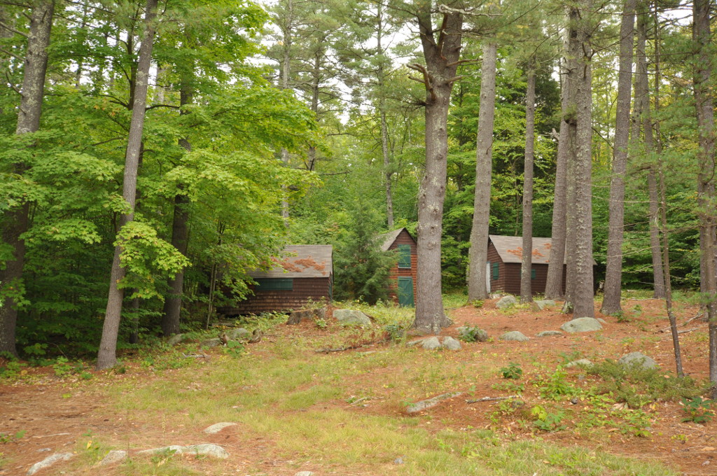
Abenaki Indian Shop and Camp
Monument and historic site · National Register of Historic Places · 2.8 mi
United States historic place

Conway Public Library
Monument and historic site · National Register of Historic Places · 3.9 mi
Public library in Conway, New Hampshire, USA

Majestic Theatre
Monument and historic site · National Register of Historic Places · 3.9 mi
Former movie theater in Conway, New Hampshire, United States

North Conway station
Monument and historic site · National Register of Historic Places · 1.2 mi
Railway station and adjacent rail yard in North Conway, New Hampshire

William K. Eastman House
Monument and historic site · National Register of Historic Places · 4.0 mi
Historic house museum in Conway, New Hampshire


North Conway 5 and 10 Cent Store
Monument and historic site · National Register of Historic Places · 1.3 mi

4 more on the map.
Parks, trails and playgrounds20





8 more on the map.
Restaurants and cafes55

Bangkok Cafe
Restaurant · Thai · 1.4 mi
2729 White Mountain Highway, North Conway
Mo-Su 11:30-21:30; Tu off; Fr,Sa 12:00-22:00

Beef & Ski Restaurant and Pub
Diner · American · 1.2 mi
2633 White Mountain Highway, North Conway
We-Su 11:30-20:00

Starbucks
Cafe · Coffee Shop · 1.1 mi
1456 White Mountain Highway, North Conway
Mo-Th 06:00-21:00, Fr-Su 06:00-22:00
Black Cap Grille
Diner · American · 1.2 mi
1498 White Mountain Highway, North Conway
43 more on the map.
History
Chartered in 1765 by colonial Governor Benning Wentworth, the town is named for Henry Seymour Conway, ambitious son of a prominent English family, who was elected to the House of Commons at age 20, fought at Culloden, and became Secretary of State. Early settlers called the area Pequawket (known colloquially as "Pigwacket"), adopting the name of the Abenaki Indian village which stretched down the Saco River to its stockaded center at Fryeburg, Maine.
North Conway is in the White Mountains, with Mount Washington to the northwest. The rugged terrain became popular in the 19th century with artists. Their paintings were known collectively as White Mountain art, which in turn attracted tourists to the area, particularly after the Portsmouth, Great Falls & Conway Railroad extended service in 1872 to North Conway. In 1874, the line built a Second Empire depot, designed by Nathaniel J. Bradlee. In 1932, "snow trains" began carrying enthusiasts to "the birthplace of American skiing", as North Conway is known.
From the History section of North Conway, New Hampshire on Wikipedia, under CC BY-SA 4.0.
Where to stay24
Cranmore Mountain Lodge
Motel and hotel · 2.4 mi
859 Kearsarge Road, North Conway
Churches and places of worship4
First Baptist Church
Church · Baptist · 1.1 mi
2905 White Mountain Highway, North Conway
Shopping24
North Conway 5¢ and 10¢ Store
Shop · 1.3 mi
2683 White Mountain Highway, North Conway
Gas and EV charging7
Schools, colleges and libraries10
Northeast Woodland Chartered Public School
School · 3.0 mi
53 Technology Lane, Conway
Healthcare3
Map of North Conway
176 places. The map loads OpenStreetMap tiles when you open it.
Climate by month
Monthly table
| Month | High | Low | Rain | Snow |
|---|---|---|---|---|
| Jan | 30°F | 10°F | 3.6 in | 20.1 in |
| Feb | 33°F | 11°F | 3.2 in | 21.8 in |
| Mar | 42°F | 20°F | 3.7 in | 15.9 in |
| Apr | 55°F | 31°F | 4.4 in | 4.5 in |
| May | 68°F | 43°F | 3.7 in | 0.0 in |
| Jun | 76°F | 53°F | 4.5 in | 0.0 in |
| Jul | 81°F | 58°F | 4.5 in | 0.0 in |
| Aug | 80°F | 56°F | 4.4 in | 0.0 in |
| Sep | 72°F | 48°F | 3.7 in | 0.0 in |
| Oct | 59°F | 37°F | 5.5 in | 0.3 in |
| Nov | 46°F | 27°F | 4.5 in | 4.5 in |
| Dec | 36°F | 18°F | 4.5 in | 16.9 in |
U.S. Climate Normals 1991-2020 for N Conway (2 mi away), NOAA NCEI.
People and cost of living
American Community Survey 5-year estimates, 2020-2024, U.S. Census Bureau. Estimates have margins of error, larger for small towns.
Disaster history
Carroll County has had 27 federal disaster declarations since 2000, most often for severe storms.
- 2026-10-07: Severe Storm And Flooding (Severe Storm)
- 2024-07-10: Severe Winter Storm And Flooding (Winter Storm)
- 2024-02-27: Severe Storm And Flooding (Severe Storm)
- 2023-09-14: Severe Storms And Flooding (Flood)
- 2023-03-15: Severe Storm And Flooding (Severe Storm)
- 2020-04-03: Covid-19 Pandemic (Biological)
OpenFEMA disaster declarations summaries.
Getting there and nearby towns
Eastern Slopes Regional Airport (FRY) is the nearest airport with scheduled flights listed in OpenStreetMap, 9 miles away.
- Conway 3 mi south, about 5 min by car
- Fryeburg 7 mi east, about 12 min by car
- Bridgton 20 mi east, about 32 min by car
- Cornish 23 mi southeast, about 37 min by car
- Gorham 25 mi north, about 40 min by car
- Steep Falls 30 mi southeast, about 49 min by car
- Oxford 30 mi east, about 49 min by car
- Norway 31 mi northeast, about 49 min by car
- Berlin 32 mi north, about 51 min by car
- Lake Arrowhead 32 mi southeast, about 51 min by car
Drive times are estimates from straight-line distance, not routes.
Local news
Headlines from INDB, the NEMICO news database.
Reviews, tips and questions
Loading what members have shared...
Sources and licences
- NCES EDGE (Public domain): public schools
- NOAA NCEI U.S. Climate Normals 1991-2020 (Public domain): climate by month
- OpenFEMA (Public domain): disaster declarations
- OpenStreetMap contributors (ODbL 1.0): places, airports, map data
- U.S. Census Bureau (Public domain): population, income, housing, education, commute
- Wikidata (CC0 1.0): elevation, founding date, time zone, website, landmarks and historic places
- Wikimedia Commons (see each image): photos
- Wikipedia (CC BY-SA 4.0): overview and history text
Photo credits
- North Conway Main Street 5, AlexiusHoratius, CC BY-SA 3.0
- Conway Scenic Railroad Station in North Conway, New Hampshire, September 2010, David Brossard, CC BY-SA 2.0
- Marcello Building 2617 White Mountain Hwy North Conway NH May 2023, Artaxerxes, CC BY-SA 4.0
- North Conway Twin Theater Cafe Italia 2627 White Mountain Hwy North Conway NH May 2023, Artaxerxes, CC BY-SA 4.0
- Conway Scenic Railway, Norcross Circle, North Conway - panoramio, Bob Linsdell, CC BY 3.0
- Conway Scenic Railway, Norcross Circle, North Conway - panoramio (2), Bob Linsdell, CC BY 3.0
- North Conway Fire Department 70 Norcross Circle North Conway NH May 2023, Artaxerxes, CC BY-SA 4.0
- North Conway Station 38 Norcross Circle North Conway NH May 2023 02, Artaxerxes, CC BY-SA 4.0
- Conway Scenic Railroad 38 Norcross Circle North Conway NH May 2023, Artaxerxes, CC BY-SA 4.0
- North Conway Depot southeast corner, Pi.1415926535, CC BY-SA 3.0
- North Conway Depot side view, Pi.1415926535, CC BY-SA 3.0
- First Baptist Church 2655 White Mountain Hwy North Conway NH May 2023 02, Artaxerxes, CC BY-SA 4.0
- North Conway Scenic Railroad Station in New Hampshire - July 2016, Todd Fowler, CC BY-SA 2.0
- Conway Scenic Railway, Norcross Circle, North Conway (494313) (11925464286), Robert Linsdell from St. Andrews, Canada, CC BY 2.0
- North Conway Station 38 Norcross Circle North Conway NH May 2023, Artaxerxes, CC BY-SA 4.0
- Zeb's General Store 2675 White Mountain Hwy downtown North Conway NH May 2023, Artaxerxes, CC BY-SA 4.0
- North Conway Depot front view, Pi.1415926535, CC BY-SA 3.0
- Conway Scenic Railway, Norcross Circle, North Conway - panoramio (1), Bob Linsdell, CC BY 3.0
- White Mountain Hwy, North Conway (494311) (11924582555), Robert Linsdell from St. Andrews, Canada, CC BY 2.0
- First Baptist Church 2655 White Mountain Hwy North Conway NH October 2013, Bob Linsdell, CC BY 3.0
- Railroad turntable at the North Conway Scenic Railway Station, September 2010, David Brossard, CC BY-SA 2.0
- Eastern Slope Inn, Swampyank at English Wikipedia, CC BY-SA 3.0
- Conway Public Library NH112, Royalbroil, CC BY-SA 4.0
- ConwayNH AbenakiCamp2, Magicpiano, CC BY-SA 4.0
- ConwayScenic, Matthew Teal, taken by myself September 25th, 2004. Original uploader was Theletterm1973 at en.wikipedia, Public domain
- ConwayNH BolducBlock, User:Magicpiano, CC BY-SA 4.0
- 100 Main Street, Conway NH, John Phelan, CC BY-SA 3.0
- North Conway 5 and 10, Swampyank at English Wikipedia, CC BY-SA 3.0
- Cranmore Mountain Resort, Davidafranklin, CC BY-SA 4.0
- 2023 Employee Photo Contest (53366131407), usfs_Eastern_Region, Public domain
- CN Class O-18-a No 7470 (8063152521), Peter Broster, CC BY 2.0
- CN Class O-18-a No 7470 (8063157216), Peter Broster, CC BY 2.0
- CN Class O-18-a No 7470 (6979556447), Peter Broster, CC BY 2.0
- CN Class O-18-a No 7470 (8063157395), Peter Broster, CC BY 2.0
- Boston and Maine 4268 EMD F7 (8061873194), Peter Broster, CC BY 2.0
- Gov. Kelly Ayotte visiting Old Village Bakery August 18 2026, Bakerbike, CC BY-SA 4.0
- Conway Scenic locomotive 1751, Pi.1415926535, CC BY-SA 3.0
- Conway Scenic Railroad Coach - August 2011, rickpilot_2000, CC BY 2.0
- Conway Scenic Railroad - August 2011, rickpilot_2000, CC BY 2.0
- Locomotive 7470 - Conway Scenic Railroad, September 2010, David Brossard, CC BY-SA 2.0


Page built October 30, 2026. Spotted a mistake? Tell us or suggest a place.