


Norwood, Ohio
Norwood is a city of 19,114 people in Hamilton County, Ohio, founded in 1888.
Why visit Norwood
Townapedia lists 79 museums and landmarks, 40 parks and trails, 144 places to eat, 9 places to stay and 3 attractions in and around town.
Highlights include Cinemark Oakley Station, Cincinnati Zoo and Botanical Garden, Norwood Municipal Building and Withrow High School.
July is the warmest month, with average highs of 87°F; January lows average 24°F.
Weather in Norwood
Forecast from the National Weather Service. Full forecast
About Norwood
Norwood is a city in Hamilton County, Ohio, United States, and an enclave of Cincinnati. The population was 19,043 at the 2020 census, making it the third-most populous city in Hamilton County. Originally settled as an early suburb of Cincinnati in the wooded countryside north of the city, the area is characterized by older homes and tree-lined streets.
From the Wikipedia article Norwood, Ohio (this version), under CC BY-SA 4.0.
Things to do3


Cincinnati Zoo and Botanical Garden
Zoo and aquarium · 3.1 mi
Second oldest zoo in the United States
Museums and landmarks79

Norwood Municipal Building
Monument and historic site · National Register of Historic Places
Building in Ohio, United States
Withrow High School
Monument and historic site · National Register of Historic Places · 1.4 mi
High school in Cincinnati, Hamilton County, Ohio
2488 Madison Road, Cincinnati
20th Century Theatre
Monument and historic site · National Register of Historic Places · 1.3 mi
Events venue and former movie theater in Cincinnati, Ohio, United States
Allen Temple AME Church
Monument and historic site · National Register of Historic Places · 1.8 mi
Church in Ohio, USA
August Bepler House
Monument and historic site · National Register of Historic Places · 3.4 mi
House in Ohio, United States of America

Ayres L. Bramble House
Monument and historic site · National Register of Historic Places · 3.5 mi
Historic house in Ohio, United States
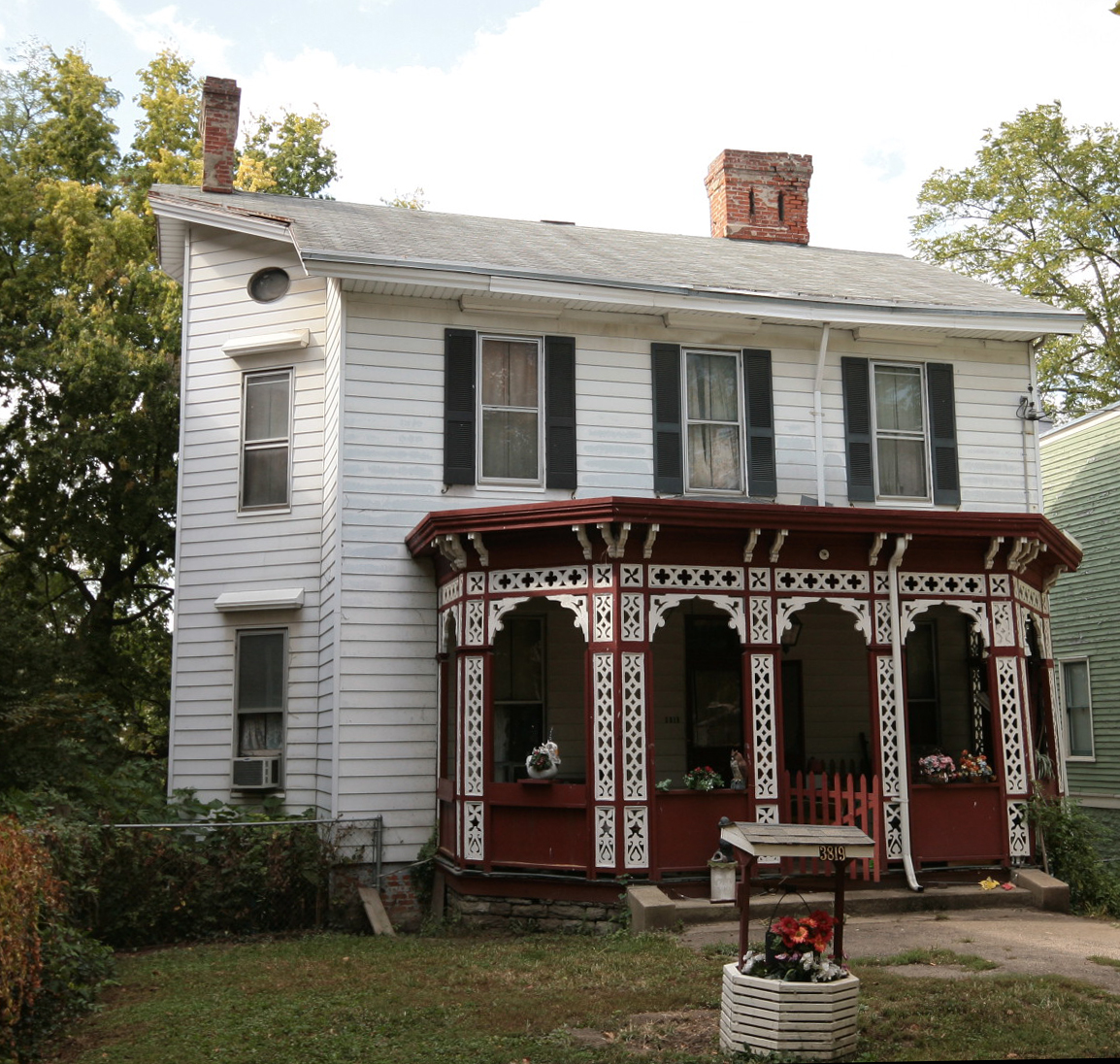
Bates Building
Monument and historic site · National Register of Historic Places · 3.5 mi
Building in Ohio, United States
Bauer Apartments
Monument and historic site · National Register of Historic Places · 2.0 mi
Building in Ohio, United States
Ben Pitman House
Monument and historic site · National Register of Historic Places · 3.1 mi
Historic house in Ohio, United States
Benham Mound
Monument and historic site · National Register of Historic Places · 2.8 mi
Archaeological site in Ohio, United States


Bernard H. Moormann House
Monument and historic site · National Register of Historic Places · 2.7 mi
Historic house in Ohio, United States
Bernheim House
Monument and historic site · National Register of Historic Places · 2.1 mi
Historic house in Ohio, United States
67 more on the map.
Parks, trails and playgrounds40


Bettman Preserve
Hiking and trails · 1.7 mi
Park in Ohio, United States of America
4 Beech Lane, Cincinnati
sunrise-sunset

French Park
Park · 3.1 mi
Public park in Amberley, Ohio, United States
28 more on the map.
Restaurants and cafes144

MadTree Brewing
Bar and pub · American, Pizza · 1.6 mi
Cincinnati craft brewery with a large taproom that serves beer, cider, non-alcoholic options alongside in-house made food.
3301 Madison Road, Cincinnati
Mo-Th 11:00-23:00; Fr 11:00-24:00; Sa 10:00-24:00; Su 10:00-23:00


Aglamesis Bro's
Ice cream · Ice Cream · 1.3 mi
3046 Madison Road, Cincinnati
Mo-Th 10:00-22:30; Fr-Sa 10:00-23:00; Su 12:00-22:30

Aladdin’s Eatery
Restaurant · Mediterranean, Lebanese · 1.3 mi
3664 Edwards Road, Cincinnati
Su-Th 11:00-21:00; Fr-Sa 11:00-22:00
Alfio’s Buon Cibo
Restaurant · Italian, Argentinian · 1.6 mi
2724 Erie Avenue, Cincinnati
Mo-Th 17:00-21:00; Fr 17:00-22:00; Sa 16:30-22:00
Arthur’s Cafe
Cafe · Burger, Wings, American, Sandwich · 1.5 mi
3515;3516 Edwards Road, Cincinnati
Mo-Su 11:00-24:00
Asiana Thai & Sushi
Restaurant · Thai, Sushi, Asian, Lunch · 0.9 mi
3922 Edwards Road, Cincinnati
Mo-Fr 11:00-14:30,17:00-21:30
Awakenings
Cafe · Coffee Shop, Wine, Tea · 1.6 mi
2734 Erie Avenue, Cincinnati
Mo-Th 06:30-21:00; Fr 06:30-23:00; Sa 07:30-23:00; Su 07:30-21:00
Baba India Restaurant
Restaurant · Indian · 1.4 mi
3120 Madison Road, Cincinnati
Mo-Sa 11:30-14:30,17:00-22:00; Su 12:00-21:00
Biggby Coffee
Cafe · Coffee Shop · 1.8 mi
4916 Barrow Avenue, Cincinnati
Mo-Sa 06:00-20:00; Su 07:00-20:00
Bonefish Grill
Restaurant · Seafood · 1.2 mi
2737 Madison Road, Cincinnati
Mo-Th 11:00-22:00; Fr-Sa 11:00-23:00; Su 11:00-21:00
Bravo
Restaurant · Italian · 0.9 mi
3825 Edwards Road, Cincinnati
Mo-Th 11:30-22:00; Fr-Sa 11:30-23:00; Su 10:00-21:00
132 more on the map.
Where to stay9
Churches and places of worship55
Winton Place Methodist Episcopal Church
Church · National Register of Historic Places · 3.5 mi
Christ the Savior-Holy Spirit Orthodox Church
Church · Orthodox · 0.4 mi
4285 Ashland Avenue, Cincinnati
Shopping20
Gas and EV charging13
Schools, colleges and libraries65
Healthcare8
Encompass Health Rehabilitation Hospital of Cincinnati at Norwood
Hospital · 0.6 mi
4953 Section Avenue, Cincinnati
CareFirst Urgent Care
Clinic and pharmacy · 1.7 mi
3802 Paxton Avenue, Cincinnati
Map of Norwood
250 places. The map loads OpenStreetMap tiles when you open it.
Climate by month
Monthly table
| Month | High | Low | Rain |
|---|---|---|---|
| Jan | 41°F | 24°F | 2.9 in |
| Feb | 45°F | 26°F | 2.8 in |
| Mar | 55°F | 33°F | 3.9 in |
| Apr | 67°F | 42°F | 4.4 in |
| May | 75°F | 53°F | 4.7 in |
| Jun | 83°F | 61°F | 4.6 in |
| Jul | 87°F | 65°F | 4.4 in |
| Aug | 86°F | 64°F | 3.4 in |
| Sep | 80°F | 56°F | 3.1 in |
| Oct | 68°F | 44°F | 3.0 in |
| Nov | 55°F | 34°F | 2.9 in |
| Dec | 45°F | 28°F | 3.3 in |
U.S. Climate Normals 1991-2020 for Cincinnati Lunken Ap (4 mi away), NOAA NCEI.
People and cost of living
American Community Survey 5-year estimates, 2020-2024, U.S. Census Bureau. Estimates have margins of error, larger for small towns.
Disaster history
Hamilton County has had 11 federal disaster declarations since 2000, most often for severe storms.
- 2026-10-02: Severe Storms, Straight-Line Winds, Tornadoes, Flooding, And Landslides (Flood)
- 2020-03-31: Covid-19 Pandemic (Biological)
- 2020-03-13: Covid-19 (Biological)
- 2018-04-17: Severe Storms, Landslides, And Mudslides (Flood)
- 2012-06-30: Severe Storms (Severe Storm)
- 2011-07-13: Severe Storms And Flooding (Severe Storm)
OpenFEMA disaster declarations summaries.
Getting there and nearby towns
Lunken Airport (LUK) is the nearest airport with scheduled flights listed in OpenStreetMap, 4 miles away.
- Cincinnati 3 mi southwest, about 5 min by car
- Reading 5 mi north, about 7 min by car
- Finneytown 5 mi northwest, about 8 min by car
- Blue Ash 7 mi northeast, about 11 min by car
- Monfort Heights 8 mi west, about 13 min by car
- Montgomery 8 mi northeast, about 14 min by car
- Sharonville 9 mi north, about 14 min by car
- White Oak 9 mi northwest, about 14 min by car
- Forestville 9 mi southeast, about 14 min by car
- Northbrook 9 mi northwest, about 14 min by car
Drive times are estimates from straight-line distance, not routes.
Local news
Headlines from INDB, the NEMICO news database.
Reviews, tips and questions
Loading what members have shared...
Sources and licences
- NCES EDGE (Public domain): public schools
- NOAA NCEI U.S. Climate Normals 1991-2020 (Public domain): climate by month
- OpenFEMA (Public domain): disaster declarations
- OpenStreetMap contributors (ODbL 1.0): places, airports, map data
- U.S. Census Bureau (Public domain): population, income, housing, education, commute
- Wikidata (CC0 1.0): elevation, founding date, time zone, website, landmarks and historic places
- Wikimedia Commons (see each image): photos
- Wikipedia (CC BY-SA 4.0): overview and history text
Photo credits
- Norwood Municipal Building in color, Nyttend, Public domain
- George Hoadley Jr. House, Nyttend, Public domain
- Observatory Historic District, Nyttend, Public domain
- Norwood ohio indian mound, Imokurnotok, Public domain
- Walter Field House, Nyttend, Public domain
- Peeble's Corner Historic District, Nyttend, Public domain
- Stephen A. Gerrard Mansion, Nyttend, Public domain
- Gilbert Row comprehensive from north, Nyttend, Public domain
- GruenWatch, Unknown author, CC BY 3.0
- MecklenburgGarden, Photo by Greg Hume ( Greg5030 ), CC BY 3.0
- Kestler Building site, Nyttend, Public domain
- Captain Stone House, Nyttend, Public domain
- Spencer Township Hall in Columbia-Tusculum, Nyttend, Public domain
- Eastwood Historic District, Nyttend, Public domain
- Houses on Sinton Avenue, Nyttend, Public domain
- Ayres L. Bramble House, Nyttend, Public domain
- Procter and Collier-Beau Brummell Building, Nyttend, Public domain
- Mardot Antique Shop site, Nyttend, Public domain
- Richard H. Mitchell House, Nyttend, Public domain
- La Tosca Flats front, Nyttend, Public domain
- Houston House in Columbia-Tusculum, Nyttend, Public domain
- JohnBakerHouse, Photo by Greg Hume ( Greg5030 ), CC BY 3.0
- Edgecliff site in Cincinnati, Nyttend, Public domain
- LuNeack House, Nyttend, Public domain
- CokeBottling, Photo by Greg Hume ( Greg5030 ), CC BY 3.0
- Frederick Lunkenheimer House, Nyttend, Public domain
- Former First Universalist Church in Cincinnati, Nyttend, Public domain
- HarrietBeecherStoweHouse, Photo by Greg Hume ( Greg5030 ), CC BY 3.0
- Mary A. Wolfe House, Nyttend, Public domain
- BatesBuilding, Photo by Greg Hume ( Greg5030 ), CC BY 3.0
- ProbascoFountain, Photo by Greg Hume ( Greg5030 ), CC BY-SA 3.0
- AlexandraApartments, Unknown author, CC BY 3.0
- Winton Place Methodist Episcopal Church front, Nyttend, Public domain
- MosesGoldsmithBuilding, Greg Hume Greg5030, CC BY-SA 3.0
- JohnUriLloydHouse, Greg5030 at English Wikipedia, CC BY 3.0
- Henry Probasco House, Nyttend, Public domain
- Bernard H. Moormann House, Nyttend, Public domain
- David and Mary May House, Nyttend, Public domain
- HamCo hearing 2017-09-27 - Crowd with FC Cincinnati supporters (25987374508), Hayden Schiff from Cincinnati, USA, CC BY 2.0
- HamCo hearing 2017-09-27 - Denise Driehaus, Todd Portune, Chris Monzel (39828403672), Hayden Schiff from Cincinnati, USA, CC BY 2.0


Page built October 30, 2026. Spotted a mistake? Tell us or suggest a place.