

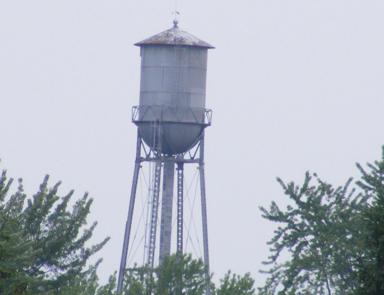


Oregon, Wisconsin
Oregon is a village of 11,547 people in Dane County, Wisconsin, founded in 1841.
Why visit Oregon
Townapedia lists 13 museums and landmarks, 20 parks and trails, 19 places to eat, 1 place to stay and 2 attractions in and around town.
Highlights include Oregon Farmers' Market, First National Bank, Fox Hall and Foxboro Golf Club.
July is the warmest month, with average highs of 82°F; January lows average 11°F.
Weather in Oregon
Forecast from the National Weather Service. Full forecast
About Oregon
Oregon is a village in Dane County, Wisconsin, United States. The population was 11,179 at the 2020 census. A suburb south of Madison, it is part of the Madison metropolitan area. The village is located mostly within the Town of Oregon.
From the Wikipedia article Oregon, Wisconsin (this version), under CC BY-SA 4.0.
Things to do2

Oregon Farmers' Market
Farm and orchard · 1.0 mi
131 West Richards Road, Oregon
Tu 14:00-18:00

Museums and landmarks13

First National Bank
Monument and historic site · National Register of Historic Places
Historic building in Oregon, Wisconsin, United States

Fox Hall
Monument and historic site · National Register of Historic Places · 1.8 mi
Historic house in Fitchburg, Wisconsin

John and Flora Gilbert House
Monument and historic site · National Register of Historic Places · 0.5 mi
Historic house in Wisconsin, United States

Lincoln Street Historic District
Monument and historic site · National Register of Historic Places · 0.5 mi
Largely intact group of five homes built from 1880 to around 1900 in Oregon, Wisconsin

Oregon Masonic Lodge
Monument and historic site · National Register of Historic Places
Masonic temple in Wisconsin, United States of America

Oregon Water Tower and Pump House
Monument and historic site · National Register of Historic Places
Building in Oregon, Wisconsin, United States

Red Brick School
Monument and historic site · National Register of Historic Places · 0.4 mi
High school in Wisconsin, United States

Rutland United Brethren in Christ Meeting House and Cemetery
Monument and historic site · National Register of Historic Places · 3.5 mi
Historic church in Wisconsin, United States


South Main Street Historic District
Monument and historic site · National Register of Historic Places
Historic district in Oregon, Wisconsin
Wisconsin Industrial School for Girls
Monument and historic site · National Register of Historic Places · 2.6 mi
Girls school for delinquent and uncared
1 more on the map.
Parks, trails and playgrounds20


8 more on the map.
Restaurants and cafes19




7 more on the map.
History
The history of Oregon, Wisconsin begins at a crossroad still present today, just south of the village at Rome Corners.
Rome Corners was settled in the fall of 1841 by John Bartlett "Bartley" Runey at the intersection of the Mineral Point-Milwaukee "Old Lead Road" and the Madison-Janesville mail route.
In 1843 Bartley completed his log cabin house and was joined by his wife Margaret and 10+ children.
Bartley opened his house, a log cabin, to the community and transformed it into Runey's Tavern and Inn, which was the site of the first marriage in Oregon, between David Anthony and Jane Runey (Barley's daughter), the first church services by Methodist missionary Rev. Hawks, the first lawsuit, and was a common gathering place as the settlement grew.
In 1847, Oregon was born through a proposal by Rosell Babbit to form a separate township.
Many of Oregon's historical buildings still stand in the downtown district, including the Netherwood Block on the south, the Badger Cycle Company building and original water tower on the southeast on Janesville Street, and numerous business lining the west side of North and South Main Street. The Red Brick School, one of the more distinguishable structures in the village, built in 1922 as the high school, stands north of downtown. It was recently restored and now serves as the business offices for the Gorman Company.
From the History section of Oregon, Wisconsin on Wikipedia, under CC BY-SA 4.0.
Where to stay1
Churches and places of worship3
Old Preachers House and Church
Church · Russian Orthodox
175 Washington Street, Oregon
Shopping3
Gas and EV charging4
Schools, colleges and libraries16
Healthcare3
Map of Oregon
84 places. The map loads OpenStreetMap tiles when you open it.
Climate by month
Monthly table
| Month | High | Low | Rain |
|---|---|---|---|
| Jan | 28°F | 11°F | 1.7 in |
| Feb | 32°F | 14°F | 1.7 in |
| Mar | 44°F | 25°F | 2.3 in |
| Apr | 57°F | 36°F | 4.2 in |
| May | 69°F | 47°F | 4.5 in |
| Jun | 78°F | 57°F | 5.7 in |
| Jul | 82°F | 61°F | 4.7 in |
| Aug | 81°F | 59°F | 4.1 in |
| Sep | 74°F | 51°F | 3.9 in |
| Oct | 61°F | 39°F | 3.0 in |
| Nov | 46°F | 28°F | 2.3 in |
| Dec | 33°F | 18°F | 1.9 in |
U.S. Climate Normals 1991-2020 for Uw Arboretum - Madison (8 mi away), NOAA NCEI.
People and cost of living
American Community Survey 5-year estimates, 2020-2024, U.S. Census Bureau. Estimates have margins of error, larger for small towns.
Disaster history
Dane County has had 11 federal disaster declarations since 2000, most often for severe storms.
- 2020-04-04: Covid-19 Pandemic (Biological)
- 2020-03-13: Covid-19 (Biological)
- 2018-10-18: Severe Storms, Tornadoes, Straight-Line Winds, Flooding, And Landslides (Flood)
- 2011-04-05: Severe Winter Storm And Snowstorm (Snowstorm)
- 2008-06-14: Severe Storms, Tornadoes, And Flooding (Severe Storm)
- 2008-03-19: Record Snow And Near Record Snow (Snowstorm)
OpenFEMA disaster declarations summaries.
Getting there and nearby towns
Dane County Regional Airport (MSN) is the nearest airport with scheduled flights listed in OpenStreetMap, 16 miles away.
- Fitchburg 5 mi northwest, about 7 min by car
- Madison 11 mi north, about 18 min by car
- Middleton 14 mi northwest, about 22 min by car
- DeForest 21 mi north, about 34 min by car
- Janesville 25 mi southeast, about 41 min by car
- Monroe 26 mi southwest, about 41 min by car
- Fort Atkinson 27 mi east, about 43 min by car
- Beloit 34 mi southeast, about 54 min by car
- Roscoe 40 mi southeast, about 1 h by car
- Machesney Park 43 mi southeast, about 1 h 15 min by car
Drive times are estimates from straight-line distance, not routes.
Local news
Headlines from INDB, the NEMICO news database.
Reviews, tips and questions
Loading what members have shared...
Sources and licences
- NCES EDGE (Public domain): public schools
- NOAA NCEI U.S. Climate Normals 1991-2020 (Public domain): climate by month
- OpenFEMA (Public domain): disaster declarations
- OpenStreetMap contributors (ODbL 1.0): places, airports, map data
- U.S. Census Bureau (Public domain): population, income, housing, education, commute
- Wikidata (CC0 1.0): elevation, founding date, time zone, website, landmarks and historic places
- Wikimedia Commons (see each image): photos
- Wikipedia (CC BY-SA 4.0): overview and history text
Photo credits
- Oregon High School, James Steakley, CC BY-SA 3.0
- Oregon Tower 1 - panoramio, Corey Coyle, CC BY 3.0
- Oregon Masonic Lodge - panoramio, Corey Coyle, CC BY 3.0
- Oregon Water Tower and Pump House - panoramio, Corey Coyle, CC BY 3.0
- Faith Evangelical Lutheran Church Oregon,Wis - panoramio, Corey Coyle, CC BY 3.0
- Oregon Observer - panoramio, Corey Coyle, CC BY 3.0
- Oregon Village Hall ^ Fire Station - panoramio, Corey Coyle, CC BY 3.0
- Oregon Masonic Lodge - panoramio (1), Corey Coyle, CC BY 3.0
- Oregon Village Hall - panoramio, Corey Coyle, CC BY 3.0
- Oregon Village hall, Wikideas1, CC0
- Oregon Bowl - panoramio, Corey Coyle, CC BY 3.0
- Oregon Area Fire-EMS Station - panoramio, Corey Coyle, CC BY 3.0
- Oregon Community Pool - panoramio, Corey Coyle, CC BY 3.0
- Oregon Public Library - panoramio, Corey Coyle, CC BY 3.0
- Oregon Municipal Building - panoramio, Corey Coyle, CC BY 3.0
- OregonWI ForestViewOutletRetrofit, Aaron Volkening, CC BY 2.0
- Oregon Post Office 53575 - panoramio, Corey Coyle, CC BY 3.0
- Oregon ForestViewOutletRetrofit2, Aaron Volkening, CC BY 2.0
- Oregon ForestViewOverflowSpillway, Aaron Volkening, CC BY 2.0
- Oregon Public Library - panoramio (1), Corey Coyle, CC BY 3.0
- 2015 Oregon Summer Fest Midway - panoramio, Corey Coyle, CC BY 3.0
- Oregon Masonic Lodge, James Steakley, CC BY-SA 3.0
- Palmer House, Lincoln Avenue Historic District, TheCatalyst31, CC0
- John and Flora Gilbert House, James Steakley, CC BY-SA 3.0
- South Main Street Historic District, James Steakley, CC BY-SA 3.0
- Rutland United Brethren Church, TheCatalyst31, CC0
- First National Bank (Oregon, Wisconsin), TheCatalyst31, CC0
- Oregon Water Tower, James Steakley, CC BY-SA 3.0
- Fox Hall, James Steakley, CC BY-SA 3.0
- Maria's Pizza - panoramio, Corey Coyle, CC BY 3.0
- Mason's on Main - panoramio, Corey Coyle, CC BY 3.0
- Bergey Jewelry ^ Gifts - panoramio, Corey Coyle, CC BY 3.0
- C.W. Netherwood Building - panoramio, Corey Coyle, CC BY 3.0
- World War I Veterans Memorial - panoramio, Corey Coyle, CC BY 3.0
- First National Bank Building - panoramio (3), Corey Coyle, CC BY 3.0
- McDermott Block - panoramio, Corey Coyle, CC BY 3.0
- C.E. Powers Building - panoramio, Corey Coyle, CC BY 3.0
- Isaac Howe Drugstore Building - panoramio, Corey Coyle, CC BY 3.0
- Firefly Coffeehouse - panoramio, Corey Coyle, CC BY 3.0
- Waterman Triangle Park band Shell - panoramio, Corey Coyle, CC BY 3.0


Page built October 30, 2026. Spotted a mistake? Tell us or suggest a place.