



Pendleton, Oregon
Pendleton is a city of 16,950 people in Umatilla County, Oregon, founded in 1851.
Why visit Pendleton
Townapedia lists 10 museums and landmarks, 24 parks and trails, 58 places to eat, 19 places to stay and 2 attractions in and around town.
Highlights include RivoliTheatre, Pendleton Center for the Arts, Bowman Hotel and Pendleton Round-Up Stadium.
July is the warmest month, with average highs of 90°F; January lows average 28°F.
Weather in Pendleton
Forecast from the National Weather Service. Full forecast
About Pendleton
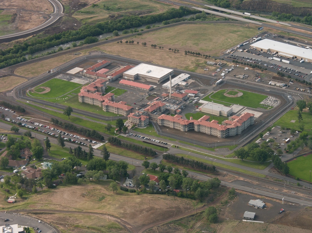
Pendleton is a city in and the county seat of Umatilla County, Oregon, United States. The population was 17,107 at the time of the 2020 census, which includes approximately 1,600 people who are incarcerated at Eastern Oregon Correctional Institution.
From the Wikipedia article Pendleton, Oregon (this version), under CC BY-SA 4.0.
Things to do2

Museums and landmarks10

Pendleton Center for the Arts
Monument and historic site · National Register of Historic Places · 1.5 mi
Art center in Pendleton, Oregon, USA
214 North Main Street, Pendleton

Bowman Hotel
Monument and historic site · National Register of Historic Places · 1.7 mi
Hotel in Pendleton, United States of America

John F. Kilkenny United States Post Office and Courthouse
Monument and historic site · National Register of Historic Places · 1.6 mi
Courthouse in Pendleton, United States of America

Masonic Temple
Monument and historic site · National Register of Historic Places · 1.7 mi
Historic building in Pendleton, Oregon, United States

Children's Museum of Eastern Oregon
Museum · 1.7 mi
400 South Main Street, Pendleton
Tu-Sa 10:00-17:00
South Main Street Commercial Historic District
Monument and historic site · 1.6 mi
National Register of Historic Places # 86003260


Pendleton Round-Up and Happy Canyon Hall of Fame
Museum · 1.1 mi
Hall of fame in Pendleton, Oregon
Pendleton Underground Tour
Monument and historic site · 1.6 mi
37 Southwest Emigrant Avenue, Pendleton
Parks, trails and playgrounds24

Pendleton Family Aquatic Center
Sports field and stadium · 0.6 mi
1901 Northwest Carden Avenue, Pendleton

12 more on the map.
Restaurants and cafes58

Great Pacific Wine & Coffee Company
Restaurant · Pizza, Sandwich, Salad, Coffee Shop, Tea · 1.6 mi
403 South Main Street, Pendleton
Mo-Sa 11:00-21:00

Shari's
Diner · American · 2.3 mi
319 Southeast Nye Avenue, Pendleton
Mo-Th 00:00-02:00,06:00-24:00; Fr,Sa 00:00-24:00; Su 06:00-24:00
Sisters Cafe
Restaurant · Crepe · 1.6 mi
380 South Main Street, Pendelton
Mo-Sa 07:00-18:00; Su 07:00-15:00
Backfire Station
Restaurant · 1.2 mi
911 Southwest Court Avenue, Pendleton
Th 11:00-21:00; Fr 11:00-22:00; Sa 09:00-22:00; Su 09:00-21:00

The Prodigal Son Brewery & Pub
Bar and pub · 1.7 mi
230 Southeast Court Avenue, Pendelton
Tu-Th 11:00-22:00; Fr-Sa 11:00-23:00; Su 12:00-21:00
Flying X Speakeasy Lounge & Restaurant
Restaurant · Italian · 1.5 mi
220 Southwest 1st Street, Pendleton
Hamley Steakhouse
Restaurant · 1.6 mi
Mo 16:00-21:30; Tu-Th 16:00-22:30; Fr-Sa 16:00-24:00; Su 16:00-21:30

El Charrito
Restaurant · Mexican · 1.5 mi
212 Southwest Dorion Avenue, Pendleton
Su-Sa 11:00-22:00
46 more on the map.
History
A group of European explorers led by Wilson Price Hunt were spotted camping near modern-day Pendleton by a band of Native Americans on January 8, 1812.
The present-day site of Pendleton was not developed by European-American settlers until William C. McKay established a trading post at the mouth of McKay Creek. In 1862 Abram Miller filed a claim for a homestead east of McKay's trading post. Soon after, Moses Goodwin traded horses for Abram Miller's plot of land. Goodwin named the plot "Goodwin's Crossing" and established its center on Pendleton's modern-day Main Street. By 1865, Goodwin had built a bridge across the Umatilla River and established a hotel. The first instance of outside investment in the town was from Lot Livermore, who built a store next to Goodwin's hotel. Umatilla County purchased Goodwin's Crossing from Moses Goodwin on December 18th, 1868. The town was renamed Pendleton, after politician and diplomat George H. Pendleton (1825–1889), who served as a U.S. Representative and Senator from Ohio. Pendleton was made the county seat of Umatilla County upon its purchase. The city was incorporated by the Oregon Legislative Assembly on October 25, 1880.
From the History section of Pendleton, Oregon on Wikipedia, under CC BY-SA 4.0.
Where to stay19
MotoLodge Pendleton
Motel and hotel · 1.8 mi
310 Southeast Dorion Avenue, Pendleton
Churches and places of worship13
Pendleton Seventh-day Adventist Church
Church · Seventh Day Adventist · 1.3 mi
1401 Southwest Goodwin Place, Pendleton
First United Methodist Church
Church · Methodist · 1.7 mi
352 Southeast 2nd Street, Pendelton
The Church of Jesus Christ of Latter-day Saints
Church · Latter Day Saints · 0.9 mi
Shopping12
Gas and EV charging9
Schools, colleges and libraries14
Intermountain Virtual Learning Academy
School · 1.7 mi
2001 Sw Nye Ave, Pendleton
Healthcare3
CHI Saint Anthony Hospital Family Clinic
Clinic and pharmacy · 1.9 mi
3001 Saint Anthony Way, Pendelton
Map of Pendleton
164 places. The map loads OpenStreetMap tiles when you open it.
Climate by month
Monthly table
| Month | High | Low | Rain |
|---|---|---|---|
| Jan | 45°F | 28°F | 1.4 in |
| Feb | 49°F | 29°F | 1.2 in |
| Mar | 58°F | 33°F | 1.3 in |
| Apr | 65°F | 38°F | 1.2 in |
| May | 73°F | 45°F | 1.6 in |
| Jun | 80°F | 51°F | 1.1 in |
| Jul | 90°F | 56°F | 0.4 in |
| Aug | 90°F | 54°F | 0.3 in |
| Sep | 80°F | 46°F | 0.4 in |
| Oct | 66°F | 38°F | 1.0 in |
| Nov | 52°F | 32°F | 1.4 in |
| Dec | 44°F | 28°F | 1.6 in |
U.S. Climate Normals 1991-2020 for Pendleton Dwtn (1 mi away), rain and snow from Pendleton 1.0 Wnw, NOAA NCEI.
People and cost of living
American Community Survey 5-year estimates, 2020-2024, U.S. Census Bureau. Estimates have margins of error, larger for small towns.
Disaster history
Umatilla County has had 11 federal disaster declarations since 2000, most often for fires.
- 2026-08-09: Hagen Fire (Fire)
- 2026-07-16: Lower Dry Creek Fire (Fire)
- 2025-01-01: Wildfires (Fire)
- 2024-07-21: Battle Mountain Fire Complex (Fire)
- 2020-04-03: Severe Storms, Flooding, Landslides, And Mudslides (Flood)
- 2020-03-28: Covid-19 Pandemic (Biological)
OpenFEMA disaster declarations summaries.
Getting there and nearby towns
Eastern Oregon Regional Airport (PDT) is the nearest airport with scheduled flights listed in OpenStreetMap, 2 miles away.
- Riverside 4 mi east, about 6 min by car
- Green Meadows 4 mi south, about 7 min by car
- Gopher Flats 5 mi east, about 8 min by car
- Tutuilla 7 mi southeast, about 11 min by car
- Mission 8 mi east, about 12 min by car
- Pilot Rock 13 mi south, about 20 min by car
- Helix 14 mi northeast, about 23 min by car
- Athena 18 mi northeast, about 30 min by car
- Hermiston 25 mi northwest, about 40 min by car
- La Grande 43 mi southeast, about 1 h 15 min by car
Drive times are estimates from straight-line distance, not routes.
Local news
Headlines from INDB, the NEMICO news database.
Reviews, tips and questions
Loading what members have shared...
Sources and licences
- NCES EDGE (Public domain): public schools
- NOAA NCEI U.S. Climate Normals 1991-2020 (Public domain): climate by month
- OpenFEMA (Public domain): disaster declarations
- OpenStreetMap contributors (ODbL 1.0): places, airports, map data
- U.S. Census Bureau (Public domain): population, income, housing, education, commute
- Wikidata (CC0 1.0): elevation, founding date, time zone, website, landmarks and historic places
- Wikimedia Commons (see each image): photos
- Wikipedia (CC BY-SA 4.0): overview and history text
Photo credits
- Pendleton Oregon downtown, Publichall at English Wikipedia, Public domain
- Eastern Oregon Correctional Institution, Pendleton, Oregon - panoramio, Sam Beebe/Ecotrust, CC BY-SA 3.0
- At the Pendleton Roundup - Flickr - brewbooks (1), brewbooks from near Seattle, USA, CC BY-SA 2.0
- At the Pendleton Roundup - Flickr - brewbooks, brewbooks from near Seattle, USA, CC BY-SA 2.0
- Ted Wheeler at Pendleton Round-Up Parade, Kirsten Comandich from Portland, OR, CC BY-SA 2.0
- Rice House - Pendleton Oregon, Ian Poellet, CC BY-SA 4.0
- Pendleton, Oregon - panoramio, Sam Beebe/Ecotrust, CC BY-SA 3.0
- Clarke House - Pendleton Oregon, Ian Poellet ( User:Werewombat ), CC BY-SA 3.0
- Pendleton Arts Center - Pendleton Oregon, Ian Poellet ( User:Werewombat ), CC BY-SA 3.0
- Umatilla River Pendleton, Ian Poellet, CC BY-SA 3.0
- Milarkey Building - Pendleton Oregon, Ian Poellet, CC BY-SA 3.0
- Lloyd Garage - Pendleton Oregon, Ian Poellet, CC BY-SA 4.0
- Kilkenny Post Office and Courthouse round window - Pendleton Oregon, Ian Poellet, CC BY-SA 4.0
- Troy Laundry - Pendleton Oregon, Ian Poellet, CC BY-SA 4.0
- Troy Laundry 2 - Pendleton Oregon, Ian Poellet, CC BY-SA 4.0
- First Presbyterian Church tower - Pendleton Oregon, Ian Poellet, CC BY-SA 4.0
- Empire Block - Pendleton Oregon, Ian Poellet, CC BY-SA 3.0
- Hamley and Co Leather Goods Store - Pendleton Oregon, Ian Poellet, CC BY-SA 3.0
- Gollock Building - Pendleton Oregon, Ian Poellet, CC BY-SA 4.0
- LaFontaine Building - Pendleton Oregon, Ian Poellet, CC BY-SA 4.0
- Pendleton City Hall - Oregon, Ian Poellet, CC BY-SA 3.0
- Cowboy performing in the trick and fancy roping event at the Round-Up, Pendleton, Oregon (4476958492), UW Digital Collections, No restrictions
- Cowboy Jason Stanley performing a riding trick at the Round-Up, Pendleton, Oregon (4476181953), UW Digital Collections, No restrictions
- Old City Hall burned out - Pendleton Oregon, Ian Poellet, CC BY-SA 4.0
- 12 SE Dorion Ave - Pendleton Oregon, Ian Poellet, CC BY-SA 4.0
- Medernach Building 2014 - Pendleton Oregon, Ian Poellet, CC BY-SA 4.0
- Pendleton, OR - Medernach Building - 333-339 South Main St 02, Joe Mabel, CC BY-SA 3.0
- Pendleton, OR - Medernach Building - 333-339 South Main St 01, Joe Mabel, CC BY-SA 3.0
- OR&N Station - Pendleton Oregon, Ian Poellet, CC BY-SA 3.0
- Medernach Building - Pendleton Oregon, Ian Poellet, CC BY-SA 3.0
- John F. Kilkenny United States Post Office and Courthouse Pendleton in 1917, National Archives, RG 121-BS, Box 73, Pendleton Folder, Public domain
- Bowman Hotel - Pendleton Oregon, Ian Poellet ( User:Werewombat ), CC BY-SA 3.0
- Masonic Temple (Pendleton, Oregon), Visitor7, CC BY-SA 3.0
- Happy Canyon Hall of Fame (Pendleton, Oregon), Visitor7, CC BY-SA 3.0
- Eastern Oregon Correctional Institution2, Eastern_Oregon_Correctional_Institution.jpg : Sam Beebe derivative work: MBisanz talk, CC BY-SA 2.0
- Rudy Rada Skatepark, SkateOregon, CC BY 2.0
- Debris against the bridge (49517023597), Oregon Department of Transportation, CC BY 2.0
- Clearing debris (49516855256), Oregon Department of Transportation, CC BY 2.0
- I-84 bridge (49526573711), Oregon Department of Transportation, CC BY 2.0
- Inspecting the bridge (49526063693), Oregon Department of Transportation, CC BY 2.0


Page built October 30, 2026. Spotted a mistake? Tell us or suggest a place.