


Peterborough, New Hampshire
Peterborough is a community of 2,539 people in Hillsborough County, New Hampshire.
Why visit Peterborough
Townapedia lists 33 museums and landmarks, 10 parks and trails, 26 places to eat, 2 places to stay and 2 attractions in and around town.
Highlights include Peterborough Community Theatre, Abijah Richardson, Sr. Homestead and Amos Learned Farm.
July is the warmest month, with average highs of 82°F; January lows average 13°F.
Weather in Peterborough
Forecast from the National Weather Service. Full forecast
About Peterborough
Peterborough is a census-designated place (CDP) and the main village in the town of Peterborough, New Hampshire, United States. The population of the CDP was 3,090 at the 2020 census, out of 6,418 in the entire town.
From the Wikipedia article Peterborough (CDP), New Hampshire (this version), under CC BY-SA 4.0.
Things to do2

Peterborough Community Theatre
Cinema and theater · 0.6 mi
6 School Street, Peterborough

Museums and landmarks33

Abijah Richardson, Sr. Homestead
Monument and historic site · National Register of Historic Places · 3.2 mi
Historic house in New Hampshire, United States

Amos Learned Farm
Monument and historic site · National Register of Historic Places · 3.4 mi
Historic house in New Hampshire, United States

Appleton Farm
Monument and historic site · National Register of Historic Places · 3.8 mi
Historic farmstead in Dublin, New Hampshire
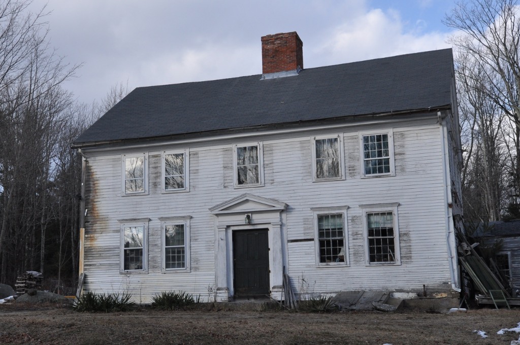
Appleton-Hannaford House
Monument and historic site · National Register of Historic Places · 3.3 mi
United States historic place

Benjamin Marshall House
Monument and historic site · National Register of Historic Places · 3.6 mi
Historic house in Dublin, New Hampshire, USA
Brackett House
Monument and historic site · National Register of Historic Places · 1.8 mi
Historic house in Dublin, New Hampshire, USA
Capt. Richard Strong House
Monument and historic site · National Register of Historic Places · 3.9 mi
Dublin, New Hampshire, NRHP-listed

Deacon Abijah Richardson House
Monument and historic site · National Register of Historic Places · 3.1 mi
Historic house in New Hampshire, United States

Frost Farm
Monument and historic site · National Register of Historic Places · 3.3 mi
Listed on the National Register of Historic Places in Cheshire County, New Hampshire

Henry Strongman House
Monument and historic site · National Register of Historic Places · 4.1 mi
Historic house in New Hampshire, United States

Ivory Perry Homestead
Monument and historic site · National Register of Historic Places · 2.0 mi
Dublin, New Hampshire, listed on the NRHP in Cheshire County


James Gowing Farm
Monument and historic site · National Register of Historic Places · 3.8 mi
Historic house in New Hampshire, United States
21 more on the map.
Parks, trails and playgrounds10



Restaurants and cafes26


Waterhouse
Diner · American · 0.6 mi
18 Depot Street, Peterborough
Su-Th 11:30-20:00, Fr-Sa 11:30-21:00


Charlie’s Olde Tyme Creamery
Ice cream · 1.6 mi
9 Sharon Road
Mo-Th 11:00-20:00; Fr-Sa 11:00-21:00; Su 14:00-20:00
Aesop's Tables
Restaurant · Bagel, Coffee Shop, Sandwich · 0.6 mi
12 Depot Street, Peterborough
Mo-Sa 07:30-16:00
Peterborough Pizza Barn
Restaurant · Pizza · 1.5 mi
71 Jaffrey Road, Peterborough
Tu-Th 11:00-22:00, Fr 11:00-23:00, Sa-Su 11:00-22:00
Pizza Peddler
Restaurant · Pizza · 2.2 mi
70 A Hancock Road, Peterborough
Su-Th 11:00-20:00; Fr-Sa 11:00-21:00

Post and Beam Brewery
Brewery and winery · 0.6 mi
Su-Mo 12:00-20:00, Tu-We 16:00-20:00, Th 12:00-20:00, Fr-Sa 12:00-21:00
14 more on the map.
Where to stay2
Churches and places of worship8
All Saints Church
Church · National Register of Historic Places · 0.8 mi
Peterborough Unitarian Church
Church · National Register of Historic Places · 0.6 mi
Peterborough United Methodist Church
Church · United Methodist · 0.8 mi
43 Concord Street
Shopping7
Gas and EV charging2
Schools, colleges and libraries14
Lionheart Classical Academy Chartered Public School
School · 1.6 mi
10 Sharon Road, Peterborough
Healthcare2
Map of Peterborough
106 places. The map loads OpenStreetMap tiles when you open it.
Climate by month
Monthly table
| Month | High | Low | Rain |
|---|---|---|---|
| Jan | 32°F | 13°F | 3.3 in |
| Feb | 35°F | 14°F | 3.4 in |
| Mar | 43°F | 22°F | 4.0 in |
| Apr | 56°F | 34°F | 3.8 in |
| May | 68°F | 45°F | 3.8 in |
| Jun | 77°F | 55°F | 4.3 in |
| Jul | 82°F | 60°F | 4.3 in |
| Aug | 80°F | 58°F | 4.0 in |
| Sep | 73°F | 51°F | 4.3 in |
| Oct | 60°F | 38°F | 5.1 in |
| Nov | 47°F | 29°F | 3.8 in |
| Dec | 37°F | 20°F | 4.3 in |
U.S. Climate Normals 1991-2020 for Jaffrey Silver Rch Airpark (5 mi away), NOAA NCEI.
People and cost of living
American Community Survey 5-year estimates, 2020-2024, U.S. Census Bureau. Estimates have margins of error, larger for small towns.
Disaster history
Hillsborough County has had 22 federal disaster declarations since 2000, most often for severe storms.
- 2020-04-03: Covid-19 Pandemic (Biological)
- 2020-03-13: Covid-19 (Biological)
- 2015-03-25: Severe Winter Storm And Snowstorm (Severe Storm)
- 2013-03-19: Severe Winter Storm And Snowstorm (Severe Storm)
- 2012-10-30: Hurricane Sandy (Hurricane)
- 2011-12-05: Severe Storm And Snowstorm (Severe Storm)
OpenFEMA disaster declarations summaries.
Getting there and nearby towns
Jaffrey Airfield Silver Ranch (AFN) is the nearest airport with scheduled flights listed in OpenStreetMap, 6 miles away.
- Jaffrey 6 mi southwest, about 9 min by car
- Marlborough 13 mi west, about 21 min by car
- Winchendon 14 mi south, about 23 min by car
- Milford 15 mi east, about 24 min by car
- Hillsborough 17 mi north, about 27 min by car
- Keene 18 mi west, about 29 min by car
- South Ashburnham 18 mi south, about 29 min by car
- Fitchburg 20 mi south, about 33 min by car
- Gardner 20 mi south, about 33 min by car
- Baldwinville 20 mi south, about 32 min by car
Drive times are estimates from straight-line distance, not routes.
Local news
Headlines from INDB, the NEMICO news database.
Reviews, tips and questions
Loading what members have shared...
Sources and licences
- NCES EDGE (Public domain): public schools
- NOAA NCEI U.S. Climate Normals 1991-2020 (Public domain): climate by month
- OpenFEMA (Public domain): disaster declarations
- OpenStreetMap contributors (ODbL 1.0): places, airports, map data
- U.S. Census Bureau (Public domain): population, income, housing, education, commute
- Wikidata (CC0 1.0): elevation, founding date, time zone, website, landmarks and historic places
- Wikimedia Commons (see each image): photos
- Wikipedia (CC BY-SA 4.0): overview and history text
Photo credits
- Main St, Peterborough NH, John Phelan, CC BY-SA 4.0
- DublinNH CaptRichardStrongHouse, User:Magicpiano, CC BY-SA 4.0
- PeterboroughNH MacdowellColony MainHouse, User:Magicpiano, CC BY-SA 4.0
- DublinNH MicajahMartinFarm, User:Magicpiano, CC BY-SA 4.0
- DublinNH BrackettHouse, User:Magicpiano, CC BY-SA 4.0
- DublinNH JamesRobbeJrHouse, User:Magicpiano, CC BY-SA 4.0
- DublinNH WoodHouse, User:Magicpiano, CC BY-SA 4.0
- DublinNH AbijahRichardsonSrHomestead, User:Magicpiano, CC BY-SA 4.0
- DublinNH FrostFarm KorpiRoad Barn, User:Magicpiano, CC BY-SA 4.0
- DublinNH TwitchellMillSite, User:Magicpiano, CC BY-SA 4.0
- Peterborough Unitarian Church, Peterborough NH, John Phelan, CC BY-SA 3.0
- DublinNH JamesGowingFarm, User:Magicpiano, CC BY-SA 4.0
- DublinNH SolomonPiperHouse, User:Magicpiano, CC BY-SA 4.0
- DublinNH AmosLearnedFarm, User:Magicpiano, CC BY-SA 4.0
- DublinNH WindmillHill, User:Magicpiano, CC BY-SA 4.0
- DublinNH DeaconAbijahRichardsonHouse, User:Magicpiano, CC BY-SA 4.0
- DublinNH AppletonHannafordHouse, User:Magicpiano, CC BY-SA 4.0
- Peterborough Town House, SayCheeeeeese, Public domain
- DublinNH DelRossis, User:Magicpiano, CC BY-SA 4.0
- DublinNH HenryStrongmanHouse, User:Magicpiano, CC BY-SA 4.0
- DublinNH LukeRichardsonHouse, User:Magicpiano, CC BY-SA 4.0
- DublinNH JohnPerryHouse, User:Magicpiano, CC BY-SA 4.0
- DublinNH JosephGowingFarm, User:Magicpiano, CC BY-SA 4.0
- All Saints Church, Peterborough, NH, John Phelan, CC BY-SA 3.0
- DublinNH JohnRichardsonHomestead, User:Magicpiano, CC BY-SA 4.0
- DublinNH RichardStrongCabin, User:Magicpiano, CC BY-SA 4.0
- DublinNH RufusPiperHomestead, User:Magicpiano, CC BY-SA 4.0
- DublinNH BenjaminMarshallHouse, User:Magicpiano, CC BY-SA 4.0
- PeterboroughNH PostOffice, User:Magicpiano, CC BY-SA 4.0
- DublinNH IvoryPerryHouse, User:Magicpiano, CC BY-SA 4.0
- DublinNH LouisCabotHouse, User:Magicpiano, CC BY-SA 4.0
- DublinNH FiskBarn, User:Magicpiano, CC BY-SA 4.0
- Peterborough, New Hampshire - 5568616134, Dougtone, CC BY-SA 2.0


Page built October 30, 2026. Spotted a mistake? Tell us or suggest a place.