


Phillipsburg, New Jersey
Phillipsburg is a town of 15,299 people in Warren County, New Jersey.
Why visit Phillipsburg
Townapedia lists 40 museums and landmarks, 32 parks and trails, 130 places to eat, 3 places to stay and 9 attractions in and around town.
Highlights include Easton–Phillipsburg Toll Bridge, Interstate 78 Toll Bridge, Easton House and Jacob Nicholas House.
July is the warmest month, with average highs of 86°F; January lows average 22°F.
Weather in Phillipsburg
Forecast from the National Weather Service. Full forecast
About Phillipsburg
Phillipsburg is a town located along the Delaware River that is the most populous municipality in Warren County, in the U.S. state of New Jersey. It is part of the Allentown-Bethlehem-Easton, PA-NJ metropolitan statistical area. As of the 2020 United States census, the town's population was 15,249, an increase of 299 (+2.0%) from the 2010 census count of 14,950, which in turn reflected a decline of 216 (−1.4%) from the 15,166 counted in the 2000 census.
From the Wikipedia article Phillipsburg, New Jersey (this version), under CC BY-SA 4.0.
Things to do9

Interstate 78 Toll Bridge
Bridge · 1.4 mi
Bridge over the Delaware River between Williams Township, Pennsylvania and Phillipsburg, New Jersey
Lehigh Valley Railroad Bridge
Bridge · 1.3 mi
Abandoned railway bridge over the Delaware River between Easton, Pennsylvania and Phillipsburg, New Jersey
Northampton Street Bridge
Bridge · 1.3 mi
Bridge over the Delaware River between Easton, Pennsylvania and Phillipsburg, New Jersey


Museums and landmarks40

Easton House
Museum · National Register of Historic Places · 1.5 mi
History building in Easton, Pennsylvania, United States of America
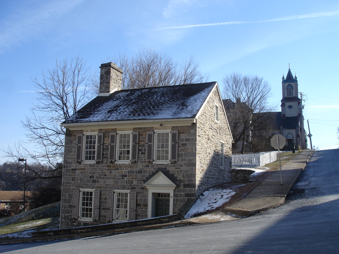
Jacob Nicholas House
Monument and historic site · National Register of Historic Places · 1.8 mi
Historic house in Pennsylvania, United States
458 Ferry Street, Easton

Parsons-Taylor House
Monument and historic site · National Register of Historic Places · 1.7 mi
House in Easton, Pennsylvania, United States
56 South 4th Street, Easton

College Hill Residential Historic District
Monument and historic site · National Register of Historic Places · 1.6 mi
Easton, PA, listed on the NRHP in Pennsylvania

Delaware Division of the Pennsylvania Canal
Monument and historic site · National Register of Historic Places · 1.4 mi
Canal in eastern Pennsylvania

Easton Cemetery
Monument and historic site · National Register of Historic Places · 2.1 mi
Cemetery in Easton, Pennsylvania

Easton Historic District
Monument and historic site · National Register of Historic Places · 1.7 mi
Listed on the NRHP in Pennsylvania

Herman Simon House
Monument and historic site · National Register of Historic Places · 2.9 mi
Historic house in Pennsylvania, United States

Hixson–Mixsell House
Monument and historic site · National Register of Historic Places · 3.5 mi
Historic house in Pohatcong Township, New Jersey

Hixson–Skinner Mill Complex
Monument and historic site · National Register of Historic Places · 3.4 mi
Historic building in Warren County, New Jersey

Jacob Mixsell House
Monument and historic site · National Register of Historic Places · 1.8 mi
Historic house in Pennsylvania, United States


John Roseberry Homestead
Monument and historic site · National Register of Historic Places
Historic house in Phillipsburg, New Jersey
28 more on the map.
Parks, trails and playgrounds32

20 more on the map.
Restaurants and cafes130

Aman's Artisan Indian Cuisine
Restaurant · Indian · 1.7 mi
336 Northampton Street, Easton
Mo, We, Th 11:30-13:30, 17:00-21:00; Fr 11:30-13:30, 17:00-21:30;...
Ciao! Sandwich Shoppe
Restaurant · Sandwich, Salad, Hot Dog · 1.6 mi
12 North 3rd Street, Easton
11:00-16:00
College Hill Cafe
Restaurant · Breakfast, Lunch · 1.6 mi
501 Cattell Street, Easton
Mo 07:00-14:00; We-Th 07:00-14:00; Fr-Su 07:00-15:00
Colonial Pizza & Spaghetti House
Restaurant · Italian, Italian Pizza · 1.5 mi
136 Spring Garden Street
Su-Fr 11:00-22:00; Sa 11:00-23:00
Hoza African Restaurant
Restaurant · African · 1.7 mi
349 Northampton Street, Easton
Tu, Th 16:00-21:00; Fr 16:00-21:30; Sa, Su 12:00-20:30
Meli European Taverna
Restaurant · Mediterranean · 1.6 mi
322 Northampton Street, Easton
Tu-Th 16:00-21:00; Fr,Sa 16:00-23:00; Su 12:00-20:00
River Grille
Restaurant · American, Gourmet · 1.5 mi
243 Northampton Street, Easton
Mo-Th 11:30-21:30; Fr,Sa 11:30-22:30; Su 16:00-20:00
Stoke Coal Fire Pizza & Bar
Restaurant · Italian · 1.5 mi
1 Lehns Court, Easton
Mo-Th,Su 12:00-22:00; Fr-Sa 12:00-24:00
Tokyo Sushi
Restaurant · Sushi · 1.6 mi
22 North 3rd Street, Easton
Mo-Th 11:00-21:30; Fr-Sa 11:00-22:30; Su 12:00-21:00
Vinny V's Pizza
Restaurant · Italian · 1.5 mi
208 Cattell Street, Easton
Mo 11:00-20:00; Tu off; We-Th 11:00-20:00; Fr-Sa 11:00-21:00; Su...

Bank Street Creamery
Cafe · 1.6 mi
15 South Bank Street, Easton
Tu-Th 13:00-21:00; Fr,Sa 12:00-22:00; Su 13:00-21:00
118 more on the map.
History
The town grew from an agricultural village in 1824. It was transformed into a transportation hub and shipping center as the Delaware River terminus of the Morris Canal, with operations commencing in 1831, the first of several transportation infrastructure projects that gave the community a direct connection 107 miles (172 km) to New York City. The Central Railroad of New Jersey soon followed with a connection. The community's growth soon reached the canal terminals of both the Delaware Canal and the Lehigh Canal by its cross-river cable ferry system to Easton, Pennsylvania. In 1853, the Lehigh Valley Railroad connected across the river with the Central Railroad of New Jersey and a passenger short line railroad, the Belvidere Delaware Railroad, and Morris Canal, all within Phillipsburg, which was followed by rapid growth.
On March 8, 1861, Phillipsburg was incorporated as a town by an act of the New Jersey Legislature from portions of Phillipsburg Township, which is now Lopatcong Township. The town was named for William Phillips, an early settler of the area.
From the History section of Phillipsburg, New Jersey on Wikipedia, under CC BY-SA 4.0.
Where to stay3
Grand Eastonian Suites Hotel
Motel and hotel · 1.4 mi
140 Northampton Street, Easton
Churches and places of worship32
St. James Lutheran Church
Church · National Register of Historic Places · 1.9 mi
First Baptist Church of Phillipsburg (FBC)
Church · Baptist · 1.4 mi
810 Red School Lane, Phillipsburg
Shopping29
Gas and EV charging16
Schools, colleges and libraries60
Healthcare12
AFC Urgent Care Phillipsburg
Clinic and pharmacy · 1.8 mi
1228 US-22, Phillipsburg
American Women's Services
Clinic and pharmacy · 1.1 mi
157 South Main Street, Phillipsburg
Life Choices Women's Health Clinic
Clinic and pharmacy · 1.1 mi
158 South Main Street, Phillipsburg
Map of Phillipsburg
250 places. The map loads OpenStreetMap tiles when you open it.
Climate by month
Monthly table
| Month | High | Low | Rain |
|---|---|---|---|
| Jan | 38°F | 22°F | 3.7 in |
| Feb | 40°F | 22°F | 3.0 in |
| Mar | 49°F | 29°F | 3.6 in |
| Apr | 62°F | 39°F | 3.9 in |
| May | 72°F | 49°F | 4.3 in |
| Jun | 81°F | 59°F | 4.8 in |
| Jul | 86°F | 64°F | 5.6 in |
| Aug | 82°F | 62°F | 5.2 in |
| Sep | 77°F | 54°F | 4.7 in |
| Oct | 65°F | 44°F | 4.5 in |
| Nov | 53°F | 32°F | 3.4 in |
| Dec | 42°F | 26°F | 4.4 in |
U.S. Climate Normals 1991-2020 for Phillipsburg-Easton Brg (1 mi away), NOAA NCEI.
People and cost of living
American Community Survey 5-year estimates, 2020-2024, U.S. Census Bureau. Estimates have margins of error, larger for small towns.
Disaster history
Warren County has had 21 federal disaster declarations since 2000, most often for severe storms.
- 2023-08-11: Severe Storm And Flooding (Severe Storm)
- 2021-09-05: Remnants Of Hurricane Ida (Hurricane)
- 2021-09-02: Remnants Of Hurricane Ida (Hurricane)
- 2021-04-28: Severe Winter Storm And Snowstorm (Snowstorm)
- 2020-03-25: Covid-19 Pandemic (Biological)
- 2020-03-13: Covid-19 (Biological)
OpenFEMA disaster declarations summaries.
Getting there and nearby towns
Lehigh Valley International Airport (ABE) is the nearest airport with scheduled flights listed in OpenStreetMap, 14 miles away.
- Allentown 17 mi southwest, about 28 min by car
- Hackettstown 22 mi northeast, about 35 min by car
- Budd Lake 26 mi northeast, about 42 min by car
- Bradley Gardens 28 mi east, about 46 min by car
- Hopatcong 32 mi northeast, about 52 min by car
- Martinsville 32 mi east, about 52 min by car
- Manville 33 mi east, about 53 min by car
- Blackwells Mills 34 mi southeast, about 54 min by car
- Bound Brook 35 mi east, about 56 min by car
- Lake Hopatcong 35 mi northeast, about 56 min by car
Drive times are estimates from straight-line distance, not routes.
Local news
Headlines from INDB, the NEMICO news database.
Reviews, tips and questions
Loading what members have shared...
Sources and licences
- NCES EDGE (Public domain): public schools
- NOAA NCEI U.S. Climate Normals 1991-2020 (Public domain): climate by month
- OpenFEMA (Public domain): disaster declarations
- OpenStreetMap contributors (ODbL 1.0): places, airports, map data
- U.S. Census Bureau (Public domain): population, income, housing, education, commute
- Wikidata (CC0 1.0): elevation, founding date, time zone, website, landmarks and historic places
- Wikimedia Commons (see each image): photos
- Wikipedia (CC BY-SA 4.0): overview and history text
Photo credits
- Pburg-281, Bruce Livingston, Public domain
- 2018-06-29 11 33 41 View east along U.S. Route 22 at Prospect Street in Phillipsburg, Warren County, New Jersey, Famartin, CC BY-SA 4.0
- Entrance to Morris canal in Phillipsburg NJ from HABS, Historic American Buildings Survey, Public domain
- 2020-08-15 12 50 11 View west along U.S. Route 22 at the exit for South Main Street (Phillipsburg) in Phillipsburg, Warren County, New Jersey, Famartin, CC BY-SA 4.0
- 2018-06-29 12 08 34 View northwest at the west end of New Jersey State Route 122 and the south end of Warren County Route 678 (South Main Street) at Pursel Street in Phillipsburg, Warren County, New..., Famartin, CC BY-SA 4.0
- 2018-06-29 12 08 24 View east at the west end of New Jersey State Route 122 (South Main Street) just east of Pursel Street in Phillipsburg, Warren County, New Jersey, Famartin, CC BY-SA 4.0
- 2021-07-20 09 15 12 View west along the westbound lanes of U.S. Route 22 (Memorial Parkway) from the pedestrian overpass at Warren County Route 677 (Morris Street) in Phillipsburg, Warren County, New..., Famartin, CC BY-SA 4.0
- 2021-07-20 09 16 31 View east along the eastbound lanes of U.S. Route 22 (Memorial Parkway) from the overpass for the ramp to Warren County Route 677 (Morris Street) in Phillipsburg, Warren County..., Famartin, CC BY-SA 4.0
- 2021-07-20 09 16 04 View west along the eastbound lanes of U.S. Route 22 (Memorial Parkway) from the overpass for the ramp to Warren County Route 677 (Morris Street) in Phillipsburg, Warren County..., Famartin, CC BY-SA 4.0
- 2021-07-20 09 17 59 View east along the westbound lanes of U.S. Route 22 (Memorial Parkway) from the pedestrian overpass at Warren County Route 677 (Morris Street) in Phillipsburg, Warren County, New..., Famartin, CC BY-SA 4.0
- Memorial Parkway wb, Phillipsburg, NJ, Feb. 2024, Mr. Matté (if there is an issue with this image, contact me using this image's Commons talk page , my Commons user talk page , or my English Wikipedia user talk page ; I'll know about it a lot faster), CC BY-SA 4.0
- Phillipsburg, NJ Municipal Building, Dec. 2025, Mr. Matté (if there is an issue with this image, contact me using this image's Commons talk page , my Commons user talk page , or my English Wikipedia user talk page ; I'll know about it a lot faster), CC BY-SA 4.0
- Lopatcong Creek, Phillipsburg, NJ - Morris Canal vicinity, Zeete, CC BY-SA 4.0
- 2018-06-29 11 26 43 View west along U.S. Route 22 just east of the Easton–Phillipsburg Toll Bridge in Phillipsburg, Warren County, New Jersey, Famartin, CC BY-SA 4.0
- Lock Street, Phillipsburg, NJ - victorian house, Zeete, CC BY-SA 4.0
- Main Street, Phillipsburg, NJ truss bridge, June 2024, Mr. Matté (if there is an issue with this image, contact me using this image's Commons talk page , my Commons user talk page , or my English Wikipedia user talk page ; I'll know about it a lot faster), CC BY-SA 4.0
- Union Station, Phillipsburg, NJ - trackside, Zeete, CC BY-SA 4.0
- Lock Street, Phillipsburg, NJ - stone house, Zeete, CC BY-SA 4.0
- 2020-08-15 12 56 55 View east along U.S. Route 22 at the exit for Main Street-Broad Street in Phillipsburg, Warren County, New Jersey, Famartin, CC BY-SA 4.0
- Third Street wb at Broad Street, Phillipsburg, NJ, Feb. 2024, Mr. Matté (if there is an issue with this image, contact me using this image's Commons talk page , my Commons user talk page , or my English Wikipedia user talk page ; I'll know about it a lot faster), CC BY-SA 4.0
- 2021-09-18 10 36 45 View east along New Jersey State Route 122 (Main Street) from the overpass for the rail line just west of Carpentersville Road in Phillipsburg, Warren County, New Jersey, Famartin, CC BY-SA 4.0
- Green's Bridge, Phillipsburg, NJ - two railway bridges, Zeete, CC BY-SA 4.0
- 2021-09-18 10 37 44 View west along New Jersey State Route 122 (Main Street) from the overpass for the rail line just west of Carpentersville Road in Phillipsburg, Warren County, New Jersey, Famartin, CC BY-SA 4.0
- 2021-09-18 10 42 40 View east along New Jersey State Route 122 (Main Street) from the overpass for the rail line just east of Kent Street in Phillipsburg, Warren County, New Jersey, Famartin, CC BY-SA 4.0
- Green's Bridge, CNJ, Phillipsburg, NJ - looking northeast, Zeete, CC BY-SA 4.0
- 2021-09-18 10 42 54 View west along New Jersey State Route 122 (Main Street) from the overpass for the rail line just east of Kent Street in Phillipsburg, Warren County, New Jersey, Famartin, CC BY-SA 4.0
- JacobNicholasHouse, KForce, CC BY-SA 3.0
- BachmannPublickHouse, KForce, CC BY-SA 3.0
- Parsons-Taylor House, Delos H. Smith, Public domain
- Seventh Street Gate, Easton Cemetery 01, Shuvaev, CC BY-SA 3.0
- EASTON PENNSYLVANIA HISTORIC DISTRICT, JERRYE & ROY KLOTZ MD, CC BY-SA 3.0
- Cattell St 200, College Hill HD, Easton PA 03, Shuvaev, CC BY-SA 3.0
- Delaware Canal w dog, Smallbones, Public domain
- Zeta Psi Fraternity House, Lafayette College 01, Shuvaev, CC BY-SA 3.0
- HIXSON-SKINNER MILL COMPLEX, WARREN COUNTY, Jerrye & Roy Klotz, MD, CC BY-SA 3.0
- JOHN ROSEBERRY HOMESTEAD, WARREN COUNTY, NJ, Jerrye & Roy Klotz, MD, CC BY-SA 3.0
- JacobMixsellHouse, KForce, CC BY-SA 3.0
- Hixson–Mixsell House, Pohatcong Township, NJ - east view, Zeete, CC BY-SA 4.0
- St. James Lutheran Church, Pohatcong Township, NJ - east view, Zeete, CC BY-SA 4.0
- HermanSimonHouse, KForce, CC BY-SA 3.0


Page built October 30, 2026. Spotted a mistake? Tell us or suggest a place.