


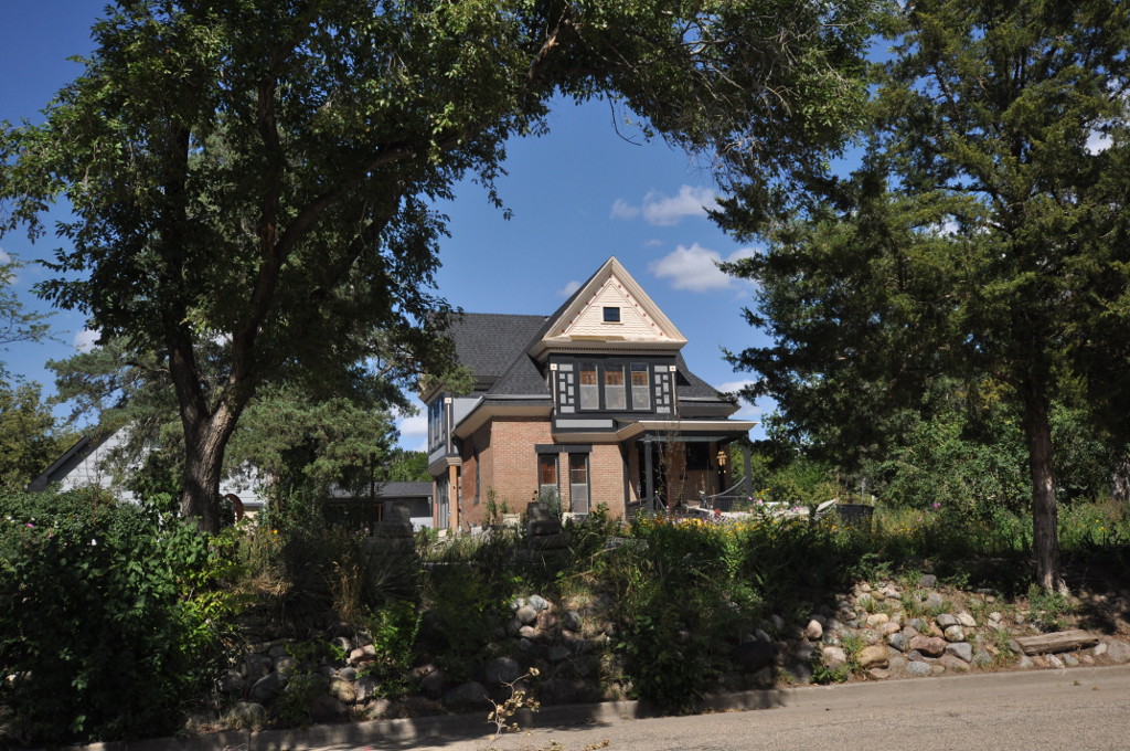


Pierre, South Dakota
Pierre is a city of 13,948 people in Hughes County, South Dakota, founded in 1880.
Why visit Pierre
Townapedia lists 24 museums and landmarks, 10 parks and trails, 19 places to eat, 11 places to stay and 2 attractions in and around town.
Highlights include Chicago and North Western Railroad Bridge, Verendrye Site and Brink-Wegner House.
July is the warmest month, with average highs of 88°F; January lows average 9°F, and about 37 inches of snow fall in a normal year.
Weather in Pierre
Forecast from the National Weather Service. Full forecast
About Pierre
Pierre is the capital city of the U.S. state of South Dakota and the county seat of Hughes County. As of the 2020 census, its population was 14,091. Pierre is the eleventh-most populous city of South Dakota, and the second-least populous U.S. state capital (after only Montpelier, Vermont).
From the Wikipedia article Pierre, South Dakota (this version), under CC BY-SA 4.0.
Things to do2

Chicago and North Western Railroad Bridge
Bridge · National Register of Historic Places · 2.5 mi
Bridge in United States of America

Museums and landmarks24

Verendrye Site
Monument and historic site · National Register of Historic Places · 3.2 mi
Archaeological site in Fort Pierre, United States of America
Brink-Wegner House
Monument and historic site · National Register of Historic Places · 1.5 mi
Historic house in South Dakota, United States
Central Block
Monument and historic site · National Register of Historic Places · 1.9 mi
Building in Pierre, South Dakota, United States
Crawford–Pettyjohn House
Monument and historic site · National Register of Historic Places · 1.1 mi
Historic house in South Dakota, United States
Dr. William and Elizabeth Blackburn House
Monument and historic site · National Register of Historic Places · 1.0 mi
Pierre, South Dakota, listed on the NRHP in South Dakota
Farr House
Monument and historic site · National Register of Historic Places · 1.5 mi
Historic house in South Dakota, United States
Fort Pierre Chouteau
Monument and historic site · National Register of Historic Places · 3.6 mi
Archaeological site in South Dakota, United States of America
Horner–Hyde House
Monument and historic site · National Register of Historic Places · 1.6 mi
Historic house in South Dakota, United States
Hughes County Courthouse
Monument and historic site · National Register of Historic Places · 1.6 mi
County courthouse in South Dakota, United States of America

I. W. Goodner House
Monument and historic site · National Register of Historic Places · 1.5 mi
Historic house in South Dakota, United States

Jefferson Davis Carr House
Monument and historic site · National Register of Historic Places · 3.1 mi
House in Fort Pierre, South Dakota


John E. and Ruth Hipple House
Monument and historic site · National Register of Historic Places · 1.4 mi
Historic house in South Dakota, United States
12 more on the map.
Parks, trails and playgrounds10



Restaurants and cafes19


Mad Mary's Steakhouse & Saloon
Restaurant · 1.8 mi
110 East Dakota Avenue, Pierre


7 more on the map.
History
Pierre was founded in 1880 on the east bank of the Missouri River opposite Fort Pierre, a former trading post that developed as a community. It was designated as the state capital when South Dakota gained statehood on November 2, 1889.
Numerous cities, namely Huron, Sioux Falls, Mitchell, and Watertown, challenged the city to be selected as the capital, but Pierre was selected for its geographic centrality in the state. Fort Pierre had developed earlier, with a permanent settlement since c. 1817 around a fur trading post. Fort Pierre Chouteau, preceding the city, was named after Pierre Chouteau, Jr., an American fur trader from St. Louis, Missouri, who was of colonial French origin.
Pierre's development was also influenced by construction of the Rapid City, Pierre and Eastern Railroad, which runs east–west through the city. It increased access to markets for regional products and improved transportation for passengers. The railroad crosses the Missouri River on the Chicago and North Western Railroad Bridge.
The capital city became relatively isolated in the post-World War II era of federally subsidized highway construction, as travelers and freight companies began to use automobiles and trucking. It is one of four state capitals not served by the Interstate Highway System.
From the History section of Pierre, South Dakota on Wikipedia, under CC BY-SA 4.0.
Where to stay11
AmericInn by Wyndham Fort Pierre Conference Center
Motel and hotel · 2.6 mi
312 Island Drive, Fort Pierre
Holiday Inn Express Pierre/Fort Pierre
Motel and hotel · 3.0 mi
110 East Stanley Road, Fort Pierre
My Place Hotel - Fort Pierre, SD
Motel and hotel · 2.8 mi
209 Hustan Avenue, Fort Pierre
Churches and places of worship16
Fort Pierre Congregational Church
Church · National Register of Historic Places · 3.1 mi
Methodist Episcopal Church
Church · National Register of Historic Places · 1.7 mi
Calvary United Pentecostal Church
Church · Pentecostal · 0.5 mi
2410 Stanton Avenue Drive, Pierre
Redeemer Evangelical Lutheran Church
Church · Lutheran · 2.0 mi
803 Sibert Place, Pierre
Holy Transfiguration of Our Lord Orthodox Chapel
Church · Orthodox · 0.6 mi
1610 Hilltop Drive, Pierre
Kingdom Hall of Jehovah's Witnesses
Church · Jehovahs Witness · 1.5 mi
2002 US Highway 14, Pierre
Oahe Presbyterian
Church · Presbyterian · 0.8 mi
2115 East Capitol Avenue, Pierre
Shopping5
Gas and EV charging2
Schools, colleges and libraries16
Healthcare1
Map of Pierre
106 places. The map loads OpenStreetMap tiles when you open it.
Climate by month
Monthly table
| Month | High | Low | Rain | Snow |
|---|---|---|---|---|
| Jan | 29°F | 9°F | 0.5 in | 5.1 in |
| Feb | 34°F | 13°F | 0.7 in | 8.0 in |
| Mar | 46°F | 23°F | 1.0 in | 5.0 in |
| Apr | 58°F | 33°F | 1.9 in | 5.3 in |
| May | 70°F | 45°F | 3.2 in | 0.0 in |
| Jun | 80°F | 56°F | 3.7 in | 0.0 in |
| Jul | 88°F | 62°F | 2.4 in | 0.0 in |
| Aug | 87°F | 59°F | 1.9 in | 0.0 in |
| Sep | 78°F | 50°F | 1.7 in | 0.0 in |
| Oct | 61°F | 36°F | 1.7 in | 1.3 in |
| Nov | 45°F | 23°F | 0.8 in | 6.3 in |
| Dec | 32°F | 13°F | 0.6 in | 6.2 in |
U.S. Climate Normals 1991-2020 for Pierre Rgnl Ap Hcn 72656 (2 mi away), NOAA NCEI.
People and cost of living
American Community Survey 5-year estimates, 2020-2024, U.S. Census Bureau. Estimates have margins of error, larger for small towns.
Disaster history
Hughes County has had 10 federal disaster declarations since 2000, most often for severe storms.
- 2026-09-01: Severe Storms, Straight-Line Winds, Tornadoes, And Flooding (Severe Storm)
- 2020-04-05: Covid-19 Pandemic (Biological)
- 2020-03-13: Covid-19 (Biological)
- 2019-06-07: Severe Winter Storm, Snowstorm, And Flooding (Flood)
- 2015-07-30: Severe Storms, Tornadoes, Straight-Line Winds, And Flooding (Severe Storm)
- 2013-08-02: Severe Storms, Tornadoes, And Flooding (Severe Storm)
OpenFEMA disaster declarations summaries.
Getting there and nearby towns
Pierre Regional Airport (PIR) is the nearest airport with scheduled flights listed in OpenStreetMap, 1 miles away.
- Fort Pierre 3 mi west, about 5 min by car
- Oahe Acres 6 mi north, about 10 min by car
- Onida 26 mi northeast, about 42 min by car
- Presho 35 mi south, about 56 min by car
- Murdo 39 mi southwest, about 1 h by car
- West Brule 40 mi southeast, about 1 h by car
- Lower Brule 42 mi southeast, about 1 h 15 min by car
- Highmore 45 mi east, about 1 h 15 min by car
- Gettysburg 47 mi north, about 1 h 15 min by car
- Fort Thompson 51 mi southeast, about 1 h 15 min by car
Drive times are estimates from straight-line distance, not routes.
Local news
Headlines from INDB, the NEMICO news database.
Reviews, tips and questions
Loading what members have shared...
Sources and licences
- NCES EDGE (Public domain): public schools
- NOAA NCEI U.S. Climate Normals 1991-2020 (Public domain): climate by month
- OpenFEMA (Public domain): disaster declarations
- OpenStreetMap contributors (ODbL 1.0): places, airports, map data
- U.S. Census Bureau (Public domain): population, income, housing, education, commute
- Wikidata (CC0 1.0): elevation, founding date, time zone, website, landmarks and historic places
- Wikimedia Commons (see each image): photos
- Wikipedia (CC BY-SA 4.0): overview and history text
Photo credits
- South Dakota State Capitol, Capitol Avenue, Pierre, SD - 53748063274, w_lemay, CC BY-SA 2.0
- PierreSD KennethRScurrHouse, Magicpiano, CC BY-SA 4.0
- PierreSD HenryMMcDonaldHouse, Magicpiano, CC BY-SA 4.0
- PierreSD BlackburnHouse, Magicpiano, CC BY-SA 4.0
- PierreSD PringleHouse, Magicpiano, CC BY-SA 4.0
- Capitol Lake - South Dakota Governor's Mansion - Pierre (52673558101), Tony Webster, CC BY 2.0
- Wv Pierre banner, Tony Webster, CC BY 2.0
- South Dakota Governor's Mansion - Pierre, Tony Webster, CC BY-SA 2.0
- South Dakota State Capitol in Pierre, Tony Webster, CC BY 2.0
- Pierre Regional Airport ticket counter, Jeffrey Beall, CC BY 4.0
- Rear Wing, South Dakota State Capitol, Capitol Avenue, Pierre, SD - 53746829097, w_lemay, CC BY-SA 2.0
- Rear Wing, South Dakota State Capitol, Capitol Avenue, Pierre, SD - 53747751286, w_lemay, CC BY-SA 2.0
- Rear Wing, South Dakota State Capitol, Capitol Avenue, Pierre, SD - 53746830217, w_lemay, CC BY-SA 2.0
- Rear Wing, South Dakota State Capitol, Capitol Avenue, Pierre, SD - 53747938863, w_lemay, CC BY-SA 2.0
- Rear Wing, South Dakota State Capitol, Capitol Avenue, Pierre, SD - 53748074889, w_lemay, CC BY-SA 2.0
- Rear Wing, South Dakota State Capitol, Capitol Avenue, Pierre, SD - 53746830717, w_lemay, CC BY-SA 2.0
- Rear Wing, South Dakota State Capitol, Capitol Avenue, Pierre, SD - 53748170805, w_lemay, CC BY-SA 2.0
- Rear Wing, South Dakota State Capitol, Capitol Avenue, Pierre, SD - 53748075974, w_lemay, CC BY-SA 2.0
- Rear Wing, South Dakota State Capitol, Capitol Avenue, Pierre, SD - 53748170230, w_lemay, CC BY-SA 2.0
- Rear Wing, South Dakota State Capitol, Capitol Avenue, Pierre, SD - 53748076049, w_lemay, CC BY-SA 2.0
- Pierre Regional Airport, Jeffrey Beall, CC BY-SA 3.0
- Rear Wing, South Dakota State Capitol, Capitol Avenue, Pierre, SD, w_lemay, CC BY-SA 2.0
- Rear Wing, South Dakota State Capitol, Capitol Avenue, Pierre, SD - 53748077589, w_lemay, CC BY-SA 2.0
- Rear Wing, South Dakota State Capitol, Capitol Avenue, Pierre, SD - 53746834652, w_lemay, CC BY-SA 2.0
- Rear Wing, South Dakota State Capitol, Capitol Avenue, Pierre, SD - 53747756566, w_lemay, CC BY-SA 2.0
- Rear Wing, South Dakota State Capitol, Capitol Avenue, Pierre, SD - 53747938548, w_lemay, CC BY-SA 2.0
- South Dakota State Capitol, Capitol Avenue, Pierre, SD - 53748078859, w_lemay, CC BY-SA 2.0
- South Dakota State Capitol, Capitol Avenue, Pierre, SD - 53747944718, w_lemay, CC BY-SA 2.0
- Rear Wing, South Dakota State Capitol, Capitol Avenue, Pierre, SD - 53747943743, w_lemay, CC BY-SA 2.0
- South Dakota State Capitol, Capitol Avenue, Pierre, SD - 53746836242, w_lemay, CC BY-SA 2.0
- Rear Wing, South Dakota State Capitol, Capitol Avenue, Pierre, SD - 53746836057, w_lemay, CC BY-SA 2.0
- South Dakota State Capitol, Capitol Avenue, Pierre, SD - 53747749881, w_lemay, CC BY-SA 2.0
- Portico, South Dakota State Capitol, Capitol Avenue, Pierre, SD - 53748167075, w_lemay, CC BY-SA 2.0
- South Dakota State Capitol, Capitol Avenue, Pierre, SD - 53747945918, w_lemay, CC BY-SA 2.0
- South Dakota State Capitol, Capitol Avenue, Pierre, SD - 53747759481, w_lemay, CC BY-SA 2.0
- South Dakota State Capitol, Capitol Avenue, Pierre, SD - 53748081124, w_lemay, CC BY-SA 2.0
- Jefferson Davis Carr House, Jeffrey Beall, CC BY-SA 3.0
- John E and Ruth Hipple House, Jeffrey Beall, CC BY-SA 3.0
- Karcher-Sahr House, Jeffrey Beall, CC BY-SA 3.0
- IW Goodner House, Jeffrey Beall, CC BY-SA 3.0


Page built October 30, 2026. Spotted a mistake? Tell us or suggest a place.