
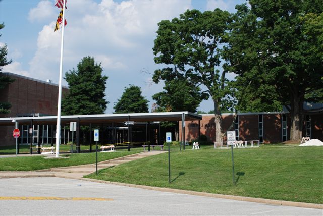


Pikesville, Maryland
Pikesville is a community of 33,524 people in Baltimore County, Maryland.
Why visit Pikesville
Townapedia lists 76 museums and landmarks, 36 parks and trails, 103 places to eat, 6 places to stay and 7 attractions in and around town.
Highlights include Next Act Cinema, Notre Dame of Maryland University, Fort Garrison and The Cloisters.
July is the warmest month, with average highs of 86°F; January lows average 27°F.
Weather in Pikesville
Forecast from the National Weather Service. Full forecast
About Pikesville
Pikesville is a census-designated place (CDP) in Baltimore County, Maryland, United States. Pikesville is just northwest of the Baltimore city limits. It is the northwestern suburb closest to Baltimore.
From the Wikipedia article Pikesville, Maryland (this version), under CC BY-SA 4.0.
Things to do7


Notre Dame of Maryland University
School · 5.0 mi
Private university in Baltimore, Maryland, United States

Museums and landmarks76

Fort Garrison
Monument and historic site · National Register of Historic Places · 0.7 mi
Building in Maryland, United States

The Cloisters
Monument and historic site · National Register of Historic Places · 2.0 mi
Building in Maryland, United States
10440 Falls Road, Lutherville Timonium

Bare Hills House
Monument and historic site · National Register of Historic Places · 2.4 mi
Historic house in Maryland
6222 Falls Road, Mount Washington

Rockland
Monument and historic site · National Register of Historic Places · 1.7 mi
Historic home in Brooklandville, Baltimore County, Maryland, United States
10214 Falls Road, Lutherville

Ambassador Theater
Monument and historic site · National Register of Historic Places · 4.2 mi
Former movie theater in Baltimore, Maryland, United States

Auburn House
Monument and historic site · National Register of Historic Places · 4.6 mi
Listed on the National Register of Historic Places

Baltimore County Circuit Courthouses
Monument and historic site · National Register of Historic Places · 5.0 mi
Courthouse in Baltimore County, United States of America

Baltimore County Jail
Monument and historic site · National Register of Historic Places · 4.9 mi
Prison in Maryland, United States of America
Bare Hills Historic District
Monument and historic site · National Register of Historic Places · 2.2 mi
Historic district in Maryland, United States
Bellona-Gittings Historic District
Monument and historic site · National Register of Historic Places · 4.6 mi
Historic district in Maryland, United States
Brooklandville House
Monument and historic site · National Register of Historic Places · 2.2 mi
Building in the United States of America


Brooklandwood
Monument and historic site · National Register of Historic Places · 3.0 mi
Building in Maryland, United States
64 more on the map.
Parks, trails and playgrounds36

Carlin's Park
Park · 5.0 mi
Park in Maryland, United States of America
Gwynn Oak Park
Park · 4.6 mi
Former amusement park in Maryland, US from 1893 to 1973
Lake Roland Park
Park · 2.8 mi
Park in Baltimore County, Maryland, United States
Mount Washington Arboretum
Park · 2.9 mi
Park in Baltimore, United States of America


24 more on the map.
Restaurants and cafes103

Giorgio's Restaurant
Restaurant · Pizza, Burger, Italian, Sandwich, Indian, Salad, Chicken, Greek · 2.5 mi
Giorgio's Restaurant in Baltimore, MD offers a variety of food choices including Pizza, Subs, Sandwiches, Wings, Seafood, quesadillas,...
6322 Reisterstown Road, Baltimore
Mo-Su 11:00-23:00

Chiyo Sushi
Restaurant · Sushi, Japanese · 3.0 mi
1619 Sulgrave Avenue, Baltimore
Tu,We 11:00-22:00; Th,Fr 11:00-23:00; Sa,Su 15:00-22:00
Ethel's Creole Kitchen
Restaurant · Cajun · 3.0 mi
1615 Sulgrave Avenue, Baltimore
Tu-Sa 11:00-14:00,17:00-22:00; Su 17:00-22:00
First Watch
Restaurant · American, Breakfast · 1.7 mi
1431 Reisterstown Road, Pikesville
Mo-Su 07:00-14:30
Garden & Grounds
Restaurant · Breakfast, Sandwich, Soup, Salad, American · 2.3 mi
1407 Clarkview Road, Baltimore
Mo-Fr 07:00-16:00; Sa,Su 08:00-16:00

Jilly's Bar & Grill
Diner · American · 1.8 mi
1012 Reisterstown Road, Pikesville
Mo-Sa 11:00-22:00; Su 12:00-19:00
Joey Chiu
Restaurant · Chinese, Sushi · 2.6 mi
10801 Falls Road, Lutherville
Mo-Th 11:30-21:00; Fr 11:30-22:00; Sa 12:00-22:00; Su 12:00-21:00
Mari Luna Mexican Grill
Restaurant · Mexican · 2.0 mi
102 Reisterstown Road, Pikesville
Tu-Th 11:00-20:00; Fr,Sa 11:00-21:00; Su 11:00-20:00
Mt. Washington Pizza & Subs & Indian Cuisine
Restaurant · Pizza, Sandwich, Indian · 3.1 mi
1620 Kelly Avenue, Baltimore
11:00-21:00
Pepe's
Restaurant · Pizza · 2.9 mi
6081 Falls Road, Mount Washington
Mo-Fr 06:00-23:00; Sa 07:00-23:00; Su 07:30-23:00
Pizza Hut
Restaurant · Pizza · 1.7 mi
1210 Reisterstown Road, Pikesville
Mo-Th,Su 10:30-23:00; Fr-Sa 10:30-24:00
91 more on the map.
History
Pikesville, Maryland, was named for the American soldier and explorer Zebulon Pike (1779–1813). While there are places named for Pike in many other states, Pikesville, Maryland, is the only contemporary place named "Pikesville".
From the History section of Pikesville, Maryland on Wikipedia, under CC BY-SA 4.0.
Where to stay6
Gramercy Mansion
Motel and hotel · 2.4 mi
1400 Greenspring Valley Road, Lutherville
Churches and places of worship49
St. John's Church
Church · Methodist · National Register of Historic Places · 3.0 mi
7534 Bellona Avenue, Towson
Mettam Memorial Baptist Church
Church · National Register of Historic Places · 1.4 mi
St. Thomas Church
Church · National Register of Historic Places · 3.9 mi
Roland Run Presbyterian
Church · Presbyterian Church In America · 2.7 mi
2200 West Joppa Road, Lutherville
Oheb Shalom Temple
Place of worship · 1.6 mi
7310 Park Heights Avenue, Pikesville
Shopping22
Gas and EV charging20
Schools, colleges and libraries88
Healthcare18
Baltimore Plastic and Cosmetic Surgery Center
Clinic and pharmacy · 2.6 mi
10807 Falls Road, Lutherville
Chesapeake Urology
Clinic and pharmacy · 2.0 mi
1838 Greene Tree Road, Pikesville
Injury Treatment Center
Clinic and pharmacy · 2.3 mi
6701 Reisterstown Road, Baltimore
Johns Hopkins Pharmacy
Clinic and pharmacy · 2.7 mi
10755 Falls Road, Lutherville
Map of Pikesville
250 places. The map loads OpenStreetMap tiles when you open it.
Climate by month
Monthly table
| Month | High | Low | Rain |
|---|---|---|---|
| Jan | 42°F | 27°F | 3.4 in |
| Feb | 46°F | 28°F | 2.8 in |
| Mar | 54°F | 34°F | 4.3 in |
| Apr | 66°F | 45°F | 3.5 in |
| May | 73°F | 54°F | 4.4 in |
| Jun | 82°F | 64°F | 4.2 in |
| Jul | 86°F | 69°F | 4.8 in |
| Aug | 84°F | 67°F | 4.2 in |
| Sep | 77°F | 60°F | 4.6 in |
| Oct | 66°F | 48°F | 4.2 in |
| Nov | 56°F | 39°F | 3.4 in |
| Dec | 46°F | 32°F | 4.0 in |
U.S. Climate Normals 1991-2020 for Cylburn (4 mi away), rain and snow from Pikesville 1.8 Sw, NOAA NCEI.
People and cost of living
American Community Survey 5-year estimates, 2020-2024, U.S. Census Bureau. Estimates have margins of error, larger for small towns.
Disaster history
Baltimore County has had 17 federal disaster declarations since 2000, most often for hurricanes.
- 2026-01-24: Severe Winter Storm (Winter Storm)
- 2020-03-26: Covid-19 Pandemic (Biological)
- 2020-03-13: Covid-19 (Biological)
- 2018-07-02: Severe Storm And Flooding (Flood)
- 2016-03-04: Severe Winter Storm And Snowstorm (Snowstorm)
- 2014-04-10: Snowstorm (Severe Storm)
OpenFEMA disaster declarations summaries.
Getting there and nearby towns
Baltimore-Washington International/Thurgood Marshall Airport (BWI) is the nearest airport with scheduled flights listed in OpenStreetMap, 15 miles away.
- Garrison 3 mi west, about 5 min by car
- Lochearn 3 mi southwest, about 5 min by car
- Towson 4 mi east, about 7 min by car
- Mays Chapel 4 mi northeast, about 7 min by car
- Milford Mill 5 mi southwest, about 8 min by car
- Owings Mills 5 mi west, about 8 min by car
- Lutherville 5 mi northeast, about 8 min by car
- Randallstown 6 mi west, about 9 min by car
- Woodlawn 6 mi southwest, about 10 min by car
- Baltimore 8 mi southeast, about 13 min by car
Drive times are estimates from straight-line distance, not routes.
Local news
Headlines from INDB, the NEMICO news database.
Reviews, tips and questions
Loading what members have shared...
Sources and licences
- NCES EDGE (Public domain): public schools
- NOAA NCEI U.S. Climate Normals 1991-2020 (Public domain): climate by month
- OpenFEMA (Public domain): disaster declarations
- OpenStreetMap contributors (ODbL 1.0): places, airports, map data
- U.S. Census Bureau (Public domain): population, income, housing, education, commute
- Wikidata (CC0 1.0): elevation, founding date, time zone, website, landmarks and historic places
- Wikimedia Commons (see each image): photos
- Wikipedia (CC BY-SA 4.0): overview and history text
Photo credits
- Pikesville High School, Wallstreethotrod at English Wikipedia, Public domain
- 2019-06-14 15 10 08 View southwest along the Outer Loop of the Baltimore Beltway (Interstate 695) at Exit 21 (Stevenson Road, TO Maryland State Route 129-Park Heights Avenue) in Pikesville, Baltimore..., Famartin, CC BY-SA 4.0
- 2020-07-28 10 44 15 View west along Maryland State Route 133 (Old Court Road) at Greenspring Avenue in Pikesville, Baltimore County, Maryland, Famartin, CC BY-SA 4.0
- 2019-06-14 15 07 01 View southwest along the Outer Loop of the Baltimore Beltway (Interstate 695) at Exit 22 (Greenspring Avenue) in Pikesville, Baltimore County, Maryland, Famartin, CC BY-SA 4.0
- 2019-07-24 13 51 59 View northeast along Interstate 695 (Baltimore Beltway) from the overpass for Stevenson Road in Pikesville, Baltimore County, Maryland, Famartin, CC BY-SA 4.0
- 2019-06-14 12 08 37 View northeast along the Inner Loop of the Baltimore Beltway (Interstate 695) at Exit 22 (Greenspring Avenue) in Pikesville, Baltimore County, Maryland, Famartin, CC BY-SA 4.0
- 2019-07-24 13 46 28 View southwest along Interstate 695 (Baltimore Beltway) from the overpass for Stevenson Road in Pikesville, Baltimore County, Maryland, Famartin, CC BY-SA 4.0
- 2020-07-28 10 37 52 View east along Maryland State Route 133 (Old Court Road) at Seven Mile Lane in Pikesville, Baltimore County, Maryland, Famartin, CC BY-SA 4.0
- 2016-07-12 14 48 22 View east along Maryland State Route 133 (Old Court Road) just east of Stevenson Road in Pikesville, Baltimore County, Maryland, Famartin, CC BY-SA 4.0
- 2016-07-12 14 48 51 View west along Maryland State Route 133 (Old Court Road) at Stevenson Road in Pikesville, Baltimore County, Maryland, Famartin, CC BY-SA 4.0
- 2016-07-12 14 28 46 View east along Maryland State Route 133 (Old Court Road) at Stevenson Road in Pikesville, Baltimore County, Maryland, Famartin, CC BY-SA 4.0
- 2020-07-28 09 44 24 View north along Maryland State Route 129 (Park Heights Avenue) at the exit TO Interstate 695 EAST (Towson) in Pikesville, Baltimore County, Maryland, Famartin, CC BY-SA 4.0
- 2020-07-28 10 30 59 View south along Maryland State Route 129 (Park Heights Avenue) at Maryland State Route 133 EAST (Old Court Road, TO Stephenson Road) in Pikesville, Baltimore County, Maryland, Famartin, CC BY-SA 4.0
- 2020-07-28 10 26 49 View south along Maryland State Route 129 (Park Heights Avenue) at the exit TO Interstate 695 EAST (Towson) in Pikesville, Baltimore County, Maryland, Famartin, CC BY-SA 4.0
- 2019-07-24 13 39 15 View northeast along Interstate 695 (Baltimore Beltway) from the overpass for Maryland State Route 129 (Park Heights Avenue) in Pikesville, Baltimore County, Maryland, Famartin, CC BY-SA 4.0
- 2020-07-28 09 40 11 View north along Maryland State Route 129 (Park Heights Avenue) at Maryland State Route 133 EAST (Old Court Road, TO Stephenson Road) in Pikesville, Baltimore County, Maryland, Famartin, CC BY-SA 4.0
- 2019-07-24 13 37 07 View southwest along Interstate 695 (Baltimore Beltway) from the overpass for Maryland State Route 129 (Park Heights Avenue) in Pikesville, Baltimore County, Maryland, Famartin, CC BY-SA 4.0
- 2020-07-28 09 48 40 View north along Maryland State Route 129 (Park Heights Avenue) at the exit for Interstate 695 SOUTH (Glen Burnie) in Pikesville, Baltimore County, Maryland, Famartin, CC BY-SA 4.0
- 2020-07-28 10 22 04 View south along Maryland State Route 129 (Park Heights Avenue) at the exit for Interstate 695 SOUTH (Glen Burnie) in Pikesville, Baltimore County, Maryland, Famartin, CC BY-SA 4.0
- The Cloisters Lutherville MD Dec 09, Pubdog ( talk ), Public domain
- Fort Garrison Dec 09, Pubdog ( talk ), Public domain
- Bare Hills House Dec 09, Pubdog ( talk ), Public domain
- St Johns Ruxton MD 01, Jameslwoodward, CC BY-SA 3.0
- Rockland Brooklandville MD Dec 09, Pubdog ( talk ), Public domain
- Mettam Memorial Baptist Church Dec 09, Pubdog ( talk ), Public domain
- DUMBARTON H.D. PIKESVILLE, BALTIMORE COUNTY, MD, JERRYE & ROY KLOTZ, M.D., CC BY-SA 4.0
- Auburn House, Towson, MD, entrance, Jameslwoodward, CC BY-SA 3.0
- Howard School PS 218 Bmore MD, Smallbones, CC0
- St Thomas Church Owings Mills MD 06, Jameslwoodward, CC BY-SA 3.0
- Baltimore County Jail Dec 09, Pubdog ( talk ), Public domain
- LM Alcott Scool Baltimore MD, Smallbones, CC0
- GoodwoodGardens, Frederic C. Chalfant, CC BY-SA 3.0
- Green Spring Valley Historic District Church Dec 09, Pubdog ( talk ), Public domain
- Brooklandwood Dec 09, Pubdog ( talk ), Public domain
- 3400 block Reistertown Rd Baltimore, Smallbones, CC0
- Old Baltimore County Courthouse, Marylandstater ( talk ), Public domain
- Cylburn Mansion Front, Simil Raghavan, CC BY-SA 4.0
- Wester Ogle Dec 09, Pubdog at en.wikipedia, Public domain
- RUSCOMBE, BALTIMORE CITY, Jerrye & Roy Klotz, MD, CC BY-SA 4.0
- Rockland Historic District Rowhouses Dec 09, Pubdog ( talk ), Public domain


Page built October 30, 2026. Spotted a mistake? Tell us or suggest a place.