


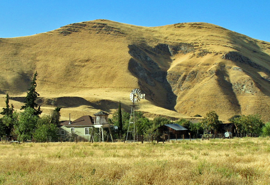

Pittsburg, California
Pittsburg is a city of 76,257 people in Contra Costa County, California, founded in 1839.
Why visit Pittsburg
Townapedia lists 5 museums and landmarks, 43 parks and trails, 81 places to eat, 2 places to stay and 3 attractions in and around town.
Highlights include Maya Cinema, California Theatre, Black Diamond Mines Regional Preserve and Hastings Adobe.
July is the warmest month, with average highs of 91°F; January lows average 40°F.
Weather in Pittsburg
Forecast from the National Weather Service. Full forecast
About Pittsburg
Pittsburg (formerly Black Diamond, New York Landing and New York of the Pacific) is a city in Contra Costa County, California, United States. It is an industrial suburb located on the southern shore of the Suisun Bay in the East Bay region of the San Francisco Bay Area, and is part of the Sacramento–San Joaquin River Delta area, the Eastern Contra Costa County area, and the San Francisco Bay Area. The population was 76,416 at the 2020 United States census.
From the Wikipedia article Pittsburg, California (this version), under CC BY-SA 4.0.
Things to do3


Museums and landmarks5
Black Diamond Mines Regional Preserve
Monument and historic site · National Register of Historic Places · 5.2 mi
Park in California

Hastings Adobe
Monument and historic site · National Register of Historic Places · 5.6 mi
Building in California, United States

Riverview Union High School Building
Monument and historic site · National Register of Historic Places · 4.0 mi
Historic district in California, United States

Roswell Butler Hard House
Monument and historic site · National Register of Historic Places · 4.6 mi
Historic house in California, United States

Parks, trails and playgrounds43


Contra Loma Regional Park
Park · 4.2 mi
Regional park in California, United States

31 more on the map.
Restaurants and cafes81

Baskin-Robbins
Ice cream · Ice Cream · 3.5 mi
4493 Century Boulevard, Pittsburg
Mo-Th 11:00-21:00; Fr-Sa 11:00-22:00; Su 11:00-21:00

Dad's BBQ
Restaurant · Barbecue · 1.2 mi
785 Railroad Avenue, Pittsburg
Mo-Sa 12:00-19:00


Lutong Bahay Restaurant
Restaurant · Regional · 1.0 mi
3811 Railroad Avenue, Pittsburg
Mr. Jalapeño Restaurant
Restaurant · Mexican · 1.0 mi
3788 Railroad Avenue, Pittsburg
69 more on the map.
History
Originally settled in 1839 as Rancho Los Méganos, the area of almost 10,000 acres was issued to Californios Jose Antonio Mesa and his brother Jose Miguel under a Mexican Land Grant by then Governor Juan Bautista Alvarado, one of the final land grants issued prior to the formation of California as a state.
In 1849, during the California gold rush, Colonel Jonathan D. Stevenson (from New York) bought Rancho Los Méganos for speculation, and laid out a town he called "New York of the Pacific". Lieutenant William Tecumseh Sherman, future General of the Army, laid out the first network of streets on the west side of town. The area was the midway stopping point for schooners traveling from San Francisco to the gold country further inland. Fishing, farming, and cattle raising for the hide and tallow industry were the major economic activities during this time.
In 1859, with the discovery of coal in the nearby town of Nortonville, the place became a port for coal. The Black Diamond Coal Mining Company commenced operations, building the Black Diamond Coal Mining Railroad to Nortonville. Steam powered engines moved coal cars down the tracks along present day Railroad Avenue to the waterfront docks that came to be called "Black Diamond Landing." The boom ended in 1885, and the company moved to Washington Territory to work a new claim.
From the History section of Pittsburg, California on Wikipedia, under CC BY-SA 4.0.
Where to stay2
Churches and places of worship38
Church of God Ministry
Church · Evangelical · 1.2 mi
4011 Railroad Avenue, Pittsburg
Church of the Nazarene
Church · Evangelical · 1.6 mi
5305 Kirker Pass Road, Pittsburg
Solomon Temple Baptist Church
Church · Baptist · 1.3 mi
655 California Ave California Avenue, Pittsburg
Crossroads Christian Center assembly of God
Church · 1.0 mi
3480 Railroad Avenue, Pittsburg
Shopping18
Gas and EV charging14
Schools, colleges and libraries63
Healthcare4
Kaiser Permanente Delta Fair Medical Offices
Clinic and pharmacy · 3.3 mi
3400 Delta Fair Boulevard, Antioch
Map of Pittsburg
250 places. The map loads OpenStreetMap tiles when you open it.
Climate by month
Monthly table
| Month | High | Low | Rain | Snow |
|---|---|---|---|---|
| Jan | 56°F | 40°F | 2.7 in | 0.0 in |
| Feb | 61°F | 44°F | 2.4 in | 0.0 in |
| Mar | 66°F | 47°F | 1.9 in | 0.0 in |
| Apr | 72°F | 50°F | 0.9 in | 0.0 in |
| May | 79°F | 54°F | 0.4 in | 0.0 in |
| Jun | 86°F | 59°F | 0.1 in | 0.0 in |
| Jul | 91°F | 61°F | 0.0 in | 0.0 in |
| Aug | 90°F | 60°F | 0.0 in | 0.0 in |
| Sep | 87°F | 59°F | 0.1 in | 0.0 in |
| Oct | 78°F | 54°F | 0.4 in | 0.0 in |
| Nov | 65°F | 46°F | 1.2 in | 0.0 in |
| Dec | 56°F | 40°F | 2.5 in | 0.0 in |
U.S. Climate Normals 1991-2020 for Antioch Pumping Plt #3 (8 mi away), NOAA NCEI.
People and cost of living
American Community Survey 5-year estimates, 2020-2024, U.S. Census Bureau. Estimates have margins of error, larger for small towns.
Disaster history
Contra Costa County has had 9 federal disaster declarations since 2000, most often for floods.
- 2023-01-14: Severe Winter Storms, Flooding, Landslides, And Mudslides (Flood)
- 2023-01-09: Severe Winter Storms, Flooding, And Mudslides (Flood)
- 2020-03-22: Covid-19 Pandemic (Biological)
- 2020-03-13: Covid-19 (Biological)
- 2017-04-01: Severe Winter Storms, Flooding, And Mudslides (Flood)
- 2017-03-16: Severe Winter Storms, Flooding, And Mudslides (Flood)
OpenFEMA disaster declarations summaries.
Getting there and nearby towns
Buchanan Field Airport (CCR) is the nearest airport with scheduled flights listed in OpenStreetMap, 9 miles away.
- Bay Point 4 mi west, about 6 min by car
- Antioch 6 mi southeast, about 10 min by car
- Concord 6 mi southwest, about 10 min by car
- Clayton 6 mi south, about 9 min by car
- Pleasant Hill 11 mi southwest, about 17 min by car
- Walnut Creek 11 mi southwest, about 18 min by car
- Brentwood 11 mi southeast, about 18 min by car
- Martinez 12 mi west, about 19 min by car
- Oakley 12 mi east, about 19 min by car
- Alamo 13 mi southwest, about 21 min by car
Drive times are estimates from straight-line distance, not routes.
Local news
Headlines from INDB, the NEMICO news database.
Reviews, tips and questions
Loading what members have shared...
Sources and licences
- NCES EDGE (Public domain): public schools
- NOAA NCEI U.S. Climate Normals 1991-2020 (Public domain): climate by month
- OpenFEMA (Public domain): disaster declarations
- OpenStreetMap contributors (ODbL 1.0): places, airports, map data
- U.S. Census Bureau (Public domain): population, income, housing, education, commute
- Wikidata (CC0 1.0): elevation, founding date, time zone, website, landmarks and historic places
- Wikimedia Commons (see each image): photos
- Wikipedia (CC BY-SA 4.0): overview and history text
Photo credits
- Old Town Pittsburg, Pittsburg California, Armenshirazd, CC BY 4.0
- Roswell Butler Hard House (Antioch, CA), Sanfranman59, CC BY-SA 3.0
- Hastings Adobe, Collinsville, CA 5-4-2013 5-46-53 PM, Sanfranman59, CC BY-SA 3.0
- Riverview Union High School (Antioch, CA), Sanfranman59, CC BY-SA 3.0
- Black Diamond Mines (Antioch, CA), Sanfranman59, CC BY-SA 3.0
- Contra Loma - panoramio, Masrur Odinaev, CC BY-SA 3.0
Page built October 30, 2026. Spotted a mistake? Tell us or suggest a place.